The best walks and hikes around Sierra Madre
4.7
(115)
2,153
hikers
13
hikes
Hiking around Sierra Madre offers direct access to the rugged terrain of the Angeles National Forest, situated at the foothills of the San Gabriel Mountains. The region is characterized by diverse landscapes, including canyons, oak woodlands, and exposed ridges, with significant elevation changes. This area provides a network of trails leading through lush canyons and up to notable peaks. The varied terrain supports a range of ecosystems, from shaded forests to sun-drenched paths.
Best hiking trails around Sierra Madre
- The…
Last updated: October 10, 2026
4
hikers
3.01km
01:22
310m
10m
Hike the moderate First Water via Mount Wilson Trail for canyon views, waterfalls, and historical sites in Angeles National Forest.
1.09km
00:24
110m
0m
If you're seeking a quick, refreshing hike in Sierra Madre, the Bailey Canyon Nature Trail is an excellent choice. This easy 0.7-mile (1.1 km) route guides you through vibrant live…

27.4km
12:04
2,110m
1,540m
This exceptionally difficult 17.0-mile loop in the San Gabriel Mountains challenges experienced hikers with rugged terrain and panoramic vie
5.0
(3)
52
hikers
10.5km
04:28
670m
670m
Hike the difficult 6.5-mile Bailey Canyon Trail to Jones Peak for panoramic views of Los Angeles and the San Gabriel Valley.
4.0
(2)
10
hikers
12.0km
04:59
710m
700m
Hike the difficult Bailey Canyon and Mount Wilson Trail Loop, a 7.5-mile route with 2319 feet of gain and panoramic views.
Get access to more routes and recommendations from other explorers.
Already have an account?
Our route recommendations are based on thousands of hikes, rides, and runs completed by other people on komoot.
Start today with a free account
Your next adventure awaits.


Tips from the Community

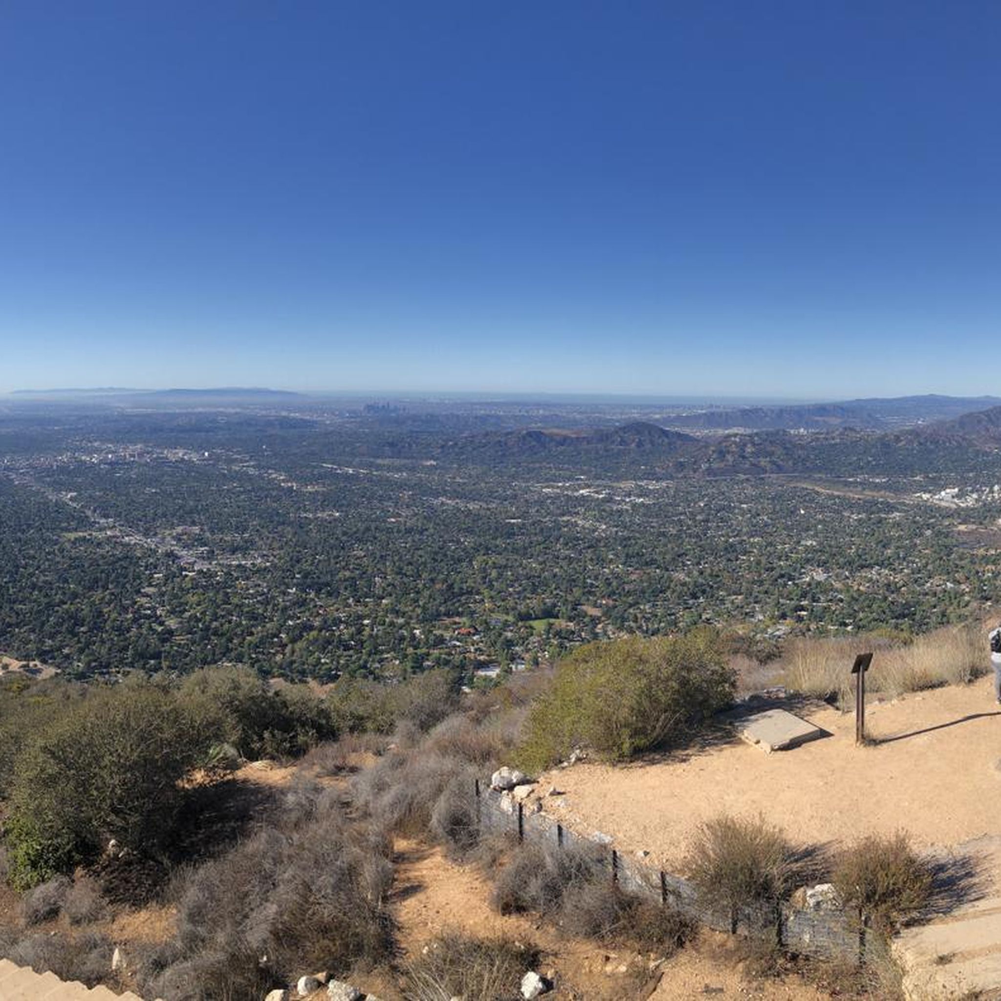
Just below the Mt Wilson Trailhead on Red Box Road, this overlook and memorial is a perfect place to pause. Sit and take in sweeping views of the San Gabriel Valley, and read the memorial plaque honoring early conservation efforts.
0
0

Mt. Wilson Trail offers exposed narrow edges on small segments with unique trail structures along the way.
0
0

This telescope was built in 1917 and took over 11 years due difficulty hauling all the components up Mt. Wilson Toll Road. The glass mirror weighs around 9,000 pounds and remains the largest solid glass mirror ever made. This was the largest telescope until the 200" telescope was built on Palomar Mountain. mtwilson.edu/building-the-100-inch-telescope
0
0
Hoegees Camp offers a hike-in first come first serve campground. There is a stream for water and it is well shaded. For more information regarding closures and amenities, visit: https://www.fs.usda.gov/recarea/angeles/recarea/?recid=41702
0
0

Iconic café spot atop Mount Wilson. Observatory visits start from here
0
0
This telescope was built in 1917 and took over 11 years due difficulty hauling all the components up Mt. Wilson Toll Road. The glass mirror weighs around 9,000 pounds and remains the largest solid glass mirror ever made. This was the largest telescope until the 200" telescope was built on Palomar Mountain. https://www.mtwilson.edu/building-the-100-inch-telescope/
0
0

The summit offers fantastic panoramic views of the entire Los Angeles metro area. On a clear day, you can see Mt. San Jacinto far to the east, and Catalina Island far to the west.
1
0
Great place to take a break, as this old cabin foundation is under trees and near a creek.
1
0
Frequently Asked Questions
Are there any easy hikes with waterfalls in Sierra Madre?
Yes, the area is well-known for its accessible waterfall trails. A great option for beginners or families is the hike to Sturtevant Falls. This popular trail leads through a shaded canyon to a beautiful 50-foot waterfall. Another choice is the Canyon View Nature Trail in Bailey Canyon Wilderness Park, which leads to a lovely seasonal waterfall.
What are some good dog-friendly trails near Sierra Madre?
Most trails in the Angeles National Forest are dog-friendly, provided your dog is on a leash. The trails starting from Bailey Canyon Wilderness Park are a great choice for hiking with your canine companion. Remember to bring enough water for both you and your dog, as many routes can be exposed to the sun.
I'm looking for a strenuous hike with great views. What do you recommend?
For a challenging climb that rewards you with expansive views, the hike to Jones Peak is an excellent choice. This route involves a significant and sustained ascent, but the summit offers panoramic vistas of the San Gabriel Valley and the surrounding mountains.
Where can I find a good circular or loop hike?
There are several great loop hikes available. For a very challenging day out, consider the Mt. Wilson Trail via Bailey Canyon Trail loop. This difficult route combines two major trails for a comprehensive tour of the local landscape with significant elevation gain.
How many hiking trails are there around Sierra Madre?
There are over 45 designated hiking trails in the Sierra Madre area. These routes offer a wide range of experiences, from 13 easy walks suitable for all skill levels to 18 difficult trails that will challenge even experienced hikers.
What do other hikers enjoy about the trails in Sierra Madre?
The trails here are highly regarded by the komoot community, with an average rating of 4.7 stars. Hikers often praise the direct access to the rugged San Gabriel Mountains, the variety of trails, and the stunning natural features like serene canyons and rewarding panoramic viewpoints.
Where is the starting point for the historic Mount Wilson Trail?
The main access point is the Mt. Wilson Trailhead, located at the top of E. Mira Monte Avenue. Nearby, you'll find Mount Wilson Trail Park, which is a small park with public restrooms available for hikers before they start their ascent. Important: Always check local alerts for trail closures, as this trail can be affected by fire damage or weather conditions.
Are there any family-friendly or beginner hikes in the area?
Yes, Bailey Canyon Wilderness Park is a perfect starting point for families and beginners. The Live Oak Self-guided Nature Trail is an easy, educational loop that's great for all ages. It's a gentle introduction to the local flora and the beauty of the San Gabriel foothills.
What is the best time of year to hike in Sierra Madre?
Spring is an ideal time to hike in Sierra Madre. The weather is pleasant, the hills are often green with wildflowers, and the waterfalls, like Sturtevant Falls, are at their most impressive. Autumn also offers comfortable temperatures. Summer can be very hot, especially on exposed trails, so early morning starts and extra water are essential.
What are the parking options for the main trailheads?
Parking can be found in residential areas near the trailheads, such as those for the Mount Wilson Trail and Bailey Canyon. Be sure to read all posted signs for any restrictions, as parking is limited and fills up quickly, especially on weekends. Arriving early is highly recommended to secure a spot.
Are there any long-distance loop hikes available?
Yes, for those seeking a full-day adventure, the Mt. Zion loop is a fantastic option. This is a difficult, 12.5-mile (20 km) circuit that takes you deep into the Angeles National Forest, offering solitude and a true wilderness feel.
Most popular attractions around Sierra Madre

Get inspired with the komoot mobile app


Explore more
Browse the best Hikes in other regions.
