The best walks and hikes in Wayne National Forest
4.8
(149)
2,036
hikers
13
hikes
Hiking in Wayne National Forest offers a diverse landscape within the Appalachian foothills and Unglaciated Allegheny Plateau. The region features rugged topography with elevation changes typically ranging from 200 to 400 feet. Hikers can explore shady coves, wildlife ponds, rock outcroppings, tall pine forests, open meadows, and quiet streams. The geology is characterized by late Paleozoic sandstones, shales, and coal beds, contributing to its unique terrain.
Best hiking trails in Wayne National Forest
- The most popular hiking route is Archers Fork Loop Trail — Wayne National Forest, a 12.8 miles (20.6 km) trail that takes 5 hours 48 minutes to complete. This route is known for its scenic views, including the Irish Run Natural Bridge and a rock shelter.
- Another top favourite among local hikers is Wildcat Hollow Day Hike — Wayne National Forest, a moderate 5.0 miles (8.1 km) path. This trail traverses ridge-tops and stream bottoms, passing through pine forests, open meadows, and rock outcroppings.
- Local hikers also love the Lake Vesuvius Lakeshore Trail — Wayne National Forest, a 7.8 miles (12.5 km) trail leading around Lake Vesuvius, often completed in about 3 hours 15 minutes.
- Hiking in Wayne National Forest is defined by rugged topography, diverse forests, and notable rock formations. The extensive trail network offers options for various ability levels, from easy walks to more challenging multi-hour hikes.
- The routes in Wayne National Forest are highly rated by the komoot community with an average score of 4.8 stars from over 100 reviews. More than 1000 hikers have used komoot to explore Wayne National Forest's varied terrain.
Last updated: October 11, 2026
5
hikers
14.7km
03:53
130m
140m
The Lake Shore Trail offers a peaceful escape into nature, tracing the edge of Lake Vesuvius. You'll find yourself immersed in a tranquil lakeside environment, with the path winding through natural settings that provide consistent views of the water. The highlight of this route is undoubtedly the unique Lake Vesuvius Rock Formations, which add a distinctive geological interest to your journey.
This moderate hiking route spans 9.1 miles (14.7 km) with a manageable 434 feet (132 metres) of elevation gain, making it a good choice for a longer, less strenuous outing. Plan for approximately 3 hours and 53 minutes to complete the trail at a comfortable pace. Parking is generally available at the trailheads, but consider an early start during busy times to ensure a spot.
Located in Lawrence County, Ohio, this trail provides an excellent opportunity to experience the natural beauty surrounding Lake Vesuvius. It's a fantastic option for those looking for a substantial walk that isn't overly challenging, offering a rewarding blend of scenic views and interesting natural features.
3
hikers
9.67km
02:35
110m
110m
Hike the 6.0-mile Lost Marbles, Salt Works, Tipple Top, and Wild Turkey Loop in Ohio's Baileys Trail System, a moderate route with 365 feet

2.24km
00:34
10m
10m
The Old Beach Trail is a delightful, easy hike that's perfect for a quick escape into nature. This short route, spanning 1.4 miles (2.2 km) with a gentle 17 feet (5 metres) of elevation gain, offers a pleasant experience for all skill levels. You can expect to complete the trail in about 34 minutes, making it an ideal option for a leisurely walk to clear your head or enjoy some fresh air. The highlight of the journey is undoubtedly the Lake Vesuvius Rock Formations, providing a unique natural landmark to observe along your path.
Planning your visit to the Old Beach Trail is straightforward due to its accessibility and easy nature. While specific parking details aren't provided, it's always a good idea to arrive early, especially on weekends, to secure a spot at the trailhead. Check local conditions before heading out, as weather can impact even the easiest trails. This trail is generally suitable for families and those looking for a relaxed outdoor experience without the need for extensive preparation.
Located in Pedro, Ohio, the Old Beach Trail offers a glimpse into the natural beauty of the region, particularly around Lake Vesuvius. Its minimal elevation gain and short distance make it a great option for beginner routes or for those seeking a less strenuous alternative to more challenging hikes. The presence of the Lake Vesuvius Rock Formations adds a distinct geological interest, making the trail more than just a simple walk. It's a good choice if you're in the area and want a quick, rewarding outdoor activity.
10.8km
02:59
140m
240m
Hike the moderate 6.7-mile Green Wood and Scenic River Loop in Wayne National Forest, featuring diverse forests, rock formations, and river
706m
00:12
30m
0m
The Rock House Trail offers a captivating journey into a 'magical landscape' of lush forest, culminating in the impressive Rock House cavern. This unique geological formation, carved from Blackhand sandstone, features natural 'windows' that create a dramatic interplay of light and shadow within the cave. It's an easy 0.4-mile (0.7 km) hike with just 89 feet (27 metres) of elevation gain, making it a perfect, quick adventure for all ages, taking only about 12 minutes to complete.
Planning your visit is straightforward, as the trail is part of a one-way loop system designed for safety and preservation. While the route itself is short, be aware that the surrounding terrain can be rocky and uneven, and the path may become slippery or muddy after rain, so sturdy footwear is a good idea. Parking is generally available, and you'll find a shelter house near the trail's exit, hinting at the site's historical significance.
What makes the Rock House Trail truly stand out is the Rock House itself, the only 'true cave' within Hocking Hills State Park. This tunnel-like corridor, about 200 feet long, 20 to 30 feet wide, and 25 feet high, has a rich history, once serving as a hideout for outlaws nicknamed 'Robber's Roost'. Archaeological evidence also suggests prehistoric Native Americans used its shallow openings as ovens, adding layers of historical intrigue to this natural wonder.
Get access to more routes and recommendations from other explorers.
Already have an account?
Our route recommendations are based on thousands of hikes, rides, and runs completed by other people on komoot.
Start today with a free account
Your next adventure awaits.



Tips from the Community

The Rock House is a wonderful outcropping with plenty of room for hanging out and having lunch.
0
0
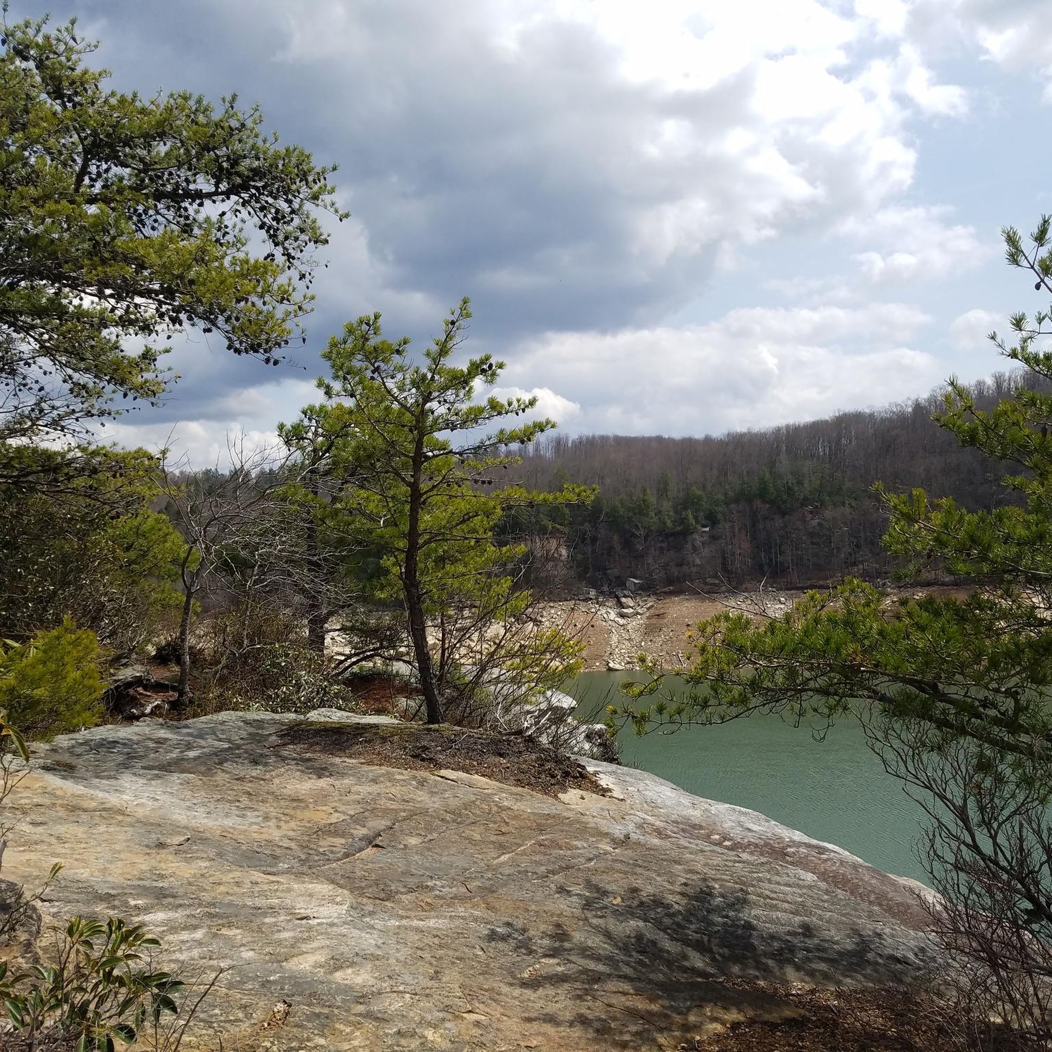
Lake Vesuvius was created in 1939 with the damming of Storm Creek and provided water for a thriving iron industry. Today, the 143-acre lake is a popular destination for hiking, fishing, swimming, and camping.
0
0
The Rock House Trail is a very short hike with a big pay-off. The trail is also considered wheel-chair accessible.
0
0

This rock formation is a nice place to take a break for a while and enjoy the sights and sounds of the forest
1
0
Frequently Asked Questions
What kind of terrain can I expect when hiking in Wayne National Forest?
Wayne National Forest offers a rugged and diverse landscape within the Appalachian foothills and Unglaciated Allegheny Plateau. You'll encounter elevation changes typically ranging from 200 to 400 feet, with trails winding through shady coves, tall pine forests, open meadows, and quiet streams. The geology features interesting sandstones, shales, and coal beds, contributing to unique rock outcroppings and formations.
Are there trails suitable for families with children in Wayne National Forest?
Yes, Wayne National Forest has several options suitable for families. For easier access, consider the Lake Vesuvius Boardwalk Trail or the Ora E. Anderson Nature Trail at Rutherford Wetlands. The Ironton Ranger District also offers a family-friendly 2-mile loop around Lake Vesuvius. These trails provide a good introduction to the forest's natural beauty without being overly strenuous.
What are some notable natural features or landmarks to look out for on the trails?
The forest is rich in natural features. You can find impressive rock formations and natural arches, particularly along trails like the Archers Fork Loop Trail, which features the Irish Run Natural Bridge and a rock shelter. The Lake Vesuvius area also boasts a unique rock house formation. Additionally, the historic Hune Covered Bridge is a prominent feature near the Covered Bridge Trail.
What do other hikers enjoy most about the trails in Wayne National Forest?
The trails in Wayne National Forest are highly rated by the komoot community, with an average score of 4.8 stars from over 100 reviews. Hikers frequently praise the diverse scenery, from quiet woodlands and wildlife ponds to impressive rock formations and stream bottoms. The extensive network of trails offers a variety of experiences, making it a favorite for many outdoor enthusiasts.
Are there any circular hiking routes in Wayne National Forest?
Yes, the forest offers several excellent circular routes. The Archers Fork Loop Trail is a popular 12.8-mile option known for its scenic views. Another great choice is the Wildcat Hollow Day Hike, which offers both a 17.2-mile scenic loop and a shorter 5-mile loop, traversing ridge-tops and stream bottoms.
What kind of wildlife can I expect to see while hiking?
Wayne National Forest is home to diverse wildlife. Hikers often spot white-tailed deer, eastern gray squirrels, and raccoons. If you're lucky, you might even catch a glimpse of a bobcat. The forest is also excellent for birdwatching, and its understory features a variety of plant life, including pawpaw, spicebush, flowering dogwood, and abundant spring wildflowers like trillium and mayapple.
Are dogs allowed on the hiking trails in Wayne National Forest?
Generally, dogs are welcome on most trails in Wayne National Forest, but they must be kept on a leash. It's always a good idea to check specific trail regulations before you go, as some areas might have restrictions. Remember to pack water for your dog and clean up after them to help keep the trails enjoyable for everyone.
What is the best time of year to go hiking in Wayne National Forest?
Hiking in Wayne National Forest is enjoyable throughout the year, but each season offers a different experience. Spring brings an abundance of wildflowers and lush greenery. Summer provides shade in the coves and forests. Autumn is spectacular with vibrant fall foliage. Winter hiking can be serene, though some trails may have more challenging conditions due to snow or ice. Always check weather and trail conditions before heading out.
Are there any water features or lakes I can visit in the forest?
Yes, Wayne National Forest includes over 500 acres of ponds and lakes. Utah Pond is a quiet, shady spot popular for fishing. You can also find Burr Oak Lake within Burr Oak State Park, which offers opportunities for swimming, fishing, and boating. The Lake Vesuvius Lakeshore Trail also provides scenic views around Lake Vesuvius.
How many hiking trails are available in Wayne National Forest?
Wayne National Forest boasts an extensive trail system with approximately 300 miles of trails open for hiking and backpacking. Komoot currently features over 60 hiking routes in the area, ranging from easy walks to more challenging multi-hour hikes, ensuring options for all skill levels.
What are the typical trail difficulties in Wayne National Forest?
The trails in Wayne National Forest cater to a wide range of abilities. Komoot's selection includes 29 easy routes, 31 moderate routes, and 4 difficult routes. The terrain can vary from relatively flat paths around lakes to rugged sections with significant elevation changes, particularly in the Appalachian foothills.
Is there parking available at the trailheads?
Yes, parking is generally available at designated trailheads throughout Wayne National Forest. Specific parking information can often be found on individual trail pages or by consulting official forest maps. It's always recommended to arrive early during peak seasons to secure a spot.
Most popular routes in Wayne National Forest
Most popular attractions in Wayne National Forest

Get inspired with the komoot mobile app


Explore more
Browse the best Hikes in other regions.
