Attractions and Places To See in Cumbres Del Ajusco - Top 6
Best attractions and places to see in Cumbres Del Ajusco include a range of natural monuments and viewpoints within the Sierra de las Cruces. This mountainous region, part of the Transversal Volcanic Axis, offers diverse landscapes from pine forests to high-altitude peaks. Visitors can explore various summits and enjoy panoramic views, making it a destination for those seeking top rated hikes Cumbres Del Ajusco. The area is characterized by its volcanic origins and significant elevation changes.
Best attractions and places…
Last updated: August 18, 2026
Pico del Águila and Cruz del Marqués (Ajusco)
Highlight • Summit
Translated by Google •
Tip by

Cruz del Marqués
Highlight • Summit
Tip by

Sign up now to discover places like this
Get recommendations on the best single tracks, peaks, & plenty of other exciting outdoor places.
Sign up for free
Pico del Águila
Highlight • Summit
Translated by Google •
Tip by
Ajusco-Chichinahutzin National Park
Highlight • Natural Monument
Translated by Google •
Tip by

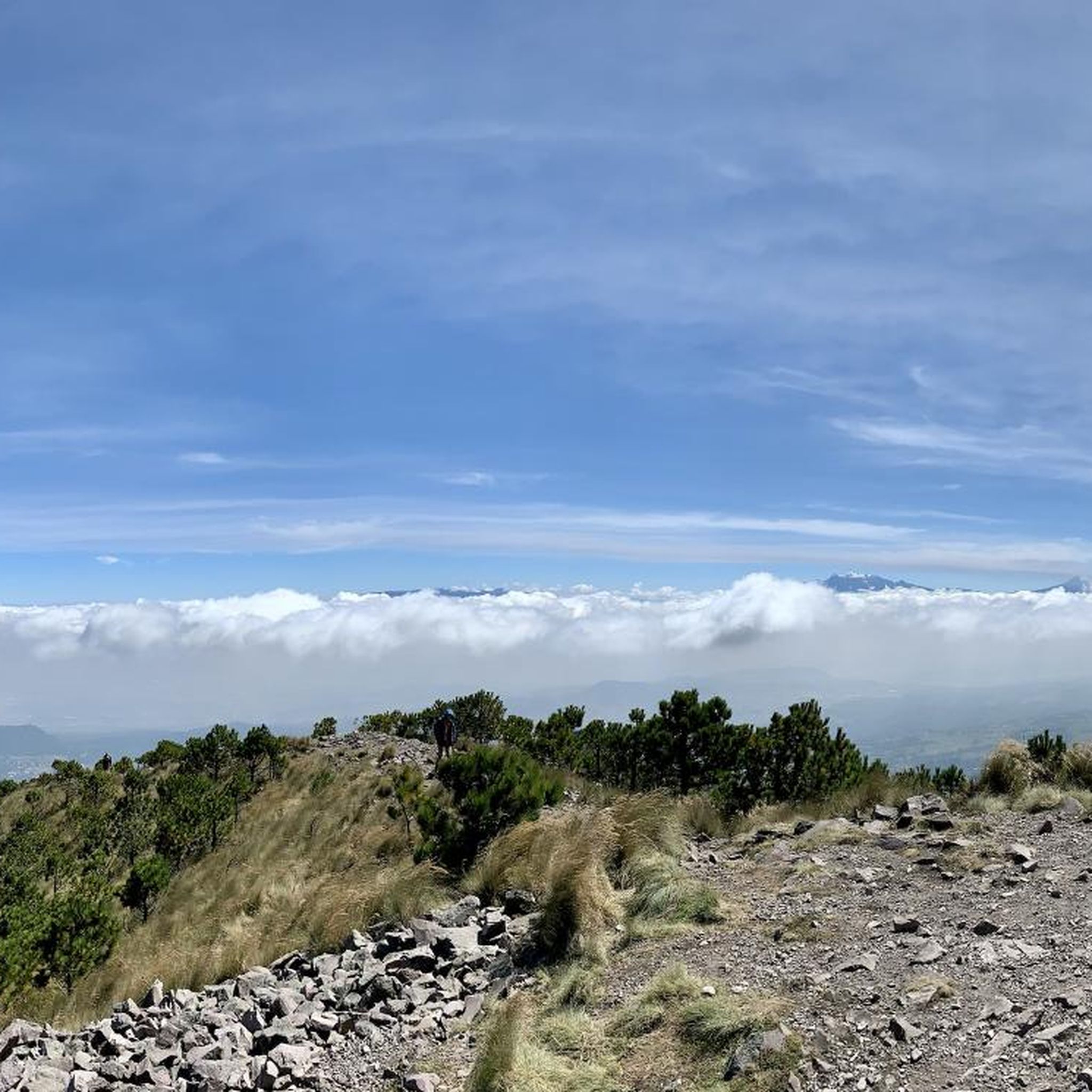
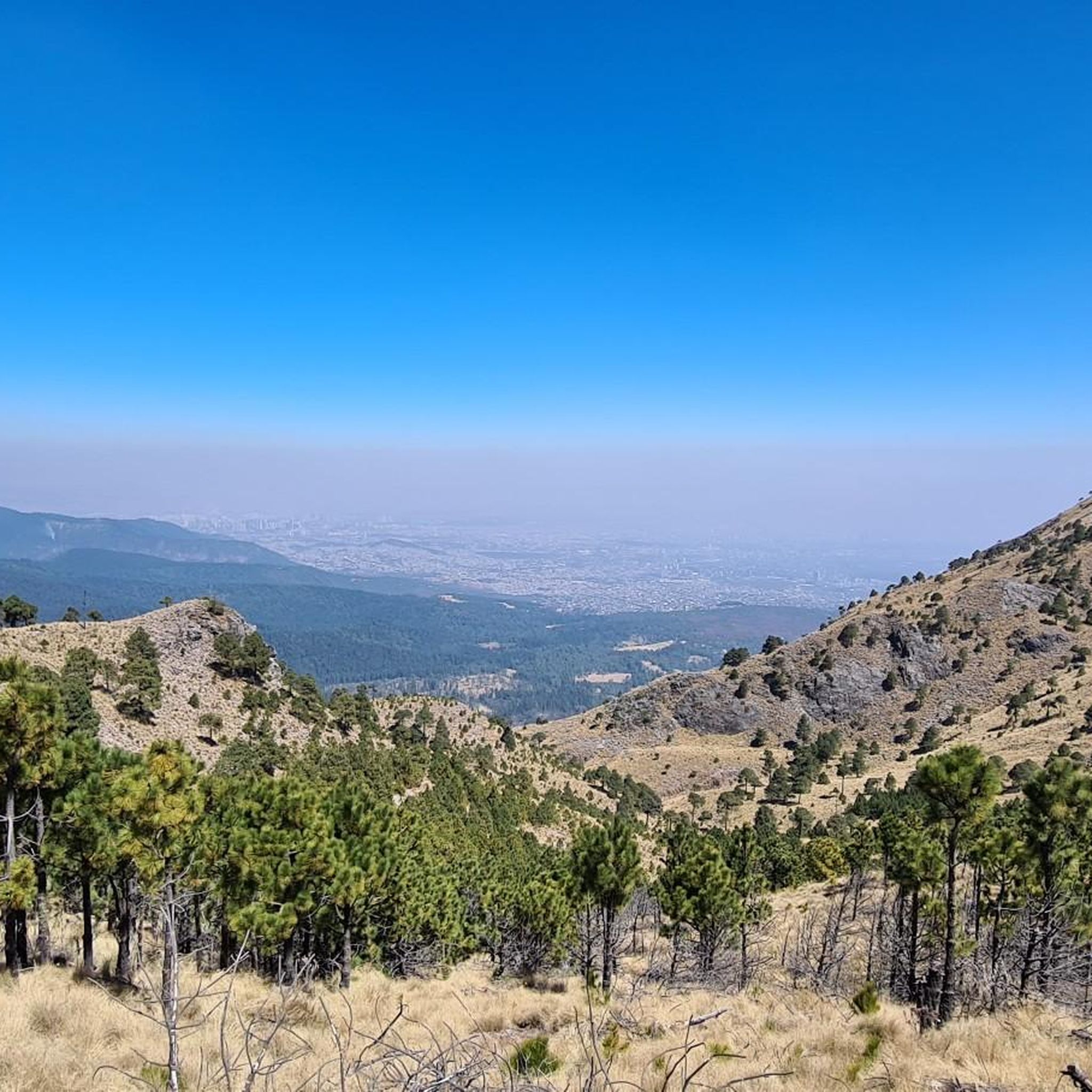
View of Mexico City from Pico Aguilar
Highlight • Viewpoint
Translated by Google •
Tip by

Sign up for free to discover even more attractions in Cumbres Del Ajusco.
Sign up for free
Already have an account?
Start today with a free account
Your next adventure awaits.
Login or Signup

Tips from the Community

Challenging, great views, easy to navigate.
0
0

Very safe to walk at 2 in the morning.
0
0

The highest point in Mexico City! A beautiful panoramic view that you simply must experience. Remember to bring enough supplies, no matter which route you take, and don't leave any trash behind. Remember to respect the mountains, and you should be prepared for any eventuality, always alert and enjoying yourself, taking care, and breathing fresh air. Enjoy! ⛰️
1
0

Don't leave your trash up here.
0
0
Your trash goes back with you.
1
0

on the way to Pico Aguilar a viewpoint towards Mexico City
1
0

Part of the Transversal Volcanic Axis, the Ajusco - Chichinahutzin mountain range, is a mountain range, whose origin marked the geography of the Basin of Mexico, characterized by the region of its extensive lakes and its transparent Anahuac regions.
0
0
Amazing place to welcome the day full of fresh air and beautiful views at the top.
3
0
Frequently Asked Questions
What kind of natural features can I explore in Cumbres Del Ajusco?
Cumbres Del Ajusco is part of the Sierra de las Cruces and the Transversal Volcanic Axis, offering diverse natural landscapes. You'll find extensive pine forests, high-altitude peaks, and volcanic formations. The area is primarily known for its mountainous terrain and natural beauty, including the Ajusco-Chichinahutzin National Park.
Are there challenging hikes in Cumbres Del Ajusco?
Yes, Cumbres Del Ajusco offers several challenging hikes. For example, the route to Pico del Águila and Cruz del Marqués (Ajusco) features steep inclines and requires basic equipment and route knowledge. Pico del Águila, the highest point in Mexico City, also presents a challenging ascent.
How long does it take to hike to the main peaks in Cumbres Del Ajusco?
A popular hike that includes both Cruz del Marqués and Pico del Águila typically takes around four hours to complete as a round trip. This allows time to enjoy the views and navigate the terrain.
What should I wear and bring when hiking in Cumbres Del Ajusco?
The weather in the mountains can change suddenly, so it's important to be prepared. Essential items include sunscreen, a jacket, sufficient water, and food. Basic hiking equipment and knowledge of your route are also recommended, especially for steeper sections.
What are the best viewpoints in Cumbres Del Ajusco?
For spectacular panoramic views, head to Pico del Águila, which is the highest point in Mexico City. Another excellent spot is View of Mexico City from Pico Aguilar, offering a clear perspective of the city. The combined summit of Pico del Águila and Cruz del Marqués also provides incredible vistas, particularly at sunrise.
Are there any circular hiking routes available?
Yes, there are several circular routes in the area. For example, you can find running trails like the "Las Canoas loop" or "Llano del Aguaje loop" starting from Reserva Ecológica Comunitaria San Nicolás Totolapan. You can explore more options on the Running Trails in Cumbres Del Ajusco guide.
What other outdoor activities can I do near these attractions?
Beyond hiking, Cumbres Del Ajusco is popular for cycling. You can find various routes for road cycling, such as the "Puerto Las Trancas loop," or more general cycling tours like the "Bike loop from San Miguel Ajusco." Check out the Road Cycling Routes and Cycling in Cumbres Del Ajusco guides for more details.
What do visitors enjoy most about Cumbres Del Ajusco?
Visitors frequently praise the spectacular views from the summits, especially at sunrise. The opportunity to experience fresh air and the natural beauty of the pine forests and mountainous terrain is also highly valued. Many appreciate the sense of accomplishment after reaching peaks like Pico del Águila.
Is Cumbres Del Ajusco suitable for beginner hikers?
While some routes, like the ascent to Pico del Águila and Cruz del Marqués, are considered challenging due to steep inclines, there are also intermediate options. It's advisable for beginners to choose shorter, less steep paths and ensure they have appropriate gear and knowledge before attempting higher peaks.
Are there any cafes or places to eat near the trails in Cumbres Del Ajusco?
The provided data does not specifically mention cafes directly on the trails. However, as the area is heavily visited, especially near popular starting points, you may find local vendors or small eateries in the surrounding communities before or after your hike.
Can I bring my dog on the trails in Cumbres Del Ajusco?
The guide data does not explicitly state whether dogs are allowed on all trails. It's always best to check local regulations or signage at trailheads regarding pet policies to ensure a responsible and enjoyable visit for everyone.
What is the best time of year to visit Cumbres Del Ajusco?
While the guide doesn't specify a single 'best' time, it emphasizes that mountain weather can change suddenly at any time of year. It's crucial to check the forecast before your visit and be prepared for varying conditions, regardless of the season.
Most popular routes in Cumbres Del Ajusco

Get inspired with the komoot mobile app


