The best road cycling routes in Cumbres Del Ajusco
5.0
(5)
84
riders
6
rides
Road cycling routes in Cumbres Del Ajusco are situated within the Sierra de Ajusco-Chichinauhtzin mountain range, offering diverse landscapes and challenging terrain. The region is characterized by high elevations, rugged slopes, and extensive pine and oak forests. Many routes feature mostly paved surfaces, providing a smooth road cycling experience through areas with significant elevation gains.
Best road cycling routes in Cumbres Del Ajusco
- The most popular road cycling route is Puerto Las Trancas loop from Ajusco, a 16.4 miles…
Last updated: July 10, 2026
5.0
(2)
8
riders
26.5km
01:28
560m
560m
Moderate road ride. Good fitness required. Mostly well-paved surfaces and easy to ride.
5.0
(1)
57
riders
Moderate road ride. Good fitness required. Mostly well-paved surfaces and easy to ride.

Sign up for free
5.0
(2)
10
riders
28.0km
01:34
610m
610m
Moderate road ride. Good fitness required. Mostly well-paved surfaces and easy to ride.
2
riders
22.1km
01:06
340m
340m
Moderate road ride. Good fitness required. Mostly well-paved surfaces and easy to ride.
5
riders
24.8km
01:14
350m
340m
Moderate road ride. Good fitness required. Mostly well-paved surfaces and easy to ride.
Our route recommendations are based on thousands of hikes, rides, and runs completed by other people on komoot.
Start today with a free account
Your next adventure awaits.
Login or Signup
Popular around Cumbres Del Ajusco


Tips from the Community

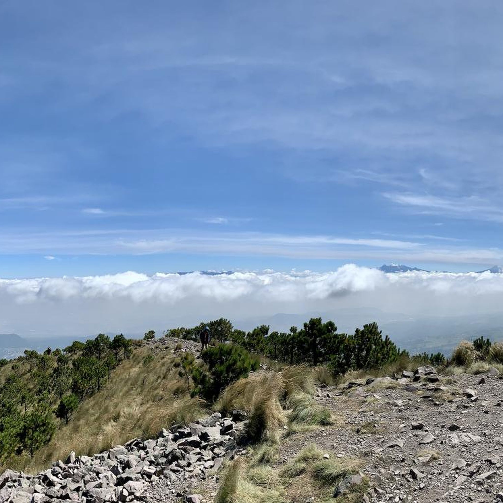
Just before the Xalatlaco highway crossing, before the Cantimplora Valley, is the abandoned cabin where food was prepared many years ago. Now it's roofless, and only the remains of the fireplace, tables, and walls with their windows remain. Once, it served as a shelter in bad weather when everything was closed, but now, without a roof, all that remains is a memory of what once was.
2
0
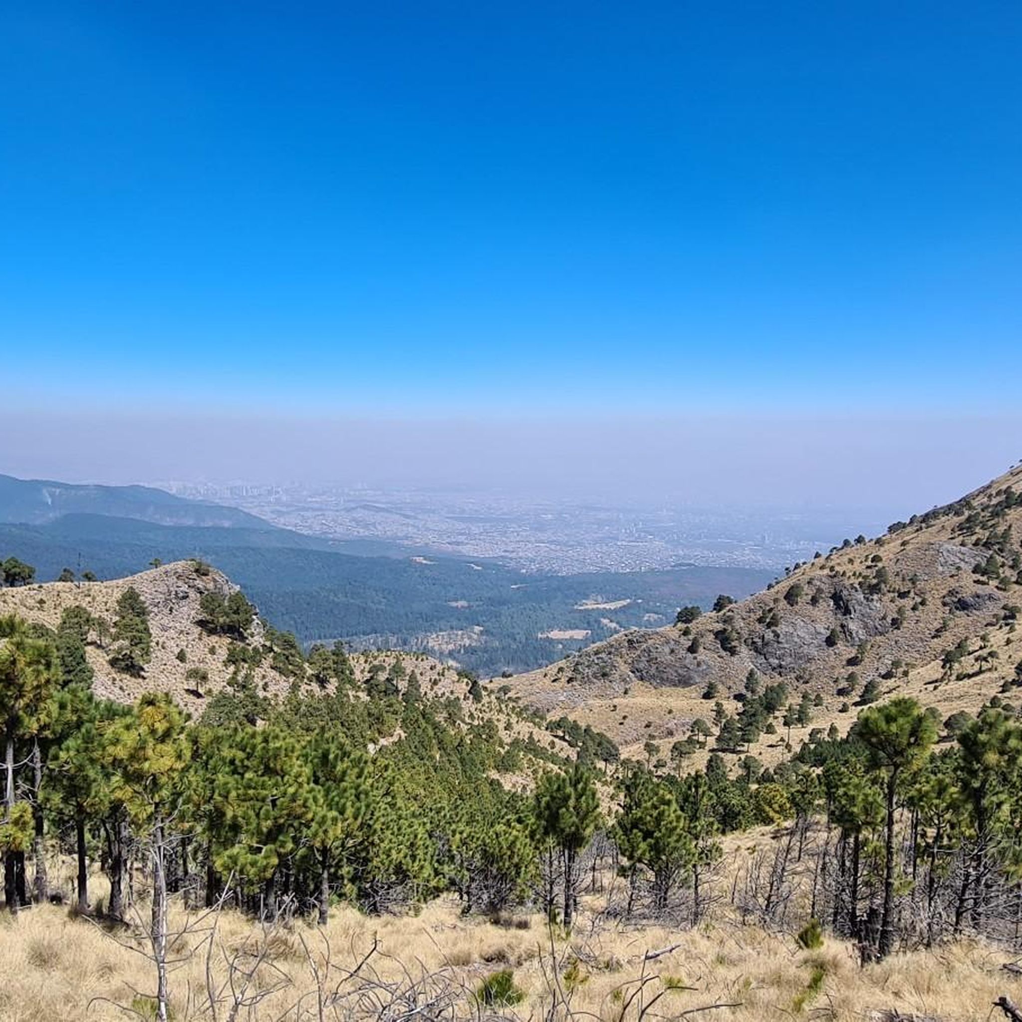
Just before reaching the famous "Y" of the Ajusco. The most panoramic and close view of the mountain with its well-known Pico del Águila. A path that has changed a lot over the years due to construction and now 2 stops on the road. The only thing that remains beautiful is the mountainous view and the feeling of having managed to reach this point by bike.
5
0
It is the section before the famous "Y" of the Ajusco circuit where you can enjoy a panoramic view of the mountain, the Pico del Águila in the distance, from there you will already have an idea of the weather that awaits you on the road to the heights . Over the years the panorama has changed due to the buildings and bars, but it is still beautiful.
3
0

Frequently Asked Questions
How many road cycling routes are available in Cumbres Del Ajusco?
Cumbres del Ajusco offers a selection of 6 road cycling routes. These routes are highly rated by the komoot community, with an average score of 5.0 stars from over 5 reviews.
What is the typical terrain like for road cycling in Cumbres del Ajusco?
The terrain in Cumbres del Ajusco is characterized by high elevations, rugged slopes, and extensive pine and oak forests. Many routes feature mostly paved surfaces, providing a smooth road cycling experience. You'll encounter consistent climbs through the mountainous landscape, with panoramic views.
What are the difficulty levels of road cycling routes in Cumbres del Ajusco?
All road cycling routes in Cumbres del Ajusco are currently rated as moderate. They offer varying degrees of challenge with significant elevation gains, making them suitable for cyclists looking for a good workout in a scenic environment.
What kind of elevation gain can I expect on Cumbres del Ajusco road cycling routes?
Road cycling routes in Cumbres del Ajusco feature substantial elevation gains. For example, the View of Pico del Águila loop from Reserva Ecológica Comunitaria San Nicolás Totolapan includes over 615 meters of ascent, while the Puerto Las Trancas loop from Ajusco has over 560 meters of climbing.
Are there any circular road cycling routes in Cumbres del Ajusco?
Yes, Cumbres del Ajusco features several excellent circular road cycling routes. Popular options include the Puerto Las Trancas loop from Ajusco and the Puerto Las Trancas – Puerto Las Cruces loop from San Miguel Ajusco, both offering scenic round trips.
What natural features or landmarks can I see while road cycling in Cumbres del Ajusco?
While cycling, you can enjoy stunning panoramic views of Mexico City and the Ajusco valley. The region is part of the Trans-Mexican Volcanic Belt, contributing to its unique geological formations. Notable peaks like Pico del Águila and Cruz del Marqués are prominent features. You might also pass by the Ajusco-Chichinahutzin National Park itself, or enjoy views from spots like View of Mexico City from Pico Aguilar.
Are there good viewpoints along the road cycling routes in Cumbres del Ajusco?
Yes, Cumbres del Ajusco is known for its spectacular viewpoints. Routes often offer panoramic vistas of the surrounding mountains and Mexico City. The View of Pico del Águila loop from Reserva Ecológica Comunitaria San Nicolás Totolapan is specifically designed to showcase these views, passing through forested areas with scenic overlooks.
Is there parking available for road cyclists in Cumbres del Ajusco?
While specific parking areas for cyclists are not detailed, the Picacho-Ajusco highway, a well-known route for cyclists, is generally accessible. It's advisable to research parking options near your chosen starting point, especially if you plan to drive to the area.
Are there places to eat or drink near the road cycling routes?
Yes, along the popular Picacho-Ajusco highway, you'll find various restaurants and food stalls. These establishments are particularly popular on weekends, offering Mexican appetizers and refreshments, perfect for a post-ride meal or a mid-ride snack.
What do other road cyclists enjoy most about road cycling in Cumbres del Ajusco?
The komoot community highly rates road cycling in Cumbres del Ajusco, with an average score of 5.0 stars. Cyclists frequently praise the challenging yet rewarding climbs, the fresh air away from the city, and the stunning panoramic views of Mexico City and the surrounding natural landscapes.
What is the best time of year to go road cycling in Cumbres del Ajusco?
Cumbres del Ajusco offers good cycling conditions for much of the year. However, during the winter months, the park can experience significant snowfall at higher elevations, which might affect some routes. For the most consistent conditions, spring and autumn generally provide pleasant weather for road cycling.
Are there any specific roads known for road cycling in the region?
The Picacho-Ajusco highway is a very well-known and popular route for road cyclists in the Cumbres del Ajusco region. It offers consistent climbs and is often lined with food vendors, making it a vibrant cycling destination.
Most popular attractions in Cumbres Del Ajusco

Get inspired with the komoot mobile app


Explore more
Browse the best Road cycling routes in other regions.
