The best running trails in Cumbres Del Ajusco
5.0
(3)
117
runners
8
runs
Jogging routes in Cumbres Del Ajusco offer a challenging environment for runners, characterized by high altitudes and varied terrain within the Sierra de Ajusco-Chichinauhtzin mountain range. The region features extensive pine-oak forests and high mountain grasslands, providing shaded trails and diverse vegetation. Its volcanic origin contributes to a unique topography with significant elevation changes, making it suitable for altitude training.
Best jogging routes in Cumbres Del Ajusco
- The most popular jogging route is Las Canoas loop from Reserva Ecológica Comunitaria…
Last updated: July 1, 2026
33
runners
8.86km
01:01
260m
260m
Moderate run. Good fitness required. Mostly paved surfaces. Suitable for all skill levels.
33
runners
Hard run. Very good fitness required. Mostly paved surfaces. Suitable for all skill levels.

Sign up for free
13
runners
Hard run. Very good fitness required. Mostly paved surfaces. Suitable for all skill levels.
5.0
(2)
13
runners
Hard run. Very good fitness required. Mostly accessible paths. Some sure footedness required.
4
runners
Hard run. Very good fitness required. Mostly paved surfaces. Suitable for all skill levels.
Get access to more routes and recommendations from other explorers.
Sign up for free
Already have an account?
Our route recommendations are based on thousands of hikes, rides, and runs completed by other people on komoot.
Start today with a free account
Your next adventure awaits.
Login or Signup
Popular around Cumbres Del Ajusco


Frequently Asked Questions
What kind of terrain can I expect on the running routes in Cumbres del Ajusco?
Jogging routes in Cumbres del Ajusco feature a diverse and challenging terrain. You'll encounter significant elevation changes, steep slopes, and rugged sections due to the region's volcanic origin. Trails often navigate through extensive pine-oak forests and high mountain grasslands, providing both shaded paths and open areas. This varied landscape makes it an excellent location for altitude training and offers a demanding workout.
Are there any easy or beginner-friendly running routes in Cumbres del Ajusco?
While Cumbres del Ajusco is known for its challenging, high-altitude terrain, there are options for different ability levels. The guide currently features one moderate route, Las Canoas loop from Reserva Ecológica Comunitaria San Nicolás Totolapan, which is 5.4 miles (8.7 km) long and navigates through forested sections with varied terrain. Most other routes tend to be more difficult, featuring significant elevation changes.
What are the typical durations for running routes in Cumbres del Ajusco?
The duration of running routes in Cumbres del Ajusco varies significantly based on distance and difficulty. For example, the moderate Las Canoas loop typically takes about 1 hour. More challenging routes, like the difficult Las Canoas – Puerta del Cielo loop, can take around 2 hours 4 minutes for 9.8 miles (15.8 km), while longer, difficult routes such as Las Canoas – Las Palomas loop, spanning 17 miles (27.3 km), might require over 3 hours 30 minutes.
What natural features or landmarks can I see while running in Cumbres del Ajusco?
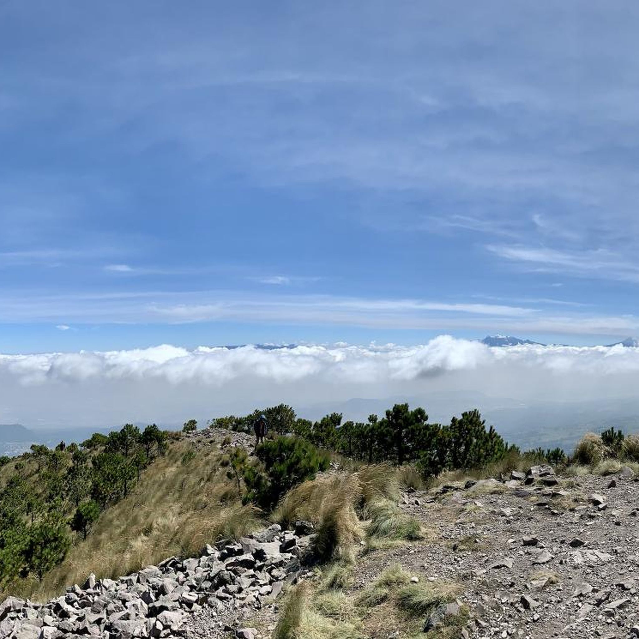
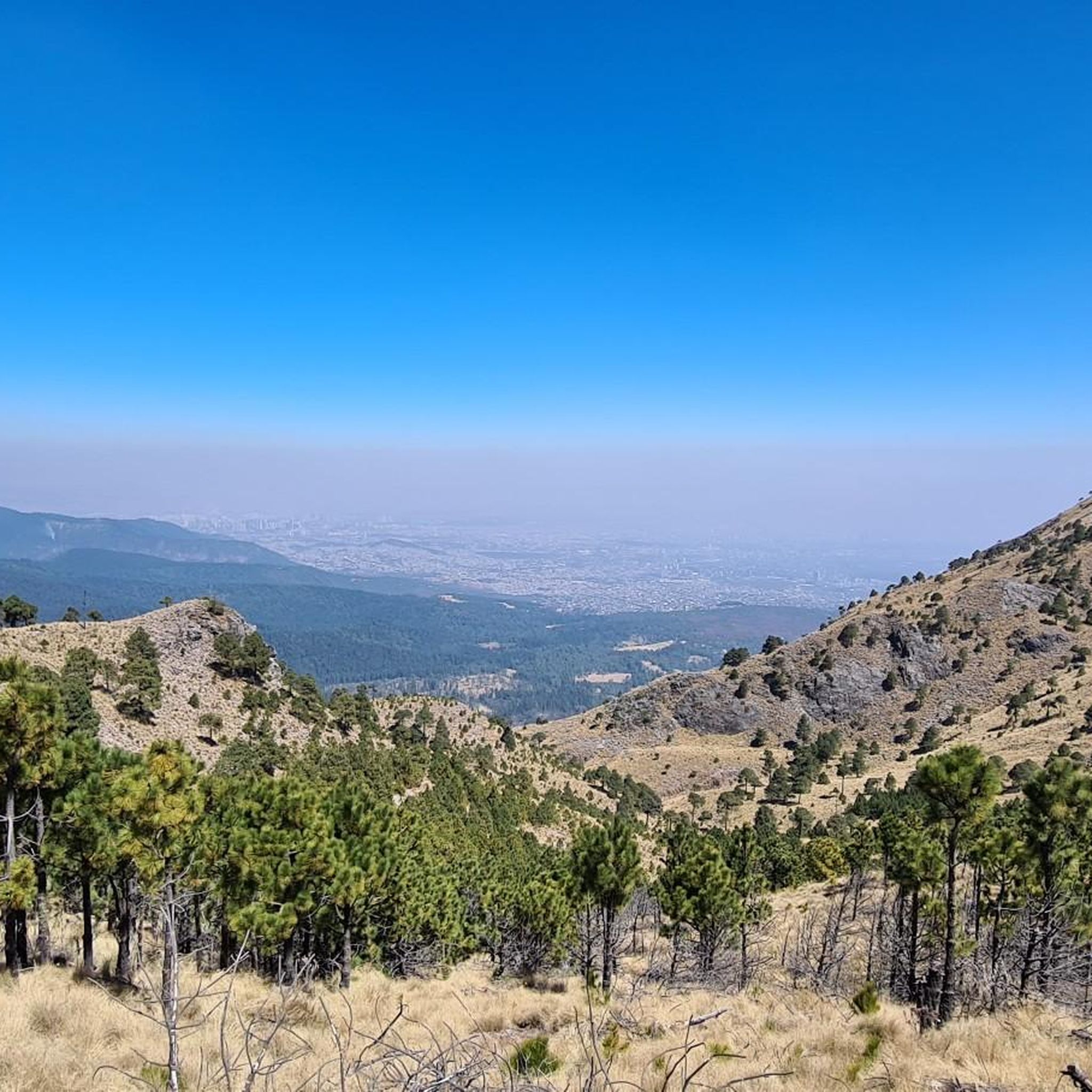
Cumbres del Ajusco offers breathtaking natural features and panoramic views. From elevated vantage points like Pico del Águila and Cruz del Marqués, you can enjoy stunning vistas of Mexico City and the surrounding volcanic landscape. The park is also characterized by lush pine-oak forests and high mountain grasslands. You might also encounter other notable summits such as Cruz del Marqués and Pico del Águila.
Is Cumbres del Ajusco suitable for family-friendly running or jogging with children?
Cumbres del Ajusco's terrain is generally challenging due to high altitudes and significant elevation changes. While there is one moderate route, Las Canoas loop, many routes are rated as difficult. Families with younger children or those seeking very easy, flat paths might find the options limited. It's best to assess the fitness level of all family members and choose routes carefully, focusing on shorter, less strenuous options if available.
Can I bring my dog on the running trails in Cumbres del Ajusco?
Cumbres del Ajusco National Park is a natural area, and generally, dogs are permitted on trails, especially if kept on a leash. However, it's always recommended to check specific park regulations or signage at trailheads for any restrictions, particularly in sensitive ecological areas or during certain seasons. Ensure your dog is accustomed to high altitudes and rugged terrain before embarking on a run.
What is the best time of year to go running in Cumbres del Ajusco?
Cumbres del Ajusco experiences considerable precipitation, leading to lush greenery, especially during the rainy season (typically May to October). This can make the forests vibrant but also trails potentially muddy. The dry season (November to April) generally offers clearer skies and firmer trails, which might be preferable for running. However, the high altitude means temperatures can be cooler year-round, and weather can change quickly, so always be prepared for varying conditions.
Are there any loop running routes available in Cumbres del Ajusco?
Yes, many of the running routes in Cumbres del Ajusco are designed as loops, offering a continuous journey without retracing your steps. Examples include the moderate Las Canoas loop, the difficult Las Canoas – Puerta del Cielo loop, and the challenging Las Canoas – Bosque Rojo loop. These loops allow you to experience the diverse landscapes and features of the park comprehensively.
What do other runners say about the jogging experience in Cumbres del Ajusco?
The running routes in Cumbres del Ajusco are highly rated by the komoot community, with an average score of 5.0 stars from over 3 reviews. More than 115 runners have used komoot to explore the varied terrain. Reviewers often praise the challenging high-altitude environment, the beauty of the pine-oak forests, and the panoramic views of Mexico City, making it a rewarding destination for outdoor enthusiasts.
Are there places to eat or get refreshments near the running trails in Cumbres del Ajusco?
Yes, after an intense running session, you can find local amenities along the Picacho-Ajusco highway. There are restaurants offering Mexican appetizers, providing a chance to refuel and relax. While specific cafes directly on the trails might be limited, options are available in the vicinity to cater to visitors.
What kind of wildlife might I encounter while running in Cumbres del Ajusco?
Cumbres del Ajusco is home to diverse wildlife, offering opportunities for nature observation during your run. You might spot various mammals such as bats, shrews, opossums, volcano rabbits, squirrels, and coyotes. The park is also a habitat for numerous bird species, including red-tailed hawks and golden eagles, adding to the natural experience.
How many running routes are available in Cumbres del Ajusco?
There are 8 running routes available in Cumbres del Ajusco, catering to various levels of difficulty. These include one moderate route and seven difficult routes, offering a range of options for runners seeking a challenge in this high-altitude environment.
Most popular attractions in Cumbres Del Ajusco

Get inspired with the komoot mobile app


Explore more
Browse the best Running Trails & Routes in other regions.
