The best walks and hikes around Lac De Montcineyre
4.5
(1765)
18,335
hikers
206
hikes
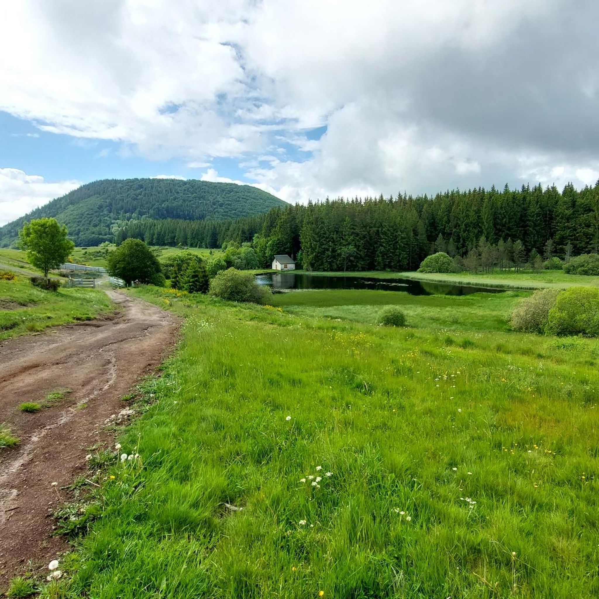
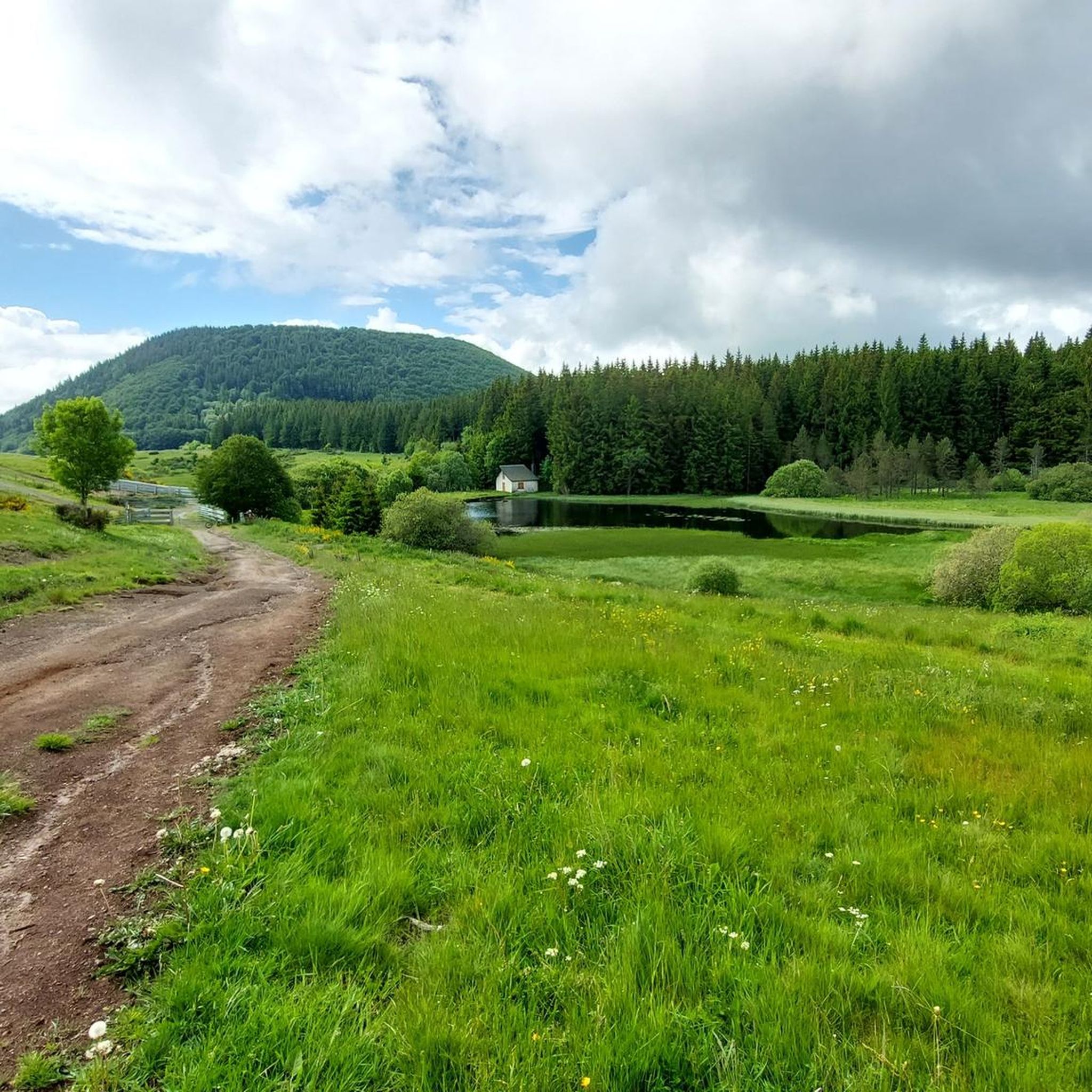
Hiking around Lac De Montcineyre offers trails through a landscape shaped by its volcanic past, situated within the Auvergne Volcanoes Regional Natural Park. The lake, formed by a lava flow, is crescent-shaped and surrounded by diverse ecosystems including dense beech forests and pastures. The region features volcanic hills (puys) and provides panoramic views of the Sancy massif.
Best hiking trails around Lac De Montcineyre
- The most popular hiking route is Lac – Lac de Montcineyre loop from Puy de Montcineyre…
Last updated: July 9, 2026
4.1
(7)
18
hikers
4.37km
01:13
80m
80m
Easy hike. Great for any fitness level. Easily-accessible paths. Suitable for all skill levels.
7
hikers
2.91km
00:52
90m
90m
Easy hike. Great for any fitness level. Easily-accessible paths. Suitable for all skill levels.

Sign up for free
8
hikers
Easy hike. Great for any fitness level. Easily-accessible paths. Suitable for all skill levels.
4.7
(58)
524
hikers
Moderate hike. Good fitness required. Easily-accessible paths. Suitable for all skill levels.
4.8
(12)
147
hikers
17.1km
04:47
330m
330m
Moderate hike. Good fitness required. Easily-accessible paths. Suitable for all skill levels.
Get access to more routes and recommendations from other explorers.
Sign up for free
Already have an account?
Our route recommendations are based on thousands of hikes, rides, and runs completed by other people on komoot.
Start today with a free account
Your next adventure awaits.
Login or Signup
Tips from the Community


very nice hike especially when the cross-country ski trails are closed
0
0

A 22 meter deep abyss that can only be conquered with a rope and shaft equipment. Below there is a spacious hall with a small lake. The height was created in an old lava tunnel when the ceiling collapsed.
2
0

Surrounded by dense forests and steep cliffs, Lake Pavin is distinguished by its deep blue waters that reflect the surrounding vegetation. This enchanting setting, accessible by a trail, combines perfectly with breathtaking views of the lake and the surrounding mountains.
1
0

Nice view over lac Pavin. Perfect to rest during the climb.
1
0

Huge rock in the shape of a throne at the center of many legends.
1
0
Volcanic lake which can be walked around along an easy/medium difficulty path.
0
0
Frequently Asked Questions
How many hiking trails are available around Lac De Montcineyre?
There are over 200 hiking routes around Lac De Montcineyre, catering to various skill levels. This includes 77 easy trails, 111 moderate routes, and 28 more challenging options.
Are there any easy, family-friendly hikes around Lac De Montcineyre?
Yes, the area offers several easy trails suitable for families. A good option is the Lac – Lac de Montcineyre loop from Puy de Montcineyre, which is 4.2 km (2.6 miles) long and takes about 1 hour 10 minutes to complete, offering pleasant views of the lake and volcanic terrain.
Can I bring my dog on the hiking trails near Lac De Montcineyre?
While specific regulations for dogs can vary, generally, dogs are welcome on many trails in the Auvergne Volcanoes Regional Natural Park, provided they are kept on a leash to protect wildlife and other hikers. Always check local signage for any specific restrictions on certain paths.
Are there any circular walks around Lac De Montcineyre?
Yes, many routes are designed as circular walks. For a shorter, accessible loop, consider the Lac de Montcineyre – Lake Montcineyre loop from Puy de Montcineyre, an easy 2.9 km (1.8 miles) path that provides immediate views of the lake.
What kind of natural features or landmarks can I expect to see while hiking?
The region is defined by its volcanic past. You'll encounter the crescent-shaped Lac de Montcineyre itself, surrounded by dense beech forests and pastures. From many points, you can enjoy panoramic views of the Sancy massif, and some trails offer glimpses of other volcanic lakes like Lac Pavin and Lac de Bourdouze.
What is the best time of year to go hiking around Lac De Montcineyre?
The best time for hiking is typically from spring through autumn (May to October), when the weather is mild and the trails are clear. During these months, the diverse ecosystems are vibrant, and the views of the Sancy massif are often unobstructed. Winter hiking is possible but requires appropriate gear for snow and ice.
Are there longer or more challenging routes available?
Yes, for those seeking a greater challenge, there are difficult routes, including some that connect multiple lakes. An example is the Lac de Bourdouze – Lake Bourdouze loop from Le Bourdouze, a difficult 17.5 km (10.9 miles) route with significant elevation changes, offering an extensive exploration of the volcanic landscape.
Can I swim or fish in Lac De Montcineyre?
No, swimming, boating, and fishing are strictly prohibited in Lac De Montcineyre. The lake is a protected natural site and serves as a drinking water reserve for over a hundred municipalities, making its preservation crucial.
What do other hikers enjoy most about the trails in Lac De Montcineyre?
The area is highly rated by the komoot community, with an average score of 4.5 stars from over 1,600 reviews. Reviewers often praise the unique volcanic landscapes, the serene atmosphere of the lake, and the diverse trails that cater to all abilities, from easy strolls through forests to more challenging multi-lake expeditions.
Are there routes that connect Lac De Montcineyre with other nearby lakes?
Yes, many popular hiking routes in the region combine Lac de Montcineyre with other volcanic lakes. For instance, the Lake Pavin – Puy Montchal loop from Communauté de communes du Massif du Sancy is an 8.7 km (5.4 miles) trail that leads through volcanic landscapes and connects to other notable lakes, offering a broader experience of the Auvergne Volcanoes Park.
Is there parking available for hikers at Lac De Montcineyre?
While specific parking locations are not detailed, the starting points for many trails, such as those from Puy de Montcineyre, typically have designated parking areas for hikers. It's advisable to check the route details on komoot for specific parking information for your chosen trail.
Are there any viewpoints offering panoramic views of the Sancy massif?
Yes, the area around Lac De Montcineyre is known for its panoramic views. From the banks of the lake and various points along the trails, you can enjoy remarkable vistas of the Sancy massif. Some routes, like the View of Lake Pavin – Lake Pavin viewpoint loop from Le Bourdouze, are specifically designed to highlight these scenic outlooks.
Most popular routes around Lac De Montcineyre

Get inspired with the komoot mobile app


Explore more
Browse the best Hikes in other regions.
