The best running trails around Embalse de Aguilar
4.3
(9)
143
runners
30
runs
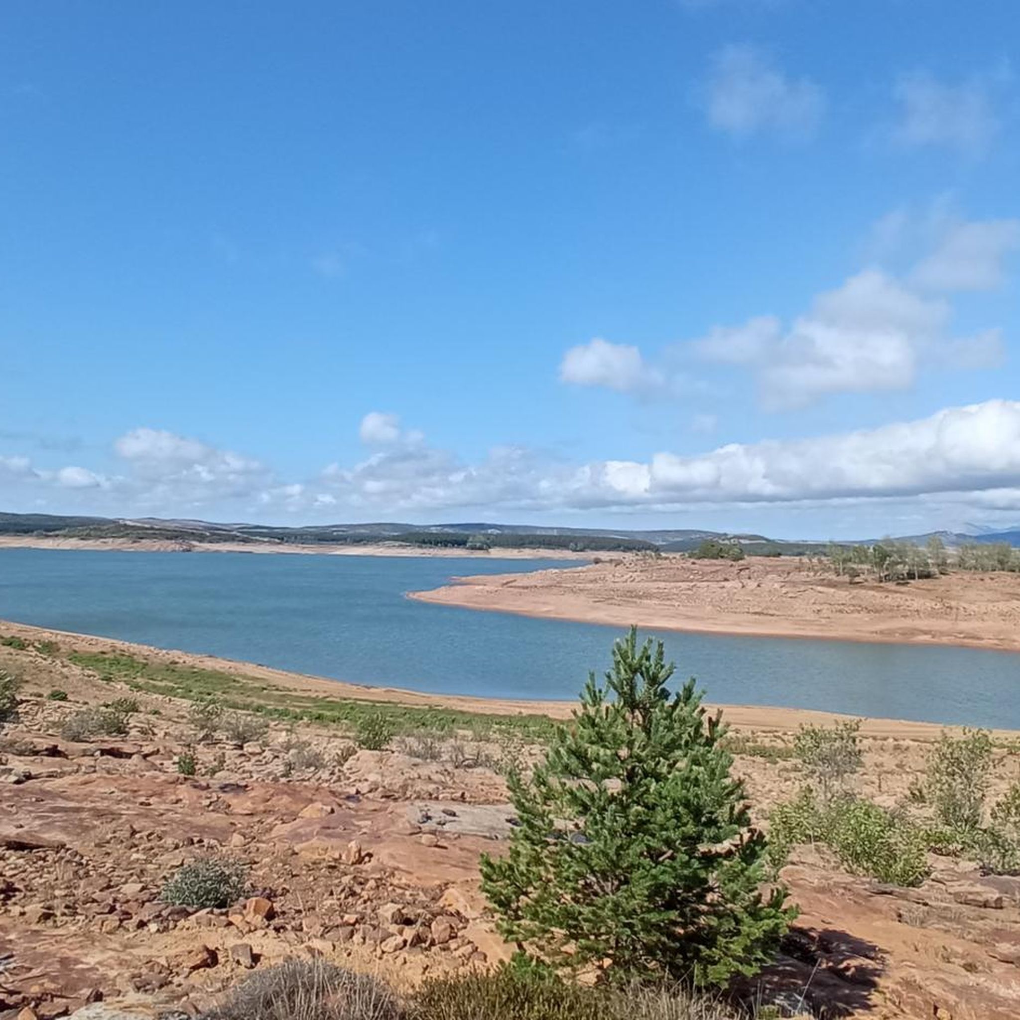
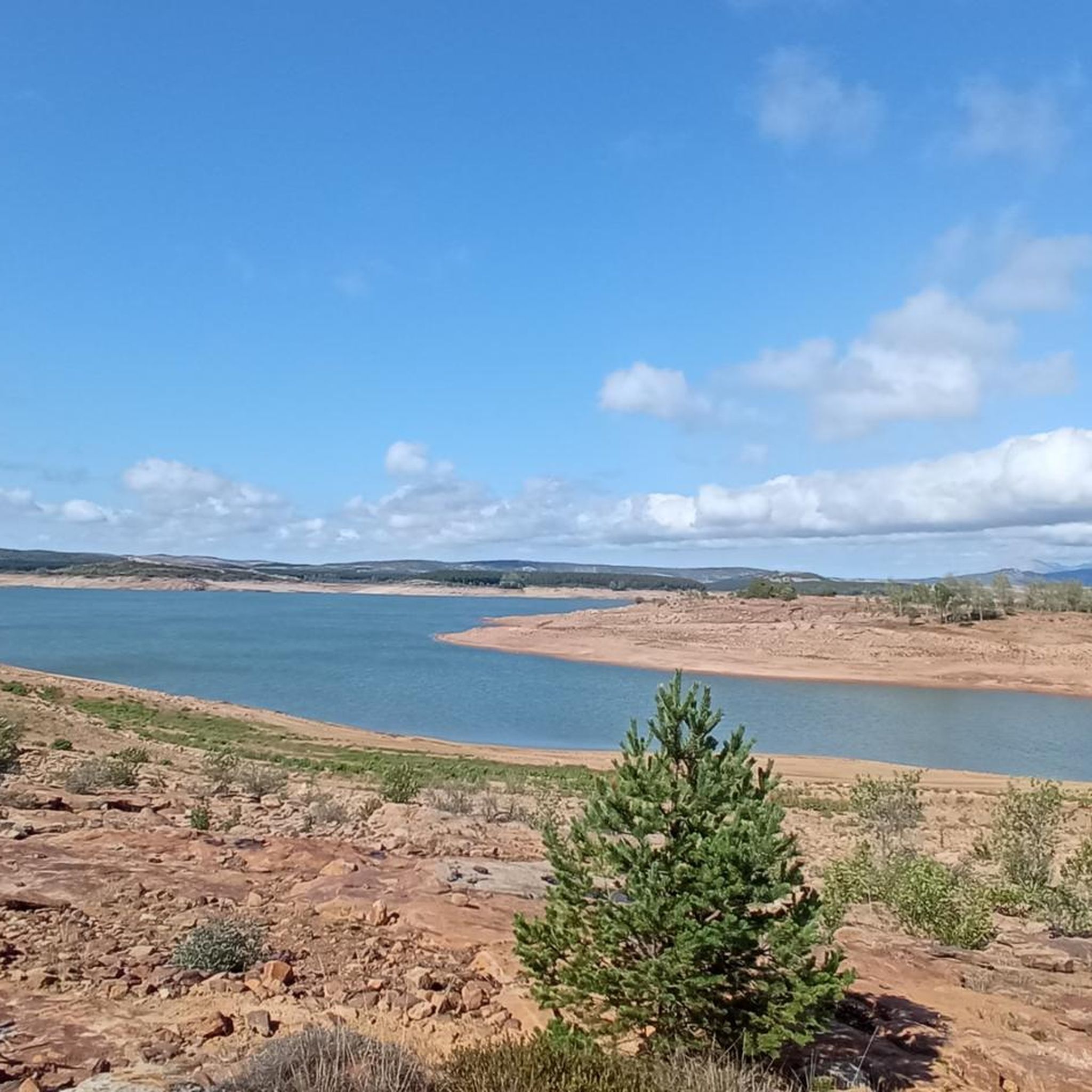
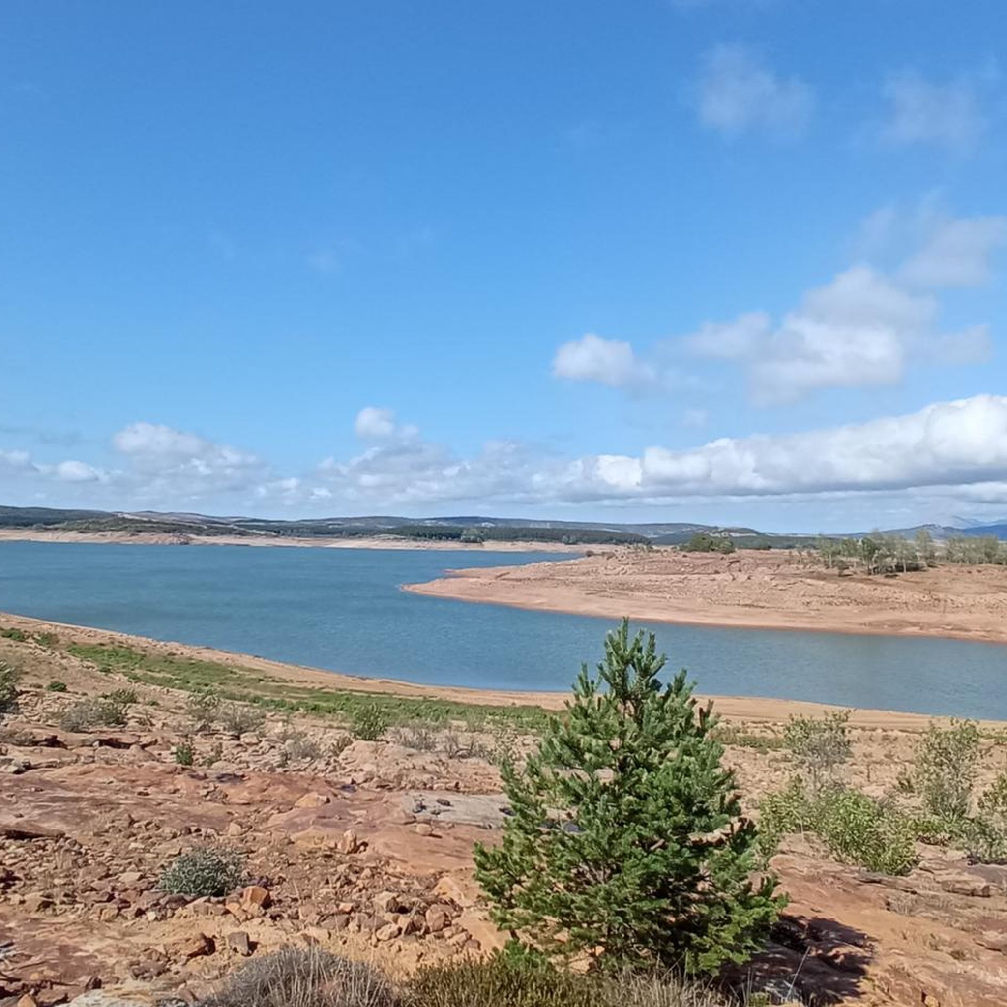
Jogging around Embalse de Aguilar offers access to the natural landscapes of the Palencia Mountains in Castilla y León, Spain. The region is characterized by the reservoir, which is the largest body of water in Palencia, set against the backdrop of the Cantabrian Mountains and limestone peaks. Running routes often follow sections of the "Ruta de los Pantanos," providing varied terrain and tranquil environments. The area features accessible trails that integrate the reservoir's expanse with surrounding natural parkland.
Best jogging…
Last updated: June 28, 2026
5.0
(1)
3
runners
5.58km
00:40
30m
30m
Moderate run. Good fitness required. Mostly paved surfaces. Suitable for all skill levels.
5
runners
20.9km
02:21
350m
350m
Hard run. Very good fitness required. Mostly paved surfaces. Suitable for all skill levels.

Sign up for free
5
runners
Moderate run. Good fitness required. Mostly paved surfaces. Suitable for all skill levels.
19
runners
Moderate run. Good fitness required. Mostly paved surfaces. Suitable for all skill levels.
4.0
(1)
13
runners
Moderate run. Good fitness required. Mostly paved surfaces. Suitable for all skill levels.
Get access to more routes and recommendations from other explorers.
Sign up for free
Already have an account?
Our route recommendations are based on thousands of hikes, rides, and runs completed by other people on komoot.
Start today with a free account
Your next adventure awaits.
Login or Signup

Tips from the Community

In the Plaza de España, the nerve centre of the town.
1
0
The amount of water this river carries is always surprising.
1
0
The views are spectacular, that alone makes it worth taking a look.
1
0

a cool place.
0
0

Puente Mayor over the Pisuerga River is of medieval origin. We can see the small islands in the river and the castle hill.
2
0
Great viewpoint tower that allows us to enjoy panoramic views of the Aguilar Reservoir and its dam. On the horizon you can see the Palencia mountains.
2
0

The stone labyrinth of Las Tuerces has several paths and the Natural monument can be explored according to one's taste, letting oneself be guided by intuition and the indications of the itineraries. The track is a general proposal with a loop that approaches the viewpoints of the Pisuerga River to learn about the natural, geological and environmental values of the natural area. The Las Tuerces labyrinth occupies a plain of limestone rocks sculpted by water erosion on a syncline hanging in the canyon of the Pisuerga River, a territory of geological interest because it marks the meeting between the Cantabrian mountains and the lands of the moor. In the shadowy stone alleys, relict beech trees, hazelnut trees, gall oaks, rocky vegetation and thorny plants from humid environments typical of other latitudes appear, coexisting amazingly with holm oaks, junipers and shrubs from a Mediterranean environment, a forest wonder. An admirable whim of nature that is a lesson in geology and the history of the Earth in the last hundred million years in the open air.
2
0

The Aguilar reservoir, inaugurated in 1964, plays a crucial role in regulating the Pisuerga River. With a height of 48 meters and a length of half a kilometer, the dam is one of the largest in the area. It is part of a set of three reservoirs and is considered a tourist attraction thanks to the "Ruta de los Pantanos".
1
0
Frequently Asked Questions
What types of running routes can I find around Embalse de Aguilar?
The Embalse de Aguilar area offers a variety of running routes, ranging from moderate loops to more challenging trails. You'll find paths along the reservoir shorelines, riverside routes, and varied terrain within the Palencia Mountains. There are 28 routes in total, with 20 classified as moderate and 8 as difficult, catering to different fitness levels.
Are there any easy jogging trails suitable for beginners or families?
While the guide primarily highlights moderate and difficult routes, many of the moderate trails around Embalse de Aguilar can be suitable for beginners or families looking for a less strenuous run. For example, the Playa del embalse de Aguilar loop from Restaurante Monte Royal is a moderate 5.6 km (3.5 miles) route that offers pleasant views of the reservoir's beach area and can be completed in about 40 minutes.
Can I find circular running routes in the Embalse de Aguilar region?
Yes, many of the running routes around Embalse de Aguilar are circular, offering convenient starting and ending points. A popular option is the Casa de la Granja loop from Aguilar de Campoo, a 6.4 km (4.0 miles) trail that takes you through the scenic area surrounding Aguilar de Campoo.
What kind of scenery and natural features will I encounter on the running paths?
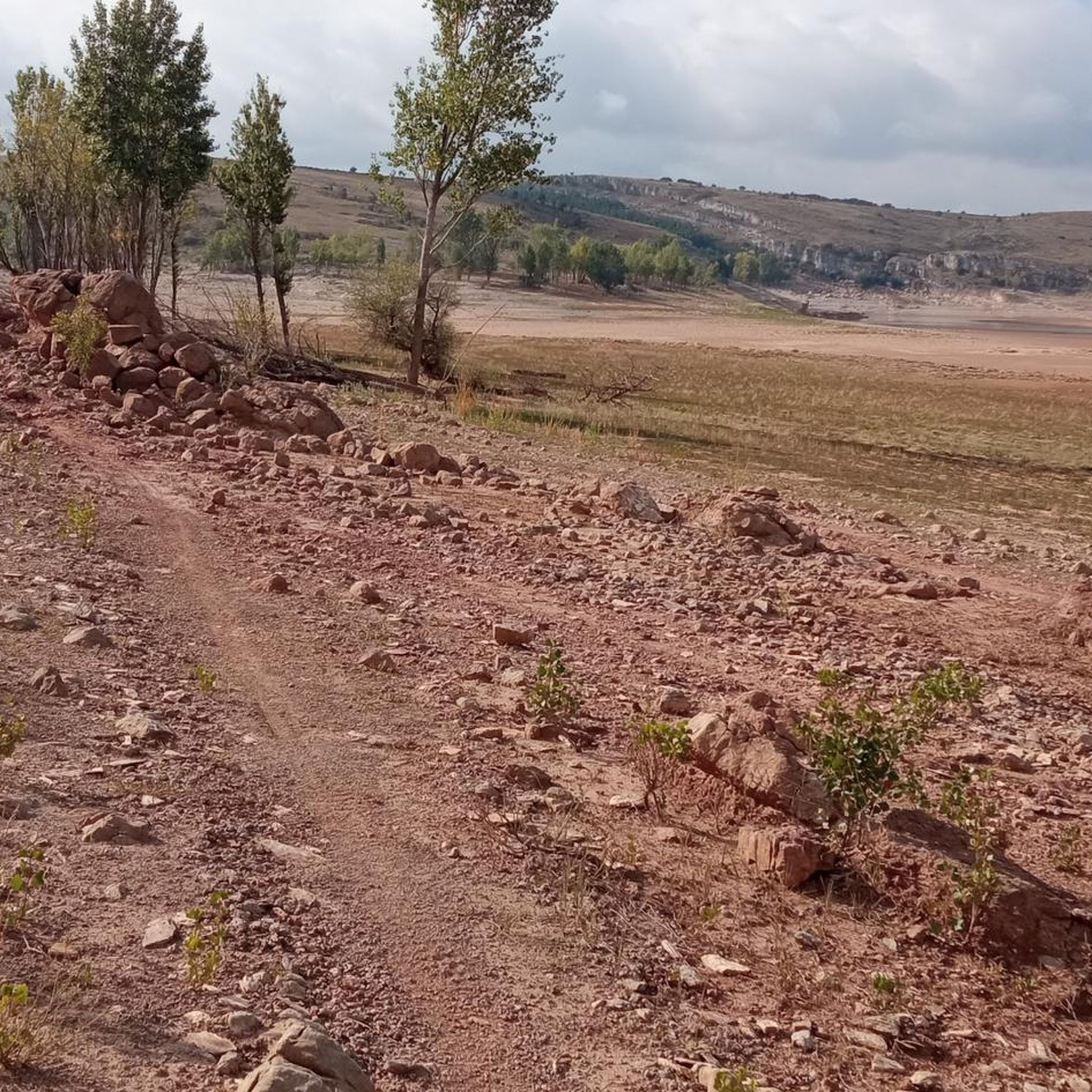
Jogging around Embalse de Aguilar immerses you in the stunning natural beauty of the Palencia Mountains. You'll experience the tranquil expanse of the reservoir, which is the largest body of water in Palencia, set against a backdrop of limestone peaks. Many routes follow sections of the "Ruta de los Pantanos," offering varied terrain, sharp, clean air, and the chance to spot local wildlife like golden eagles. When water levels are low, you might even see the haunting remains of the submerged village of Cenera de Zalima.
Are there any historical or cultural landmarks along the jogging routes?
The region is rich in Romanesque architecture, and while jogging, you might encounter historical elements that add a cultural dimension to your run. The Palencia Mountains boast one of Europe's largest concentrations of Romanesque constructions. For instance, the Horadada Tunnel – Collegiate Church of San Miguel loop from Aguilar de Campoo is a more challenging route that passes by significant historical sites.
What do other runners say about the trails in Embalse de Aguilar?
The running routes in Embalse de Aguilar are highly rated by the komoot community, with an average score of 4.2 stars from over 10 reviews. Runners often praise the varied terrain, the stunning reservoir views, and the tranquil environment that allows for an immersive outdoor experience. Over 100 runners have used komoot to explore the area's diverse paths.
Are there any riverside running options available?
Yes, you can find excellent riverside running experiences. A notable route is Quintanaluengos from Salinas de Pisuerga on the banks of the river Pisuerga, a moderate 10.8 km (6.7 miles) path that follows the banks of the Pisuerga River, offering a different scenic perspective.
What is the best time of year to go running in Embalse de Aguilar?
The Embalse de Aguilar region offers beautiful conditions for running throughout much of the year. The sharp, clean air is a constant, but specific seasons might offer different advantages. Summer can reveal unique historical landscapes as water levels recede, while other seasons provide lush greenery or crisp, clear days. Always check local weather conditions before heading out.
Are there any longer or more challenging running routes for experienced runners?
Absolutely. For experienced runners seeking a greater challenge, there are 8 difficult routes available. An example is the Horadada Tunnel – Collegiate Church of San Miguel loop from Aguilar de Campoo, which covers 17.5 km (10.9 miles) and features more significant elevation changes, providing a demanding yet rewarding experience.
Are there places to explore or towns near the running trails?
The Embalse de Aguilar is conveniently located near the town of Aguilar de Campoo, which serves as a great base for exploring the area. Many routes, such as the Plaza de España – Pisuerga River loop from Aguilar de Campoo, start or pass through the vicinity of the town, allowing you to combine your run with local exploration.
What are the typical distances and durations for running routes in this area?
The running routes around Embalse de Aguilar vary in length and duration. Moderate routes can range from around 5.6 km (3.5 miles) taking about 40 minutes, to longer paths like 10.8 km (6.7 miles). More difficult routes can extend up to 17.5 km (10.9 miles), requiring several hours to complete, depending on your pace and fitness level.
Most popular routes around Embalse de Aguilar

Get inspired with the komoot mobile app


Explore more
Browse the best Running Trails & Routes in other regions.
