The best running trails around Lac des Quirlies
4.8
(15)
1,668
runners
57
runs
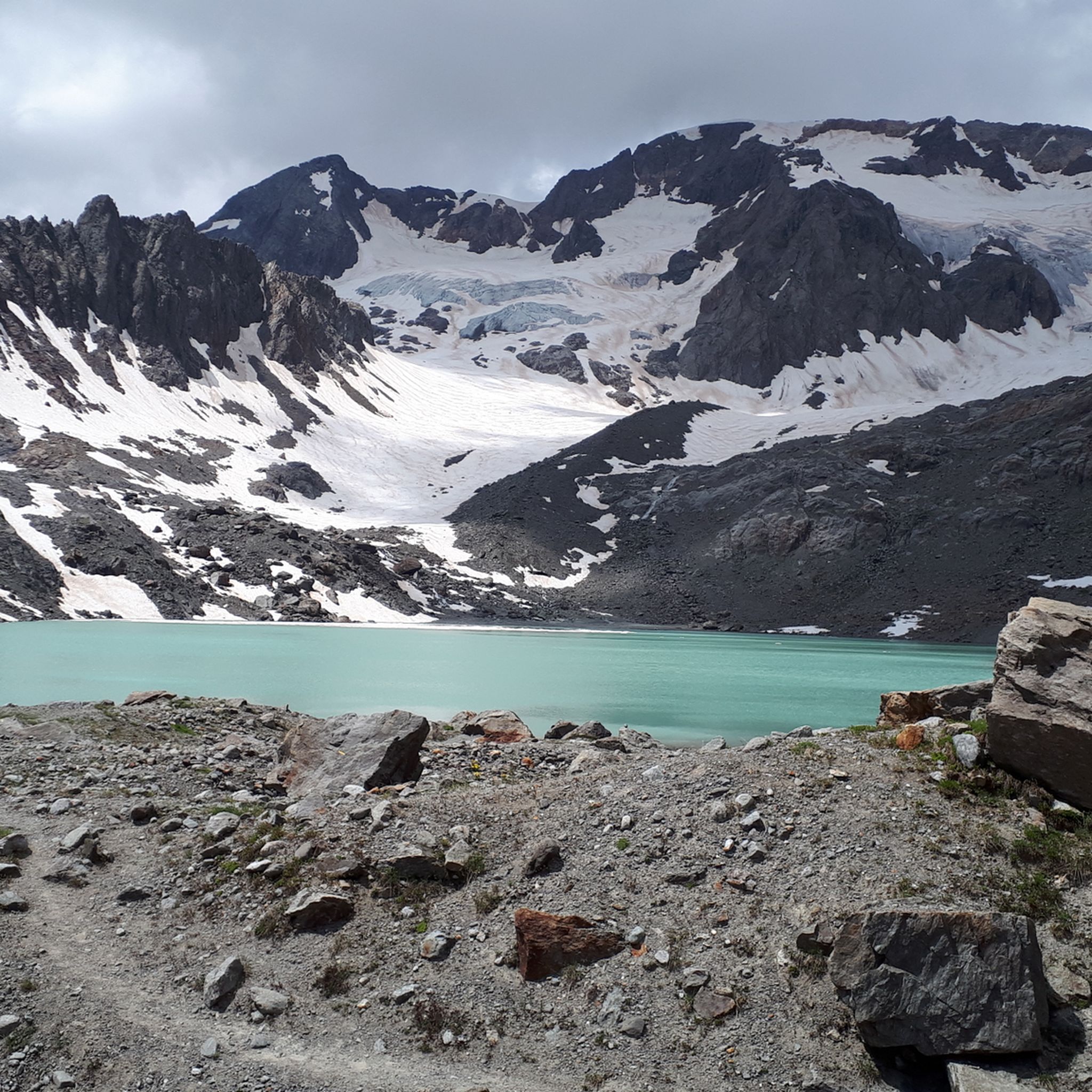
Jogging routes around Lac des Quirlies traverse a high-mountain environment in the Grandes Rousses massif, characterized by challenging terrain and significant elevation changes. The region features dramatic glacial landscapes, including the distinctive milky-blue Lac des Quirlies itself, surrounded by granite moraines and high glaciers. Running paths often involve steep ascents, rocky sections, and offer panoramic views of iconic peaks like the Aiguilles d'Arves and La Meije. This area is primarily suited for experienced trail runners seeking demanding routes rather than…
Last updated: July 1, 2026
18
runners
6.31km
01:06
470m
470m
Hard run. Very good fitness required. Mostly paved surfaces. Suitable for all skill levels.
278
runners
39.0km
05:41
1,940m
1,940m
Hard run. Very good fitness required. Sure-footedness, sturdy shoes and alpine experience required.

Sign up for free
46
runners
5.83km
00:44
100m
100m
Hard run. Good fitness required. Sure-footedness, sturdy shoes and alpine experience required.
60
runners
14.2km
02:13
830m
830m
Hard run. Very good fitness required. Sure-footedness, sturdy shoes and alpine experience required.
5.0
(1)
31
runners
8.64km
01:02
300m
290m
Hard run. Good fitness required. Sure-footedness, sturdy shoes and alpine experience required.
Get access to more routes and recommendations from other explorers.
Sign up for free
Already have an account?
Our route recommendations are based on thousands of hikes, rides, and runs completed by other people on komoot.
Start today with a free account
Your next adventure awaits.
Login or Signup
Tips from the Community

Located just before Alpe d’Huez, the village of Huez combines charm and authenticity. Its peaceful alleyways, traditional houses, and old church contrast with the modernity of the resort that overlooks it.
0
0

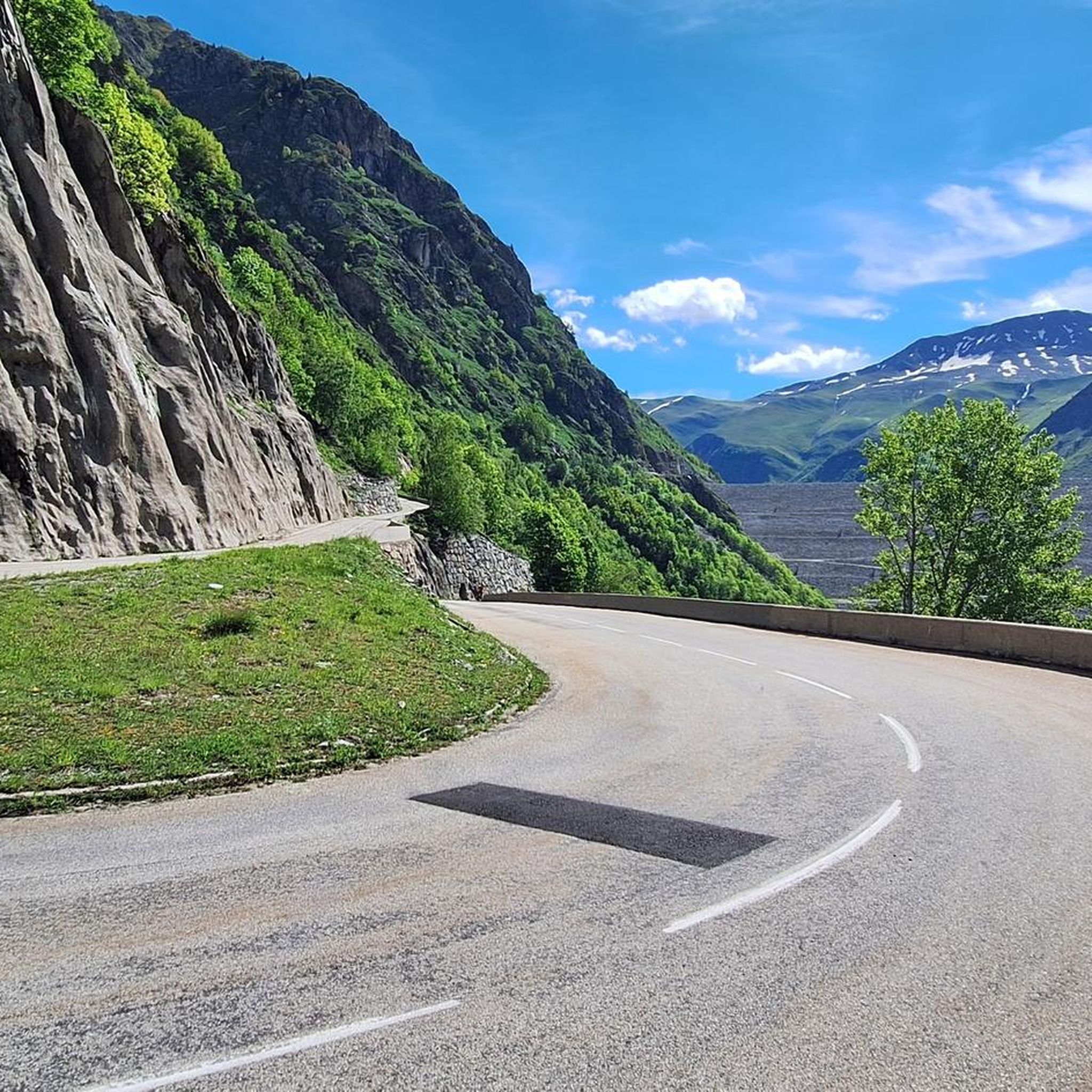
The most beautiful hill to climb in these areas.
12
0

There are no crowds here, just you, the mountain, the wind, and the sensation of pedaling on one of the remote peaks of the French Alps. The summit, at almost 2,000 meters, offers a 360° panorama that erases fatigue and ignites the cycling spirit.
4
0

A busy hiking trail in summer. All those lakes and vistas are beautiful.
0
0
A busy hiking trail in summer. All those lakes and vistas are beautiful.
0
0
Just want a drink? You're not allowed to sit on the terrace. (Summer peak season)
0
0

Beautiful glacial lake on a plateau above the Alpe d'Huez ski resort,
0
0
Frequently Asked Questions
What kind of terrain can I expect on running routes around Lac des Quirlies?
The terrain around Lac des Quirlies is challenging and rugged, characteristic of a high-mountain environment. Runners will encounter significant elevation changes, steep ascents, rocky sections, granite moraines, and scree. Some paths may involve aerial passages and unbridged stream crossings, requiring sure-footedness and alpine experience.
Are there any easy or beginner-friendly running trails near Lac des Quirlies?
The running routes around Lac des Quirlies are predominantly difficult, with 46 out of 50 routes classified as such. There are no easy routes, and only 4 are considered moderate. The area is primarily suited for experienced trail runners seeking demanding challenges rather than casual jogging or beginner trails.
What natural features or landmarks can I see while running in this region?
The region offers dramatic landscapes and unique natural features. You can expect to see the captivating milky-blue glacial Lac des Quirlies itself, surrounded by granite moraines and high glaciers. The Ferrand valley features the impressive Ferrand Bridge waterfall, where two cascades converge, and the imposing Échine de Praouat schist ridge. You'll also be treated to panoramic views of iconic peaks like the Grand Sauvage, the Plateau d'Emparis, the Aiguilles d'Arves, and La Meije.
How many running routes are available around Lac des Quirlies?
There are over 50 running routes available around Lac des Quirlies, offering a wide range of challenging experiences for trail runners. The vast majority of these, 46 routes, are classified as difficult, with the remaining 4 being moderate.
What do other runners say about the trails in Lac des Quirlies?
The running trails in Lac des Quirlies are highly rated by the komoot community, with an average score of 4.6 stars from more than 10 reviews. Over 1800 runners have used komoot to explore the varied and demanding terrain, often praising the spectacular high-alpine scenery and the challenging nature of the routes.
Are there any circular running routes in the area?
Yes, there are several circular running routes. For instance, the Col du Sabot loop from Vaujany is a difficult 15.7 km path with significant elevation gain, offering a comprehensive tour of the mountain landscape.
Can I bring my dog on the running trails around Lac des Quirlies?
While specific regulations for dogs on every trail are not detailed, the area is classified as Natura 2000, indicating its ecological importance and fragile, protected biodiversity. It's generally advisable to keep dogs on a leash in such sensitive high-mountain environments to protect wildlife and ensure their safety on challenging terrain.
What is the best time of year to go running near Lac des Quirlies?
Given its high-mountain location at 2,566 meters (8,418 feet), the best time for running around Lac des Quirlies is typically during the warmer months, from late spring to early autumn. Outside of this period, you can expect snow and ice, making the already challenging trails even more difficult and potentially dangerous due to high-mountain conditions.
Are there any routes that pass by waterfalls?
Yes, the Sabot Pass – La Fare Waterfall loop from Vaujany is a notable route that leads through mountain passes and directly past the impressive La Fare Waterfall, offering a scenic and challenging experience.
What kind of fitness level is required for running in this region?
Running in the Lac des Quirlies region requires a very good fitness level, sure-footedness, and alpine experience. The trails involve significant elevation gain, steep ascents, and rugged terrain, making them suitable for experienced trail runners seeking a demanding workout rather than casual joggers.
Where can I start a running route to Lac des Quirlies?
A common starting point for accessing the high-mountain trails leading towards Lac des Quirlies is Le Perron in Clavans-en-Haut-Oisans. Another popular starting village for several routes is Vaujany, which offers access to trails like the Saint-Étienne Church – Le Serf loop from Vaujany.
Most popular routes around Lac des Quirlies

Get inspired with the komoot mobile app


Explore more
Browse the best Running Trails & Routes in other regions.
