The best walks and hikes around St. Issey
4.7
(2020)
19,389
hikers
272
hikes
Hikes around St Issey Cornwall explore a landscape defined by the Camel Estuary and its tidal creeks. The terrain consists of rolling fields, riverside paths, and sections of historic trails like The Saints' Way. Most routes feature gentle gradients with some moderate climbs when heading inland or along the coast.
Best hiking trails around St. Issey
- The most popular hiking route is Padstow to Trevone loop — Cornwall, a 7.5 mile (12.1 km) trail that takes about 3 hours 15 minutes to complete. This moderate route follows coastal paths near the popular harbour town of Padstow.
- Another top favourite among local hiking enthusiasts is The Camel Trail & Padstow loop from Little Petherick — Cornwall, a moderate 5.7 mile (9.2 km) path. The route combines a section of the largely flat Camel Trail with paths around Little Petherick Creek.
- Local hiking enthusiasts also love the Brea Hill & St Enodoc loop from Rock — Cornwall, a 3.5 mile (5.6 km) trail leading through coastal dunes and past the historic St Enodoc Church, often completed in about 1 hour 30 minutes.
- Hiking around St. Issey is defined by estuary walks, coastal headlands, and ancient inland paths. The network of trails provides options for various ability levels, from easy riverside strolls to more challenging coastal hikes.
- The routes in St. Issey are highly rated by the komoot community with an average score of 4.7 stars from over 1,600 reviews. More than 16,000 hikers have used komoot to explore St. Issey's varied terrain.
Last updated: October 10, 2026
4.8
(177)
954
hikers
12.1km
03:15
150m
150m
Embark on the Padstow to Trevone loop, a moderate hike spanning 7.5 miles (12.1 km) with an elevation gain of 486 feet (148 metres), typically taking 3 hours and 15 minutes to complete. This route treats you to panoramic views of the Atlantic Ocean and the tranquil Camel Estuary. As you hike, you'll navigate varied terrain, from dedicated paths to rugged sections beyond Gun Point, passing golden sandy beaches like Trevone Bay and Hawker's Cove. The path undulates with ascents and descents along cliff tops, offering a true taste of Cornwall's dramatic coastline.
Starting from the charming fishing town of Padstow, this loop requires good fitness due to its moderate difficulty and varied ground underfoot. You should wear sturdy footwear to handle the diverse surfaces, which include footpaths, some road stretches, and sandy dunes. Trevone Bay, a key point on the route, offers convenient facilities such as toilets, a cafe, and a shop, making it a good spot for a break. Be prepared for uneven sections, especially beyond Gun Point, to fully enjoy the experience.
This quintessential Cornish coastal walk beautifully combines natural grandeur with historical and geological points of interest. You will encounter the prominent Stepper Point Daymark, a historical navigational beacon offering expansive views. The route also passes the impressive Trevone Roundhole, a natural collapsed sea-cave, and provides views of the infamous Doom Bar sand bank at the mouth of the Camel Estuary. The dramatic coastline features towering cliffs, unique rock formations, and an abundance of coastal wildlife and wildflowers.
4.4
(14)
69
hikers
9.19km
02:28
110m
110m
Embark on the Saints Way and Camel Trail Circular, a moderate hike covering 5.7 miles (9.2 km) with an elevation gain of 366 feet (111 metres). This route takes about 2 hours and 27 minutes to complete. You will experience a varied journey, traversing lush valleys and ancient farmland on the historic Saints Way, then enjoying the flatter terrain of the Camel Trail with its stunning views of the Camel Estuary, especially beautiful at high tide near Padstow Harbour. The trail offers a rich experience of Cornwall's diverse natural features. You will find a unique blend of historical significance and picturesque Cornish landscapes along the way.
To plan your visit, consider starting your hike near areas like Little Petherick, where you can often find parking options. The route is generally well-marked, particularly the Saints Way, which features distinctive black and yellow signage to guide you. Be ready for varied terrain, as the trail combines the flat, accessible sections of the disused railway line on the Camel Trail with the sometimes steeper paths you will encounter on the Saints Way. This ensures a dynamic and engaging experience for your hike.
This circular route stands out for its combination of two significant Cornish paths. The historic Saints Way, an ancient pilgrimage route, winds through inland creeks and traditional villages, offering glimpses into the region's past. In contrast, the scenic Camel Trail follows a disused railway line, providing expansive views of the estuary and a different perspective on the Cornish coast. The trail offers a rich tapestry of Cornwall's natural beauty and heritage, making it a notable option for exploring the area.

4.7
(7)
48
hikers
5.61km
01:30
60m
60m
The Brea Hill & St Enodoc loop from Rock, Cornwall, offers an easy hiking experience with varied landscapes. This route covers 3.5 miles (5.6 km) with a gentle elevation gain of 208 feet (64 metres), taking about 1 hour and 29 minutes to complete. You will walk on mostly flat, accessible paths, passing through dunes, fields, and coastal sections. From Brea Hill, you can enjoy panoramic views of the Camel Estuary, the town of Padstow across the water, Daymer Bay, and the Atlantic. The trail features golden, sandy beaches and some gentle climbs.
This easy trail is suitable for most fitness levels, with paths that are generally well-maintained. Be aware that some portions of the route cross through the St Enodoc Golf Course. The trail is a popular choice for exploring the Cornish coastline, and you can easily access it from Rock. Consider taking the convenient ferry service from Rock to Padstow if you wish to extend your exploration across the estuary.
A significant highlight of the loop is the ancient St Enodoc Church, a 12th-century structure once almost entirely buried in sand. This quaint church is also the final resting place of Poet Laureate Sir John Betjeman. Brea Hill itself was historically a Roman lookout station and contains Bronze Age burial mounds, adding a layer of history to your hike. Daymer Bay, another feature, is a beautiful spot for swimming at high tide, and its dunes are known for their wildlife.
4.8
(110)
644
hikers
25.8km
06:57
330m
330m
Hard hike. Very good fitness required. Easily-accessible paths. Suitable for all skill levels.
4.8
(56)
452
hikers
26.6km
07:12
370m
370m
Hard hike. Very good fitness required. Easily-accessible paths. Suitable for all skill levels.
Get access to more routes and recommendations from other explorers.
Already have an account?
Our route recommendations are based on thousands of hikes, rides, and runs completed by other people on komoot.
Start today with a free account
Your next adventure awaits.


Other adventures around St. Issey

Tips from the Community

The South West Coast Path is Britain's longest and arguably most iconic national trail. Stretching an impressive total length of over a thousand kilometres, this iconic route meanders along the rugged coastlines of Somerset, Devon, Cornwall, and Dorset. Originally, the path was formed by the coastguard, who patrolled the cliffs day and night in search of smugglers. Today, the route takes walkers along a continuous alternation of sheer granite cliffs, deep coves, golden sandy beaches, and idyllic fishing villages. Walking the South West Coast Path is a sporting and physical challenge, as the constant ascents and descents along the cliff edges mean you cover a huge amount of elevation gain over the entire length. However, it rewards you at every point with breathtaking panoramas of the Atlantic Ocean, encounters with seabirds and seals, and a unique glimpse into the region's rich maritime and industrial past.
0
0
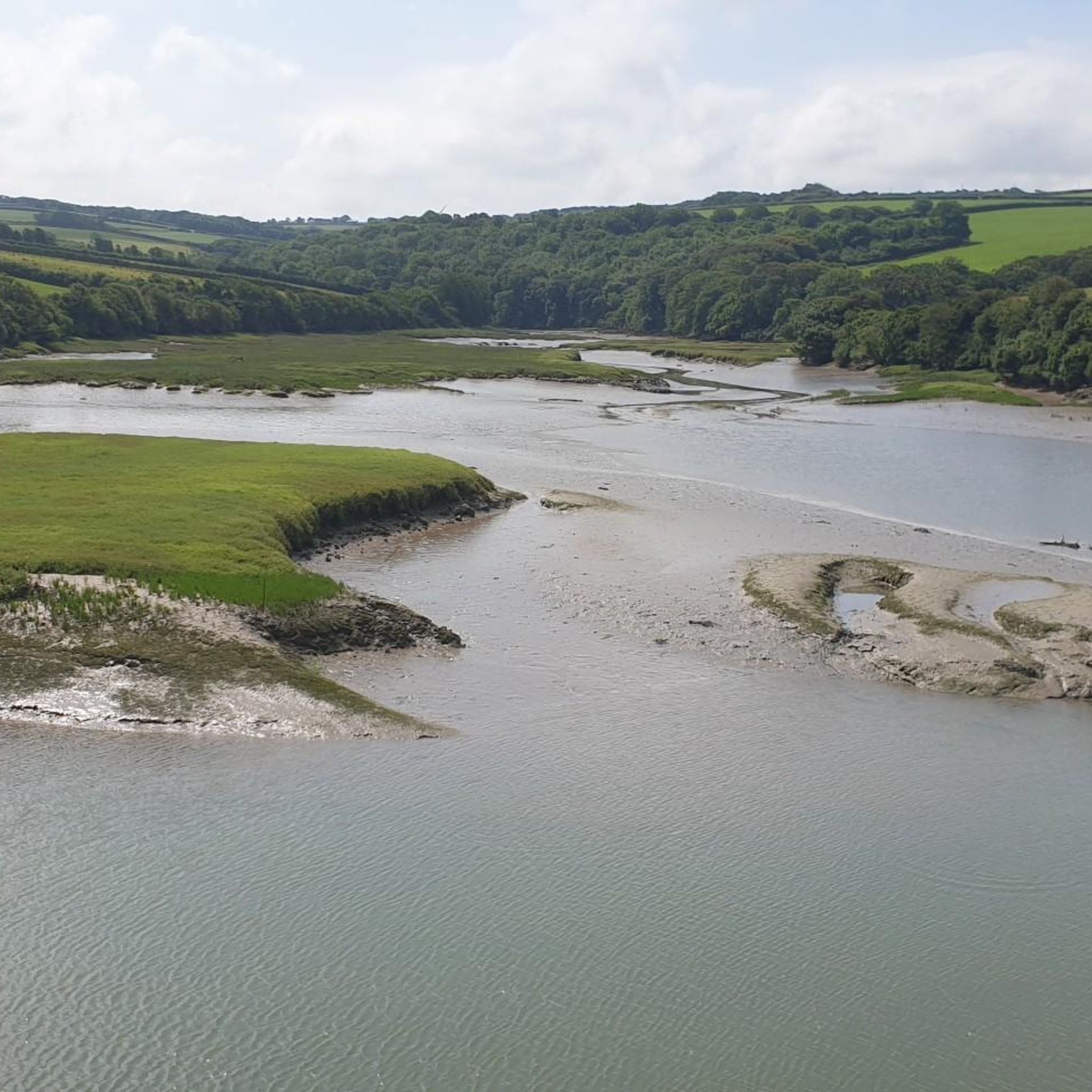
The view of the Camel Estuary is one of the most beautiful river and coastal landscapes in North Cornwall. From the cliffs and surrounding walking paths, you have a magnificent view down onto the wide estuary where the River Camel flows into the Atlantic Ocean. The changing tide constantly transforms the panorama from a vast, azure expanse of water to an idyllic landscape full of golden sandbanks, including the infamous The Doom Bar. Around the estuary, you will see green hills, sailboats bobbing on the water, and the picturesque silhouettes of villages such as Padstow and Rock. It is a fantastic place to get some fresh air, spot waterfowl, and enjoy the soothing English coastal scenery.
0
0
The rugged coastal cliffs of Cornwall are among the most spectacular and impressive natural landscapes in Great Britain. The granite and slate rocks, meters high and rising directly from the Atlantic Ocean, are constantly battered by wild waves and powerful sea winds. Walking along the famous South West Coast Path, you will discover a succession of dramatic cliffs, deep coves, hidden smugglers' bays, and remnants of historic tin mines balancing above the water. From the cliff paths, you can enjoy breathtaking panoramic views, often encounter seabirds and seals, and experience the raw, pure power of the English coastal nature.
0
0
Stepper Point Daymark Tower is a striking, stone-built 1830s lighthouse that towers high above the cliffs at the northern end of Stepper Point, near Padstow in Cornwall. The round lighthouse, over nine metres high, was originally built to safely guide and warn ships into the mouth of the River Camel and Padstow harbour, alerting them to the infamous and dangerous sandbank, The Doom Bar. Today, the tower is a beloved and photogenic landmark for walkers on the iconic South West Coast Path. From the cliffs surrounding the tower, you can enjoy spectacular panoramic views across the Atlantic Ocean, the rugged north Cornwall coastline, and the inner reaches of the Camel Estuary.
0
0

Nice run, sometimes narrow paths for a trail run but beautiful route!
0
0


Beautiful hike well worth the effort and experience. It’s called the roller coaster for a reason 😁
0
0
Frequently Asked Questions
Are there many circular walks around St. Issey?
Yes, the area offers numerous circular walks. While many trails follow the estuary or coast, you can find loops that combine these scenic paths with inland routes through fields and villages. A great example of a longer, more challenging circular route is the Stepper Point Daymark Tower – Constantine Bay Beach loop from Padstow, which provides dramatic coastal views.
What is The Saints' Way and can I walk it from St. Issey?
The Saints' Way is a historic 27-mile pilgrimage trail crossing Cornwall from Padstow to Fowey. St. Issey is located directly on this route, making it an excellent starting point. You can walk a popular section north towards Little Petherick Creek and Padstow, or head south to explore the inland Cornish countryside. For more details on the full trail, you can consult the official information on visitcornwall.com.
Are the walking trails near St. Issey dog-friendly?
Many trails around St. Issey are suitable for walking with dogs, especially the paths through open fields and along the Camel Estuary. However, always be mindful of livestock and keep your dog on a lead where required. Some coastal areas may have seasonal restrictions on beaches, so it's best to check local signage.
What is the terrain like on the walks around St. Issey?
The terrain is quite varied. You'll find many gentle, relatively flat paths, particularly along the Camel Trail and the estuary creeks. Routes that venture onto the coastal path, such as towards Stepper Point, will involve more moderate climbs and descents with some uneven surfaces. Inland walks typically feature rolling hills and country lanes.
Are there any good short walks suitable for families?
Absolutely. The section of the Camel Trail between Wadebridge and Padstow is a popular choice for families as it's largely flat and traffic-free. For a shorter loop with coastal scenery, the 3.5-mile Brea Hill & St Enodoc loop from Rock is an excellent option, taking you through dunes and past a historic church.
How do I get to the trailheads using public transport?
St. Issey and the surrounding area, including Padstow and Wadebridge, are served by local bus routes. These can connect you to the start of many popular walks, including sections of The Saints' Way and the Camel Trail. It's recommended to check the latest bus timetables in advance as services can vary, especially on weekends and holidays.
Where is the best place to park for walks near St. Issey?
For walks starting in St. Issey itself, there is limited on-street parking. For access to the Camel Trail or coastal paths around Padstow, it's often easier to use the larger pay-and-display car parks in Padstow or Wadebridge. Some specific trailheads, like those for the Pentire Headland, have their own dedicated parking areas.
Are there any long-distance hiking options starting near St. Issey?
Yes, St. Issey is an ideal base for long-distance hikers. Besides being on The Saints' Way, it offers easy access to the South West Coast Path. You can tackle challenging day-long sections of this national trail, such as the demanding Polzeath Beach – View from Pentire Point loop from Rock, which covers over 16 miles of stunning coastline.
What do other hikers say about the trails around St. Issey?
The trails are highly regarded by the komoot community, with an average rating of 4.7 out of 5 stars. Hikers frequently praise the beautiful views across the Camel Estuary and the variety of walks available, from gentle riverside strolls to more rugged coastal treks.
Can I find a pub or cafe on a walk near St. Issey?
Yes, many walks are conveniently located near villages and towns with excellent pubs and cafes. The popular harbour town of Padstow, a common point on many local routes, has numerous options for refreshments. Similarly, walks starting or finishing in Wadebridge or Rock will provide plenty of choices for a post-hike meal or drink.
What are some popular places for hiking in the St. Issey area?
Several spots are local favorites for hiking. Stepper Point is a picturesque headland offering fantastic views over the bay. For a wilder coastal experience, the National Trust - Trevose Headland is renowned for its dramatic scenery and birdwatching opportunities. The Pentire Headland Walk is another highly-rated option, known for its amazing views down the Camel Estuary, though it can be muddy.
Most popular routes around St. Issey
Most popular attractions around St. Issey

Get inspired with the komoot mobile app


Explore more
Browse the best Hikes in other regions.
