The best running trails in South West England
4.4
(2159)
196,530
runners
22,865
runs
Jogging in South West England offers diverse natural landscapes, from rugged coastlines to expansive moorlands and ancient woodlands. The region is characterized by its national parks, including Dartmoor and Exmoor, which provide varied and challenging terrains. Extensive networks of trails, such as the South West Coast Path, wind through dramatic clifftops, river valleys, and rolling hills, catering to a wide range of running preferences. This varied geography ensures a mix of gradients and surfaces for runners.
Best jogging routes in South West England
- The most popular jogging route is South West Coast Path: Isle of Portland Circuit, a 12.8 miles (20.5 km) trail that takes 2 hours 27 minutes to complete. This difficult route offers coastal views around the rugged Isle of Portland.
- Another top favourite among local runners is Bath Skyline loop from Bath Spa, a moderate 7.5 miles (12.0 km) path. This route provides scenic views around the historic city of Bath, traversing varied terrain.
- Local runners also love the Wye valley trail to Tintern from Chepstow, a 12.2 miles (19.7 km) trail leading through the scenic Wye Valley, often completed in about 2 hours 19 minutes.
- Jogging in South West England is defined by its dramatic coastlines, open moorland, and tranquil river valleys. The extensive network of routes offers options for various ability levels, from gentle runs to challenging trail runs.
- The routes in South West England are highly rated by the komoot community with an average score of 4.4 stars from over 1,600 reviews. More than 171,000 runners have used komoot to explore South West England's varied terrain.
Last updated: October 10, 2026
4.3
(15)
451
runners
20.5km
02:27
280m
280m
Lace up for a challenging jogging adventure on the South West Coast Path: Isle of Portland Circuit. This difficult route covers 12.8 miles (20.5 km) and features an elevation gain of 918 feet (280 metres), typically completed in about 2 hours and 27 minutes. You will experience constantly changing coastal views, from dramatic cliffs overlooking the English Channel to the distinctive red and white striped Portland Bill Lighthouse. The varied terrain ensures a demanding yet rewarding run.
When planning your visit, be aware that the trail includes old quarry tracks, coastal paths, and sections of shingle, particularly on Chesil Beach. Some parts, especially on the southwestern side, can be extremely poor, slippery, or muddy, even for jogging. Proper footwear with good grip is essential to tackle the mixed surfaces and occasional steep ascents and descents you will encounter. Always check local conditions before you head out.
This circuit offers a unique perspective on the Dorset Area of Outstanding Natural Beauty, showcasing its distinctive geology. As you jog, you will also catch views back along Chesil Beach and the Fleet Lagoon, which is Britain's largest tidal lagoon. The route is ideal for experienced joggers seeking a demanding coastal run with plenty of natural beauty and geological interest.
4.6
(17)
361
runners
12.0km
01:27
190m
190m
Embark on a moderate jogging adventure with the Bath Skyline loop, covering 7.5 miles (12.0 km) and gaining 639 feet (195 metres) in elevation, typically completed in 1 hour and 26 minutes. This route offers a diverse multi-terrain experience, guiding you through solid woodland trails, open grass meadows, and gravel paths. You will encounter rolling hills and some challenging ascents, including sections that can be muddy after rain. As you jog, you'll be treated to panoramic views of the historic city of Bath, nestled among tree-lined hills. A highlight is passing Sham Castle, an 18th-century folly that provides a picturesque backdrop for photos with the city in the distance.
To begin your jog, the loop is easily accessible from Bath Spa, making it convenient if you are arriving by public transport. The trail is well-managed by the National Trust and clearly marked with yellow arrows, so navigation is straightforward. Due to the varied surfaces and potential for mud, especially after wet weather, wearing good trail shoes is highly recommended for comfort and grip. While the route is dog-friendly, please keep your dog under control, particularly when passing through fields where livestock may be present.
What makes this loop special is its unique blend of natural beauty and rich history, offering a peaceful countryside escape just a short distance from the city center. As you jog, you will traverse ancient woodlands like Rainbow Wood and Bathwick Wood, and pass sites of Iron Age hillforts and Roman settlements. The trail also crosses the ancient Wansdyke boundary ditch, providing a glimpse into the area's deep past. This route truly showcases how the landscape around Bath has been shaped and appreciated over centuries.

4.8
(5)
240
runners
19.7km
02:19
510m
510m
Hard run. Very good fitness required. Mostly accessible paths. Some sure footedness required.
4.5
(4)
254
runners
8.55km
00:55
20m
20m
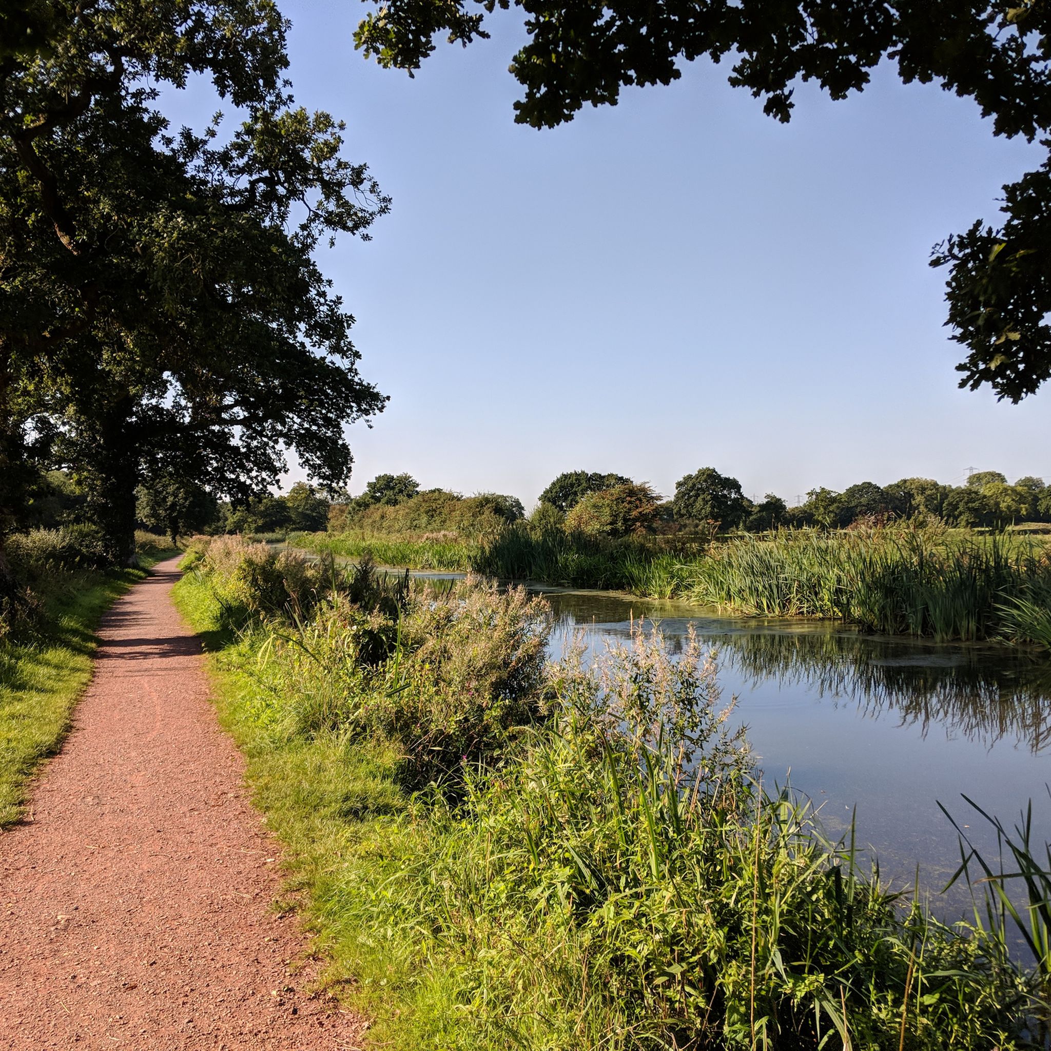
Embark on a moderate jogging loop through Riverside Valley Park and along the River Exe, a route spanning 5.3 miles (8.5 km) with a gentle elevation gain of 62 feet (19 metres). You can expect to complete this scenic journey in about 55 minutes. As you jog, you'll enjoy peaceful views of the River Exe and the Exeter Ship Canal, with lush greenery and open meadows surrounding you. Keep an eye out for glimpses of Exeter Cathedral in the distance, adding a historic touch to your outdoor experience. The trail offers a refreshing escape, connecting you with nature right near the city.
This accessible route is conveniently located, making it easy to start your jogging adventure. You can reach the trailhead with just a short walk from Exeter city centre, particularly near the historic Quayside. For those driving, convenient parking is available nearby. The path is well-used and shared responsibly, so you will encounter other joggers, cyclists, and dog walkers enjoying the same beautiful surroundings.
Beyond the natural beauty, this trail provides an excellent opportunity to observe local wildlife, such as kingfishers, grey herons, and swans, especially near the water's edge. The route also offers a direct connection to the vibrant Exeter Quay area, perfect for extending your outing with a visit to its shops and cafes. It's a popular choice for anyone looking to combine urban accessibility with a refreshing outdoor experience.
5.0
(3)
198
runners
9.24km
01:01
130m
130m
Embark on the Dartington Estate & Staverton loop, a moderate jogging route that covers 5.7 miles (9.2 km) with an elevation gain of 430 feet (131 metres). You can expect to complete this scenic journey in about 1 hour and 1 minute. As you jog, you will follow tranquil riverside paths along the River Dart, winding through lush woodlands like North Wood, where impressive Redwood trees stand tall. The route also guides you through the beautifully maintained Dartington Hall gardens, offering a blend of natural beauty and historical charm.
Planning your visit to this route is straightforward, as the Dartington Estate is a well-known and accessible starting point. The trail features varied terrain, including asphalt, natural, unpaved, and gravel surfaces, catering to different preferences. While generally considered moderate, the paths are easily accessible, so a good level of fitness will ensure you enjoy the experience fully. Consider starting your jog in the morning to experience the peaceful atmosphere before it gets too busy.
This historic estate offers a rich tapestry of scenery and a chance to connect with nature and history. Keep an eye out for local wildlife, such as kingfishers and herons, along the riverbanks, adding to the natural appeal. The Dartington Hall gardens themselves are a highlight, showcasing ancient trees and artistic sculptures that provide unique visual interest throughout your jog. This route stands out for its combination of natural landscapes and cultural heritage.
3.7
(3)
159
runners
Hard run. Very good fitness required. Sure-footedness, sturdy shoes and alpine experience required.
5.0
(2)
203
runners
23.5km
02:48
450m
450m
Embark on a difficult jogging adventure along the Old Harry Rocks loop from Corfe Castle, a challenging 14.6-mile (23.5 km) route that demands very good fitness. This trail takes approximately 2 hours and 47 minutes to complete, guiding you through varied terrain including accessible paths, soft trails, and hard-packed ground. You will experience dramatic coastal vistas along the Jurassic Coast, sweeping views across Poole Bay, and the iconic chalk sea stacks of Old Harry Rocks.
Prepare for a demanding experience, as this loop involves significant elevation gain, totaling 1478 feet (450 metres). The route traverses diverse surfaces characteristic of the Isle of Purbeck, from coastal paths and chalk ridges to open heathlands. Starting from the historical Corfe Castle, you should be ready for a run that tests your endurance and sure-footedness across its varied landscapes.
This trail offers more than just a workout; it is a journey through a UNESCO World Heritage Site. Keep an eye out for diverse wildlife, including various seabirds, and if you are lucky, seals and bottlenose dolphins in the waters around Old Harry Rocks. Completing this loop is a notable achievement for joggers, combining historical interest with stunning natural beauty and the chance to spot peregrine falcons above Ballard Down.
4.5
(2)
185
runners
12.6km
01:30
230m
230m
This moderate jogging loop, the Freshford, Iford & Avoncliff loop from Bradford on Avon, offers a diverse and picturesque experience. You'll cover 7.8 miles (12.6 km) with about 739 feet (225 metres) of elevation gain, taking around 1 hour and 29 minutes to complete. Expect varied terrain, including natural paths, gravel, paved sections, and asphalt, as you follow riverside paths, tranquil canal towpaths, and open fields. Keep an eye out for the impressive Avoncliff Aqueduct, a key landmark on your route. While generally gentle, be prepared for some short, steep uphill sections and potentially muddy spots after rain. You'll also encounter several stiles and need to cross roads and railway lines, so stay aware of your surroundings.
Planning your visit is straightforward, as the trail is easily accessible. You can reach the route by public transport, with train stations conveniently located at Freshford and Avoncliff. This makes it a great option if you prefer not to drive. Along the way, you'll find several pubs and cafes, such as The Inn at Freshford and the Cross Guns Inn at Avoncliff, perfect for a break or refreshments. Remember to wear appropriate footwear, especially if there's been recent rain, to handle any muddy sections comfortably.
What makes this loop truly special is its blend of natural beauty and rich history, set within the southernmost end of the Cotswolds Area of Outstanding Natural Beauty. Beyond the Avoncliff Aqueduct, you'll pass by the beautiful Iford Manor & Gardens, known for its Italianate design, and other historic buildings like Westwood Manor and the Bradford-on-Avon Tithe Barn. The trail offers a unique opportunity to jog through charming Cotswold hamlets and enjoy the undulating countryside, providing a rewarding experience for those with good fitness.
4.6
(5)
137
runners
9.93km
01:18
300m
300m
Embark on the Haytor Rocks, Hound Tor & Black Hill loop for a challenging jogging adventure through Dartmoor National Park. This difficult 6.2-mile (9.9 km) route, which you can complete in about 1 hour and 18 minutes, features varied terrain from open moorland to wide grass tracks and old mining tramways. You will encounter steep ascents and descents, especially around Becka Brook, and need sure-footedness on some less defined paths. As you jog, you will pass the impressive granite outcrops of Haytor Rocks and Hound Tor, offering panoramic views across Dartmoor and even to the coast on clear days.
Planning your visit, be aware that this is considered a hard run, demanding good to very good fitness due to its significant 997 feet (304 metres) of elevation gain and varied surfaces. While some paths are well-worn, others require careful navigation. If you visit in springtime, particularly May or early June, you can enjoy fields carpeted with bluebells between Hound Tor and Emsworthy Mire. Always be prepared for changing conditions on the open moorland.
What makes this loop truly unique is its blend of dramatic natural landscapes and rich history. You can explore Haytor Rocks, a prominent landmark with climbable sections, and the striking Hound Tor, steeped in legends of hunting dogs turned to stone. The trail also incorporates the historic Haytor Tramway and passes Haytor Quarry, where granite was once mined for projects like the reconstruction of London Bridge, offering a glimpse into the region's industrial past alongside its ancient sites.
4.2
(6)
165
runners
9.19km
00:59
100m
100m
Set out on the Coast & Canal Loop from Bude for a varied jogging experience that combines dramatic coastal scenery with peaceful waterside paths. This moderate 5.7-mile (9.2 km) route, which you can complete in about 58 minutes, features a diverse terrain, from rugged coastal sections with rolling hills and cliffs to flat, accessible canal towpaths. You will gain about 318 feet (97 metres) in elevation, with some steady climbs along the way. Enjoy panoramic views over Widemouth Bay and the distinctive Black Rock, then transition to the tranquil Bude Canal, where you might spot ducks and herons. The trail offers a blend of exhilarating sea air and calm inland stretches.
As you plan your jogging trip, be aware that while the canal path is mostly level and surfaced, the coastal sections require good fitness and some sure-footedness. Always exercise caution near cliff edges, as they can be undermined. The route is generally considered good for dogs, passing a beach and pubs that welcome them. You will encounter kissing gates along the way, but no stiles. Consider starting your run early to enjoy the quietest moments along the canal and the best light for coastal views.
This trail stands out for its unique combination of natural beauty and historical significance. The Bude Canal, a remarkable relic of 19th-century engineering, was originally built to transport lime-rich sand inland for agricultural use. Beyond its historical charm, the canal and the adjacent Bude Marshes are rich in wildlife, offering a chance to see various birds like herons and egrets. Along the route, you can also pass by sandy beaches, the Bude Sea Pool, and the historic Bude Castle, adding cultural points of interest to your run.
Get access to more routes and recommendations from other explorers.
Already have an account?
Our route recommendations are based on thousands of hikes, rides, and runs completed by other people on komoot.
Start today with a free account
Your next adventure awaits.
Popular around South West England
Other adventures in South West England


Tips from the Community

From the rolling hillside of the Purbeck Hills, Corfe Castle emerges like a shattered crown against the Dorset skyline. The elevated vantage point reveals the dramatic scale of the 11th-century fortress, its fractured stone keeps and crumbling ramparts clinging to a steep mound. Below, the historic village wraps neatly around the castle base, its gray limestone roofs smoking gently. Depending on the hour, the view shifts dramatically: morning mist often isolates the ruins above a sea of white, while the setting sun casts long, haunting shadows across the surrounding vibrant green valley.
0
0
Corfe Castle offers breathtaking, panoramic views of the Purbeck Hills and rolling Dorset countryside. From its hilltop ruins, you can see the historic Swanage Railway steam trains passing below. On clear days, the vistas stretch across the vibrant heathlands all the way to Poole Harbour and the distant sea.
0
0

Varied cycle path that you can follow relaxed to the coast in Exmouth.
0
0

The Experience Today Standing next to it today, you realize it’s more than just a pillar; it’s a monument to the connection between London and the Dorset coast. It’s a bit of a "geographic hug"—on one side you have the sweep of Swanage Bay, and on the other, the massive expanse of Poole Harbour. It’s the perfect place to lean against the cold stone, catch your breath, and realise you’re touching a piece of 19th-century London history that just happened to find a better view in Dorset.
0
0
The "Why" Behind the Hill Burt didn't just put it there because it looked nice. He dedicated it to his uncle and mentor, John Mowlem (another massive figure in Swanage history). But there was a practical side, too: A Landmark: It served as a waypoint for ships navigating the tricky waters around Old Harry Rocks. The View: Burt was obsessed with showing off the beauty of his hometown. By placing it on the ridge, he essentially gave people a reason to climb the hill and look down at the town he was helping to build. The Great Disappearing Act (WWII) If you look closely at the obelisk today, it looks remarkably "clean." That’s because the one you see now is a reconstruction. During World War II, the original stone obelisk was considered a "navigational hazard." The British military was worried that German pilots would use the tall, white stone pillar as a landmark to help them find their bearings for bombing raids on nearby Bournemouth or Poole. So, in 1941, they knocked it down. For decades, it lay in pieces in the grass. It wasn't until 1973 that the Encombe Estate and local residents gathered the resources to rebuild it (using a mix of the original stone and some fresh Purbeck masonry) to celebrate "Plant a Tree in '73"—though ironic, as there isn't a tree in sight on that windy ridge!
0
0
If you’ve been hiking those ridges, that lone stone pillar standing guard over Swanage has likely caught your eye. It’s officially known as the Ballard Down Obelisk (or the Burt Memorial), and the story behind it is a classic tale of Victorian pride, a bit of eccentricity, and some very literal "re-gifting." The "Stolen" Monument The obelisk wasn't originally built for the Purbeck Hills. It actually started its life in London. In the mid-1800s, it served as a monument to a man named James Thompson, standing near the entrance to the Vauxhall Bridge. However, when the bridge was being rebuilt in the late 19th century, the obelisk became an "obstruction" and was destined for the scrap heap. Enter George Burt: The Man Who Moved London Swanage looks the way it does today largely because of George Burt, a local businessman who ran a massive masonry firm in London. He had a habit of taking "architectural leftovers" from London and shipping them back to Swanage as ballast on his empty stone boats. When he saw the obelisk was going to be demolished in 1892, he stepped in. He didn't just save it; he dismantled it, shipped it down the coast, and hauled it all the way to the top of Ballard Down.
0
0

The Giant's Cave is a small pass through cave with a great view of the River Wye and Landscape
0
0
Frequently Asked Questions
How many jogging routes are available in South West England?
South West England offers an extensive network of over 24,000 running routes. These range from gentle riverside paths to challenging coastal trails and moorland ascents, catering to all preferences and fitness levels.
Are there running routes suitable for beginners or those looking for an easy jog?
Yes, South West England has over 2,500 easy running routes. For a relatively flat and scenic option, consider the Riverside Valley Park & River Exe loop from Exeter, which offers a pleasant 8.5 km path along the River Exe.
What kind of challenging trail runs can I find in the South West?
For those seeking a challenge, the region boasts over 4,100 difficult routes. The South West Coast Path: Torcross and Prawle Point Loop is a demanding 35.6 km trail with significant elevation changes, offering a true test of endurance amidst stunning coastal scenery.
Are there any circular running routes in South West England?
Many routes in South West England are circular, allowing you to start and finish in the same location. An excellent example is the Dartington Estate & Staverton loop, a moderate 9.2 km trail that explores the beautiful Dartington Estate.
Can I find running trails that are accessible by public transport?
Yes, several routes are conveniently located near public transport hubs. The Bath Skyline loop from Bath Spa is a popular moderate 12 km route that starts directly from Bath Spa station, providing scenic views around the historic city.
Are there dog-friendly running trails in the South West?
South West England is generally very dog-friendly, with many trails welcoming canine companions. Devon, in particular, is recognized for its dog-running trails. Always check specific route details and local signage for any restrictions, especially in nature reserves or during nesting seasons.
What are some scenic viewpoints or landmarks I can see while running?
The region is rich in natural beauty and landmarks. You can encounter rugged granite tors like Haytor Rocks and Hound Tor in Dartmoor, or dramatic coastal features along the South West Coast Path. The Route 1: Mermaids and seals between Zennor and Saint-Ives offers stunning views around the Land's End area.
Are there any running routes that feature waterfalls?
Yes, South West England has several beautiful waterfalls. You might find routes near highlights such as Lydford Gorge or Golden Valley Nature Reserve Waterfall. These natural features often provide picturesque backdrops for a refreshing run.
What do other runners enjoy most about jogging in South West England?
The komoot community highly rates the running experiences in South West England, with an average score of 4.4 stars from over 1,600 reviews. Runners often praise the region's diverse and striking natural landscapes, from the dramatic coastlines to the expansive moorlands and tranquil river valleys, offering a wide range of experiences.
Are there running routes with good parking facilities?
Many trailheads, especially those in National Parks or popular coastal areas, offer designated parking. For example, routes around Dartmoor and Exmoor National Parks typically have parking available. It's always advisable to check specific route descriptions for parking information before you go.
Can I find running routes that pass through historic or charming towns?
Absolutely. The region is dotted with historic towns and villages. The Freshford, Iford & Avoncliff loop from Bradford on Avon is a moderate 12.5 km route that takes you through picturesque villages and along river paths, offering a blend of natural beauty and local charm.
Are there any coastal running routes that are not part of the main South West Coast Path?
While the South West Coast Path is prominent, other coastal options exist. The Coast & canal loop from Bude is a moderate 9.1 km route that combines coastal views with a peaceful canal path, offering a different coastal running experience in Cornwall.
What are the best areas for running in South West England if I want varied terrain?
For varied terrain, consider Dartmoor and Exmoor National Parks. Dartmoor offers rugged granite tors, open moorland, and river valleys, while Exmoor features moorland, ancient forests, and dramatic coastlines. Both provide a mix of gradients and surfaces, from gentle slopes to challenging ascents.
Most popular routes in South West England
Most popular attractions in South West England

Get inspired with the komoot mobile app


Didn’t find what you were looking for?
Check out more Running Trails & Routes throughout South West England below and find the perfect route in your destination.
Explore more
Browse the best Running Trails & Routes in other regions.
