The best running trails around Sainte-Marie-D'Alvey
4.2
(62)
2,518
runners
181
runs
Jogging around Sainte-Marie-D'Alvey, located in the Savoie department of Auvergne-Rhône-Alpes, France, offers diverse landscapes for runners. The region is characterized by rolling hills and fields, providing elevated vantage points with panoramic views of the Avant-Pays, Isère, Ain, and the Chartreuse mountains. Its topography, including the Bugey Savoyard region, features varied terrain suitable for trail running. This area provides a network of routes that traverse natural features and offer tranquil rural settings.
Best jogging routes around Sainte-Marie-D'Alvey
- The most popular jogging…
Last updated: July 1, 2026
9
runners
11.6km
01:21
310m
310m
Hard run. Very good fitness required. Mostly paved surfaces. Suitable for all skill levels.
3.0
(1)
11
runners
Moderate run. Good fitness required. Mostly paved surfaces. Suitable for all skill levels.

Sign up for free
11
runners
4.81km
00:33
110m
110m
Moderate run. Good fitness required. Mostly paved surfaces. Suitable for all skill levels.
10
runners
11.4km
01:20
240m
240m
Moderate run. Good fitness required. Mostly accessible paths. Some sure footedness required.
8
runners
11.6km
01:31
450m
450m
Hard run. Very good fitness required. Mostly paved surfaces. Suitable for all skill levels.
Get access to more routes and recommendations from other explorers.
Sign up for free
Already have an account?
Our route recommendations are based on thousands of hikes, rides, and runs completed by other people on komoot.
Start today with a free account
Your next adventure awaits.
Login or Signup
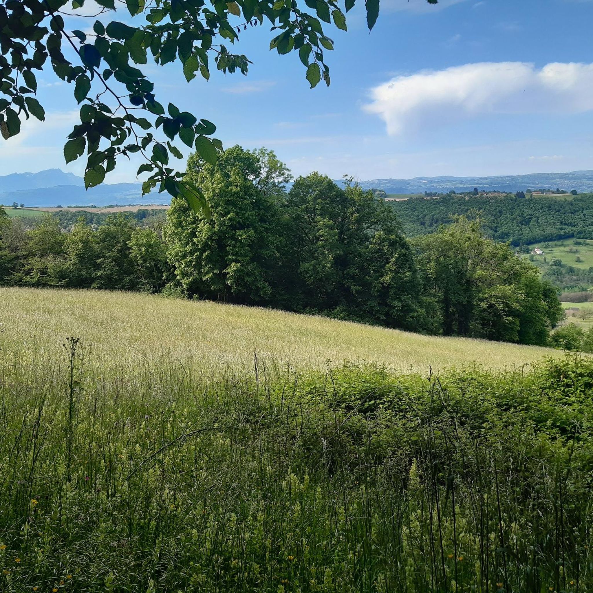
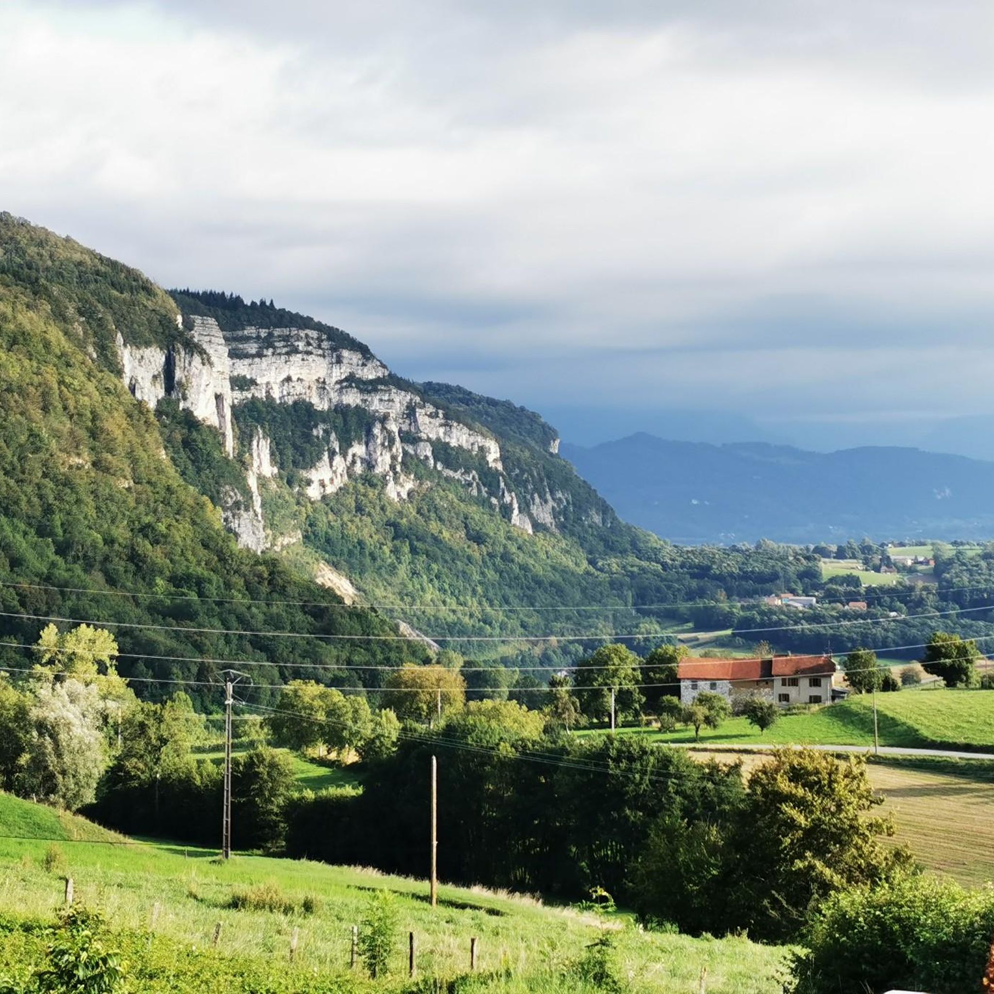
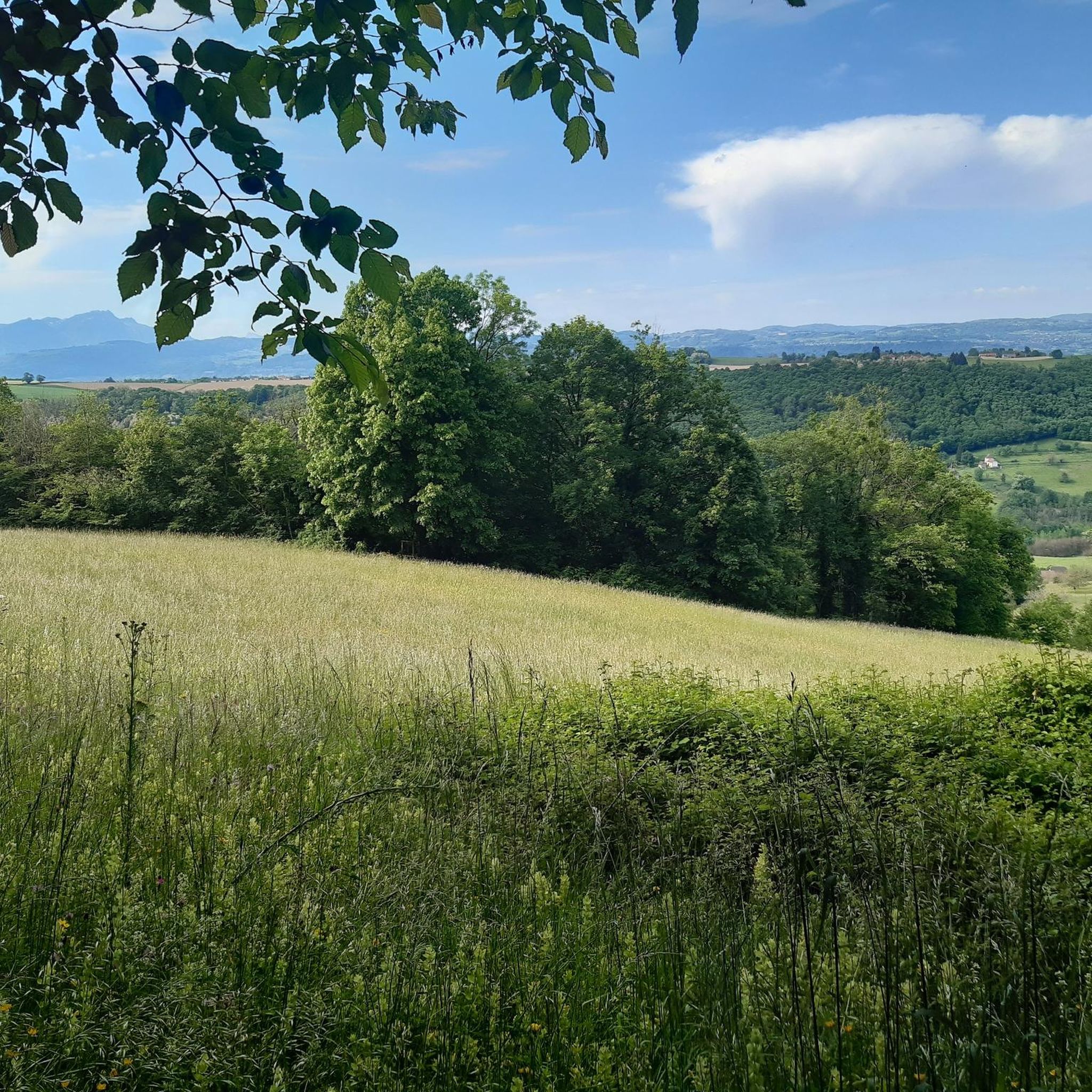
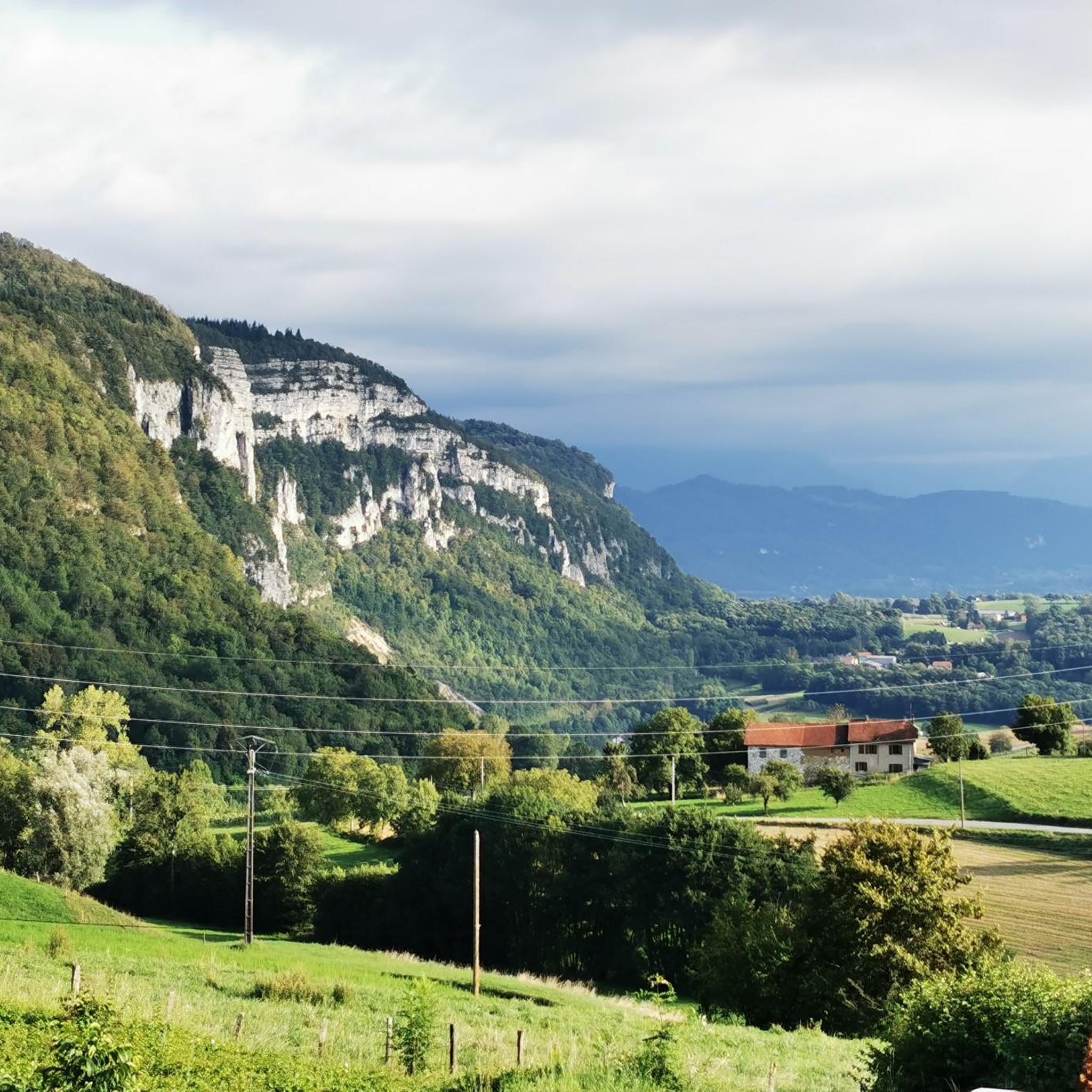

Tips from the Community

Dizzying belvedere from the top of Mont Tournier, view of the Grand Thur, the Grand Colombier and of course the Rhône.
1
0

Pass located at an altitude of 573 m, to be climbed from Saint-Genix-sur-Guiers or Novalaise.
1
0
The Col du Banchet is a mountain pass located at an altitude of 590 m in the Mont Tournier range, south of the Jura massif, in the Savoyard Avant-Pays, in the Savoie department.
1
0

From Rochefort, the Col du Banchet climbs in a bend with a fairly steep passage on the first part. The view rewards the efforts made to get there.
1
0
The Col de la Lattaz offers beautiful views. Located at an altitude of 754 meters, the climb from the Mont Tournier pass is rather gradual. The road continues around the summit of Mount Chaffaron.
1
0


A nice road to pass. By this pass on the other hand, in winter it does not seem to be cleared of snow. With a mountain bike it's hot, on the road it's dead.
0
0
Frequently Asked Questions
How many running routes are available in Sainte-Marie-D'Alvey?
Sainte-Marie-D'Alvey offers a wide selection of running routes, with over 130 trails identified. These routes cater to various fitness levels, ranging from easy strolls to more challenging trail runs through the diverse landscapes of the Savoie region.
Are there easy jogging routes suitable for beginners in Sainte-Marie-D'Alvey?
Yes, there are several easy jogging routes perfect for beginners or those looking for a relaxed run. The area features 13 easy trails that allow you to enjoy the rural tranquility and scenic views without significant elevation challenges.
Can I find challenging trail runs in the Sainte-Marie-D'Alvey area?
Absolutely. For experienced runners seeking a challenge, Sainte-Marie-D'Alvey provides 30 difficult routes. These trails often feature significant elevation gains and varied terrain, offering rewarding views of the Avant-Pays, Isère, Ain, and the Chartreuse mountains. An example is the Running loop from Gresin, which includes notable elevation.
Are there any circular jogging routes around Sainte-Marie-D'Alvey?
Many of the running routes in Sainte-Marie-D'Alvey are circular, allowing you to start and finish at the same point. For instance, the Col de la Lattaz loop from Gerbaix is a moderate circular option, perfect for exploring the local scenery.
What kind of terrain can I expect on the jogging trails in this region?
The terrain around Sainte-Marie-D'Alvey is quite varied, characterized by rolling hills, fields, and wooded areas. You'll encounter a mix of paved paths, gravel tracks, and natural trails, reflecting the Bugey Savoyard region's mountainous topography. This diversity provides an engaging experience for trail runners.
Are there scenic viewpoints or natural features to see while running?
Yes, the region is known for its panoramic views. Many routes offer elevated vantage points overlooking the Avant-Pays, Isère, Ain, and the Chartreuse mountains. You might also encounter natural features like the Site des Chenevières, visible from routes such as the Crusille Pass (573 m) – View of Site des Chenevières loop from Sainte-Marie-d'Alvey.
Are the running trails in Sainte-Marie-D'Alvey dog-friendly?
While specific regulations for each trail can vary, many of the rural paths and trails in Sainte-Marie-D'Alvey are generally suitable for jogging with dogs, especially if kept on a leash. It's always recommended to check local signage and ensure your dog is well-behaved and doesn't disturb wildlife or other users.
What about family-friendly jogging options in Sainte-Marie-D'Alvey?
For families, the easier and moderate routes are often the best choice. These trails typically have less challenging terrain and elevation, making them enjoyable for all ages. The tranquil rural settings provide a pleasant environment for a family run or walk.
When is the best time of year to go jogging in Sainte-Marie-D'Alvey?
Sainte-Marie-D'Alvey offers good jogging conditions throughout much of the year. Spring brings blooming daffodils and pleasant temperatures, while autumn provides beautiful foliage. Summer is also popular, though it's advisable to run in the mornings or evenings to avoid the midday heat. Winter can be beautiful, but some higher elevation trails might require appropriate gear due to snow or ice.
Are there options for parking near the running routes?
Yes, many routes in and around Sainte-Marie-D'Alvey have accessible starting points with parking options. Given the region's focus on outdoor activities, you'll often find designated parking areas near trailheads in villages like Saint-Maurice-de-Rotherens or Rochefort, which serve routes like the Col du Banchet loop from Rochefort.
What do other runners say about the jogging experience in Sainte-Marie-D'Alvey?
The running routes in Sainte-Marie-D'Alvey are highly rated by the komoot community, with an average score of 4.1 stars from over 60 reviews. Runners often praise the diverse landscapes, the tranquility of the rural settings, and the rewarding panoramic views of the surrounding mountains and valleys.
Are there any specific landmarks or attractions I can explore near the routes?
Yes, the area around Sainte-Marie-D'Alvey is rich in natural and historical points of interest. You can explore mountain passes like Épine Pass, Col du Banchet, or Crucifix Pass. The picturesque Lac d'Aiguebelette is also a significant natural attraction in the vicinity, offering scenic views from certain trails.
How long are the typical running trails in Sainte-Marie-D'Alvey?
The running trails in Sainte-Marie-D'Alvey vary significantly in length. You can find shorter routes, but many popular options range from 5 to 7 miles (8 to 11 km). For example, the Mount Tournier – Col de la Lattaz loop from Saint-Maurice-de-Rotherens is about 7.2 miles (11.6 km) long.
Most popular routes around Sainte-Marie-D'Alvey
Most popular attractions around Sainte-Marie-D'Alvey

Get inspired with the komoot mobile app


Explore more
Browse the best Running Trails & Routes in other regions.
