The best walks and hikes around Sainte-Marie-D'Alvey
4.4
(973)
5,798
hikers
142
hikes
Hiking trails around Sainte-Marie-D'Alvey traverse a diverse landscape in the Savoie department of the Auvergne-Rhône-Alpes region. The commune features an average altitude of 531 meters, with elevations ranging from 330 to 767 meters, providing varied terrain. The region is characterized by wooded areas, rocky ridges, and natural features such as Mont Tournier and the Col du Banchet. These trails offer a mix of easy walks and more challenging hikes across its varied topography.
Best hiking trails around Sainte-Marie-D'Alvey
- The most…
Last updated: July 11, 2026
4.6
(12)
70
hikers
11.4km
03:21
330m
320m
Moderate hike. Good fitness required. Easily-accessible paths. Suitable for all skill levels.
4.1
(7)
134
hikers
8.99km
02:40
270m
270m
Moderate hike. Good fitness required. Mostly accessible paths. Sure-footedness required.

Sign up for free
5.0
(3)
16
hikers
6.79km
01:57
170m
160m
Easy hike. Great for any fitness level. Easily-accessible paths. Suitable for all skill levels.
4.0
(1)
8
hikers
5.83km
01:40
130m
130m
Easy hike. Great for any fitness level. Easily-accessible paths. Suitable for all skill levels.
4.0
(1)
8
hikers
Moderate hike. Good fitness required. Easily-accessible paths. Suitable for all skill levels.
Get access to more routes and recommendations from other explorers.
Sign up for free
Already have an account?
Our route recommendations are based on thousands of hikes, rides, and runs completed by other people on komoot.
Start today with a free account
Your next adventure awaits.
Login or Signup
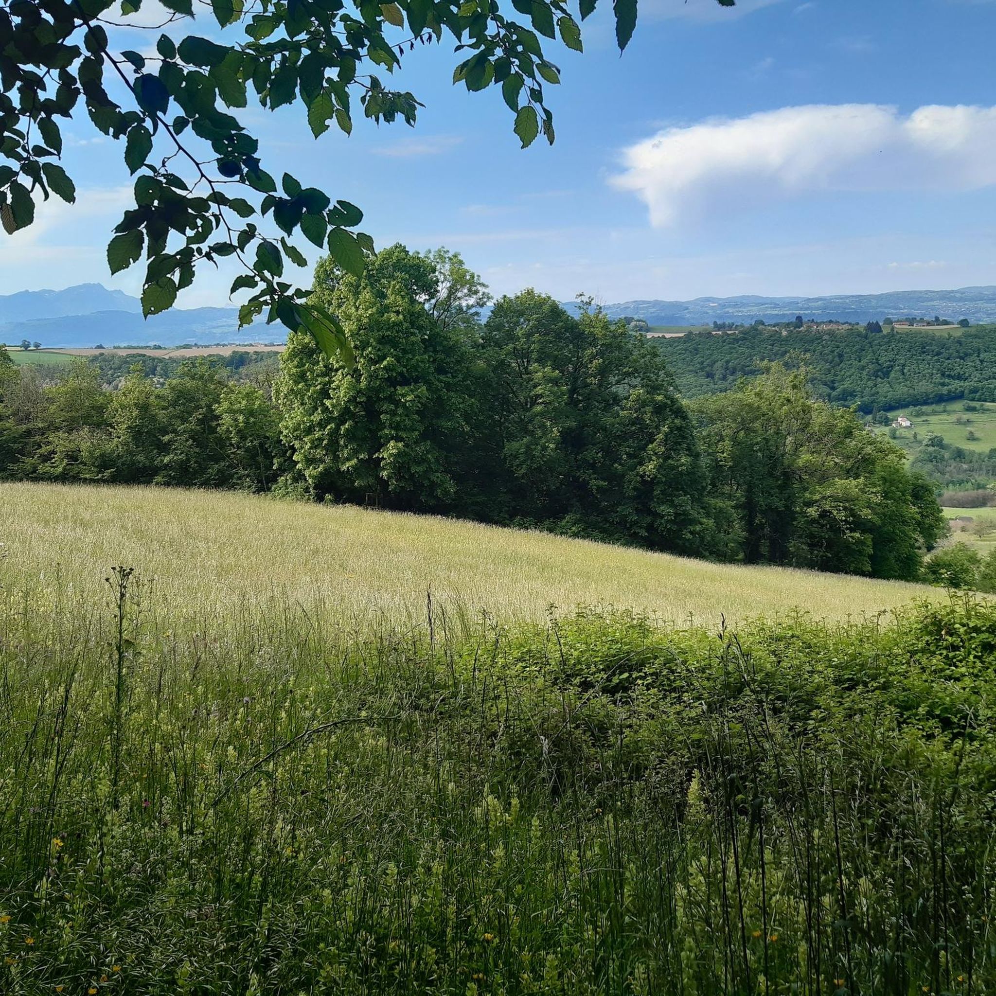
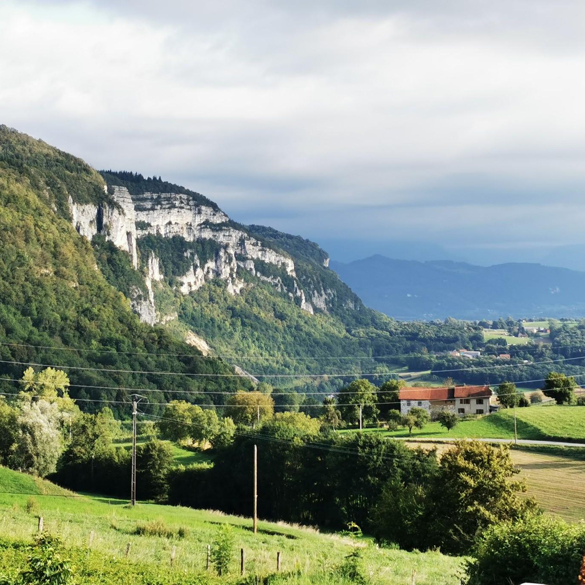
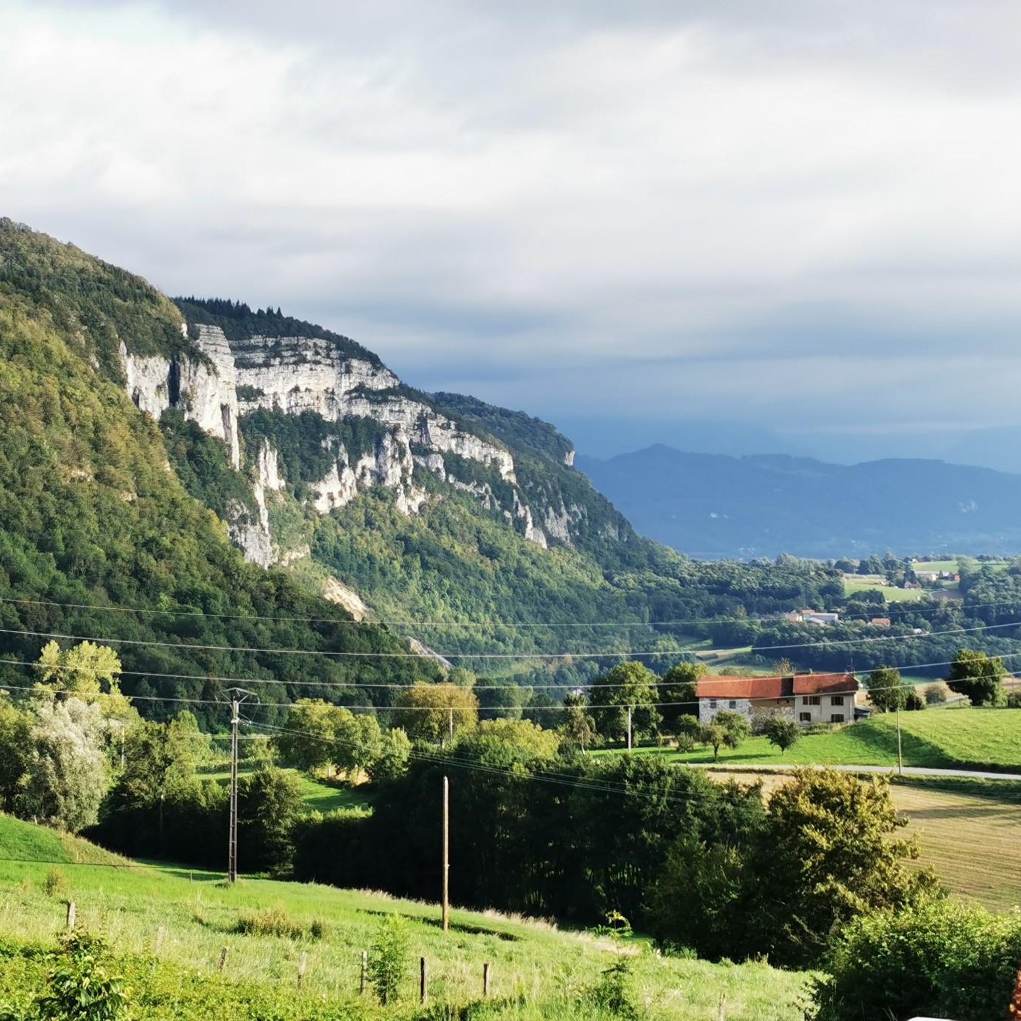
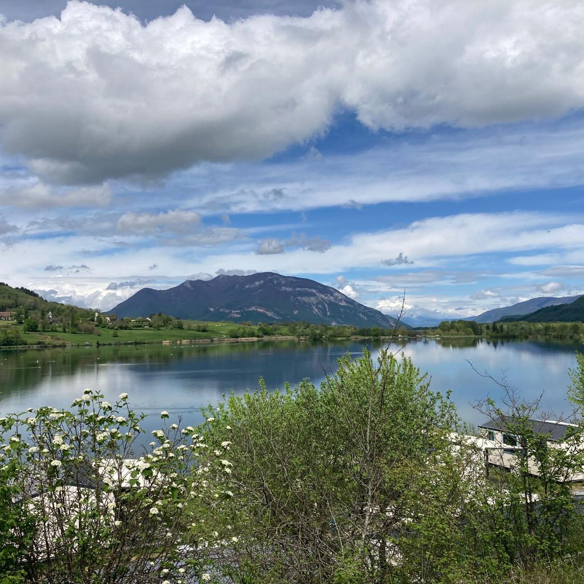

Tips from the Community

Dizzying belvedere from the top of Mont Tournier, view of the Grand Thur, the Grand Colombier and of course the Rhône.
1
0


Pass located at an altitude of 573 m, to be climbed from Saint-Genix-sur-Guiers or Novalaise.
1
0
The Col du Banchet is a mountain pass located at an altitude of 590 m in the Mont Tournier range, south of the Jura massif, in the Savoyard Avant-Pays, in the Savoie department.
1
0
The Col du Mont Tournier – 851 m – is located in the Savoyard Avant-Pays but belongs, from a geological point of view, to the Jura Massif.
2
0

From Rochefort, the Col du Banchet climbs in a bend with a fairly steep passage on the first part. The view rewards the efforts made to get there.
1
0
Frequently Asked Questions
How many hiking trails are available around Sainte-Marie-D'Alvey?
There are over 140 verified hiking routes around Sainte-Marie-D'Alvey, offering a diverse range of options for all skill levels. These trails traverse varied terrain, from wooded areas to rocky ridges and mountain passes.
What are the different difficulty levels of hikes available?
The trails around Sainte-Marie-D'Alvey cater to various fitness levels. You'll find over 50 easy walks, nearly 80 moderate hikes, and 15 more challenging routes for experienced hikers. This variety ensures there's something for everyone, from leisurely strolls to more strenuous ascents.
What natural features or landmarks can I see while hiking?
The region is rich in natural beauty. You can explore areas like Mont Tournier and the Chenevières ridge. Nearby, you might encounter natural monuments such as the Rochefort Cliffs or enjoy views of Lac d'Aiguebelette. The area also features several mountain passes, including Col du Banchet and Col de la Lattaz.
Are there any circular hiking routes in the area?
Yes, many of the trails around Sainte-Marie-D'Alvey are designed as circular routes, allowing you to start and end at the same point. An example is the moderate Crusille Pass (573 m) – Col du Banchet loop from Sainte-Marie-d'Alvey, which navigates through varied terrain and mountain passes.
What do other hikers enjoy about the trails in Sainte-Marie-D'Alvey?
The hiking trails in Sainte-Marie-D'Alvey are highly regarded by the komoot community, with an average rating of 4.4 stars from over 900 reviews. Hikers often praise the diverse landscapes, well-maintained paths, and the opportunity to discover both wooded areas and scenic viewpoints.
Are there family-friendly hiking options in Sainte-Marie-D'Alvey?
Absolutely. The region offers several easier trails suitable for families. For instance, the Sons' Lookout loop from Saint-Maurice-de-Rotherens is a 6.9 km easy hike through wooded areas, often completed in under two hours, making it a great option for a family outing.
What is the best time of year for hiking in Sainte-Marie-D'Alvey?
The region is enjoyable for hiking across multiple seasons. Spring brings blooming daffodils, while summer offers lush greenery and pleasant temperatures. Autumn provides beautiful foliage. While some higher passes might be affected by snow in winter, many lower-altitude trails remain accessible for crisp, scenic walks.
Can I bring my dog on the hiking trails?
Many trails in the Sainte-Marie-D'Alvey area are dog-friendly, allowing you to enjoy the outdoors with your canine companion. However, it's always recommended to check specific trail regulations and keep your dog on a leash, especially in protected areas or near livestock.
Are there any longer or more challenging hikes for experienced hikers?
Yes, for those seeking a greater challenge, there are routes with more significant elevation gain and distance. The Mount Tournier – Pierre Vire loop from Saint-Maurice-de-Rotherens is a moderate 12.3 km hike with over 330 meters of elevation gain, offering a more demanding experience.
What kind of landscapes can I expect to see on hikes around Sainte-Marie-D'Alvey?
Hikes in this region showcase a varied landscape, including dense wooded areas, prominent rocky ridges, and open viewpoints. You'll encounter the Savoyard foothills, mountain passes, and potentially glimpses of ancient paths that once connected local villages.
Are there any scenic viewpoints along the trails?
Yes, the area offers several scenic viewpoints. For example, the View of the Rhône from Belvédère du Site des Fils provides expansive vistas. Many trails, particularly those around Mont Tournier and Chenevières, also offer picturesque outlooks over the surrounding valleys and natural features.
What are the options for parking at trailheads?
While specific parking details vary by trailhead, many popular starting points for hikes in Sainte-Marie-D'Alvey and the surrounding communes offer designated parking areas. It's advisable to check the route details on komoot for information on parking availability at your chosen trailhead.
Is public transport available to reach hiking trailheads?
Public transport options to reach specific trailheads directly within Sainte-Marie-D'Alvey can be limited. However, regional bus services might connect to larger towns nearby, from which you could potentially access some starting points. For detailed information, it's best to consult local transport schedules.
Most popular routes around Sainte-Marie-D'Alvey
Most popular attractions around Sainte-Marie-D'Alvey

Get inspired with the komoot mobile app


Explore more
Browse the best Hikes in other regions.
