The best running trails around Saint-Maurice-De-Rotherens
4.3
(93)
3,074
runners
179
runs
Jogging routes around Saint-Maurice-De-Rotherens are situated on an agricultural and forested plateau, offering diverse landscapes for running. The region features elevated routes on the southern slope of Mont Tournier, providing panoramas of the Chartreuse mountains and the Rhône Valley. Nearby Lac d'Aiguebelette and the Grenant Stream offer additional scenic paths, with terrain varying from flat sections to moderate elevation gains.
Best jogging routes around Saint-Maurice-De-Rotherens
- The most popular jogging route is Running loop from Saint-Pierre-d'Alvey, a 5.4 miles (8.7…
Last updated: July 15, 2026
16
runners
11.1km
01:09
20m
20m
Moderate run. Good fitness required. Mostly paved surfaces. Suitable for all skill levels.
12
runners
8.71km
00:56
130m
130m
Moderate run. Good fitness required. Mostly paved surfaces. Suitable for all skill levels.

Sign up for free
9
runners
11.6km
01:21
310m
310m
Hard run. Very good fitness required. Mostly paved surfaces. Suitable for all skill levels.
3.0
(1)
11
runners
Moderate run. Good fitness required. Mostly paved surfaces. Suitable for all skill levels.
11
runners
4.81km
00:33
110m
110m
Moderate run. Good fitness required. Mostly paved surfaces. Suitable for all skill levels.
Get access to more routes and recommendations from other explorers.
Sign up for free
Already have an account?
Our route recommendations are based on thousands of hikes, rides, and runs completed by other people on komoot.
Start today with a free account
Your next adventure awaits.
Login or Signup

Tips from the Community


Pass located at an altitude of 573 m, to be climbed from Saint-Genix-sur-Guiers or Novalaise.
1
0

The Col de la Lattaz offers beautiful views. Located at an altitude of 754 meters, the climb from the Mont Tournier pass is rather gradual. The road continues around the summit of Mount Chaffaron.
1
0


A pleasant place to stop and have a picnic on the ViaRhôna cycle path.
1
0

Perfect for a short break
0
0

Nice and quiet place on the Rhone - good for a break.
1
0

Fairly rolling pass and most pleasant, especially early in the morning to avoid cars.
4
0
Frequently Asked Questions
How many running routes are available around Saint-Maurice-De-Rotherens?
There are nearly 150 running routes around Saint-Maurice-De-Rotherens, offering a wide variety of options for all fitness levels. The komoot community has explored over 2500 of these routes.
Are there easy jogging routes for beginners in Saint-Maurice-De-Rotherens?
Yes, Saint-Maurice-De-Rotherens offers 10 easy jogging routes, perfect for beginners or those looking for a relaxed run. These routes typically feature minimal elevation gain and cover diverse landscapes.
What kind of terrain can I expect on the running trails in this region?
The running trails in Saint-Maurice-De-Rotherens feature varied terrain, from relatively flat sections to routes with moderate elevation gains. You'll find paths traversing agricultural plateaus, forested slopes of Mont Tournier, and scenic lakeside or riverfront paths near Lac d'Aiguebelette and the Grenant Stream.
Are there any running routes with panoramic views?
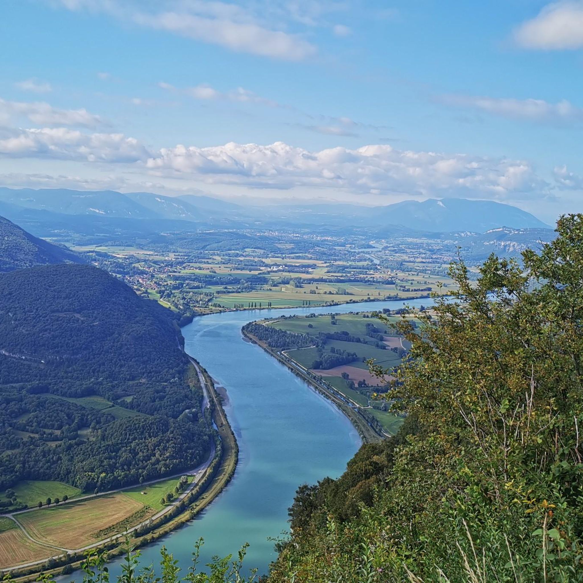
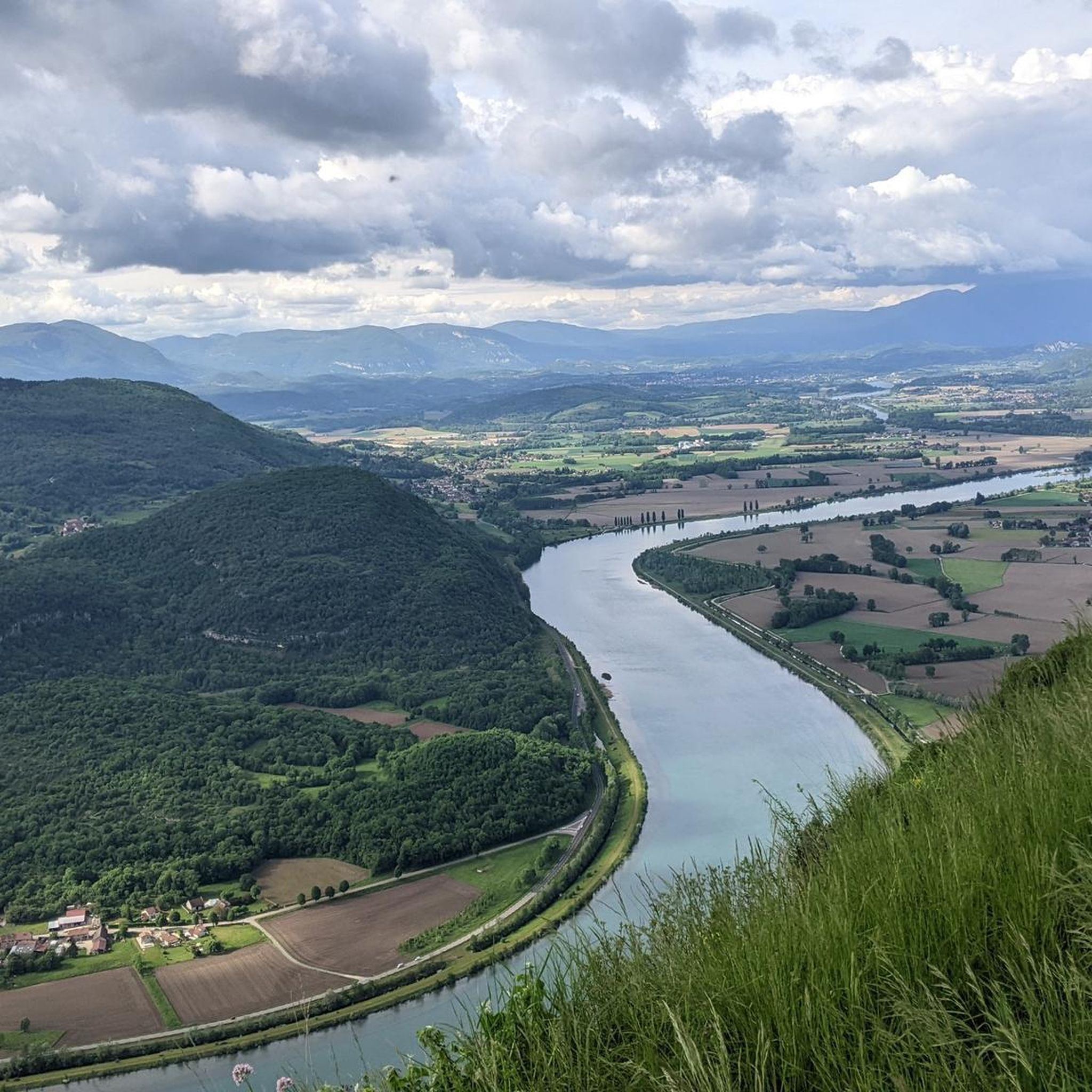
Absolutely! The region is known for its magnificent and expansive panoramas. Many routes offer sweeping vistas of the Chartreuse mountains, the Rhône Valley, and the lower Guiers Valley. For example, the Recorba Viewpoint – Mount Tournier loop from Loisieux provides excellent scenic opportunities, as does the Belvédère du Site des Fils.
What do other runners say about the trails in Saint-Maurice-De-Rotherens?
The running routes in Saint-Maurice-De-Rotherens are highly rated by the komoot community, with an average score of 4.2 out of 5 stars from over 87 reviews. Runners often praise the diverse landscapes, the quiet woodlands, and the inspiring views of the Chartreuse mountains and Rhône Valley.
Can I find long-distance running trails in the area?
Yes, Saint-Maurice-De-Rotherens serves as a junction point for major long-distance hiking routes like the GR9 and GR65. These well-established paths provide extensive options for longer and more challenging running routes, allowing you to cover significant distances.
Are there any circular running routes available?
Many of the running routes in Saint-Maurice-De-Rotherens are designed as loops, offering convenient circular options. An example is the Running loop from Saint-Pierre-d'Alvey, which is a popular moderate trail.
What natural attractions can I see while running in Saint-Maurice-De-Rotherens?
While running, you can encounter several natural attractions. These include the serene Grenant Stream winding through a tranquil forest, the picturesque Lac d'Aiguebelette, and the dramatic Glandieu Waterfall. Don't miss the Belvédère du Site des Fils for breathtaking views of the Rhône.
Are there any historical landmarks along the running paths?
Yes, the region offers historical points of interest. The 'Balcons de Saint-Maurice de Rotherens' circuit, suitable for jogging, passes by historical remnants like the ruins of Château de Mauchamp and the 11th-century Tour de Conspectus. You might also encounter the intriguing Pierre qui Vire limestone formation.
What is a challenging running route in the area?
For a more challenging run, consider the Mount Tournier – Col de la Lattaz loop from Saint-Maurice-de-Rotherens. This difficult 11.6 km path features significant elevation changes and offers rewarding views towards the Chartreuse mountains and the Rhône Valley.
Are there running routes that pass by water features?
Yes, several running routes incorporate water features. You can find paths along the shores of Lac d'Aiguebelette, offering easy routes with mountain and lake views. The Grenant Stream also provides a serene natural setting for a run.
What is the best time of year for running in Saint-Maurice-De-Rotherens?
The region offers diverse landscapes suitable for running throughout much of the year. While specific seasonal considerations depend on weather, the panoramic views are particularly stunning in autumn and winter, when a sea of clouds can often be observed below the viewpoints.
Is there a moderate running route that offers good views?
A great moderate option is the Crusille Pass (573 m) – View of Site des Chenevières loop from Sainte-Marie-d'Alvey. This 8.6 km trail leads through areas with potential panoramic views and is typically completed in just over an hour.
Most popular routes around Saint-Maurice-De-Rotherens
Most popular attractions around Saint-Maurice-De-Rotherens

Get inspired with the komoot mobile app


Explore more
Browse the best Running Trails & Routes in other regions.
