The best MTB trails around Saint-Maurice-De-Rotherens
4.3
(378)
1,669
riders
93
rides
Mountain biking around Saint-Maurice-De-Rotherens offers varied landscapes across the Savoie department in southeastern France. The region is characterized by an agricultural and forested plateau on the southern slope of Mont Tournier, providing views of the Rhône Valley, Guiers Valley, and the Chartreuse Massif. The terrain includes rolling sections, ascents, and descents through forests and along valleys, catering to different skill levels.
Best mountain bike trails around Saint-Maurice-De-Rotherens
- The most popular mountain bike trail is Liévrin Cave – Pont du Guiers…
Last updated: October 14, 2026
4.3
(18)
59
riders
Easy mountain bike ride. Great for any fitness level. Suitable for all skill levels.
4.5
(18)
36
riders
27.2km
02:27
620m
620m
Moderate mountain bike ride. Good fitness required. Advanced riding skills necessary.

4.7
(3)
36
riders
35.2km
04:02
1,100m
1,100m
Hard mountain bike ride. Very good fitness required. Advanced riding skills necessary. Some portions of the route may require you to push your bike.
4.7
(9)
45
riders
55.4km
03:17
190m
190m
Moderate mountain bike ride. Good fitness required. Suitable for all skill levels.
4.4
(7)
34
riders
41.5km
04:21
1,160m
1,160m
Hard mountain bike ride. Very good fitness required. Advanced riding skills necessary. Some portions of the route may require you to push your bike.
Get access to more routes and recommendations from other explorers.
Already have an account?
Our route recommendations are based on thousands of hikes, rides, and runs completed by other people on komoot.
Start today with a free account
Your next adventure awaits.

Tips from the Community

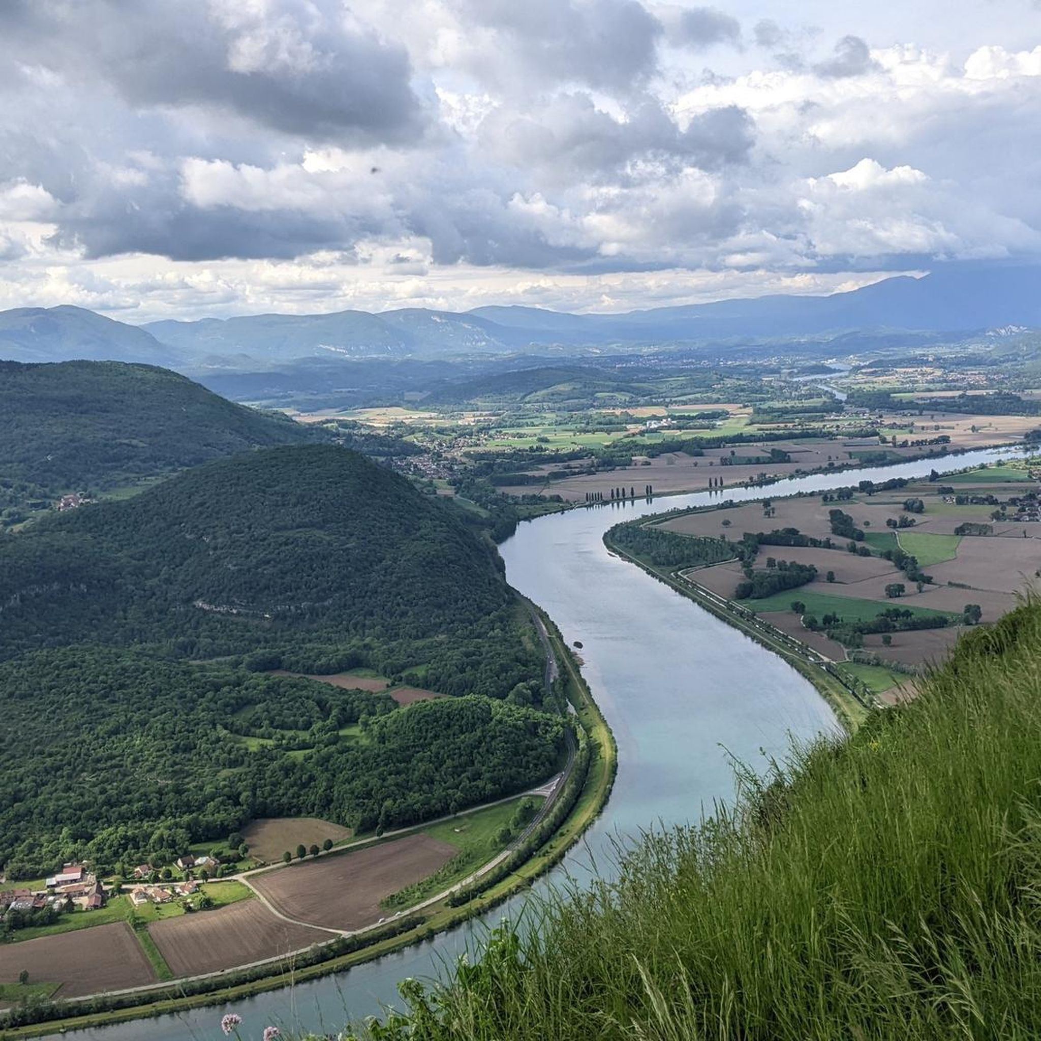
The trail runs along the Guiers river to its confluence with the Rhône, on the edge of Savoie.
0
0
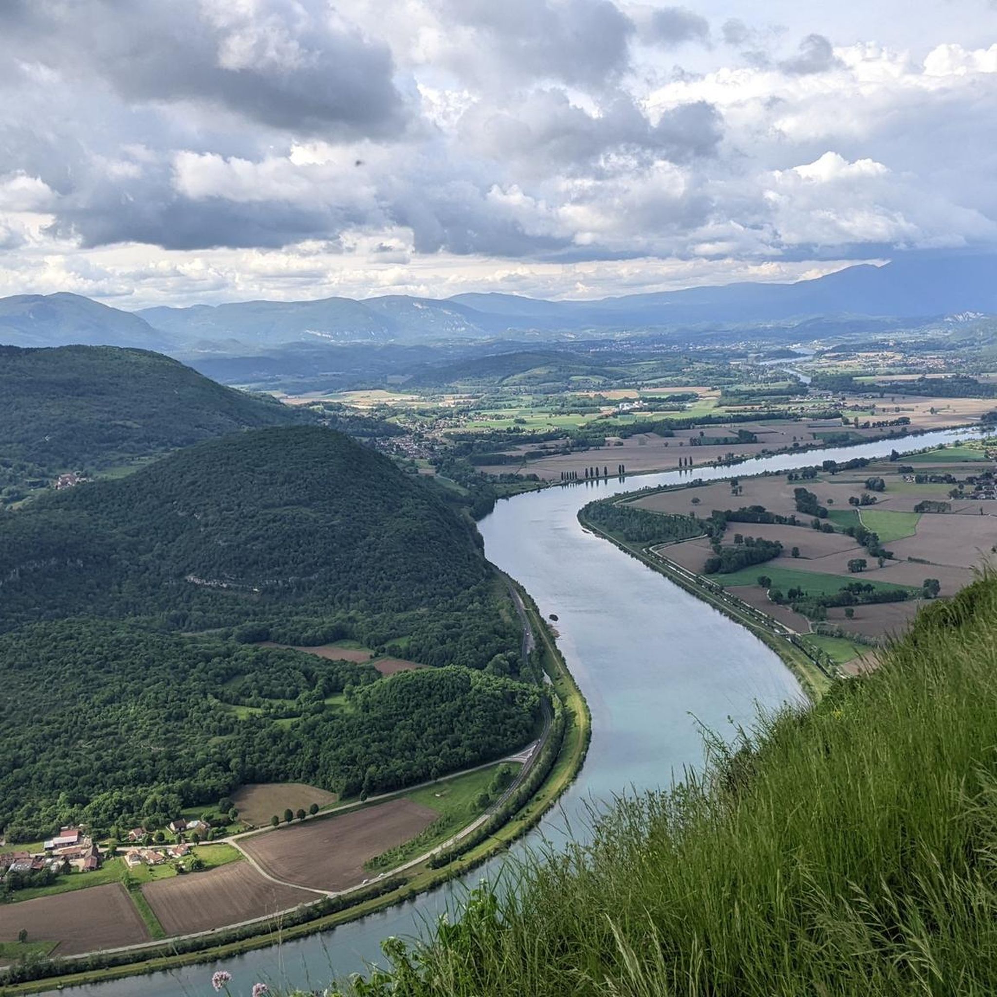
The trail runs along the Guiers river to its confluence with the Rhône, on the edge of Savoie.
0
0
Col de la Lattaz is a mountain pass located at an altitude of 754 meters in the Savoie department, in the heart of the Avant-Pays savoyard. Although it is administratively located in Savoie, it geologically belongs to the Jura Massif. It is a popular spot for cyclists and hikers for its rural landscapes and its numerous access variants.
0
0
This is a spot highly appreciated by local cyclists for its tranquility, its little-used roads, and its shaded forest paths. Several slopes allow access to it
0
0
This forest is particularly appreciated for the richness of its trails and its exceptional viewpoints
0
0
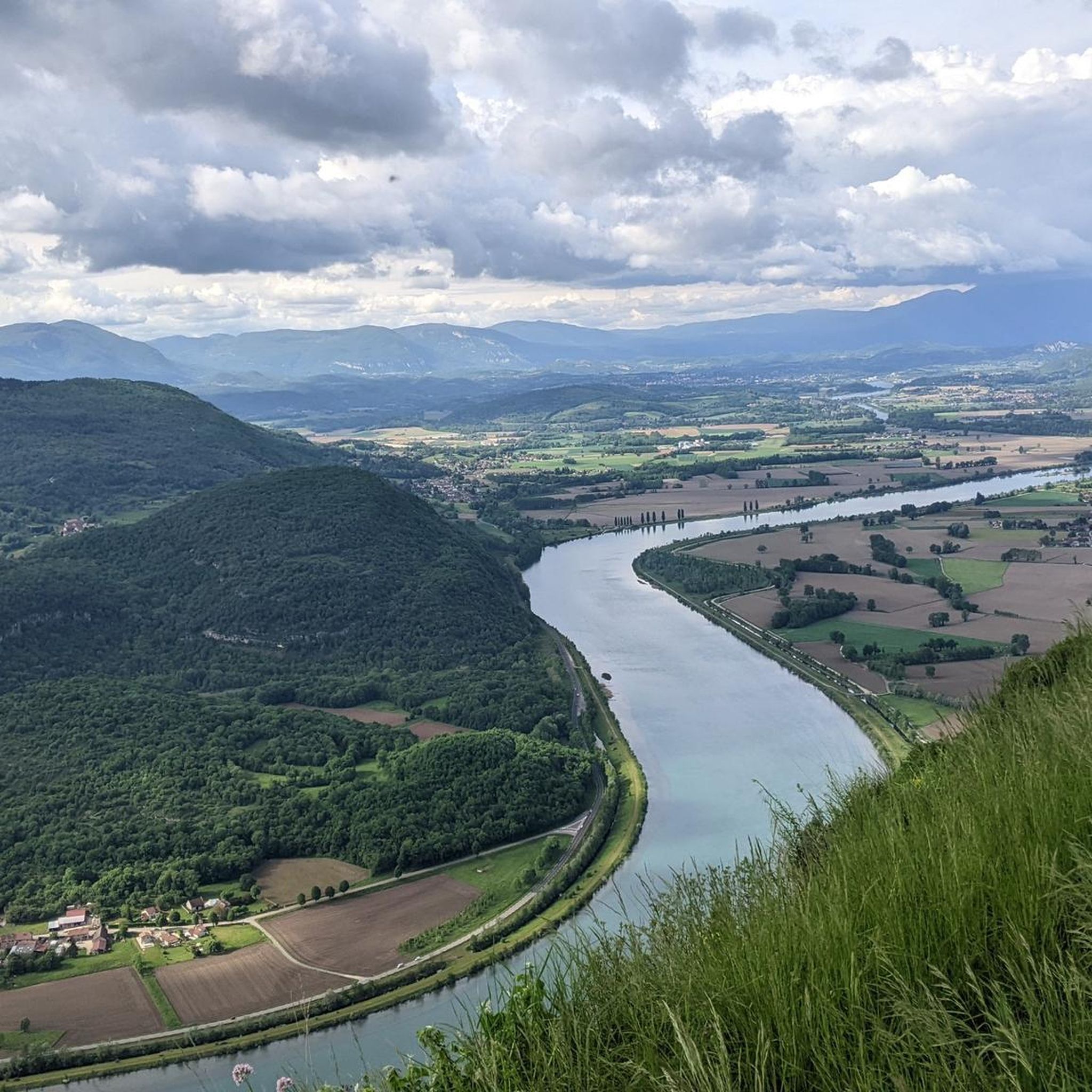
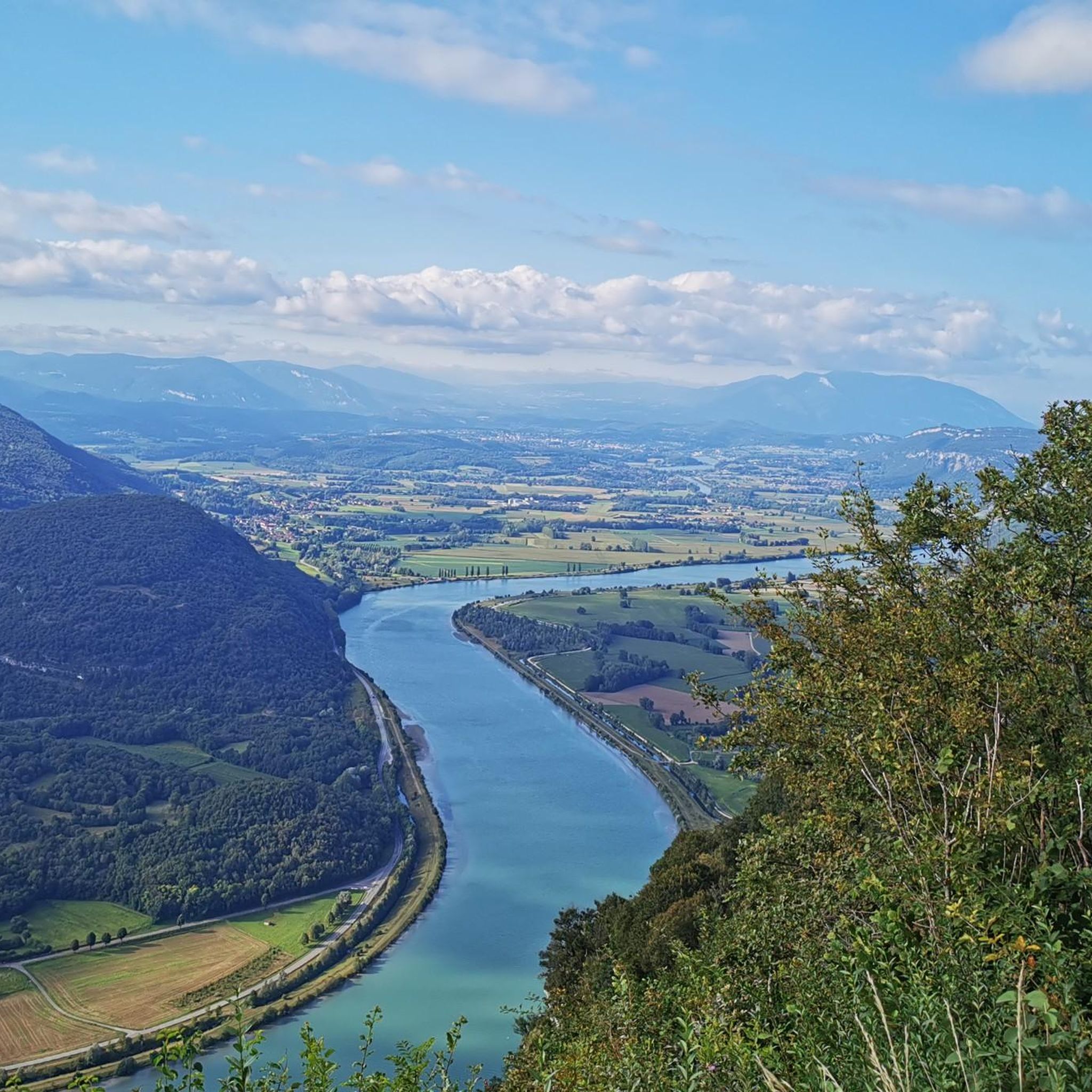
The commune of Champagneux, nestled in the Avant-Pays savoyard, is surrounded by magnificent viewpoints over the Rhône valley and the Mont Tournier chain. Belvédère du Recorba (Rocher des Corbeaux) Belvédère du Site des Fils Le Belvédère de Crozet
0
0
The commune of Champagneux, nestled in the Avant-Pays savoyard, is surrounded by magnificent viewpoints over the Rhône valley and the Mont Tournier chain. Belvédère du Recorba (Rocher des Corbeaux) Belvédère du Site des Fils Le Belvédère de Crozet
0
0
For a long time, this bridge marked the political border between the Kingdom of France (Dauphiné side) and the States of Savoy. In 1822, a border stone (stone no. 5) had been set in its center to demarcate the two territories. This historic stone has since been moved to the Place des Tilleuls in the village, where it serves as a fountain.
0
0
Frequently Asked Questions
What types of mountain bike trails can I find around Saint-Maurice-De-Rotherens?
The region offers a diverse range of mountain bike trails, from easy to difficult. You'll find routes traversing forested plateaus, river valleys, and the prominent Mont Tournier, with options for rolling sections, ascents, and technical descents. In total, there are over 80 mountain bike trails available.
Are there mountain bike trails suitable for beginners or families?
Yes, there are trails suitable for various skill levels. For an easier experience, consider the 'Le Petit Mont Tournier (N°26)' which is an 11 km blue trail with rolling sections and splendid views. While specific family-friendly routes aren't detailed, the easier trails provide a good starting point.
What are some challenging mountain bike routes for experienced riders?
Experienced riders can tackle more demanding routes such as the View of Lake Aiguebelette – Saint-Michel Pass loop from Novalaise, a 35 km trail with significant elevation gain. Another challenging option is the 'Tour du Mont Tournier (N°28)', a 28 km black trail with 950m elevation gain, featuring panoramic sections and technical descents through the Glaize wood and Gerbaix forest.
What natural features and landmarks can I see while mountain biking in the area?
The trails offer access to stunning natural features and historical sites. You can enjoy views of the Rhône Valley, Guiers Valley, and the Chartreuse Massif. Notable attractions include the Lac d'Aiguebelette, the picturesque Glandieu Waterfall, and the tranquil Grenant Stream. Don't miss the Belvédère des Fils for a spectacular 180° panorama of the Rhône.
Are there any mountain bike routes that offer great viewpoints?
Absolutely. Many routes provide breathtaking vistas. The 'Le Petit Mont Tournier (N°26)' loop offers splendid views of the Rhône and Val Guiers. The 'Tour du Mont Tournier (N°28)' includes panoramic sections leading to its summit. The Belvédère des Fils is a prime spot for expansive views, often accessible from nearby trails.
When is the best time of year to go mountain biking in Saint-Maurice-De-Rotherens?
The region is generally pleasant for mountain biking from spring through autumn. During these seasons, the weather is typically mild, and the trails are in good condition. Summer offers the chance to cool off at Lac d'Aiguebelette or the Glandieu Waterfall. While winter can bring snow, some trails might still be accessible, but conditions can be challenging.
What do other mountain bikers enjoy most about the trails here?
The mountain biking experience around Saint-Maurice-De-Rotherens is highly rated by the komoot community, with an average score of 4.3 stars from over 300 reviews. Riders often praise the varied terrain, the stunning views of the Rhône Valley and Chartreuse Massif, and the well-developed trail networks that cater to different skill levels.
Can I find circular mountain bike routes in the area?
Yes, many of the mountain bike trails in Saint-Maurice-De-Rotherens are designed as loops. Examples include the 'Le Petit Mont Tournier (N°26)' and the 'Boucle de la Lattaz (N°27)', which both circle the Saint-Maurice plateau. The Crusille Pass (573 m) – Col du Mont Tournier (851 m) loop from Gerbaix is another popular circular option.
Are there any specific passes or summits I can reach by mountain bike?
Yes, the area is known for its mountain passes and summits. You can ride to the Col du Mont Tournier (851 m), which is featured in routes like the Mount Tournier – Col du Mont Tournier (851 m) loop from Novalaise. Other passes in the vicinity include the Crusille Pass (573 m) and the Col de la Lattaz (754 m).
What kind of terrain defines mountain biking around Mont Tournier?
Mountain biking around Mont Tournier is characterized by a mix of terrain. You'll encounter forested plateaus, ascents to panoramic viewpoints, and descents through woods like the Gerbaix forest. Routes often feature rolling sections, some short challenging parts, and can include technical descents, providing a varied and engaging ride.
Are there any historical sites to explore along the mountain bike trails?
Yes, the region has historical points of interest. The 'Balcons de Saint-Maurice' trail, which can be explored by mountain bike, unveils historical vestiges like the ruins of Château de Mauchamp and the 11th-century Tour de Conspectus. The Belvédère des Fils was also once home to a powerful wireless telegraph station.
Is there a route that combines mountain biking with views of Lake Aiguebelette?
Yes, the View of Lake Aiguebelette – Saint-Michel Pass loop from Novalaise is a 35 km trail that leads through varied terrain and offers beautiful views of Lake Aiguebelette. The lake itself is a popular summer attraction, and its surrounding roads and trails provide opportunities for scenic rides.
Most popular routes around Saint-Maurice-De-Rotherens
Most popular attractions around Saint-Maurice-De-Rotherens

Get inspired with the komoot mobile app


Explore more
Browse the best MTB trails in other regions.
