Top 20 Mountain Passes around Saint-Sauveur-Sur-Tinée
Best mountain passes around Saint-Sauveur-Sur-Tinée are situated in the French Alps, within the Tinée Valley and Mercantour National Park. This region offers diverse landscapes, from lush valleys to high alpine environments. The passes provide access to challenging cycling routes and trails, often featuring significant elevation gains and panoramic views. Many routes traverse areas with historical military remnants and unique natural features.
Best mountain passes around Saint-Sauveur-Sur-Tinée
- The most popular mountain pass is Col de la Lombarde, a mountain_pass that…
Last updated: July 10, 2026
Col de la Lombarde
Highlight • Mountain Pass
Translated by Google •
Tip by

The start of Col Saint-Martin
Highlight (Segment) • Mountain Pass
Translated by Google •
Tip by

Sign up now to discover places like this
Get recommendations on the best single tracks, peaks, & plenty of other exciting outdoor places.
Sign up for free
Col de la Colmiane
Highlight • Mountain Pass
Translated by Google •
Tip by

Saint-Martin Pass (La Colmiane)
Highlight • Mountain Pass
Translated by Google •
Tip by

Col Tesina
Highlight • Mountain Pass
Translated by Google •
Tip by

Sign up for free to discover even more mountain passes around Saint-Sauveur-Sur-Tinée.
Sign up for free
Already have an account?
Start today with a free account
Your next adventure awaits.
Login or Signup
Popular around Saint-Sauveur-Sur-Tinée

Europe Trail (GR 5) – Hike from Nice to Saint-Étienne-de-Tinée

Cycling from the Italian Riviera to the French Alps – Alpine Arc (part 1)
Road Cycling Routes around Saint-Sauveur-Sur-Tinée
Hiking around Saint-Sauveur-Sur-Tinée
Cycling around Saint-Sauveur-Sur-Tinée
Running Trails around Saint-Sauveur-Sur-Tinée
MTB Trails around Saint-Sauveur-Sur-Tinée

Gravel biking around Saint-Sauveur-Sur-Tinée

Mountain Hikes around Saint-Sauveur-Sur-Tinée


Tips from the Community

The Col Saint-Martin Pass, or Col de la Colmiane, is a mountain pass in the Southern Alps located at an altitude of 1,500 meters in the Alpes-Maritimes department of France. It provides a year-round road link between the Tinée Valley to the west and the Vésubie Valley to the east.
0
0
The Col Saint-Martin Pass, or Col de la Colmiane, is a mountain pass in the Southern Alps located at an altitude of 1,500 meters in the Alpes-Maritimes department of France. It provides a year-round road link between the Tinée Valley to the west and the Vésubie Valley to the east.
0
0
Col Saint Martin (el. 1500 m.) is a high mountain pass in the Alps in the department of Alpes-Maritimes in France.[1] It is traversed by the D-2205 highway.[2] The place has been crossed at the Tour de France road cycling race in 1973, 1975 and 2020, as well as at multiple editions of the Paris-Nice.
0
0

https://youtu.be/hC4eceIyyMw?si=515BXh8fRIHsMTkt At the top, there's a wooden stall with snacks and drinks; that's it, a road pass.
0
0

In July during the week there was almost no traffic, making it a completely relaxed drive up.
0
0

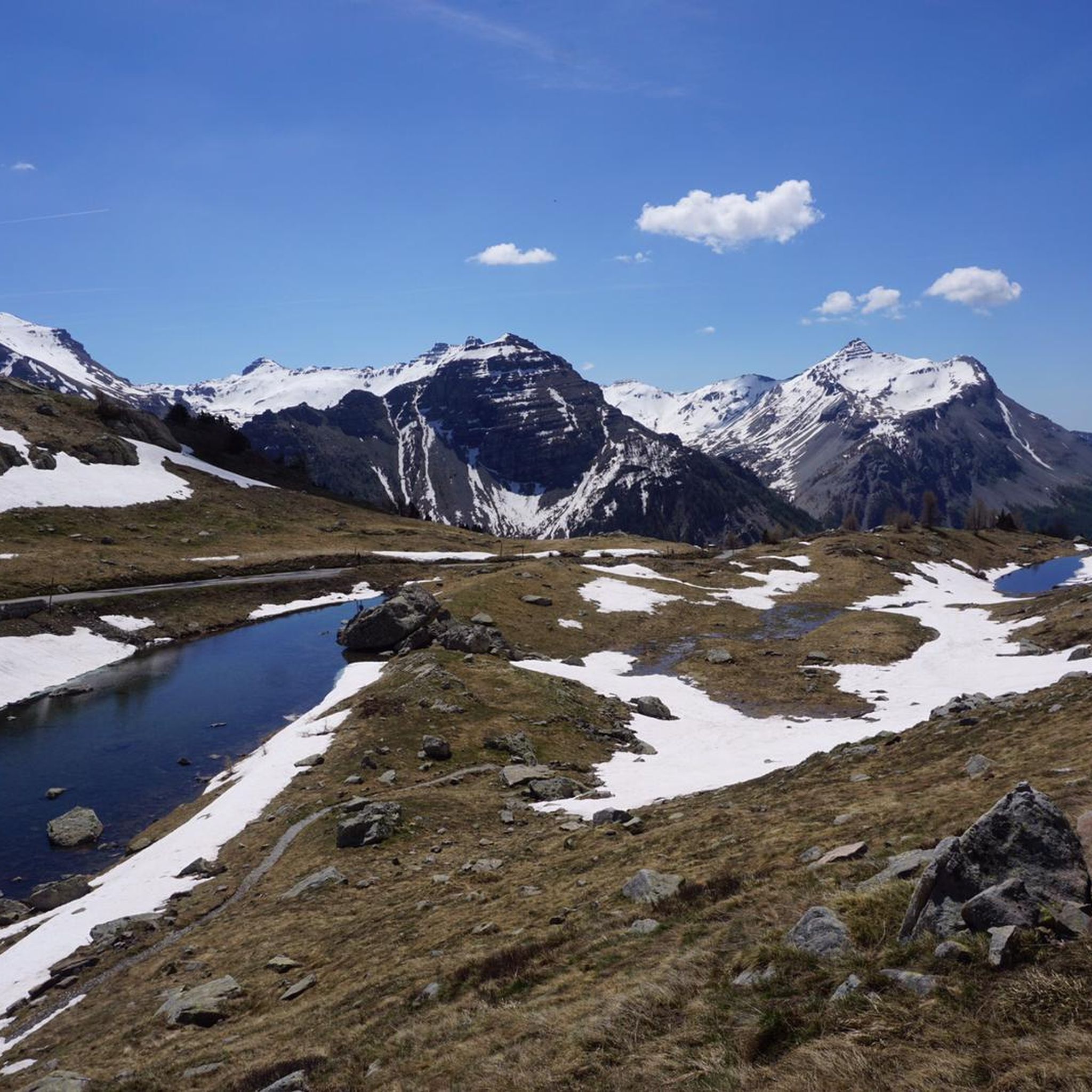
Beautiful pass at 2400m altitude. You go from a sunny and very green environment to a shady side, more rocky and that may still have residual snow (in my case at the beginning of June there was enough to block the passage). Spectacular stretch of path on the balcony on the west side.
0
0

I recommend the ring climb from the Tesina pass, with the saboulet, etc., as mentioned it's always windy
1
0

Frequently Asked Questions
What are some of the most highly-rated mountain passes by the komoot community around Saint-Sauveur-Sur-Tinée?
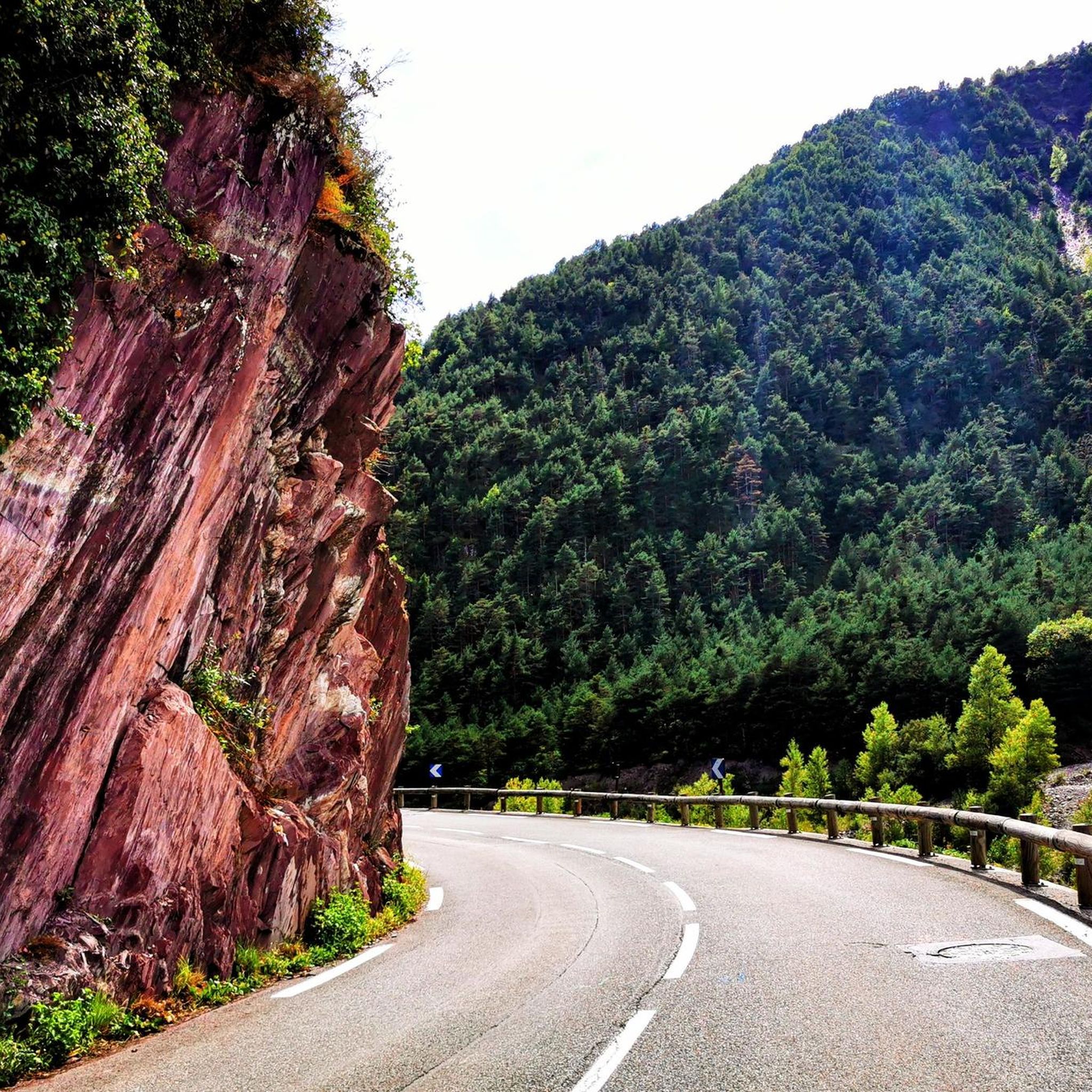
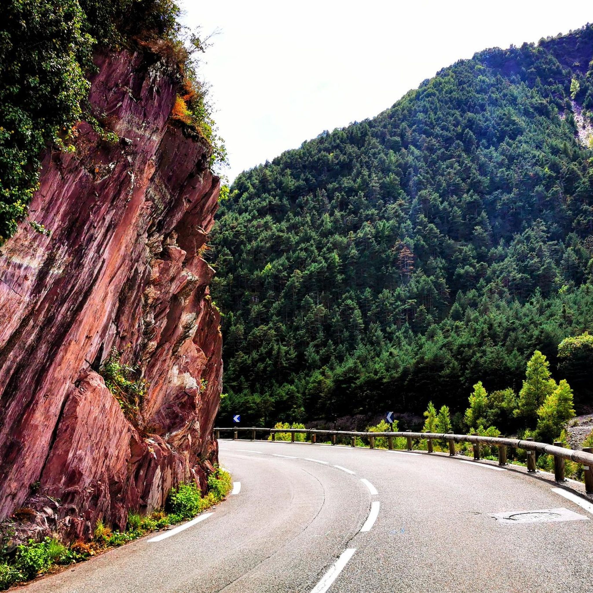
The komoot community highly rates several passes. Col de la Lombarde is a popular choice, known for its challenging climb and cross-border experience. Col Tesina is another favorite, serving as a transit pass for lake tours at 2400 meters. Additionally, The start of Col Saint-Martin is appreciated for its dramatic views carved into the rock face.
What kind of natural beauty and wildlife can I expect to see on these mountain passes?
The mountain passes around Saint-Sauveur-sur-Tinée are nestled within the Mercantour National Park, offering diverse landscapes. You can expect lush green vegetation and steep rock faces at lower altitudes, transitioning to more open, sometimes lunar, treeless environments higher up. Many passes, like the Col de la Bonette and Col de la Lombarde, are excellent for spotting local fauna such as marmots, and in summer, vibrant wildflowers. Passes like Col de la Cayolle also feature waterfalls and picturesque hamlets.
Are there any historical sites or features along these mountain passes?
Yes, several passes offer glimpses into history. Along the route to the Col de la Bonette, you can find historical military remnants of the Maginot Line. The Col de la Lombarde also features significant military structures from World War II. Additionally, the road to Col de la Couillole passes through the perched medieval village of Roubion, built directly onto steep rocks, offering an interesting historical stop.
When is the best time of year to visit the mountain passes near Saint-Sauveur-sur-Tinée?
Most mountain passes in the region are typically open from late spring (around June) to early autumn (around October) due to snow cover. For instance, the Col de la Cayolle is usually open for about half the year. Late spring and early summer offer the chance to see high snow-walls and vibrant wildflowers, while autumn provides stunning colorful foliage. Always check current road conditions before planning your trip, especially outside peak summer months.
What outdoor activities, besides cycling, can I do near these mountain passes?
Beyond challenging cycling routes, the area offers a wealth of other outdoor activities. You can find numerous hiking trails, such as the Valscura and Terre Rouge Lakes Loop, or the Two villages with character: Roure and Roubion. For more strenuous adventures, there are mountaineering routes like the Vens Lakes loop. Running enthusiasts can explore trails around Isola 2000 and the Col de la Lombarde. For more details on these activities, refer to the Hiking around Saint-Sauveur-Sur-Tinée, Mountain Hikes around Saint-Sauveur-Sur-Tinée, and Running Trails around Saint-Sauveur-Sur-Tinée guides.
Which mountain passes offer a unique cross-border experience?
The Col de la Lombarde is a high mountain pass that marks the international border between France and Italy. It links the Tinée Valley in France to the Stura di Demonte Valley in Italy, offering a unique opportunity to experience two countries in one journey.
Are there any specific regulations for visiting Mercantour National Park, especially regarding dogs or permits?
The mountain passes are located within or near the Mercantour National Park. While the core zone of the park has strict regulations, including restrictions on dogs (even on a leash), some areas outside the core zone may be more permissive. It's always best to check the official Mercantour National Park website for the most up-to-date information on dog regulations and any required permits for specific activities or areas before your visit.
Where can I find food and accommodation near the mountain passes?
Saint-Sauveur-sur-Tinée itself serves as an excellent base with various accommodation options, restaurants, and cafes. Along the routes, you might find small villages like Roubion, which has an auberge, or the ski resort of Isola 2000 near the Col de la Lombarde, which offers amenities. However, services can be sparse at higher altitudes, so it's advisable to plan accordingly and carry provisions.
Which passes are particularly known for their panoramic views?
Many passes in the region boast spectacular views. The Col de la Bonette offers breathtaking 360-degree panoramas, especially from the Cime de la Bonette loop, which is the highest paved road in France. The Col de la Couillole provides stunning panoramic views of the Mercantour National Park and surrounding valleys. Similarly, the Col de la Lombarde and Saint-Martin Pass (La Colmiane) also offer expansive vistas of the Mercantour mountains and the Tinée and Vésubie valleys.
What makes the Col de la Bonette unique among European mountain passes?
The Col de la Bonette is renowned for being one of the highest paved roads in Europe. While the pass itself is at 2,715 meters, a scenic loop around the Cime de la Bonette peak reaches 2,802 meters, making it the highest paved road in France and Europe. This offers an unparalleled experience of driving or cycling through diverse landscapes, from forests to a lunar, treeless environment, culminating in breathtaking 360-degree panoramas.
Can I find less crowded mountain passes for a wilder alpine experience?
Yes, if you're seeking a wilder and potentially less crowded experience, the Col des Champs is an excellent choice. It is known for its vast mountain pasture and wild, beautiful scenery. It often forms part of a challenging cycling trilogy with Col de la Cayolle and Col d'Allos, offering majestic views and varied terrain for those who appreciate a more rugged alpine environment.
What are some notable features of the ascent to Col de la Couillole from Saint-Sauveur-sur-Tinée?
The ascent to Col de la Couillole from Saint-Sauveur-sur-Tinée is approximately 16 kilometers long with an average gradient of 7.3%. The initial 11 kilometers wind through a valley with lush green vegetation and impressive, steep rock faces. The narrow road offers views high above the deepest part of the valley and passes the picturesque, perched village of Roubion. Beyond Roubion, the landscape opens up, providing stunning panoramic views of the Mercantour National Park.
What are the typical road conditions and challenges for cyclists on these passes?
The mountain passes in this region are known for challenging cycling routes. Many feature significant elevation gains and sustained average slopes. For example, the Col de la Couillole has sections reaching 15.5% gradient, and the Col de la Lombarde has a sustained average slope for over 20 kilometers, with parts approaching 10%. Roads often feature numerous hairpin bends. While some sections, like parts of the Col de la Couillole, have seen improvements for major cycling events, roads can be narrow, especially on the Italian side of the Col de la Lombarde. Always be prepared for steep climbs and varying road surfaces.
Most popular routes around Saint-Sauveur-Sur-Tinée
Most popular attractions around Saint-Sauveur-Sur-Tinée

Get inspired with the komoot mobile app


Explore more
See even more epic mountain passes by checking out these guides around Saint-Sauveur-Sur-Tinée:
