The best walks and hikes around Aunat
4.4
(269)
2,189
hikers
17
hikes
Aunat hiking trails popular routes are situated within the Pays de Sault, a heavily wooded plateau in the Aude department of southern France. The terrain is largely rugged and forested, with elevations ranging between 990 and 1310 meters. This region is characterized by its mountain climate and proximity to the Pyrenees mountains, offering diverse landscapes for outdoor activities. The area features significant natural heritage, including Natura 2000 sites, providing a rich biodiversity and varied terrain for hikers.
Best hiking trails…
Last updated: October 7, 2026
4.7
(3)
36
hikers
Moderate hike. Good fitness required. Easily-accessible paths. Suitable for all skill levels.
4.0
(2)
30
hikers
20.4km
07:57
990m
990m
Hard hike. Very good fitness required. Mostly accessible paths. Sure-footedness required.

5.0
(3)
21
hikers
10.4km
03:01
280m
280m
Moderate hike. Good fitness required. Easily-accessible paths. Suitable for all skill levels.
4.7
(3)
13
hikers
6.19km
01:53
210m
210m
Easy hike. Great for any fitness level. Easily-accessible paths. Suitable for all skill levels.
5.0
(1)
7
hikers
7.15km
02:08
220m
220m
Moderate hike. Good fitness required. Easily-accessible paths. Suitable for all skill levels.
Get access to more routes and recommendations from other explorers.
Already have an account?
Our route recommendations are based on thousands of hikes, rides, and runs completed by other people on komoot.
Start today with a free account
Your next adventure awaits.

Tips from the Community

Once more populated, it had 833 inhabitants at its peak in 1851 compared to around 230 today. From the 16th century, Espezel occupied a leading position in the Pays de Sault and received the gendarmerie at the turn of the 19th century. Every last weekend of October, its large departmental agricultural fair attracts more than 50,000 visitors.
0
0

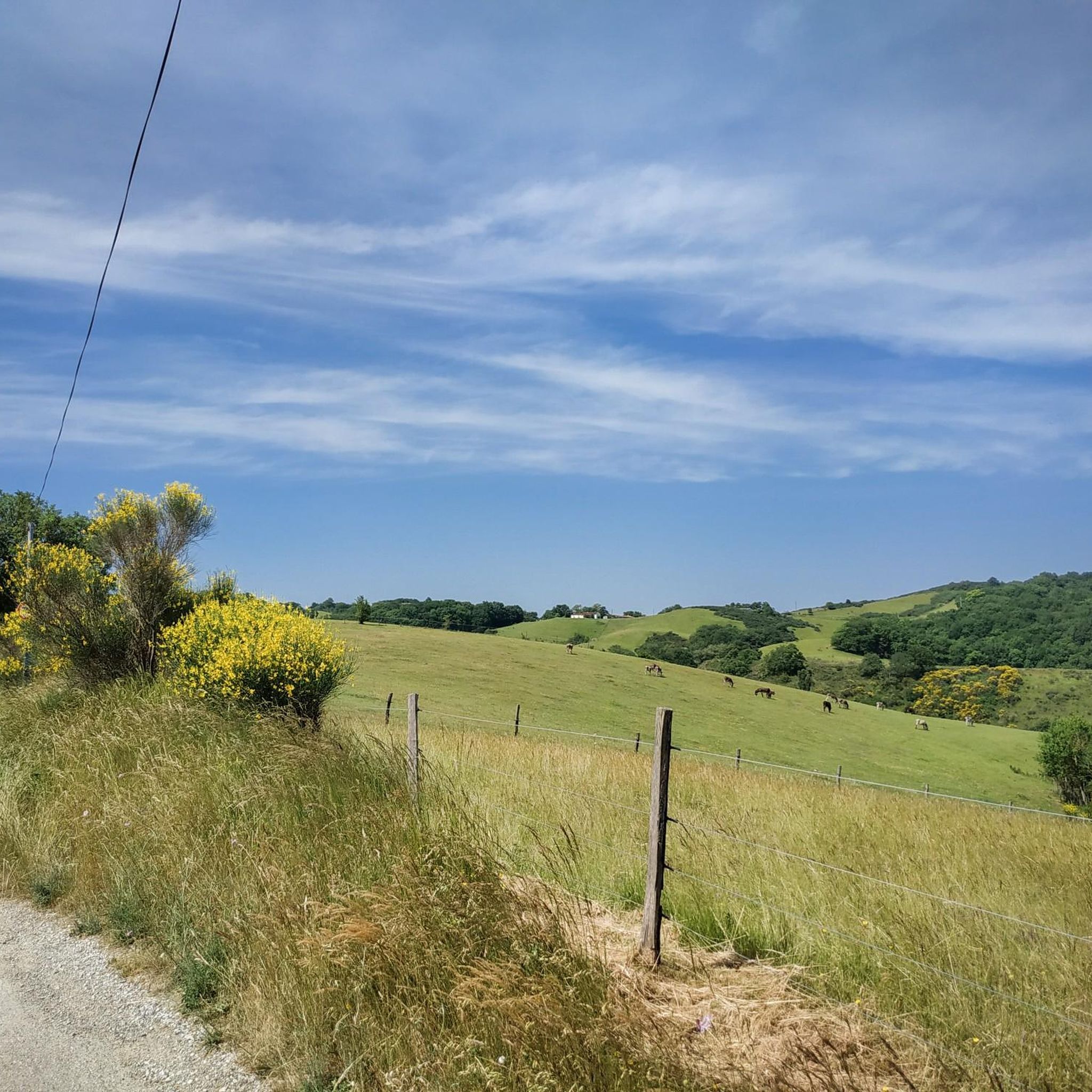
Magnificent landscape at the summit of the peak. Pretty flower and some horses Nice hike don't forget to drink... water
1
0

Nice climb, there are signs at the rocky parts, if the top is in the clouds the trails are also slippery, but it is more than worth the nice climb.
16
0

The setting here is truly stunning. The Rabassoles ponds shine in the valley, standing out against the surrounding granite cliffs. You can see the Rabassoles pond (1,851 metres), the Blue pond (1,920 metres) and the Black pond (1,970 metres).
2
0

When you hike up to this view of the Etang Bleu, you are rewarded with a breathtaking sight where the bright blue waters of the pond are nestled among the rugged peaks of the Pyrenees. The Etang Bleu, known for its deep blue and strikingly clear waters, is surrounded by lush vegetation and rocky outcrops, creating a tranquil and almost magical atmosphere. You can take advantage of this peaceful spot to take a break and soak up the natural beauty of the area before continuing your exploration of the nearby Etang de Rabassoles and its equally captivating landscape.
2
0
360 degree view of the Pays de Sault
0
0

gorgeous view! and the way from there down to the lakes is definitely worth securing.
2
1

The peak of Tarbésou, which culminates at 2,364 meters and overlooks the ponds of Rabassoles, offers a magnificent belvedere.
3
0
Frequently Asked Questions
What kind of terrain can I expect on hikes around Aunat?
Hikes around Aunat are characterized by a rugged, heavily wooded plateau within the Pays de Sault. You'll encounter varied elevations, ranging between 990 and 1310 meters, indicative of its mountain climate and proximity to the Pyrenees. The landscape offers natural scenery and diverse paths through forests.
Are there hiking options for all skill levels in Aunat?
Yes, Aunat offers a range of trails suitable for different abilities. You'll find options from easy strolls to more challenging ascents. For instance, the Pic de sarasi pays de sault loop from Roquefeuil is an easy 6.2 km trail, while the View of Étang Bleu – Pic de Tarbesou loop from Station de Mijanès is a difficult 20.4 km path with significant elevation gain.
How long do hikes typically take in Aunat?
Hike durations vary significantly depending on the route and your pace. Shorter, easier trails like the Pic de sarasi pays de sault loop from Roquefeuil can be completed in under 2 hours. More moderate routes, such as the Pic du Midi de Roquefeuil loop from Espezel (10.4 km), typically take around 3 hours. Challenging, longer hikes can extend to 8 hours or more.
What natural features or landmarks can I see while hiking near Aunat?
The region around Aunat is rich in natural beauty. You can explore the scenic Gorges de l'Aude, visit Lac de Belcaire, or discover fascinating underground formations at Grotte de l'Aguzou and Grotte de Fontrabiouse. There are also several mountain passes to discover, such as Pailhères Pass and Col du Garavel (1256 m), offering expansive views.
Are there circular hiking routes available in Aunat?
Yes, many of the trails around Aunat are designed as loops, allowing you to start and end at the same point. Examples include the Pic du Midi de Roquefeuil loop from Espezel and the Pic du Midi de Roquefeuil loop from Roquefeuil, providing convenient options for exploration.
Is Aunat a good destination for family-friendly hikes?
Aunat offers several trails that are suitable for families, especially those looking for easier or moderate walks through forested areas. The diverse network of paths means you can find routes with manageable distances and elevation gains, allowing families to enjoy the natural surroundings together.
Can I bring my dog on the hiking trails in Aunat?
Generally, dogs are welcome on many hiking trails in the Aunat region, especially in natural areas. However, it's always advisable to keep them on a leash, particularly in areas with wildlife or near livestock, and to check for any specific local regulations or protected zones before you go.
What are the parking options for hikers in Aunat?
Many trailheads around Aunat, especially those starting from villages like Roquefeuil or Espezel, offer designated parking areas for hikers. For routes originating from more remote locations, roadside parking might be available, but it's always best to check specific route details or local signage.
When is the best time of year to go hiking in Aunat?
The best time for hiking in Aunat is typically from spring through autumn when the weather is milder and trails are clear of snow. Given its mountain climate and proximity to the Pyrenees, summer offers pleasant temperatures for higher elevations, while spring and autumn showcase vibrant foliage. Winter hiking is possible but may require appropriate gear due to snow and colder conditions, especially at higher altitudes.
What do other hikers enjoy most about the trails in Aunat?
The trails in Aunat are highly rated by the komoot community, with an average score of 4.4 stars from over 220 reviews. Hikers often praise the diverse landscapes, from wooded plateaus to Pyrenean foothills, and the variety of routes catering to different abilities. The natural scenery and opportunities for reconnecting with nature are frequently highlighted.
Are there any moderate hikes with good views around Aunat?
Absolutely. For a moderate hike with rewarding views, consider the Pic du Midi de Roquefeuil – Pic de sarasi pays de sault loop from Roquefeuil. This 11.0 km route offers scenic vistas across the wooded plateau and takes approximately 3 hours and 18 minutes to complete.
Most popular attractions around Aunat

Get inspired with the komoot mobile app


Explore more
Browse the best Hikes in other regions.
