The best running trails around Montagny-Lès-Buxy
4.3
(53)
1,518
runners
138
runs
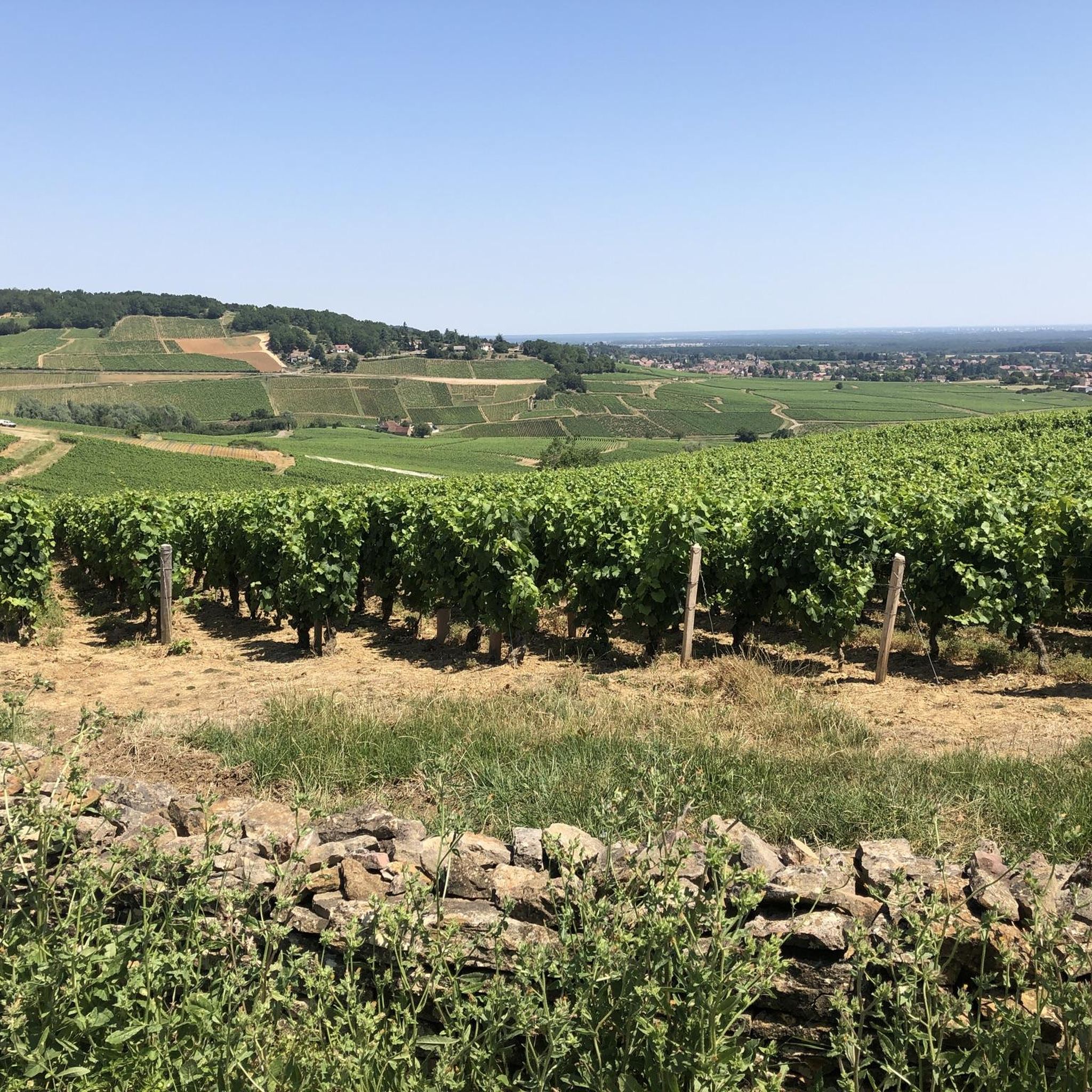
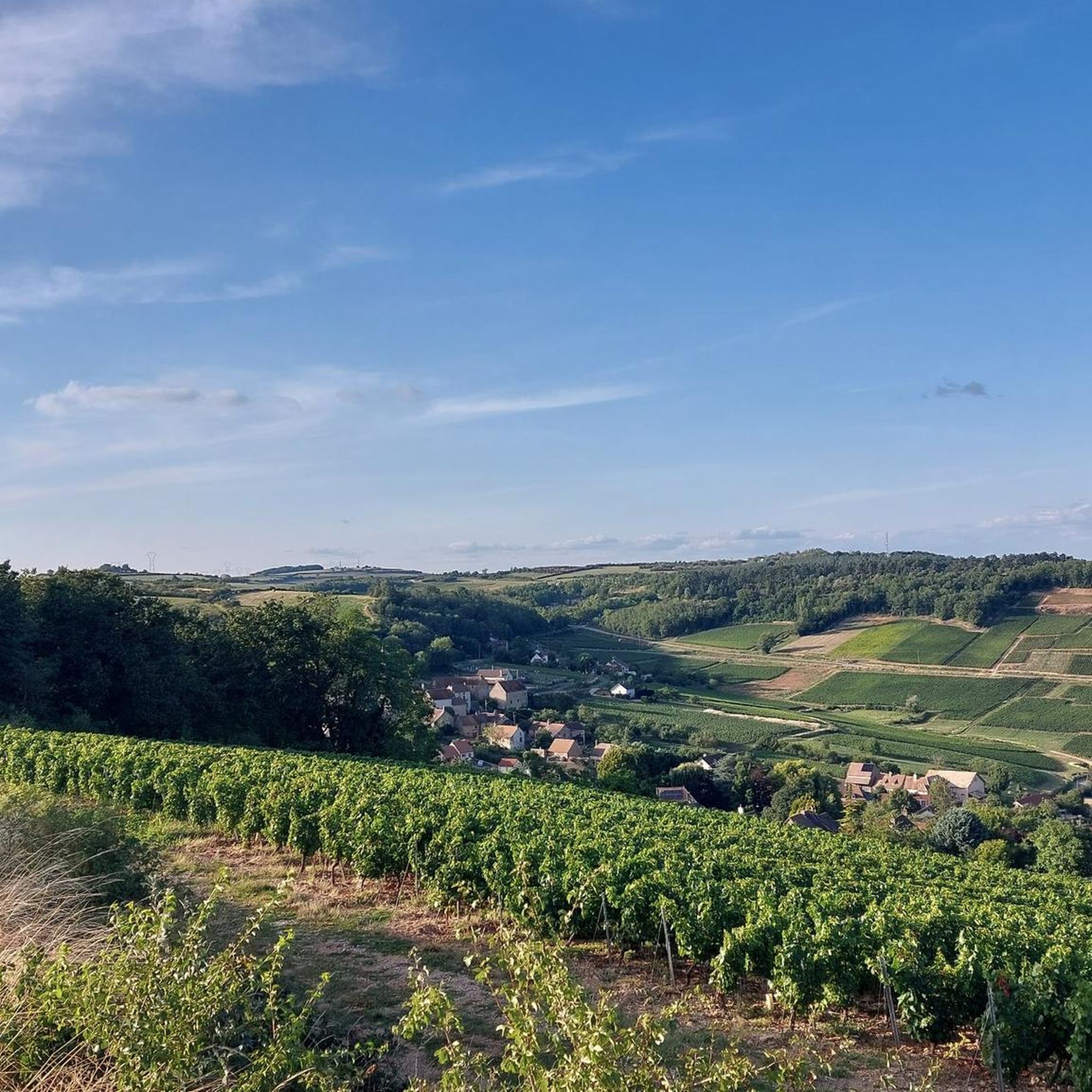
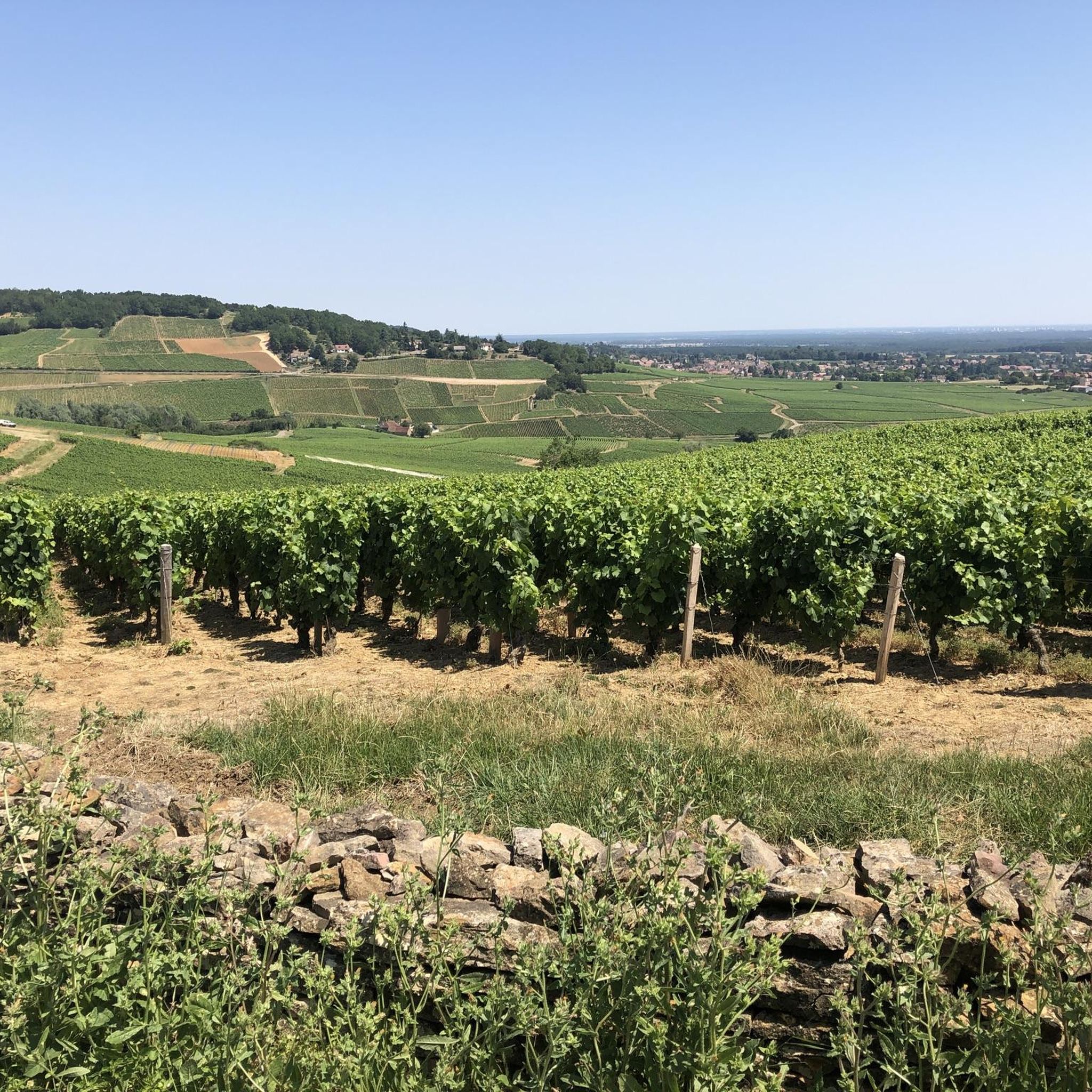
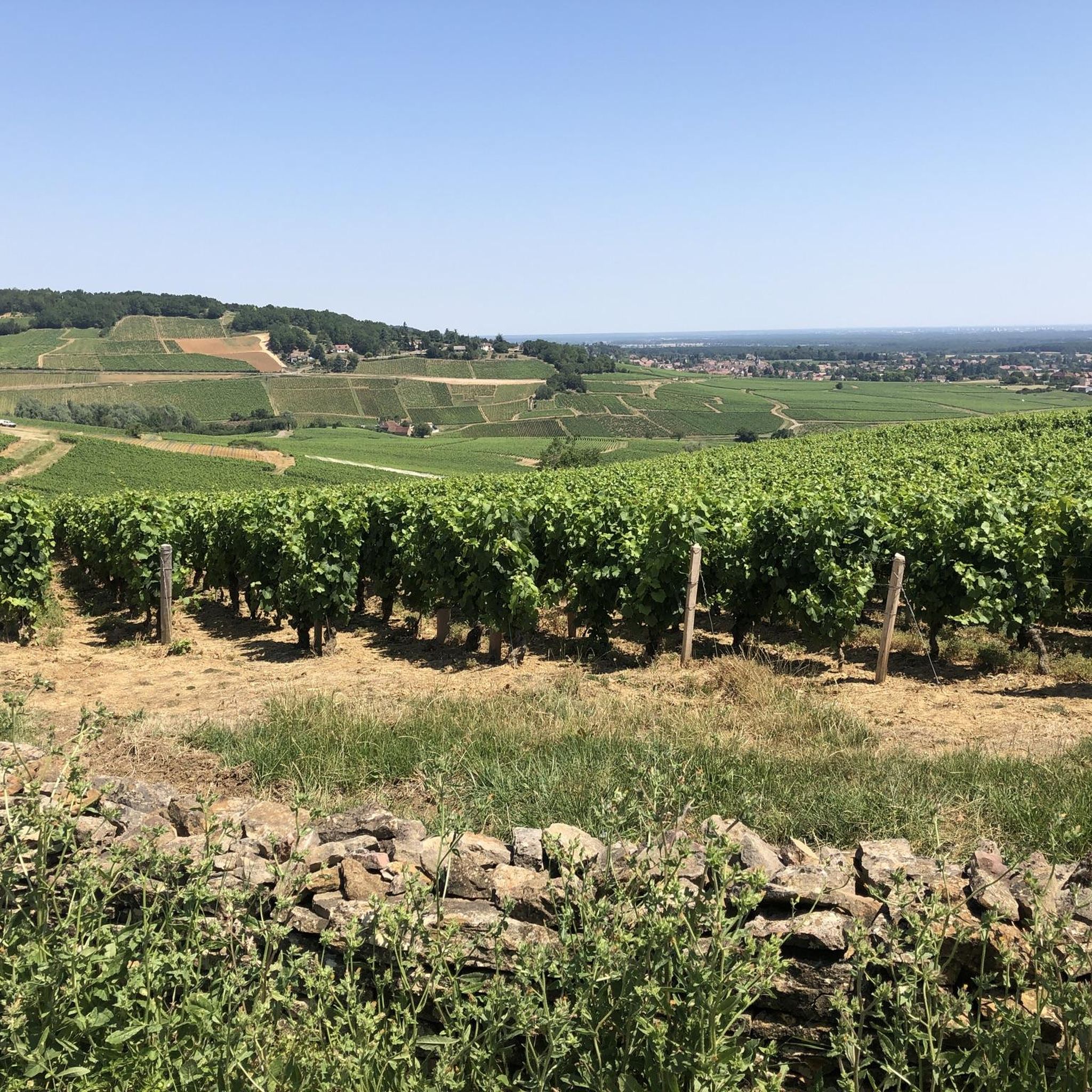
Jogging around Montagny-Lès-Buxy offers routes through a landscape characterized by extensive vineyards, particularly those producing Chardonnay wines. The terrain includes calcareous grasslands, known as "Pelouses Calcicoles," and gentle hills with elevations ranging from 245 to 415 meters. These features provide varied running experiences with both flat sections and moderate inclines. The region's natural features and well-maintained trails make it suitable for outdoor activities.
Best jogging routes around Montagny-Lès-Buxy
- The most popular jogging route is Running loop from Montagny-lès-Buxy, a 7.2 miles (11.6 km) trail that takes 1 hour 25 minutes to complete. This route features varied terrain with an elevation gain of over 230 meters.
- Another top favourite among local runners is Running loop from Jully-lès-Buxy, a moderate 3.9 miles (6.3 km) path. This route offers scenic views with gentle inclines, gaining over 50 meters in elevation.
- Local runners also love the Running loop from Buxy, a 2.2 miles (3.5 km) trail leading through the local area, often completed in about 24 minutes.
- Jogging around Montagny-Lès-Buxy is defined by vineyards, calcareous grasslands, and gentle hills. The network of routes offers options for various ability levels, from easy loops to more challenging runs with greater elevation changes.
- The routes in Montagny-Lès-Buxy are highly rated by the komoot community with an average score of 4.3 stars from over 50 reviews. More than 1400 runners have used komoot to explore Montagny-Lès-Buxy's varied terrain.
Last updated: July 6, 2026
6
runners
11.6km
01:25
230m
230m
Moderate run. Good fitness required. Mostly paved surfaces. Suitable for all skill levels.
3
runners
6.33km
00:42
50m
50m
Moderate run. Good fitness required. Mostly paved surfaces. Suitable for all skill levels.

Sign up for free
4
runners
3.55km
00:24
30m
30m
Easy run. Great for any fitness level. Mostly paved surfaces. Suitable for all skill levels.
3
runners
7.48km
00:49
130m
130m
Moderate run. Good fitness required. Mostly paved surfaces. Suitable for all skill levels.
3
runners
16.9km
01:47
120m
120m
Hard run. Very good fitness required. Mostly paved surfaces. Suitable for all skill levels.
Get access to more routes and recommendations from other explorers.
Sign up for free
Already have an account?
Our route recommendations are based on thousands of hikes, rides, and runs completed by other people on komoot.
Start today with a free account
Your next adventure awaits.
Login or Signup
Tips from the Community

Magnificent view over the hilly cultural landscape, which is particularly shaped by viticulture.
1
0

Rimont is a small, peaceful hamlet where 2 congregations of brothers and sisters reside.
1
0

Buxy not only has good wine but also good restaurants, some directly on the Voie Verse
1
0

Great cycling route and a fantastic spice shop in the train station. It's definitely worth a visit for anyone who loves cooking and is looking for a new flavor!
1
0

Buxy retains a remarkable medieval town. This developed from the 10th century, when the small city was a capital, then became a provostship.
2
0

adorable little medieval center
1
0

The former train station has been beautifully restored and houses an information center on regional environmental planning and culture.
3
1
Frequently Asked Questions
How many running routes are available around Montagny-lès-Buxy?
There are over 100 dedicated running routes around Montagny-lès-Buxy, offering a wide variety of options for all skill levels. The komoot community has explored more than 1400 routes in the area.
What is the typical terrain like for jogging in Montagny-lès-Buxy?
The terrain around Montagny-lès-Buxy is characterized by extensive vineyards, particularly those producing Chardonnay wines, and unique calcareous grasslands known as "Pelouses Calcicoles." You'll find a mix of gentle inclines and declines, with elevations varying between 245 and 415 meters, providing engaging running experiences.
Are there running routes suitable for beginners or those looking for an easy jog?
Yes, Montagny-lès-Buxy offers several easy running routes. For example, the Running loop from Buxy is a 2.2-mile (3.5 km) trail with minimal elevation gain, perfect for a relaxed run. Overall, there are 6 easy routes available.
Can I find longer or more challenging running trails in the area?
Absolutely. For those seeking a greater challenge, there are 23 difficult routes available. A notable option is the Medieval town of Buxy loop from Buxy, which spans nearly 17 km and offers a more extensive workout.
What natural features can I expect to see along the running trails?
While running, you'll be immersed in the region's natural beauty, including vast vineyards, especially the Montagny appellation, and the ecologically significant "Pelouses Calcicoles" (calcareous grasslands). You might also encounter "cadoles" (dry stone huts) and the diverse flora of a conservatory orchard.
Are there any specific wine-themed running routes?
Yes, the area is famous for its vineyards. A key highlight is the Sentier Viticole du Montagny, a 4.5-kilometer interpretive path that winds through the vineyards, offering insights into the local terroir and wines through informational steles. This provides a structured and scenic running experience.
What points of interest or landmarks can I see while jogging around Montagny-lès-Buxy?
Beyond the vineyards, you can explore various points of interest. Some routes might take you near historical settlements like Saint-Gengoux-le-National or Jambles. You could also pass by Sercy Castle or enjoy a View of Saint-Denis-de-Vaux.
Are the running trails in Montagny-lès-Buxy dog-friendly?
Many trails in the Montagny-lès-Buxy area are suitable for running with dogs, especially the numerous marked trails that crisscross the vineyards and natural areas. It's always recommended to keep your dog on a leash, especially near vineyards or protected natural sites like the "Pelouses Calcicoles," and to respect local signage.
Are there any circular running routes available?
Yes, many of the running routes around Montagny-lès-Buxy are designed as loops, allowing you to start and finish in the same location. For instance, the popular Running loop from Montagny-lès-Buxy is a 11.6 km circular trail.
What do other runners enjoy most about jogging in Montagny-lès-Buxy?
The running routes in Montagny-lès-Buxy are highly rated by the komoot community, with an average score of 4.3 stars from over 50 reviews. Runners often praise the beautiful vineyard landscapes, the varied terrain with gentle hills, and the well-maintained trails that offer a refreshing outdoor experience.
Is there public transport access to the trailheads in Montagny-lès-Buxy?
While Montagny-lès-Buxy is a rural area, it is located near the GR 76 long-distance hiking trail and the "Voie Verte" (Greenway), which can be accessed via public transport in nearby larger towns. For specific trailheads, local bus services might be limited, so checking regional transport schedules in advance is advisable.
Where can I find parking for the running trails?
Parking is generally available in the villages and near popular trailheads. For routes starting directly from Montagny-lès-Buxy or other nearby villages like Buxy, you can usually find designated parking areas. For specific routes, it's best to check the route details on komoot for parking suggestions.
What is the best time of year to go running in Montagny-lès-Buxy?
Spring and autumn are particularly pleasant for running in Montagny-lès-Buxy. In spring, the vineyards burst into life, and in autumn, the foliage offers stunning colors. Summer can be warm, so early morning or late afternoon runs are recommended. Winter runs are also possible, offering a different, quieter perspective of the landscape.
Most popular attractions around Montagny-Lès-Buxy

Get inspired with the komoot mobile app


Explore more
Browse the best Running Trails & Routes in other regions.
