The best mountain hikes around Langenzersdorf
5.0
(4)
47
hikers
8
hikes
Mountaineering around Langenzersdorf offers routes through the diverse landscapes bordering the Vienna Woods and the Danube Valley. The region is characterized by the Bisamberg mountain, which reaches 358 meters, featuring mixed oak forests, dry grasslands, and vineyards. Elevated trails provide views over Vienna and the surrounding area, with the Danube river often visible.
Best mountaineering routes around Langenzersdorf
- The most popular mountaineering route is Haßlinger Wine Tavern – Habsburgwarte on the Hermannskogel loop from Döbling, a 6.5 miles (10.4…
Last updated: July 1, 2026
5.0
(1)
15
hikers
Moderate mountaineering route. Good fitness required. Easily-accessible paths. Suitable for all skill levels.
4
hikers
Easy mountaineering route. Great for any fitness level. Easily-accessible paths. Suitable for all skill levels.

Sign up for free
5.0
(3)
8
hikers
Moderate mountaineering route. Good fitness required. Easily-accessible paths. Suitable for all skill levels.
8
hikers
Easy mountaineering route. Great for any fitness level. Easily-accessible paths. Suitable for all skill levels.
3
hikers
Moderate mountaineering route. Good fitness required. Easily-accessible paths. Suitable for all skill levels.
Get access to more routes and recommendations from other explorers.
Sign up for free
Already have an account?
Our route recommendations are based on thousands of hikes, rides, and runs completed by other people on komoot.
Start today with a free account
Your next adventure awaits.
Login or Signup
Popular around Langenzersdorf


Tips from the Community

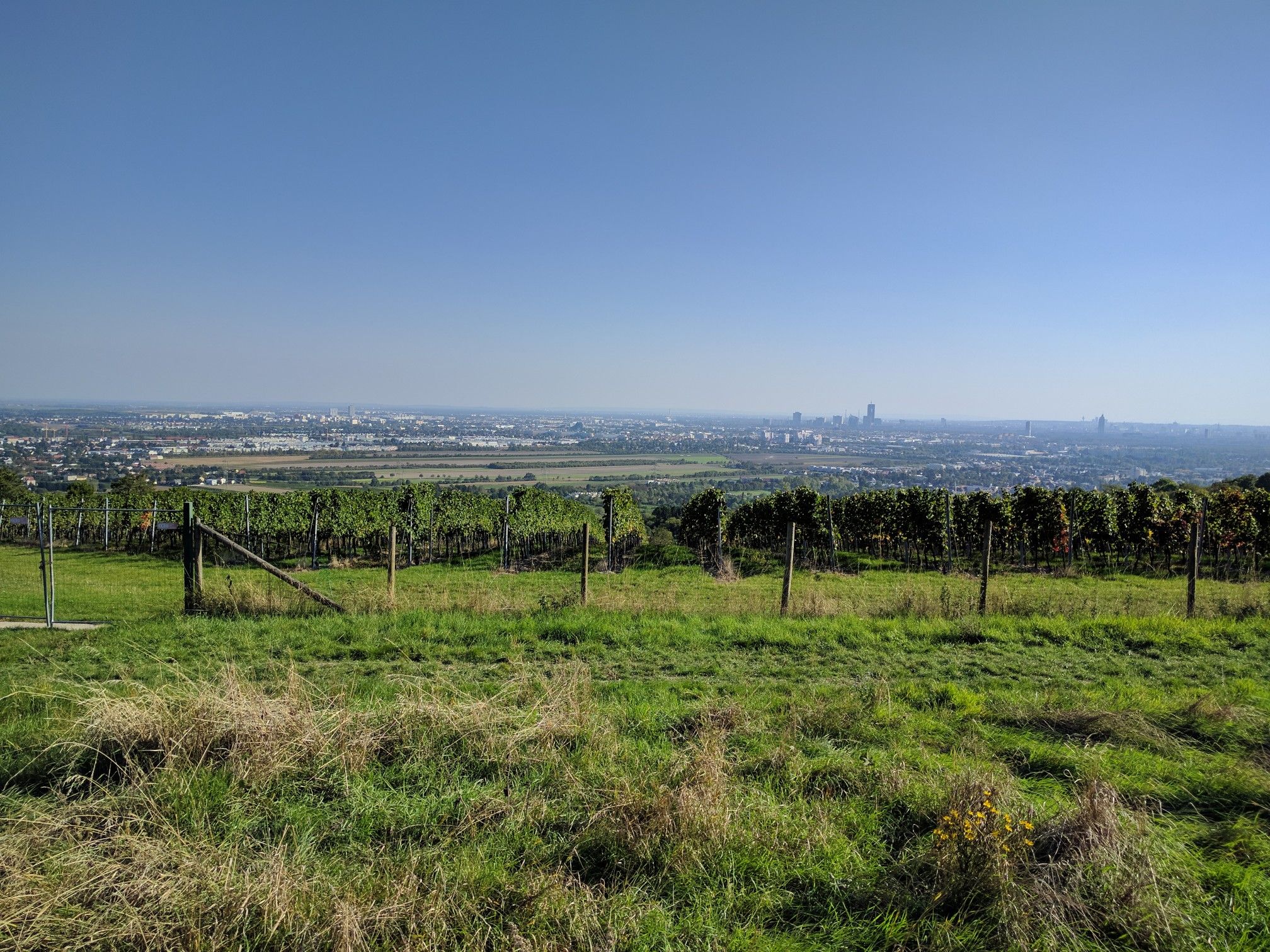
The viewing platform on Kahlenberg is one of Vienna's most famous viewpoints, offering a sweeping panoramic view of the city. From the platform, large parts of the Inner City, the Danube, Danube Island, and the outer districts are clearly visible. On a clear day, the view extends far beyond the city limits into the Vienna Basin and the surrounding countryside. Its elevated position on the edge of the Vienna Woods combines nature with city views, making the platform a popular destination for cyclists who want to experience Vienna from a bird's-eye perspective.
0
0

Under favorable conditions, a fantastic panorama, fantastic. The skyline with the magnificent skyscrapers in "Donau City" and the view of Vienna itself never cease to fascinate me.
1
1


Still in Vienna but very rural. Close to Nasenweg
1
1

The climb is quite strenuous but shady when the sun is shining. The great view rewards the effort. Note: Bring plenty of water if you plan to hike up there in hot temperatures.
1
1

The Cossack Memorial commemorates the contribution of Ukrainian Cossacks to the liberation of Vienna from the Ottoman siege in 1683. It is located at Nasenweg in the 19th district and was ceremoniously unveiled on April 23, 2013.
14
0
Leopoldsberg Castle is a historic ruin on the hill of the same name in the Vienna Woods. Dating back to the 12th century, it now offers—along with the remains of the old castle—one of the most beautiful views over Vienna and the Danube. 🏰🌄
14
1
Leopoldsberg is one of the most popular hiking destinations around Vienna – and rightly so! From here, you can enjoy breathtaking views over the city of Vienna, the Danube, and all the way to Klosterneuburg. 🌇🌊
14
1
Frequently Asked Questions
How many mountaineering routes are available around Langenzersdorf?
There are 9 distinct mountaineering routes around Langenzersdorf, offering a variety of experiences. These include 4 easy routes and 5 moderate routes, ensuring options for different fitness levels.
What kind of views can I expect on mountaineering routes near Langenzersdorf?
Mountaineering routes around Langenzersdorf offer expansive views over Vienna and the surrounding area, including the Danube valley. Notable viewpoints like the Panoramic view of Vienna and the Danube from Leopoldsberg provide stunning vistas, and on clear days, you might even spot the Schneeberg mountain.
Are there any family-friendly mountaineering routes in the Langenzersdorf area?
Yes, the region offers several routes suitable for families. The Bisamberg area, for instance, features the "Rund um den Bisamberg" nature trail and the "Natura Trail" starting from Stammersdorf, which is even accessible with a pram. While specific family-friendly mountaineering routes are not detailed, the 4 easy routes available provide less strenuous options for a family outing.
What are some notable landmarks or attractions along the mountaineering trails?
Along the mountaineering trails, you can discover several interesting landmarks and natural features. Highlights include the Habsburgwarte on the Hermannskogel, the Panoramic view of Vienna and the Danube from Leopoldsberg, and the Tempelberg Observation Tower. You might also encounter natural features like the Gspöttgraben or the Kierlingbach Valley.
Are there any circular mountaineering routes available?
Yes, many of the mountaineering routes around Langenzersdorf are designed as loops. For example, the moderate Haßlinger Wine Tavern – Habsburgwarte on the Hermannskogel loop from Döbling is a popular circular trail. Another option is the easy View from Leopoldsberg – View of Vienna from the Kahlenberg loop from Biosphärenpark Wienerwald Kernzone Leopoldsberg, which offers panoramic views.
What is the best time of year for mountaineering in Langenzersdorf?
The Langenzersdorf region, with its mixed oak forests, vineyards, and dry grasslands, is generally pleasant for elevated hiking from spring through autumn. Spring brings blooming flora, while autumn offers vibrant foliage. While not specifically for technical mountaineering, the trails are accessible for active outdoor pursuits during these seasons. Winter mountaineering is possible, but conditions may vary, and appropriate gear is recommended.
Can I find places to eat or rest along the mountaineering routes?
Yes, some routes pass by local taverns or guesthouses. For instance, the Haßlinger Wine Tavern – Habsburgwarte on the Hermannskogel loop from Döbling is known for passing by local taverns. The Bisamberg area also includes guesthouses, making it convenient for a stop during your hike.
What do other mountaineers say about the routes in Langenzersdorf?
The mountaineering routes in Langenzersdorf are highly regarded by the komoot community, holding an impressive average rating of 5.0 stars. Reviewers often praise the diverse terrain, scenic views of Vienna and the Danube, and the well-maintained paths that cater to various ability levels.
Are there any easy mountaineering routes for beginners?
Absolutely. Langenzersdorf offers 4 easy mountaineering routes perfect for beginners or those looking for a less strenuous experience. An example is the View of Vienna loop from Biosphärenpark Wienerwald Kernzone Leopoldsberg, which provides beautiful scenery without significant difficulty.
How can I reach the mountaineering trails using public transport?
Langenzersdorf's proximity to Vienna means many trailheads are accessible via public transport. For routes around Kahlenberg and Leopoldsberg, you can often reach starting points from areas like Wien Nußdorf or Biosphärenpark Wienerwald Kernzone Leopoldsberg, which are typically served by local buses or S-Bahn connections from Vienna. It's advisable to check local transport schedules for specific trailheads.
Are there any less crowded mountaineering routes near Langenzersdorf?
While popular spots like Bisamberg and Kahlenberg can attract visitors, the extensive network of trails means you can often find quieter paths. Exploring some of the lesser-known sections of the Eastern Austrian Borderland Trail (07) or the Weinviertelweg 632, which traverses gentle landscapes north of Vienna, might offer a more secluded experience away from the main tourist hubs.
What kind of terrain should I expect on these routes?
The terrain around Langenzersdorf is varied, characterized by forested hills, scenic vineyards, and dry grasslands, particularly on the Bisamberg. You'll encounter mixed oak forests and downy oak scrub forests. While not technical mountaineering, routes can involve elevated sections and require good fitness and sure-footedness on some moderate trails.
Most popular routes around Langenzersdorf
Most popular attractions around Langenzersdorf

Get inspired with the komoot mobile app


Explore more
Browse the best Mountain Hikes & Routes in other regions.
