The best walks and hikes around Paspardo
4.4
(1143)
7,970
hikers
19
hikes
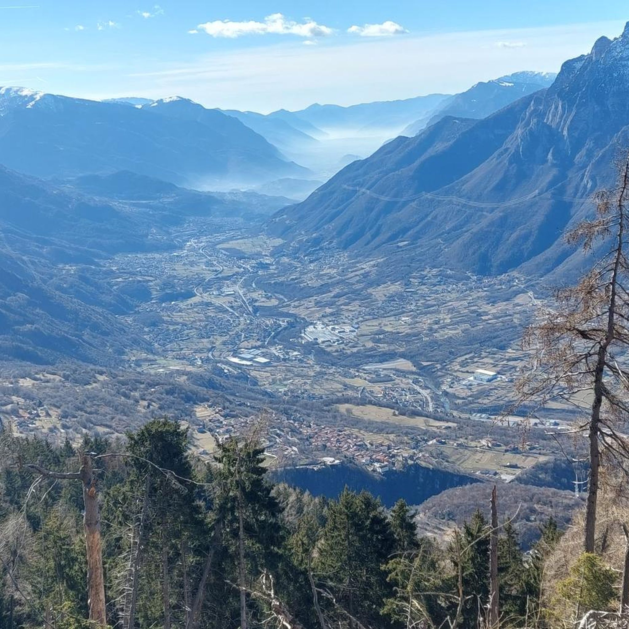
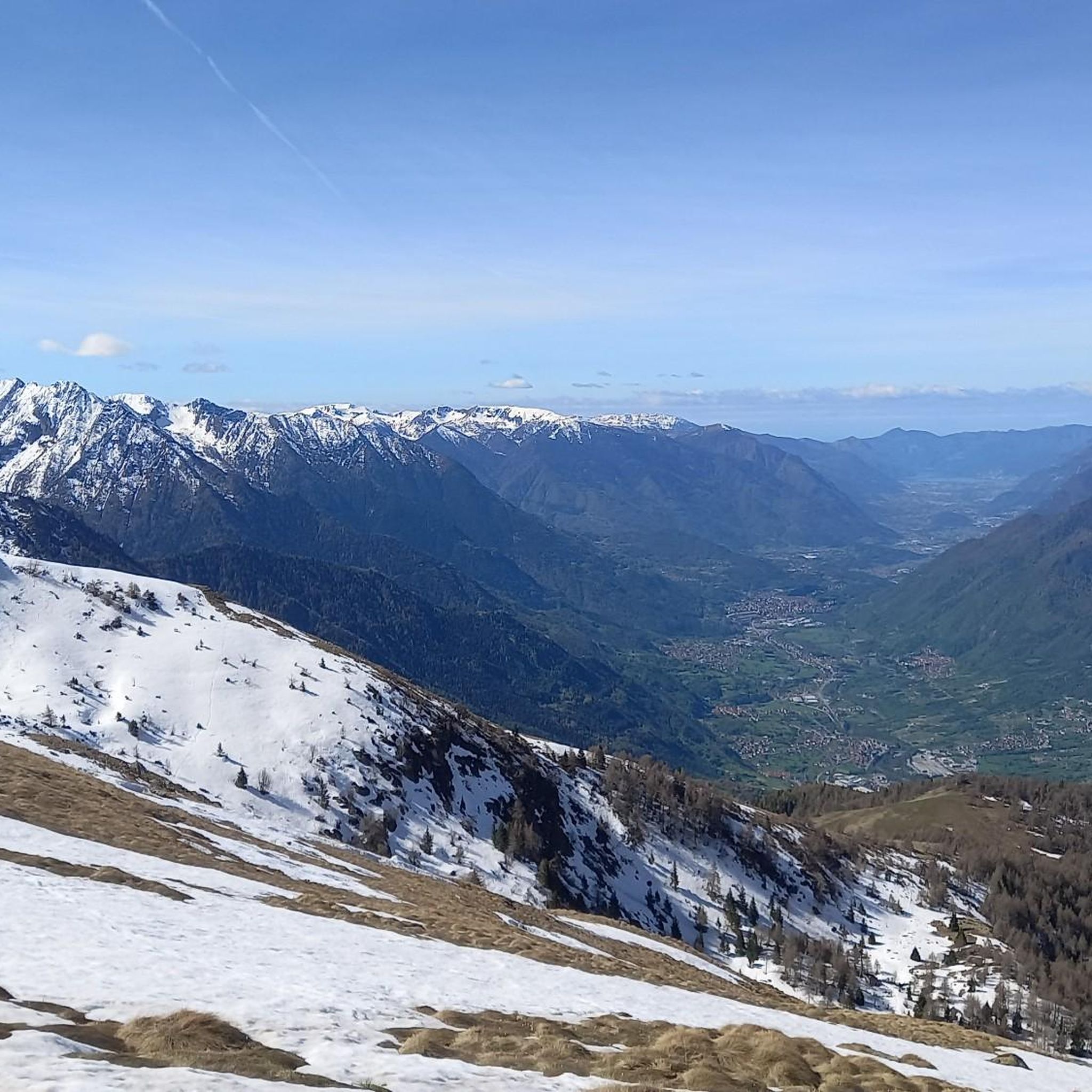
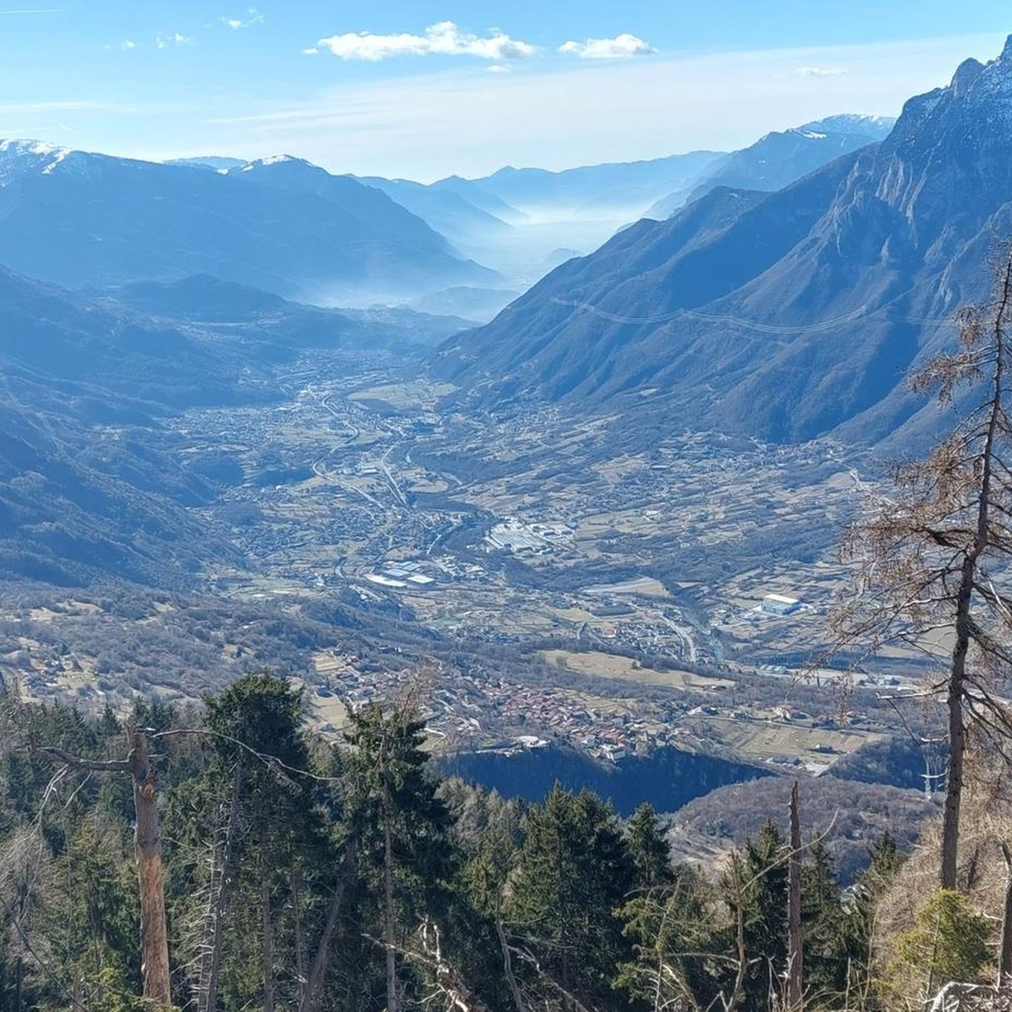
Hiking around Paspardo offers diverse landscapes within Italy's Valle Camonica, characterized by prominent mountain ranges and alpine terrain. The region features views of the Concarena massif, Pizzo Badile Camuno, and the Piccole Dolomiti Scalvine. Hikers can explore areas within the Adamello Regional Park and the Rock art Natural Reserve of Ceto, Cimbergo and Paspardo, a UNESCO World Heritage site. This area provides a variety of hiking trails suitable for different skill levels.
Best hiking trails around Paspardo
- The most popular…
Last updated: July 7, 2026
4.0
(1)
18
hikers
15.2km
06:37
1,170m
1,170m
Alpine trail through stone shepherds' huts with dramatic views of the towering Concarena massif.
2.0
(1)
9
hikers
15.3km
05:25
760m
760m
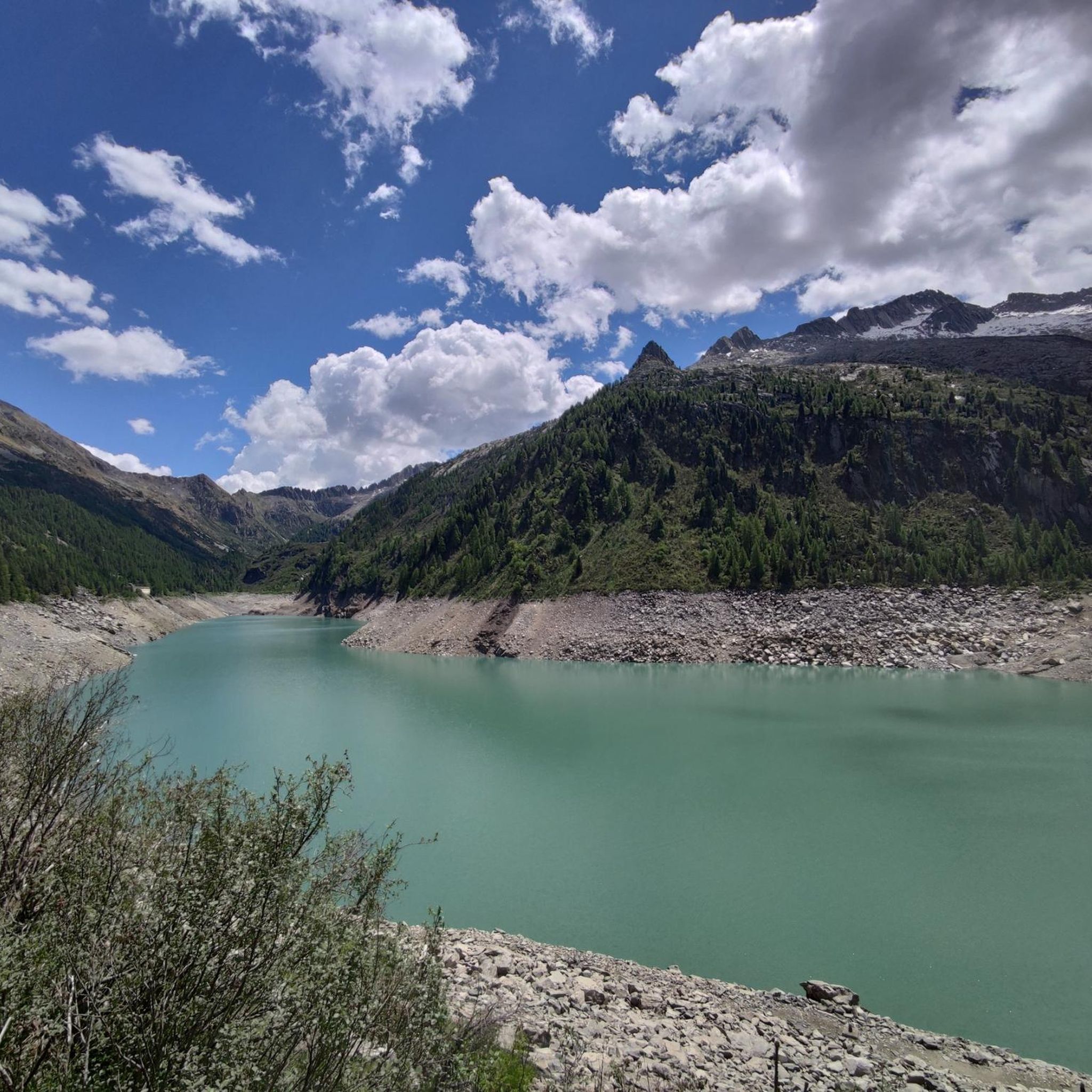
Hike the difficult Sentiero dei Tre Fratelli to Lago d'Arno, a 9.5-mile route with 2494 feet of gain to an emerald alpine lake.

Sign up for free
15.5km
06:40
1,430m
1,430m
Alpine trail through untouched wilderness connecting mountain huts to a dramatic dam reservoir.
4.3
(48)
257
hikers
11.4km
04:29
770m
770m
Moderate hike. Good fitness required. Mostly accessible paths. Sure-footedness required.
4.7
(45)
263
hikers
17.1km
05:46
850m
850m
Hard hike. Very good fitness required. Easily-accessible paths. Suitable for all skill levels.
Get access to more routes and recommendations from other explorers.
Sign up for free
Already have an account?
Our route recommendations are based on thousands of hikes, rides, and runs completed by other people on komoot.
Start today with a free account
Your next adventure awaits.
Login or Signup


Tips from the Community

The Pizzo Badile Camuno is one of the most iconic peaks in the middle Val Camonica: a limestone mountain with an unmistakable shape, a summit at 2,435 m, spectacular views, and a challenging but very rewarding via ferrata. Here is a clear and updated summary to help you orient yourself. 🏔️ Pizzo Badile Camuno Profile - Altitude: 2,435 m a.s.l. - Location: between Ceto and Cimbergo, in the Adamello group. - Mountain character: isolated peak, "shovel" shape (hence the name), often called the "Cervino of Camonica". - Geology: very white limestone upper part, resting on the dark Fasa band, with a granite base of the Adamello massif. 🧗♂️ The Pizzo Badile Camuno via ferrata One of the best-known and most frequented routes in the area, classified C/D, therefore challenging. - Total elevation gain: ~1,385 m - Total duration: approximately 6h30’ (approach + via ferrata + return). - Difficulty: moderate technical skill required, but physically very demanding. - Exposure: constant, with equipped sections on smooth slabs and Grade I passages in the woods. - Mandatory equipment: helmet, harness, via ferrata set (the rock is crumbly and prone to rockfall). 🚶♂️ Ascent Itinerary (from Cimbergo – Volano) Starting point: dirt road above Cimbergo, near Rifugio De Marie (1420 m). 1) Approach - CAI Trail 77, steep and with equipped sections already in the woods. - Passages on smooth slabs with chains and some rocky jumps. - Exit from the woods with a view of the Volano basin and the middle Val Camonica. 2) Mario Donati Bivouac - Small wooden structure nestled in the rock, a perfect spot for a break. - From here, the most exposed section towards the base of the wall begins. 3) Final via ferrata - Long and continuous steel cable. - Exposed passages on grassy rocks and oblique traverses. - Arrival at the fissure that divides the Pizzo in two: from here the summit is close. 🌄 View from the summit One of the widest in Val Camonica: - Adamello and Pian di Neve - Concarena - Presolana - Lake Iseo - Up to the more distant Disgrazia and Bernina on clear days 📜 Historical Notes - First documented explorations: 1855, Prof. Regazzoni. - First official ascent: May 25, 1884, Ballardini and Beatrici.
0
0
🌿 Origins: an ancient cult in the highlands The devotion to the Madonna delle Nevi (Our Lady of the Snows) is widespread throughout the Alps. It originates from a legendary episode in the 4th century, linked to the Basilica of Santa Maria Maggiore in Rome, but in the Lombard mountains it takes on a more concrete meaning: invoking protection against avalanches, sudden snowfalls, and the dangers of alpine pastures. The small church of Paspardo fits exactly into this tradition: a small oratory built to protect shepherds, woodcutters, and travelers who climbed towards Colombé, Barbignaga, and the high mountain pastures.
0
0
Le Baite del Pusol are a small cluster of huts at an altitude of approximately 1400 m above Paspardo, on the slope of Monte Colombé. They are reachable via the agro–silvo–pastoral road that climbs from Ghisgiulì and offer an exceptional panoramic point over the Concarena. The most reliable information available online confirms the location and access route. 📍 Where exactly they are located - Municipality: Paspardo (BS) - Altitude: ~1400 m - Area: southern slope of Monte Colombé - Approximate coordinates: 46.04 N, 10.38 E - Access: agro–silvo–pastoral road from Ghisgiulì (1080 m), reachable by car (toll section) 🥾 How to get to Le Baite del Pusol Simplest itinerary (from Paspardo – Ghisgiulì) - Departure: Paspardo → Fles locality → Faunistic Center parking → Ghisgiulì - Departure altitude: 1080 m - Arrival: Le Baite del Pusol (1400 m) - Elevation gain: ~320 m - Time: 45–60 min - Difficulty: T/E (tourist–hiker) - Terrain: dirt road, easily passable The route is confirmed by the hiking report that describes the ascent from Deria–Paspardo to Pusol, with a spectacular panorama over the Concarena. 🌄 What to expect - Dominating panorama over the Concarena, especially at sunset - Wide meadows and scattered huts, a very tranquil environment - Ideal spot for: - photography - short hikes towards Colombé / Saline / Daha - sunset observation over the Concarena fissure 🔗 Useful links From Pusol depart or pass: - the path towards Saline (junction for Lago d’Arno) - the track that climbs towards Malga Colombé - connections towards Pian di Campo and the high ridge Colombé–Barbignaga
0
0
La Concarena is an imposing limestone-dolomite massif in the Orobic Prealps, culminating in Cima della Bacchetta (2549 m), and it separates the middle Val Camonica from Val di Scalve. It is a rugged, vertical mountain, rich in couloirs and fractured ridges, visible even from the Po Valley on clear days. 📍 Location - Region: Lombardy - Provinces involved: Brescia (predominant) and Bergamo (Scalve sector) - Municipalities concerned: Lozio, Cerveno, Losine, Ono San Pietro, Capo di Ponte; Bergamo side: Schilpario 🧭 Morphological characteristics - Limestone massif belonging to the Calcare di Esino formation - Vertical walls, chimneys, sharp ridges - Impressive elevation gain: ~2200 m from the valley floor in just 5 km - Presence of particular geological phenomena: - Frost chimneys (cold air escaping from fissures) - Marine fossils (limestone algae, corals) 🥾 Hikes and access La Concarena is wild and little frequented, ideal for experienced hikers. 🌄 Most popular itineraries - Cima della Bacchetta - Very demanding itinerary, 4h30 ascent only, requires experience and a surefootedness - Rifugio Baita Iseo (the only refuge in the massif) - Access from Ono San Pietro - Elevation gain ~800 m, loop trail - Val Varadega - Simpler trekking (2h30, excluding the final section) - Long traverses - Connections towards Mortirolo, Monte Pagano, Laghi Seroti - High-altitude routes, often on unstable terrain 🌅 Equinox phenomenon A distinctive and fascinating feature: at sunset during the equinoxes, the sun sets exactly in the split of the Concarena, creating a luminous effect that seems to "cut" the mountain. The ancient Camuni interpreted it as a manifestation of the "Great Spirit".
0
0
La Concarena is an imposing limestone-dolomite massif in the Orobie Prealps, culminating in Cima della Bacchetta (2549 m), and it separates the middle Val Camonica from Val di Scalve. It is a rugged, vertical mountain, rich in gullies and fractured ridges, visible even from the Po Valley on clear days. 📍 Location - Region: Lombardy - Provinces involved: Brescia (predominant) and Bergamo (Scalvino sector) - Municipalities concerned: Lozio, Cerveno, Losine, Ono San Pietro, Capo di Ponte; Bergamo side: Schilpario 🧭 Morphological characteristics - Limestone massif belonging to the Calcare di Esino formation - Vertical walls, chimneys, sharp ridges - Impressive elevation gain: ~2200 m from the valley floor in just 5 km - Presence of particular geological phenomena: - Frost chimneys (cold air escaping from fissures) - Marine fossils (limestone algae, corals) 🥾 Hikes and access La Concarena is wild and little frequented, ideal for experienced hikers. 🌄 Most popular routes - Cima della Bacchetta - Very demanding route, 4h30 ascent only, requires experience and a surefootedness - Rifugio Baita Iseo (the only refuge in the massif) - Access from Ono San Pietro - Elevation gain ~800 m, loop trail - Val Varadega - Simpler trekking (2h30, excluding the final section) - Long traverses - Connections towards Mortirolo, Monte Pagano, Laghi Seroti - High-altitude routes, often on unstable terrain 🌅 Equinox phenomenon A distinctive and fascinating feature: at sunset during the equinoxes, the sun sets exactly in the split of the Concarena, creating a luminous effect that seems to "cut" the mountain. The ancient Camuni interpreted it as a manifestation of the "Great Spirit".
0
0
The Rifugio Colombé is a highly appreciated mountain hut above Paspardo (Valcamonica), easily accessible and perfect for a scenic hike. It is located at an altitude of 1710 m and offers access to numerous itineraries towards Monte Colombé, Passo della Porta, Lago d’Arno, and the rock art area. 📍 Location - Location: Monte Colombé, Paspardo (BS) - Coordinates: 46.04454 N, 10.38432 E - Useful address: Via Zumella, Paspardo (most common starting point) 🥾 How to get there From Paspardo – CAI Trail 117 / 127 - Departure: Via Zumella – Centro Faunistico del Parco dell’Adamello (1100 m) - Arrival: Rifugio Colombé (1710–1850 m, depending on sources) - Elevation gain: ~750 m - Time: 1h40 – 2h30 - Difficulty: E (Hiking) The path is well-marked, starts in the woods, and then opens up to panoramic clearings with views of Valcamonica. From Cimbergo - Time: ~3h - Elevation gain: ~850 m 🏔️ What to see and do in the surroundings - Monte Colombé - Cima Barbignaga (2367 m) - Passo della Porta (connection towards Lago d’Arno) - Corno delle Pile (2899 m) - Pizzo Badile Camuno (2435 m) - Rock art sites of the Adamello Park 🛖 The hut - Manager: Massimo Alessandria - Phone: 366 503 3070 - Email: info@rifugiocolombe.it / massimo@rifugiocolombe.it - Beds: 35–37 - Lunch seats: ~90 indoors + 50 outdoors - Opening: often on request (always check) - Half board: €55–60 The hut is known for: - home-style cooking - warm welcome - splendid panoramic terrace overlooking Valcamonica
0
0

Rifugio Colombè, at 1,720 m, is located in Valcamonica and offers typical local cuisine and hospitality in a family atmosphere. Overnight stays are also possible with 37 beds. Starting point for excursions to Monte Colombè and Concarena, with a view of the Adamello group and Pizzo Badile Camuno. To check opening times, visit the refuge page: https://www.facebook.com/p/Rifugio-Colombé-100088546332468/
1
0

Frequently Asked Questions
How many hiking trails are there in Paspardo?
Paspardo offers a wide range of hiking opportunities, with a total of 19 routes available. These trails cater to various skill levels, from easy walks to challenging alpine excursions.
What types of terrain can I expect on Paspardo's hiking trails?
Hikers in Paspardo will encounter diverse alpine terrain, characterized by prominent mountain ranges and valleys. The trails often feature significant elevation changes, leading through landscapes with views of the Concarena massif, Pizzo Badile Camuno, and the Piccole Dolomiti Scalvine.
Are there any easy or family-friendly hiking options in Paspardo?
Yes, Paspardo has 3 easy hiking routes suitable for families or those seeking a more relaxed experience. While the region is known for its challenging alpine trails, there are options to enjoy the scenery without extensive difficulty.
Are there any circular hiking routes in Paspardo?
Yes, Paspardo offers several circular routes. For example, you can explore the De Marie al Volano Mountain Hut – Colombé Hut loop from Paspardo, which provides a comprehensive experience of the area's natural beauty and mountain refuges. Another option is the View of Concarena – Colombé Hut loop from Paspardo, offering stunning vistas.
What are some notable natural attractions or viewpoints along the trails?
Paspardo's trails offer spectacular views of the Concarena massif, Pizzo Badile Camuno, and the Piccole Dolomiti Scalvine. Hikers can also reach significant mountain passes like the Campelli Pass, which provides expansive views of the Scalve and Camonica valleys. The region is also part of the Adamello Regional Park, ensuring pristine natural beauty.
Are there any cultural or historical sites to visit while hiking in Paspardo?
Absolutely. Paspardo is home to the Rock art Natural Reserve of Ceto, Cimbergo and Paspardo, a UNESCO World Heritage site. This reserve features at least 420 rock surfaces with ancient engravings, offering a unique blend of nature and history that can be explored via various itineraries.
Can I find mountain huts or refuges along the hiking routes?
Yes, several trails in Paspardo lead to and connect mountain refuges, providing opportunities for longer excursions or overnight stays. Notable huts include Campione Hut, Città di Lissone Hut, and Colombé Hut.
What do other hikers say about the trails in Paspardo?
The hiking routes in Paspardo are highly rated by the komoot community, with an average score of 4.4 stars from over 900 reviews. Hikers often praise the stunning panoramic views, the challenging yet rewarding alpine terrain, and the well-maintained paths that lead to significant natural and cultural landmarks.
What is the best time of year to go hiking in Paspardo?
The best time to hike in Paspardo is generally from late spring to early autumn (May to October) when the weather is most favorable for alpine excursions. During these months, trails are typically clear of snow, and the temperatures are pleasant for outdoor activities. Always check local weather conditions before heading out.
Is parking available near the trailheads in Paspardo?
While specific parking information for each trailhead varies, Paspardo, as a rural mountain community, generally offers parking options in or near the village centers and at common starting points for popular trails. It is advisable to check local signage or specific route descriptions for the most accurate parking details.
Are there any particularly challenging hikes for experienced trekkers?
Paspardo is well-suited for experienced trekkers, with 7 difficult routes available. Trails like the From Baite Nicol to Diga d'Arno (via CAI Trail 678), which covers 15.5 km with significant elevation gain, offer demanding alpine experiences and are often completed in about 6 hours 40 minutes.
Most popular attractions around Paspardo

Get inspired with the komoot mobile app


Explore more
Browse the best Hikes in other regions.
