Top 8 Mountain Passes around Camporosso
Best mountain passes around Camporosso offer routes through the Ligurian Alps, characterized by significant ascents and descents. This municipality in the province of Imperia, Italy, provides access to scenic mountainous terrain. The area features diverse landscapes, from Mediterranean scrubland to higher alpine environments. These routes are popular for cycling and hiking, connecting to historical and natural attractions.
Best mountain passes around Camporosso
- The most popular mountain passes is Passo del Bandito, a mountain pass that serves as an MTB…
Last updated: June 26, 2026
The Cradle
Highlight • Summit
Translated by Google •
Tip by

Col de Vescavo – Olivetta San Michele Border Crossing
Highlight (Segment) • Mountain Pass
Translated by Google •
Tip by

Sign up now to discover places like this
Get recommendations on the best single tracks, peaks, & plenty of other exciting outdoor places.
Sign up for free
Tunnel at Colle dei Termini di Bajardo
Highlight • Structure
Translated by Google •
Tip by

Col de Vescavo (477 meters)
Highlight • Mountain Pass
Showing Translation
Tip by

Passo del Bandito
Highlight • Mountain Pass
Translated by Google •
Tip by

Sign up for free to discover even more mountain passes around Camporosso.
Sign up for free
Already have an account?
Start today with a free account
Your next adventure awaits.
Login or Signup

Tips from the Community

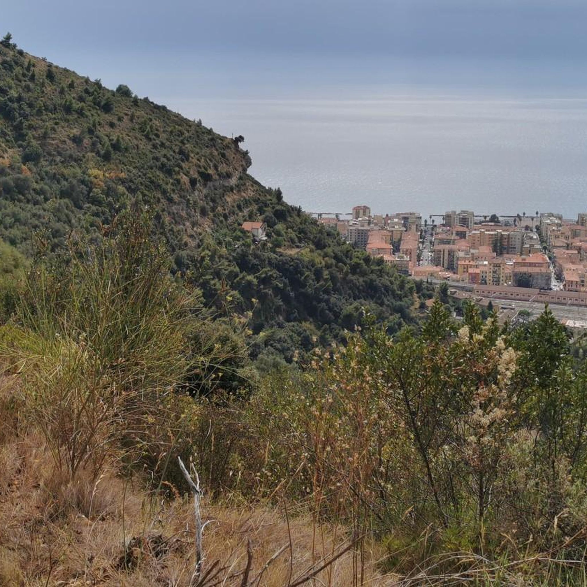
Demanding climb, rough terrain, but what a reward up there… 🌄 Between sky, sea, and relief, the scenery is simply exceptional. A hike that puts you in your place and reminds you why we love the mountains 💪
0
0

A beautiful training route with varying gradients (5% to 11%). Those who enjoy culture as well as nature should also cycle the last 5 km to Piene Haute.
0
0

Small and westernmost municipality in all of Liguria, Olivetta San Michele is located between Col de Vescavo and Airole, along the banks of the Bevera stream. Here the Ligurian Roiasco dialect is spoken, but - a unique case in Liguria - the entire municipal territory also belongs to the historical Occitan linguistic minority. Olivetta, which has a station on the Ventimiglia-Turin route in the hamlet of San Michele, is part of the Union of the municipalities of the Nervia and Roja Valleys.
1
0

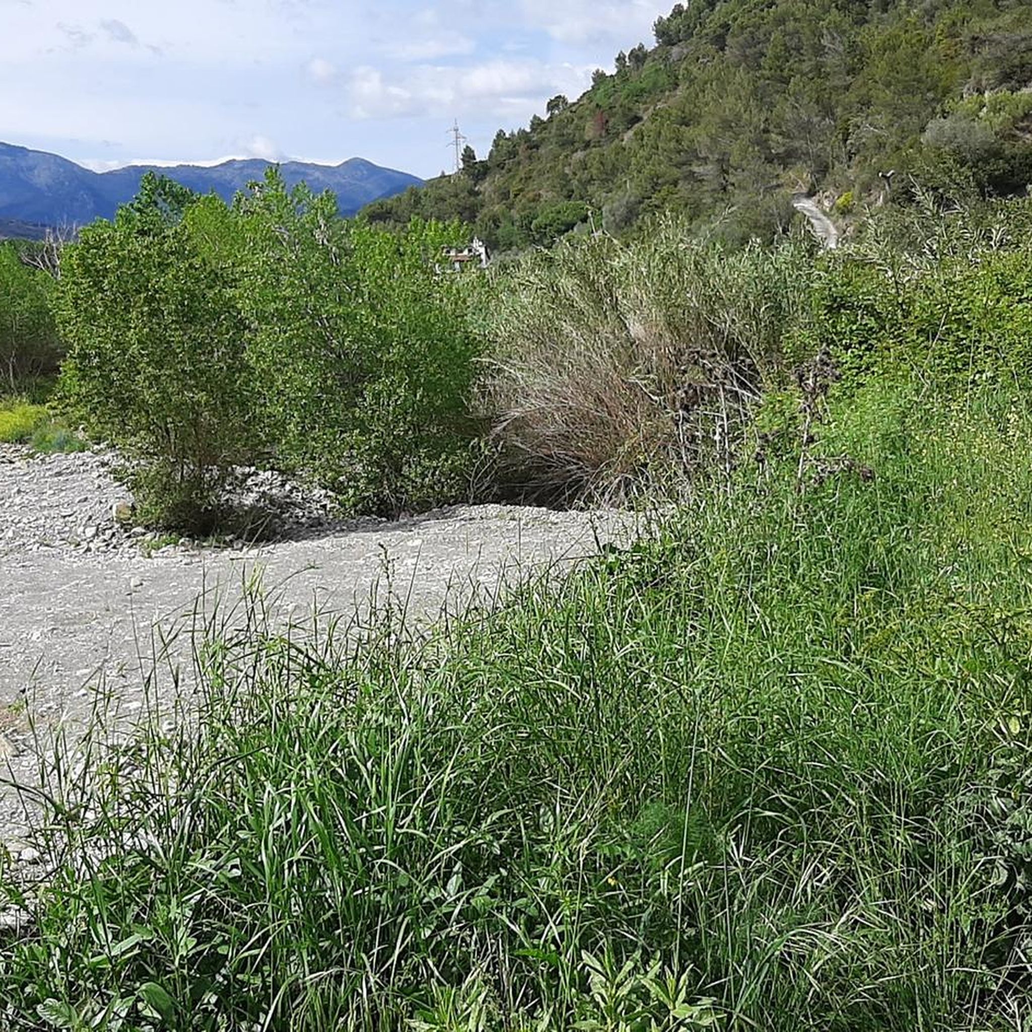
Passed in January 2023, very beautiful even with rain, the ground drains enough
1
0

Tunnel under the Colle dei Termini di Baiardo. Short and passable without worries by bike
1
0

From the Col du Berceau, located at an altitude of 1,050 meters, you have the first incredible views of the town of Menton and the sea. There is in fact a flat area at this pass, surrounded by two peaks, the Roc de Restaud and that of Orméa. The whole thing unequivocally evokes the shape of a cradle. So it’s a cozy little nest with lawn and pine forest that awaits you. The place really invites you to sit back and relax before the last stage which leads to Plan du Lion and then to Garavan.
2
1

Arrived at the col du Berceau, you will have to climb the 2 peaks, on its right and its left, which are to be done absolutely, and transcend the hike.
2
0

Small green oasis between two peaks. Small fireplace invites you to grill. Several paths cross here.
1
1
Frequently Asked Questions
What are some notable mountain passes and viewpoints around Camporosso?
The area around Camporosso features scenic routes with significant elevation changes rather than numerous distinct named passes. However, you can find notable spots like The Cradle, a summit and mountain pass offering incredible views of Menton and the sea from 1,050 meters altitude. Another interesting point is Col de Vescavo – Olivetta San Michele Border Crossing, located in the westernmost municipality of Liguria along the Bevera stream. Vescavo Pass (477 m) also offers panoramic views from the Franco-Italian border.
What kind of views and natural features can I expect from the mountain passes near Camporosso?
The region offers diverse landscapes, transitioning from Mediterranean scrubland near the coast to higher alpine environments. From many passes and viewpoints, you can enjoy breathtaking vistas of the Ligurian Sea and the French Alps. For example, The Cradle provides stunning views of Menton and the sea. The broader area, including parts of the Alta Via del Sale and the High Way of the Ligurian Mountains, features landscapes of rare beauty with varied flora and fauna.
Are there good cycling routes that incorporate mountain passes around Camporosso?
Yes, the area is very popular for cycling, with routes offering substantial climbs and descents. While not always named 'passes,' these routes effectively traverse mountainous terrain. Examples include a 52.8 km route with 1,550 meters of ascent and descent starting and ending in Camporosso, or a 66.7 km route with 1,608 meters of elevation gain towards Seborga. For more cycling options, explore the Cycling around Camporosso guide.
What hiking opportunities are available near Camporosso's mountain passes?
The mountainous terrain around Camporosso offers numerous hiking opportunities, from challenging long-distance routes to shorter trails. The Alta Via del Sale (High Road of Salt) is a physically demanding route popular with hikers, offering sea views and moving between alpine and Mediterranean environments. The High Way of the Ligurian Mountains also provides varied landscapes. For specific hiking trails, refer to the Hiking around Camporosso guide, which includes routes like the moderate Tyrrhenian Trail or the difficult Old Bridge of Dolceacqua loop.
How challenging are the mountain passes and routes in the Camporosso area?
The routes around Camporosso vary in difficulty. Many cycling routes feature significant elevation changes, requiring very good fitness. For instance, the 'Castillon Pass – Braus Pass loop from Vallecrosia' involves a 2,070-meter ascent and descent over 99.1 km. Hiking routes like the Alta Via del Sale are physically demanding. However, there are also easier options available. Always check the specific route details for distance and elevation gain to match your fitness level.
When is the best time of year to visit the mountain passes around Camporosso?
The best time to visit depends on your activity. For cycling and hiking, spring (April-June) and autumn (September-October) generally offer pleasant temperatures and stable weather conditions, avoiding the intense summer heat. During these seasons, you can enjoy the diverse landscapes without extreme weather. Winter can offer different experiences, but some higher routes may be inaccessible due to snow or require specific winter gear.
Are there any family-friendly options for exploring the mountain areas near Camporosso?
While many routes involve significant elevation, there are options for families. Look for shorter, less steep sections of trails or explore charming Ligurian villages in the valleys. When planning, check the difficulty ratings of specific routes. For example, the Hiking around Camporosso guide lists easy routes like the 'Bordighera Railway Station – Bordighera Beach and Promenade loop'.
What facilities like cafes or pubs are available near the mountain passes?
While the higher, more remote mountain passes themselves may not have direct facilities, you will find cafes and pubs in the charming villages located in the valleys and along the routes. For instance, Olivetta San Michele, near the Col de Vescavo – Olivetta San Michele Border Crossing, is a small municipality where you can find amenities. It's always a good idea to plan your route and check for services in nearby towns before heading out.
Can I find parking for hiking and cycling trails near Camporosso's mountain passes?
Parking is generally available in the towns and villages that serve as starting points for routes into the mountainous areas. For example, you can often find parking in Camporosso itself or in nearby municipalities like Vallecrosia or Dolceacqua, which are common starting points for various tours. Specific parking availability for more remote trailheads might require local inquiry or checking detailed route descriptions.
What do visitors enjoy most about the mountain passes and routes around Camporosso?
Visitors frequently praise the stunning Mediterranean and alpine landscapes, the physical challenge offered by the routes, and the opportunity to explore charming Ligurian villages. Many appreciate the panoramic viewpoints, such as those from The Cradle, which offers incredible sea views. The diverse topography and the blend of natural beauty with historical connections make for an immersive outdoor experience.
Are there any unique historical or cultural aspects to the mountain passes in this region?
Yes, the region has a rich history. The Alta Via del Sale (High Road of Salt) is a spectacular former military dirt road, highlighting its historical significance for trade and defense. The area also features unique linguistic heritage; for example, in Olivetta San Michele, both the Ligurian Roiasco dialect and the historical Occitan linguistic minority are present. Exploring these routes often means encountering historical markers or traditional villages.
Are there any specific tips for navigating the mountain passes, such as finding water or specific trail conditions?
When exploring the passes, it's advisable to carry sufficient water, especially on longer routes. For instance, near Vescavo Pass, you can find a public fountain in Olivetta San Michele. For trail conditions, some passes like Passo del Bandito are noted for draining well even in wet weather. Always check local conditions and weather forecasts before embarking on a trip.
Most popular attractions around Camporosso

Get inspired with the komoot mobile app


Explore more
See even more epic mountain passes by checking out these guides around Camporosso:
