The best road cycling routes around Fara Gera D'Adda
4.2
(718)
14,081
riders
364
rides
Road cycling around Fara Gera D'Adda, located in the Province of Bergamo, Italy, features a predominantly flat terrain ideal for road cyclists. The region is characterized by the Adda River and the Parco Adda Nord, offering numerous routes along riverbanks and through agricultural plains. Its alluvial gravelly soils contribute to the flat topography, providing conditions for steady-paced rides. Many routes utilize asphalted cycle paths, making them suitable for road bikes.
Best road cycling routes around Fara Gera D'Adda
- The most…
Last updated: July 12, 2026
3.0
(1)
31
riders
35.4km
01:34
270m
270m
Moderate road ride. Great for any fitness level. Some segments of this route may be unpaved and difficult to ride.
174km
07:08
400m
400m
Hard road ride. Very good fitness required. Mostly well-paved surfaces and easy to ride.

Sign up for free
4.5
(65)
648
riders
49.4km
01:58
120m
120m
Easy road ride. Great for any fitness level. Mostly well-paved surfaces and easy to ride.
4.5
(4)
136
riders
103km
04:59
1,350m
1,350m
Hard road ride. Very good fitness required. Mostly well-paved surfaces and easy to ride.
3.7
(3)
92
riders
Easy road ride. Great for any fitness level. Mostly well-paved surfaces and easy to ride.
Get access to more routes and recommendations from other explorers.
Sign up for free
Already have an account?
Our route recommendations are based on thousands of hikes, rides, and runs completed by other people on komoot.
Start today with a free account
Your next adventure awaits.
Login or Signup

Tips from the Community

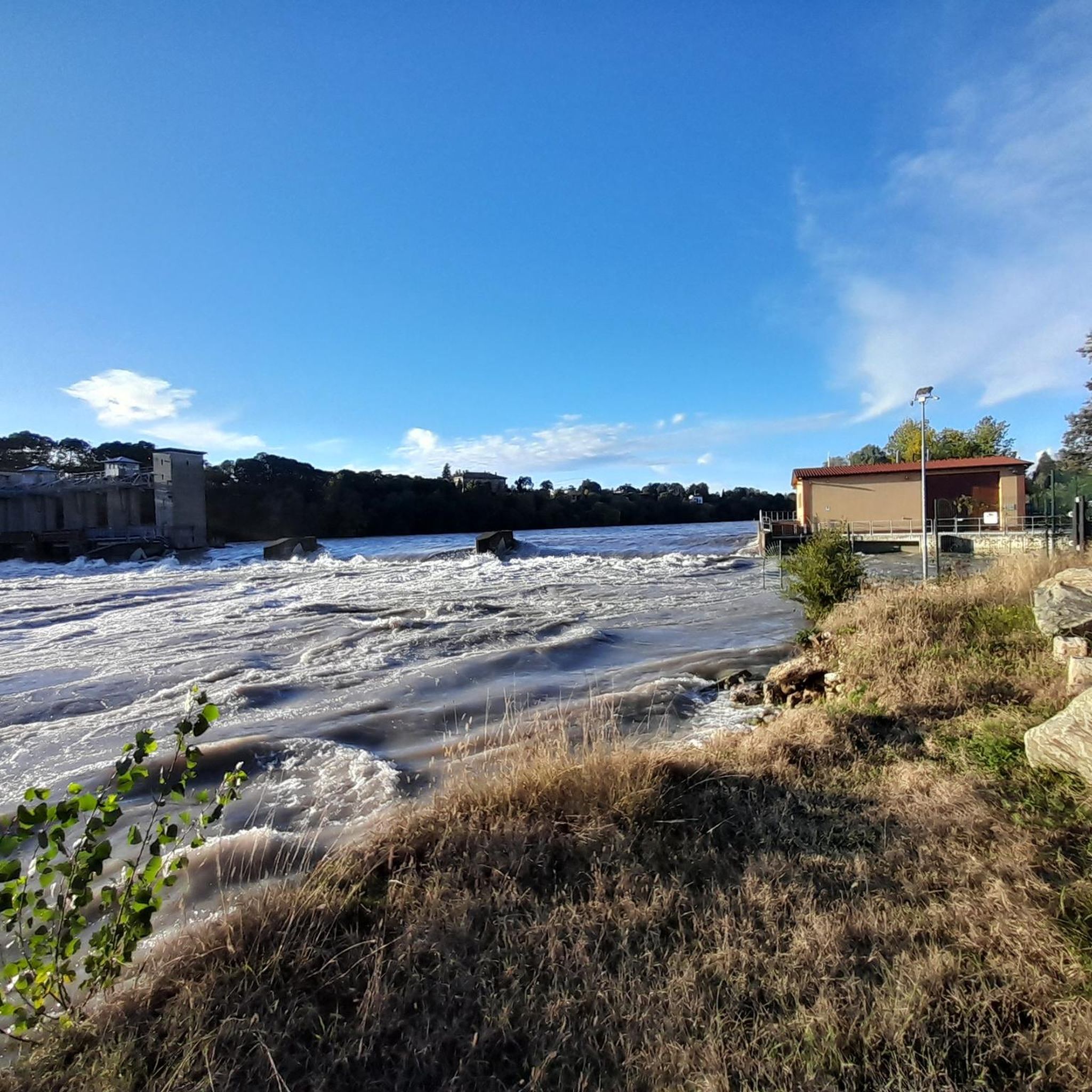
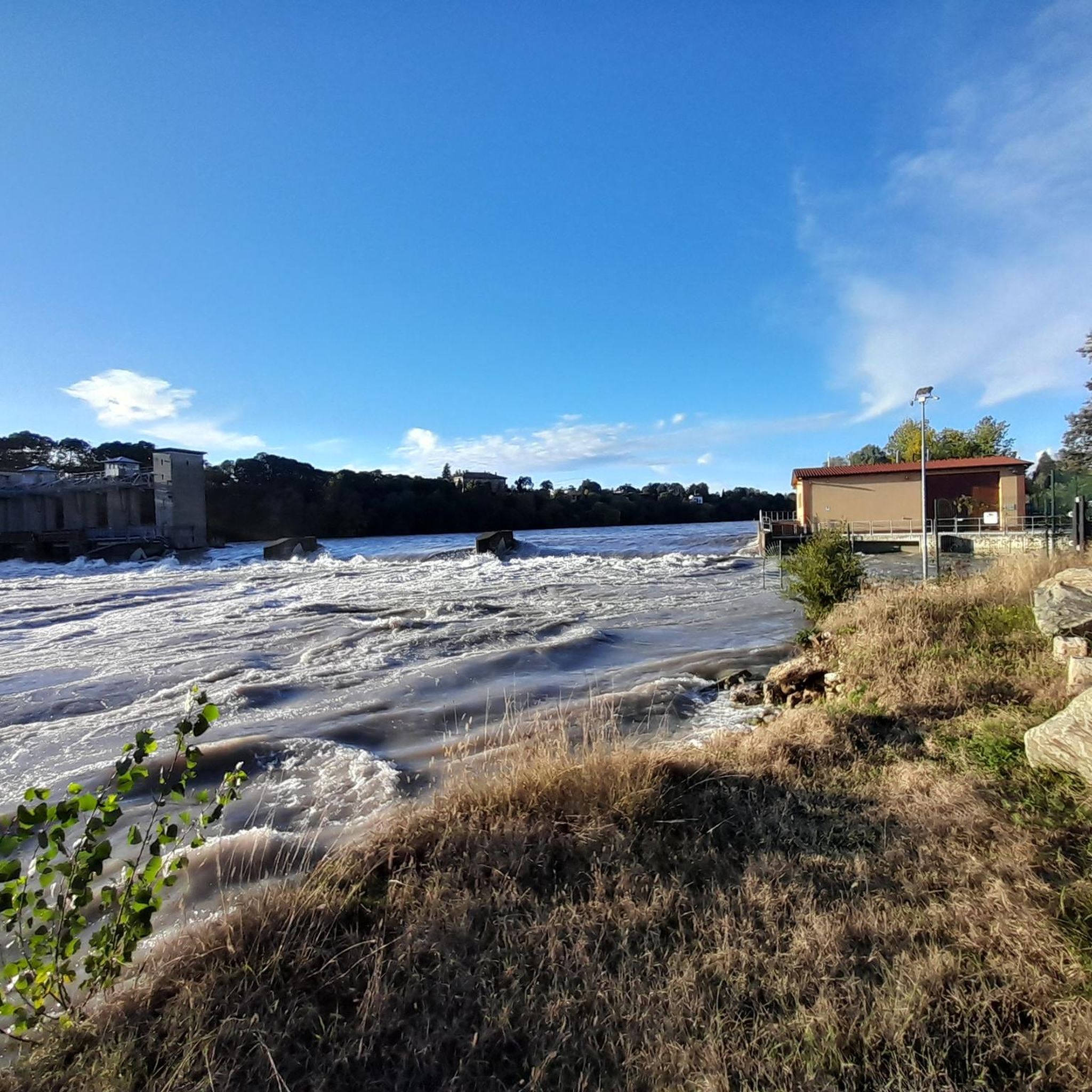
The Angelo Bertini Hydroelectric Power Plant is a gem of industrial archaeology located in Porto d'Adda (a hamlet of Cornate d'Adda, Monza and Brianza). Inaugurated on September 28, 1898, by the Edison group, it holds an extraordinary historical record: at the time of its construction, it was the most powerful hydroelectric power plant in Europe and the second in the world, surpassed only by that of Niagara Falls. Its original purpose was fundamental for the modernization of Milan, as it had to supply the energy necessary for the electrification of Milan's tram network, allowing for the definitive replacement of horse-drawn trams.
0
0

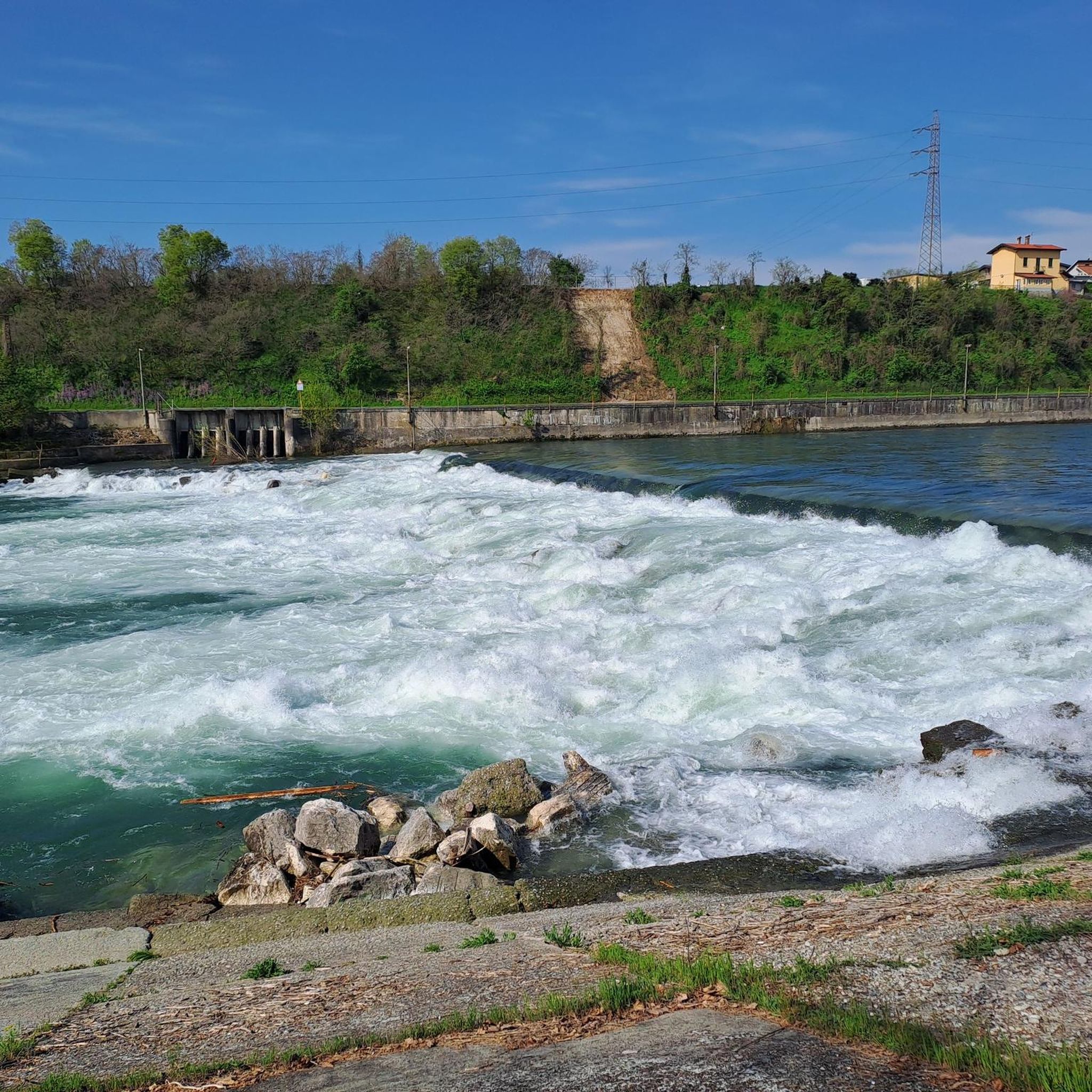
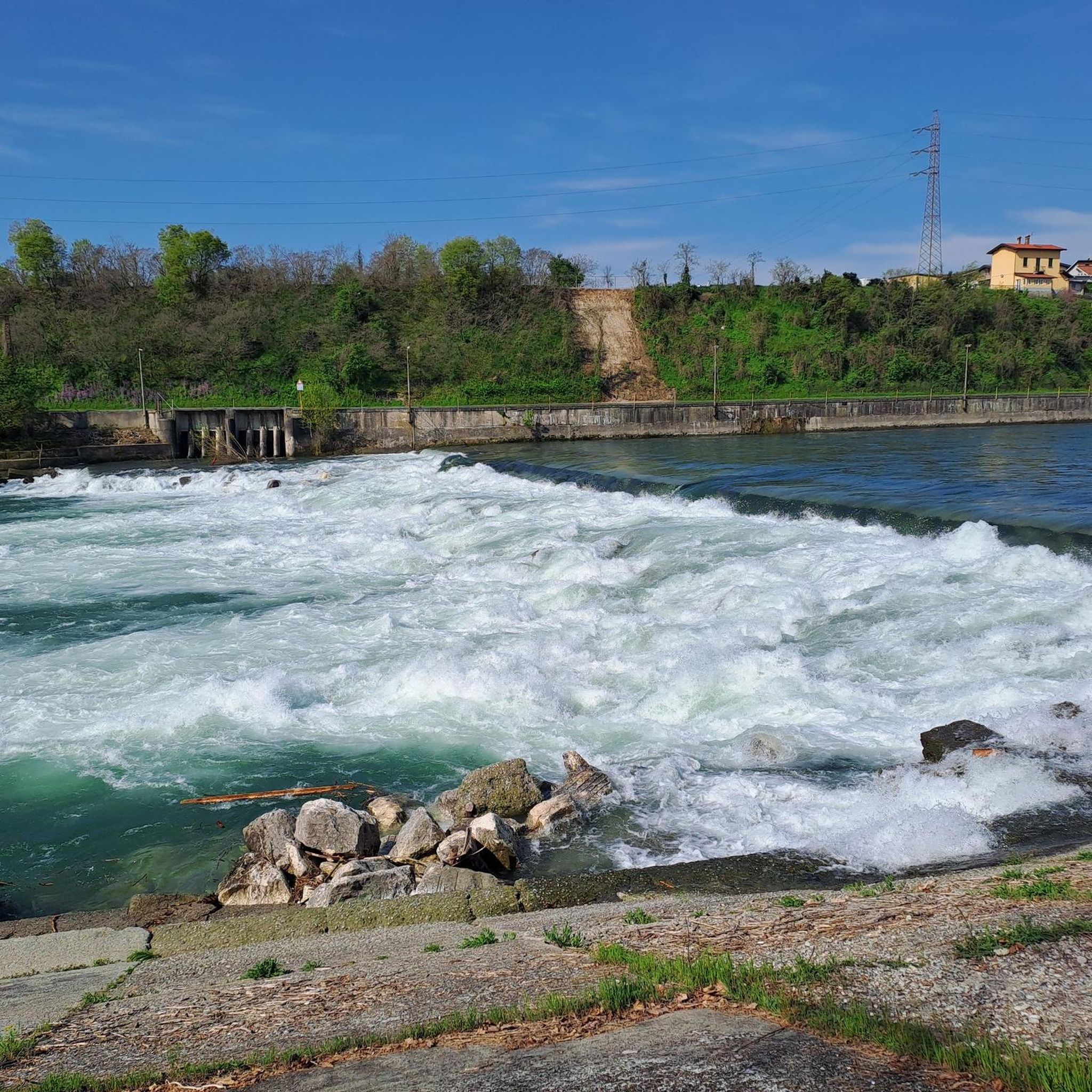
The Locks of Bellinzago Lombardo are an important historical hydraulic engineering work located along the course of the Naviglio della Martesana. They represent one of the best-known stopping and points of interest for cyclists and hikers who frequent the canal bank. These historical hydraulic systems (locks or sluices) originally served to regulate the flow of water and allow commercial navigation between the Adda and Milan.
0
0

classic water refill point on arrival or departure in Selvino
1
0

The arrival point after the last and hard climb
1
0
Beautiful and challenging climb, beautiful and relaxing views, little traffic
0
0
Naviglio della Martesana is perhaps the least known of the ancient artificial canals connecting Milan to the great Lombard rivers. It originates from the Adda in Concesa, a hamlet of Trezzo d’Adda, crosses the Martesana sub-region, northeast of the provincial capital, and once in the city, it plunges underground beneath Via Melchiorre Gioia, at the height of Cassina de’ Pomm. It measures approximately 38 km in length, with a width varying from 9 to 18 meters. However, once upon a time, the Naviglio della Martesana continued in the open air all the way to the center, where a lock system centered on the Conca dell’Incoronata connected it to the short Naviglio di S. Marco and the urban network of the Navigli. The lock was inaugurated in 1496, utilizing lock gates designed by Leonardo da Vinci. The canal had been opened in 1471, under Francesco Sforza. By connecting it to the other Navigli, Leonardo laid the foundations for realizing a dream of the Sforzas: to travel by water from the Ticino, and therefore from Lake Maggiore, all the way to the Adda.
1
0
The route runs alongside the Naviglio della Martesana, perhaps the least known among the ancient artificial canals connecting Milan to the great Lombard rivers. It originates from the Adda river in Concesa, a hamlet of Trezzo d’Adda, crosses the Martesana sub-region, north-east of the provincial capital, and once in the city, it plunges underground beneath via Melchiorre Gioia, near Cassina de’ Pomm. It measures approximately 38 km in length, with a width varying from 9 to 18 meters. However, at one time, the Naviglio della Martesana continued in the open air right into the center, where a system of locks centered on the Conca dell’Incoronata connected it to the short Naviglio di S. Marco and the urban ring of the Navigli. The lock was inaugurated in 1496, utilizing lock gates designed by Leonardo da Vinci. The canal had been opened in 1471, under Francesco Sforza. By connecting it to the other Navigli,
3
0
The Naviglio della Martesana, initially known as Naviglio Piccolo, is one of the Milanese canals that connects Milan with the course of the Adda river through the municipalities of Martesana. Commissioned in the 15th century by Francesco Sforza, it was used for irrigating the countryside but also represented the ambitious project of connecting Milan with Lake Como and thus with the Alps and Ticino. The Naviglio della Martesana is a place rich in history and beauty, a heritage for everyone that, however, today is still little known and protected. Along the Naviglio runs a rather busy cycle path, which allows you to admire the landscape and cultural beauties, such as the rich flora, fauna, or the numerous historic villas, including the Renaissance Villa Melzi d’Eril in Vaprio d’Adda.
1
0
Frequently Asked Questions
What kind of terrain can I expect on road cycling routes around Fara Gera D'Adda?
The region of Fara Gera D'Adda, part of the Bergamasca plain, is predominantly flat. Its alluvial gravelly soils contribute to this flat topography, making it ideal for road cyclists seeking less strenuous rides or those who prefer to maintain a steady pace without significant climbs. Many routes utilize asphalted cycle paths along the Adda River.
How many road cycling routes are available around Fara Gera D'Adda?
There are over 370 road cycling routes available around Fara Gera D'Adda, catering to various skill levels. You'll find a good mix of easy, moderate, and difficult options to explore the area.
Are there easy road cycling routes suitable for beginners or families?
Yes, Fara Gera D'Adda offers numerous easy routes perfect for beginners or family outings. Many of these follow the scenic Adda River on asphalted cycle paths. An excellent option is the Adda River at Trezzo sull'Adda – Brembate Sotto Parish loop from Canonica d'Adda, which is an easy 41.3 km path offering pleasant riverside views.
What are some notable natural features or scenic viewpoints along the routes?
The Adda River and the Parco Adda Nord are central to the region's natural beauty. Many routes run along the riverbanks, offering scenic views of the water and surrounding wooded areas. The flat plains also provide expansive vistas of the agricultural landscape.
What historical attractions can I see while cycling in Fara Gera D'Adda?
The area is rich in history. You can encounter fascinating sites like the famous 'Rudun' (hydraulic wheel) in Groppello d'Adda, which is believed to have been designed by Leonardo da Vinci (The Rudun Water Wheel, Groppello d'Adda). Other historical points of interest include the Taccani Hydroelectric Power Plant and Trezzo Castle Tower, and the Visconti Castle of Cassano d'Adda.
Are there any long-distance or more challenging road cycling routes?
For those seeking a longer challenge, the Adda River Backbone Trail is a difficult route spanning over 174 km. Another demanding option is the Salmezza Pass Viewpoint – Selvino Switchbacks loop from Treviglio Ovest, which covers over 102 km with significant elevation gain.
What do other road cyclists enjoy most about cycling in Fara Gera D'Adda?
The area is highly rated by the komoot community, with an average score of 4.3 stars from over 650 reviews. Cyclists often praise the flat, well-maintained asphalted paths along the Adda River, the peaceful agricultural landscapes, and the blend of natural beauty with historical landmarks that make for engaging stops.
Are there circular road cycling routes available?
Yes, many routes in the region are designed as loops, allowing you to start and finish in the same location. For example, the Vaprio d'Adda Bridge – Adda River at Trezzo sull'Adda loop from Canonica d'Adda is a popular 53.7 km circular route through riverine landscapes.
What is the best time of year for road cycling in Fara Gera D'Adda?
The flat terrain makes Fara Gera D'Adda enjoyable for road cycling across many seasons. Spring and autumn offer pleasant temperatures and beautiful scenery. Summer can be warm, but riverside routes provide some shade. Even winter can be suitable, though checking local weather conditions is always advisable.
Where can I find parking for road cycling routes in Fara Gera D'Adda?
Given the popularity of cycling along the Adda River, you can typically find parking in towns and villages adjacent to the main cycle paths, such as Fara Gera D'Adda itself, Canonica d'Adda, or Trezzo sull'Adda. Look for designated parking areas near river access points or town centers.
Are there any routes that follow canals or waterways other than the Adda River?
Yes, the region also features the Naviglio Martesana. The Adda and Paderno Canal Trail is a moderate 35.4 km route that follows both the Adda River and the Paderno Canal, offering a varied waterside cycling experience.
Most popular routes around Fara Gera D'Adda
Most popular attractions around Fara Gera D'Adda

Get inspired with the komoot mobile app


Explore more
Browse the best Road cycling routes in other regions.
