The best running trails around Tavernole Sul Mella
4.6
(40)
3,768
runners
129
runs
Jogging around Tavernole Sul Mella offers diverse landscapes within Italy's Lombardy region, situated on the Mella river in the upper Trompia Valley. The area features green fields, pre-alpine lakes, and routes alongside the Mella River, including a 20 km path extending into Val Trompia. Joggers can also find more challenging terrain with mountain peaks and the expansive Caregno Plateau, which includes grassy areas and geological formations. This varied environment provides options for different running experiences, from flat riverside paths to elevated trails.
Best jogging routes around Tavernole Sul Mella
- The most popular jogging route is Running loop from Tavernole sul Mella, an 8.3 miles (13.4 km) trail that takes 1 hour 25 minutes to complete. This moderate route offers a good overview of the local terrain.
- Another top favourite among local runners is Cimmo – Magno–Caregno Road loop from Tavernole sul Mella, a difficult 16.6 miles (26.8 km) path. This route traverses the Caregno Plateau, providing varied scenery and significant elevation.
- Local runners also love the Forcelino (1,070 m) loop from Tavernole sul Mella, a 19.7 miles (31.7 km) trail leading through mountainous terrain with substantial elevation gain, often completed in about 4 hours 53 minutes.
- Jogging around Tavernole Sul Mella is defined by the Mella River, the Trompia Valley, and the Caregno Plateau. The network of routes offers options for various ability levels, from moderate loops to difficult mountain trails.
- The routes in Tavernole Sul Mella are highly rated by the komoot community with an average score of 4.8 stars from over 60 reviews. More than 2900 runners have used komoot to explore Tavernole Sul Mella's varied terrain.
Last updated: July 6, 2026
54
runners
26.8km
03:34
1,070m
1,070m
Hard run. Very good fitness required. Sure-footedness, sturdy shoes and alpine experience required.
5.0
(1)
31
runners
16.6km
02:51
1,140m
1,130m
Hard run. Very good fitness required. Sure-footedness, sturdy shoes and alpine experience required.

Sign up for free
5.0
(1)
28
runners
15.5km
02:35
940m
940m
Hard run. Very good fitness required. Sure-footedness, sturdy shoes and alpine experience required.
37
runners
31.8km
04:54
1,700m
1,700m
Hard run. Very good fitness required. Sure-footedness, sturdy shoes and alpine experience required.
12
runners
25.1km
03:26
1,240m
1,240m
Hard run. Very good fitness required. Sure-footedness, sturdy shoes and alpine experience required.
Get access to more routes and recommendations from other explorers.
Sign up for free
Already have an account?
Our route recommendations are based on thousands of hikes, rides, and runs completed by other people on komoot.
Start today with a free account
Your next adventure awaits.
Login or Signup

Tips from the Community

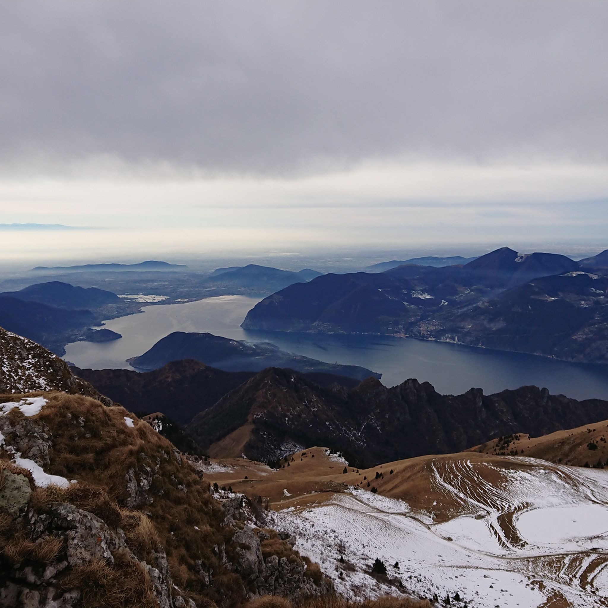
Monte Guglielmo (known in the Brescian dialect as Gölem or Culmine) is a mountain in the Brescian Prealps, 1,957 meters high. Located in Lombardy, it stretches along the mountain ridge that separates the middle Val Trompia from the basin of Lake Iseo and the lower Valle Camonica. It is the most iconic, frequented, and beloved peak by Brescian hikers.
0
0

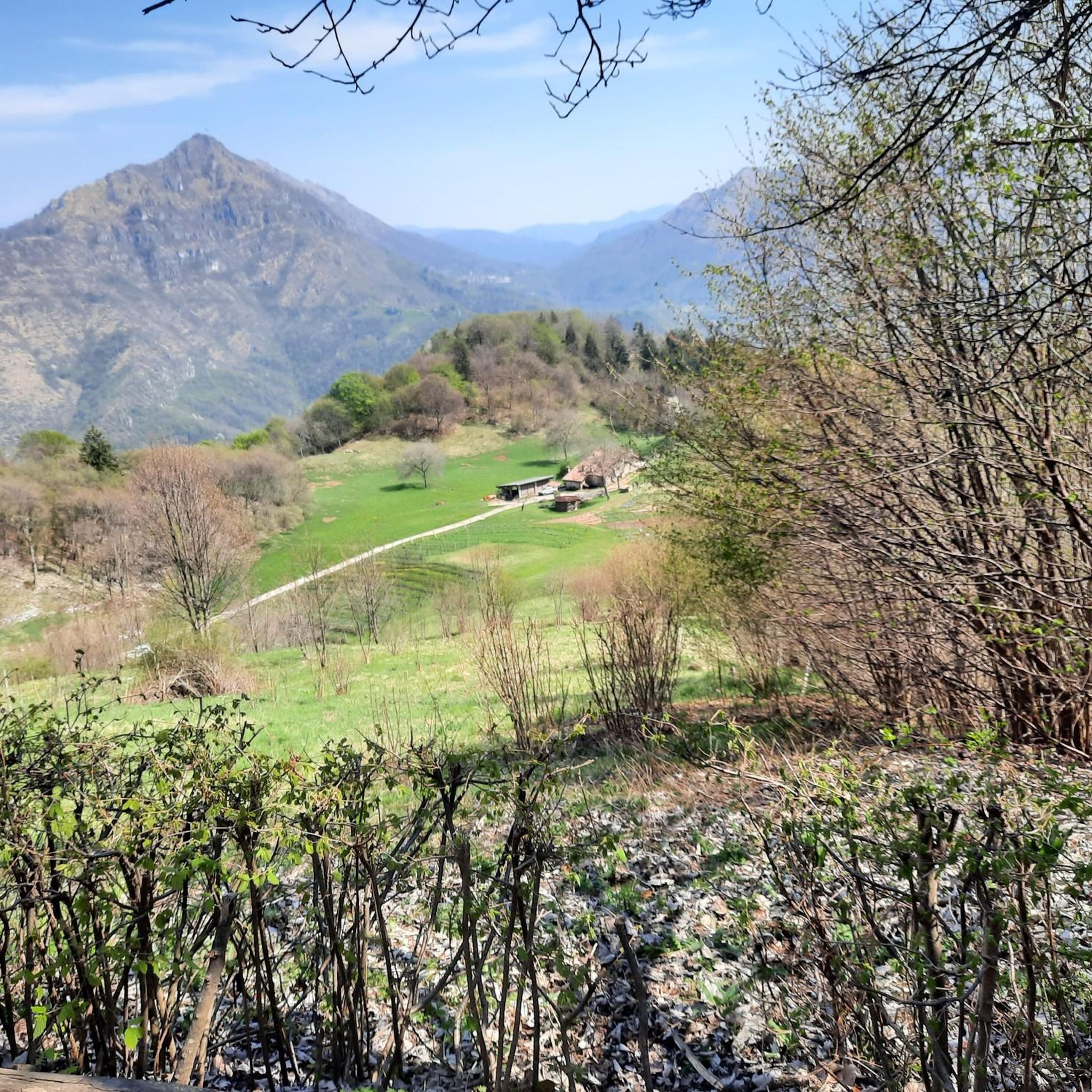
Rifugio CAI Valtrompia, also known as Rifugio Pontogna, is located in the Pontogna area (Tavernole sul Mella, BS) at an altitude of 1259 meters. It is situated on the eastern slopes of Monte Guglielmo and is managed by the CAI section of Gardone Val Trompia.
0
0
Punta Caravina is an iconic ridge and viewpoint located at 1,850 meters above sea level in Lombardy, along the Monte Guglielmo massif (known in the Brescian dialect as Gölem or Gem). It is located in the province of Brescia, in the mountainous territory overlooking the upper Lake Iseo and the eastern shore of Val Camonica. The summit offers an extraordinary panorama stretching from the Orobie Bergamasche to the Adamello.
1
0

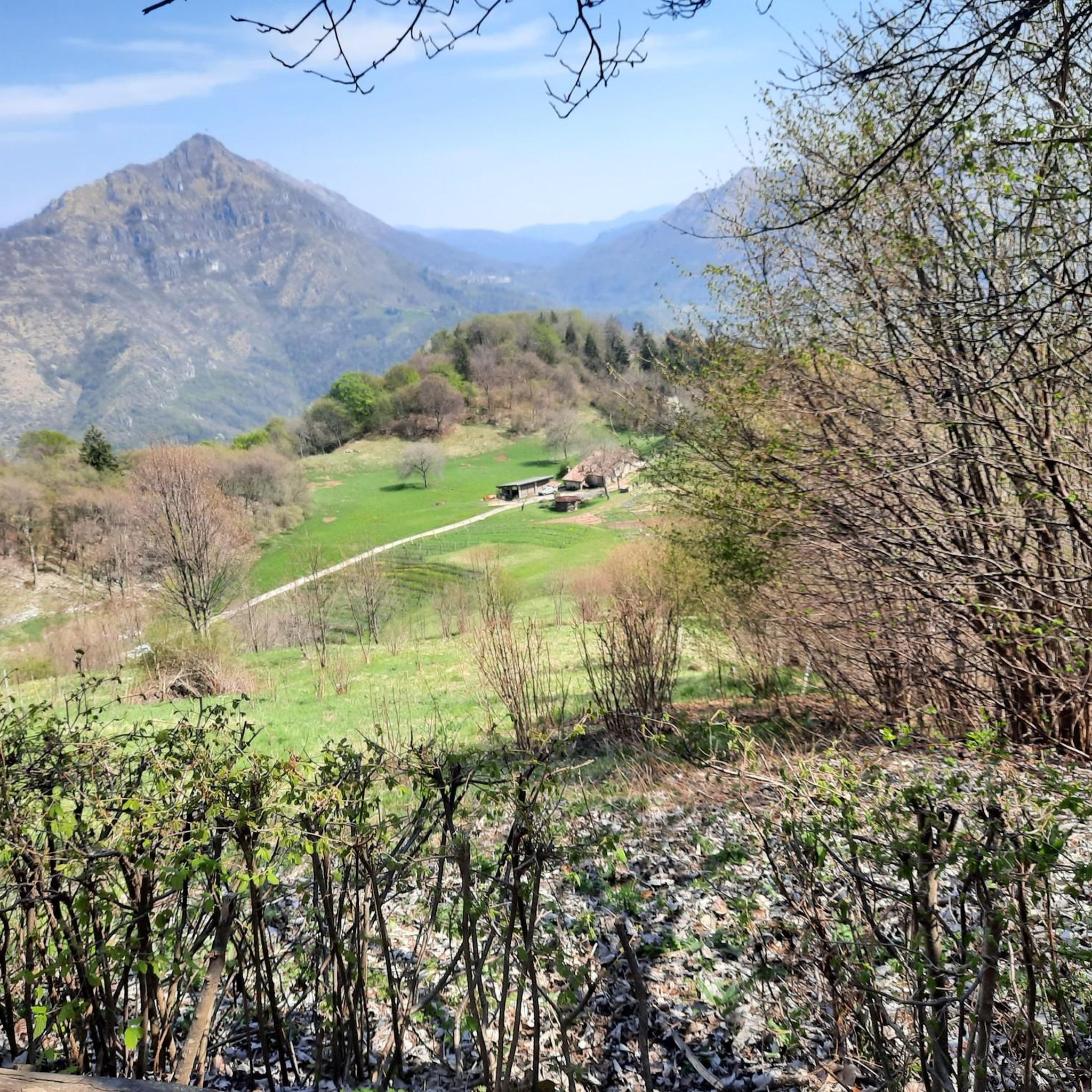
The Rifugio Croce di Marone is located at 1,166 m on the southern slope of Monte Guglielmo, above Marone, and is one of the most convenient and frequented starting points for climbing the Guglielmo. 🏔️ Hut identity and location The refuge is located in the Croce di Marone area, reachable via the road that climbs from Marone → Cislano → Madonna della Rota, crossing the Valle dell’Opol. It is situated in a panoramic and strategic point for: Monte Guglielmo (1948 m) – classic and very frequented ascent Malga Guglielmo di Sotto and di Sopra Rifugio Almici Piani di Caregno The refuge is open all year round, has a restaurant, electric light, hot water, and about 15 beds. 🚗 How to get there By car from Marone Follow the signs for Zone. After about 4.5 km, past the cable car underpasses, you will find a sharp right turn with a sign for the refuge. The road becomes narrow and steep in the final kilometers. Paid parking with scratch card (3 € up to 4 hours, 5 € for longer). On foot from Zone (Englar) You can leave your car at the Englar restaurant (640 m). Ascent along the road/CAI 226 trail → approx. 1h20’–1h50’ depending on whether you cut corners. 🚶♂️ Main excursions from the refuge 1. Monte Guglielmo (E – approx. 2h) This is the shortest and most direct route to reach the summit of Guglielmo: Initial mule track Junction for Malpensata Section with white-blue 3V trail markers Malga Guglielmo di Sotto → Malga di Sopra Rifugio Almici → summit with the Monument to the Redeemer The panorama over the Sebino and the Prealps is considered one of the most beautiful in the area. 2. Rifugio Almici (1861 m) – 2h Simple and panoramic route along the mule track. 3. Piani di Caregno – 3h30’ Longer but very scenic route. 🏞️ Environment and atmosphere The area is characterized by: beech and fir woods open pastures views of Lake Iseo and Val Trompia presence of the 3V trail nearby It is an ideal spot for short excursions, longer treks, or family days out.
0
0

It was my destination for today, next summer I will go up to the top (in gravel)
0
0
when they say lose your head, unique landscapes that will steal your heart
0
0

It's been 5 years since I climbed this peak, today I found the perfect day
1
0

Frequently Asked Questions
What kind of terrain can I expect on the running trails around Tavernole sul Mella?
The region offers a diverse range of terrain for runners. You'll find routes alongside the Mella River, which are generally flat and accessible, perfect for a relaxed run. For those seeking more of a challenge, the area also features hilly terrain and mountain peaks, including trails that ascend towards the Caregno Plateau, providing significant elevation gain and varied surfaces.
Are there any easy or beginner-friendly running routes in Tavernole sul Mella?
Yes, there are options suitable for beginners and those looking for an easier run. While many routes offer elevation, you can find paths that follow the Mella River, providing a flatter experience. For a moderate, yet accessible run, consider the Running loop from Tavernole sul Mella, which covers 8.3 miles (13.4 km) with manageable elevation.
What are some of the more challenging running trails available?
For experienced runners seeking a significant challenge, Tavernole sul Mella offers several difficult routes with substantial elevation. The Forcelino (1,070 m) loop from Tavernole sul Mella is a demanding 19.7 miles (31.7 km) trail with considerable climbing. Another option is the Cimmo – Magno–Caregno Road loop from Tavernole sul Mella, a difficult 16.6 miles (26.8 km) path that traverses the scenic Caregno Plateau.
Can I find circular running routes in the area?
Absolutely. Many of the running paths around Tavernole sul Mella are designed as loops, allowing you to start and finish in the same location. An example is the popular Running loop from Tavernole sul Mella, which offers a great overview of the local landscape.
What natural features or landmarks can I see while running?
The routes often pass through the picturesque Trompia Valley, offering views of green fields and pre-alpine lakes. You can also run alongside the Mella River. For those on higher trails, you might catch glimpses of mountain peaks and the unique geological formations of the Caregno Plateau. Some routes may lead you near mountain huts, such as the Almici Hut – Monte Guglielmo or the Santa Maria del Giogo mountain hut and sanctuary, which offer scenic stops.
Are the running trails around Tavernole sul Mella suitable for families?
While some trails involve significant elevation, there are family-friendly options, particularly along the Mella River. These flatter sections are generally more accessible for families. Always check the route's difficulty and elevation profile on komoot to ensure it matches your family's fitness level before heading out.
Are dogs allowed on the running trails?
Generally, dogs are welcome on most outdoor trails in the region, provided they are kept under control, especially around livestock or other trail users. It's always a good idea to bring water for your dog, especially on longer runs or during warmer weather. Specific regulations may vary, so look out for local signage.
What is the best time of year for running in Tavernole sul Mella?
The Trompia Valley is flexible for outdoor activities across all seasons. Spring and autumn offer pleasant temperatures and beautiful scenery, making them ideal for running. Summer can be warm, so early morning or late afternoon runs are recommended. Winter running is possible, but higher elevation trails may be affected by snow and ice, requiring appropriate gear and caution.
How many running routes are available in the Tavernole sul Mella area?
There are over 100 running routes available around Tavernole sul Mella on komoot, catering to various fitness levels and preferences. This extensive network ensures you'll find plenty of options to explore the diverse landscapes of the region.
What do other runners say about the trails in Tavernole sul Mella?
The running routes in Tavernole sul Mella are highly rated by the komoot community, with an average score of 4.8 stars from over 60 reviews. Runners often praise the varied terrain, from serene riverside paths to challenging mountain climbs, and the beautiful natural surroundings of the Trompia Valley.
Is public transport available to reach trailheads in Tavernole sul Mella?
Tavernole sul Mella is situated within the Trompia Valley, and while local bus services connect towns, direct public transport to every trailhead might be limited. It's advisable to check local bus schedules and routes in advance if you plan to rely on public transport to access specific starting points for your runs.
Are there any long-distance running routes for endurance training?
Yes, for those looking for longer distances and endurance training, the region offers several extensive routes. The Forcelino (1,070 m) loop from Tavernole sul Mella, at nearly 20 miles (31.7 km), provides a significant challenge with considerable elevation, ideal for long-distance preparation.
Most popular routes around Tavernole Sul Mella
Most popular attractions around Tavernole Sul Mella

Get inspired with the komoot mobile app


Explore more
Browse the best Running Trails & Routes in other regions.
