The best road cycling routes around Brugherio
4.2
(1351)
24,812
riders
422
rides
Road cycling around Brugherio is characterized by the gentle plains of the Po Valley, offering generally flat and accessible terrain. The region features an extensive network of canal-side cycle paths, including the historic Martesana Canal and the Villoresi Canal, which provide mostly paved and traffic-separated routes. Local green spaces like Parco Increa and Parco Media Valle Lambro also contribute to the cycling landscape, offering additional loops and connections. This environment is suitable for cyclists seeking routes with minimal elevation gain.
…Last updated: July 11, 2026
4.2
(5)
162
riders
50.7km
02:15
320m
320m
Moderate road ride. Good fitness required. Some segments of this route may be unpaved and difficult to ride.
4.5
(2)
141
riders
125km
06:03
1,650m
1,650m
Hard road ride. Very good fitness required. Mostly well-paved surfaces and easy to ride.

Sign up for free
4.6
(5)
76
riders
Moderate road ride. Good fitness required. Mostly well-paved surfaces and easy to ride.
4.7
(98)
1,047
riders
Easy road ride. Great for any fitness level. Mostly well-paved surfaces and easy to ride.
4.5
(4)
49
riders
64.6km
02:47
450m
450m
Moderate road ride. Good fitness required. Mostly well-paved surfaces and easy to ride.
Get access to more routes and recommendations from other explorers.
Sign up for free
Already have an account?
Our route recommendations are based on thousands of hikes, rides, and runs completed by other people on komoot.
Start today with a free account
Your next adventure awaits.
Login or Signup

Tips from the Community

The Locks of Bellinzago Lombardo are an important historical hydraulic engineering work located along the course of the Naviglio della Martesana. They represent one of the best-known stopping and points of interest for cyclists and hikers who frequent the canal bank. These historical hydraulic systems (locks or sluices) originally served to regulate the flow of water and allow commercial navigation between the Adda and Milan.
0
0
The Cascata della Vallategna is a spectacular waterfall of about 30 meters located on the geographical border between the municipalities of Asso and Canzo, in the province of Como. This natural attraction represents a famous symbolic border, as it separates the end of the hilly Brianza from the beginning of the mountainous area of Vallassina.
3
0
The Monticello fountain (located in Monticello Brianza, in the province of Lecco) is one of the most famous and frequented rest and water supply points for cyclists and walkers from all over Brianza and Lombardy.
0
0
The complex of the Church of Saints Peter and Paul and the former Benedictine Monastery of Brugora is a Romanesque jewel from the 12th century located in Montesiro, a hamlet of Besana in Brianza (MB). Founded in 1102, it features a stone facade with valuable sculptures and houses a 16th-century Last Supper inside.
1
0

Easy cycle path suitable for everyone!
3
0

Naviglio della Martesana is perhaps the least known of the ancient artificial canals connecting Milan to the great Lombard rivers. It originates from the Adda in Concesa, a hamlet of Trezzo d’Adda, crosses the Martesana sub-region, northeast of the provincial capital, and once in the city, it plunges underground beneath Via Melchiorre Gioia, at the height of Cassina de’ Pomm. It measures approximately 38 km in length, with a width varying from 9 to 18 meters. However, once upon a time, the Naviglio della Martesana continued in the open air all the way to the center, where a lock system centered on the Conca dell’Incoronata connected it to the short Naviglio di S. Marco and the urban network of the Navigli. The lock was inaugurated in 1496, utilizing lock gates designed by Leonardo da Vinci. The canal had been opened in 1471, under Francesco Sforza. By connecting it to the other Navigli, Leonardo laid the foundations for realizing a dream of the Sforzas: to travel by water from the Ticino, and therefore from Lake Maggiore, all the way to the Adda.
1
0
The Naviglio della Martesana, initially known as Naviglio Piccolo, is one of the Milanese canals that connects Milan with the course of the Adda river through the municipalities of Martesana. Commissioned in the 15th century by Francesco Sforza, it was used for irrigating the countryside but also represented the ambitious project of connecting Milan with Lake Como and thus with the Alps and Ticino. The Naviglio della Martesana is a place rich in history and beauty, a heritage for everyone that, however, today is still little known and protected. Along the Naviglio runs a rather busy cycle path, which allows you to admire the landscape and cultural beauties, such as the rich flora, fauna, or the numerous historic villas, including the Renaissance Villa Melzi d’Eril in Vaprio d’Adda.
1
0
The Naviglio Martesana cycle path is a cycle-pedestrian route of about 30-35 km that connects Milan (Cassina de' Pomm/via Melchiorre Gioia area) to Trezzo sull'Adda, running alongside the canal of the same name. It is a predominantly asphalted, flat, easy route suitable for everyone, which crosses parks, rural areas, and historic noble villas from the 17th-18th centuries.
2
0
Frequently Asked Questions
How many road cycling routes are available around Brugherio?
There are over 400 road cycling routes available around Brugherio on komoot. These routes cater to various skill levels, with a significant number being easy or moderate, making the region accessible for many cyclists.
What makes road cycling in Brugherio unique?
Road cycling in Brugherio is characterized by the gentle plains of the Po Valley, offering generally flat and accessible terrain. The region boasts an extensive network of well-maintained, traffic-separated canal-side cycle paths, such as the historic Martesana Canal and the Villoresi Canal. These paths provide a blend of natural beauty, historical villas, and peaceful riding experiences.
Are there easy road cycling routes suitable for beginners in Brugherio?
Yes, Brugherio offers many easy road cycling routes perfect for beginners. The flat terrain and dedicated canal paths, like those along the Martesana Canal, provide a safe and enjoyable experience. For example, the Martesana Cycle Path – Bellinzago Lombardo Locks loop from Cologno Nord is an easy 46.4 km route with minimal elevation gain.
Can I find challenging road cycling routes near Brugherio?
While much of the immediate area is flat, more challenging routes with significant elevation gain are accessible from Brugherio. For instance, the Lake Segrino – Lake Segrino loop from Cologno Nord is a difficult 125 km route featuring over 1600 meters of elevation gain, offering a substantial challenge for experienced riders.
Are there family-friendly road cycling options in Brugherio?
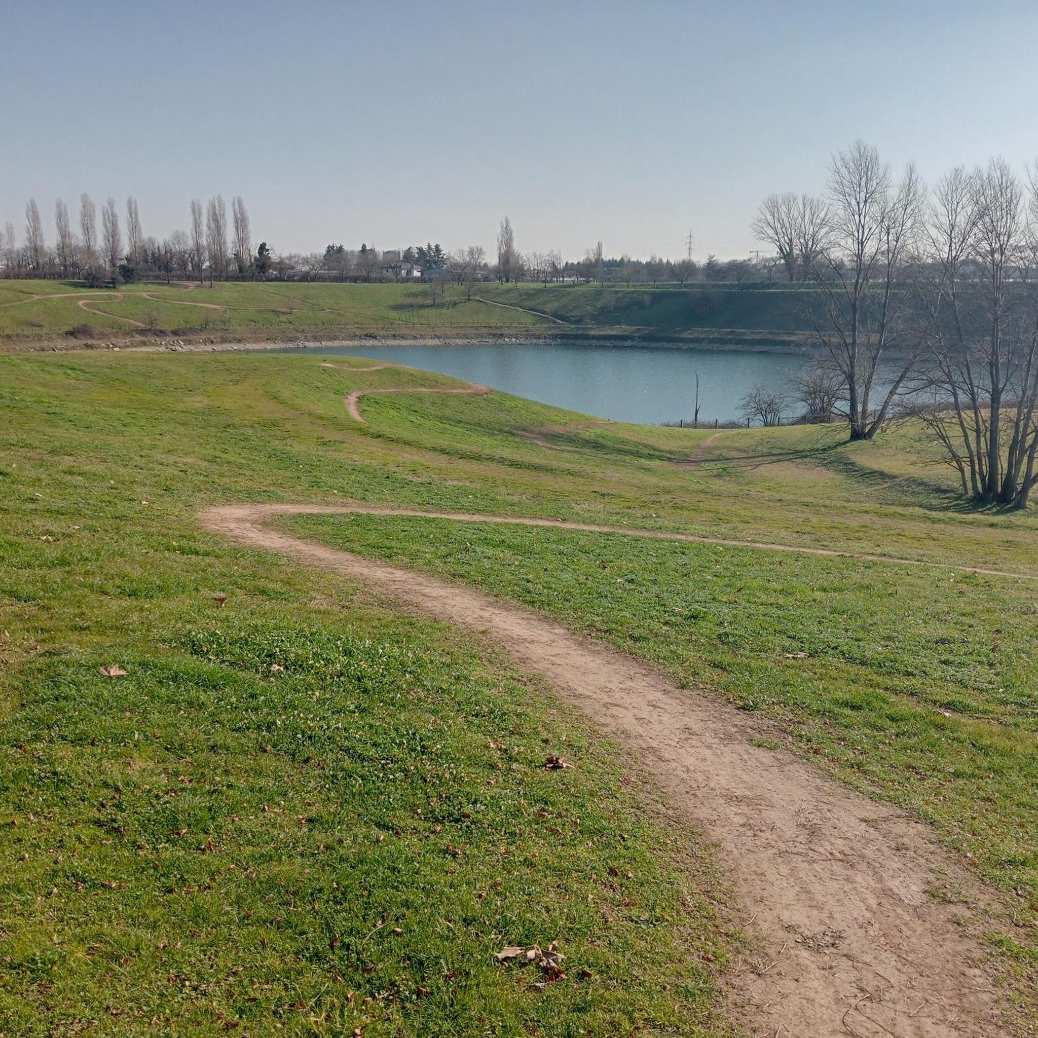
Absolutely. The flat, traffic-separated canal paths, particularly along the Martesana and Villoresi Canals, are ideal for family cycling. Additionally, local green spaces like Increa Park offer easy loops and a safe environment for all ages, with amenities like an artificial lake and open fields.
What scenic views or landmarks can I expect to see on road cycling routes around Brugherio?
Many routes offer scenic views along the historic Martesana and Villoresi Canals, passing by 17th- and 18th-century villas. You can also cycle through green areas like Increa Park, which features an artificial lake. Further afield, the routes can lead to attractions like the Idroscalo of Milan or offer distant views of the Grigna Mountains.
Are there long-distance road cycling routes available from Brugherio?
Yes, for those seeking longer rides, Brugherio serves as a great starting point. Routes like the difficult Lake Segrino – Lake Segrino loop from Cologno Nord extend over 125 km, providing extensive distances for endurance cyclists.
Can I find circular road cycling routes in the Brugherio area?
Many road cycling routes around Brugherio are designed as loops, allowing you to start and end in the same location. Examples include the Gerno Climb – Villa Greppi and Historic Park loop from Cologno Nord and the Martesana Cycle Path – Bellinzago Lombardo Locks loop from Cologno Nord, offering convenient circular journeys.
What do other cyclists enjoy most about road cycling in Brugherio?
The komoot community highly rates road cycling in Brugherio, with an average score of 4.3 stars from over 1,100 reviews. Cyclists frequently praise the well-maintained, mostly flat canal cycle paths, the separation from car traffic, and the pleasant environment for active recreation, often highlighting the blend of natural beauty and cultural points of interest.
What is the best time of year for road biking in Brugherio?
The best time for road biking in Brugherio is typically during spring and autumn when the weather is mild and pleasant. Summer can be warm, but the shaded canal paths offer some respite. Winter rides are possible, but it's advisable to check local weather conditions for rain or colder temperatures.
Are there road cycling routes with cafe stops or places to rest?
Yes, many routes along the Martesana and Villoresi Canals pass through towns and villages where you can find cafes, restaurants, and places to rest. These historic waterways are often lined with amenities, making it easy to refuel and enjoy a break during your ride.
How accessible are road cycling routes in Brugherio by public transport?
Brugherio and its surrounding areas are well-connected by public transport, particularly with Milan. Many popular starting points for road cycling routes, such as Cologno Nord, are accessible via the Milan Metro (M2 line), making it convenient to reach the cycling paths without a car.
Most popular attractions around Brugherio

Get inspired with the komoot mobile app


Explore more
Browse the best Road cycling routes in other regions.
