The best walks and hikes around Albino
4.4
(584)
3,437
hikers
116
hikes
Hiking around Albino, located in Italy's Lombardy region within the Seriana Valley, offers a diverse landscape for outdoor activities. The area is characterized by the Serio River, which contributes to scenic trails and varied terrain, ranging from gentle valley paths to challenging mountain ascents. Hikers can explore a network of routes that weave through historical sites, offer panoramic views from summits, and traverse woodlands and open areas.
Best hiking trails around Albino
- The most popular hiking route is Ancient Albino Valley Trail (via Route 550), a 5.0 miles (8.0 km) trail that takes 3 hours 1 minute to complete. This route follows an ancient mule track and features historical elements.
- Another top favourite among local hikers is Monte Rena loop with Devil's Foot (via Route 520), a difficult 7.9 miles (12.7 km) path. This trail is known for its unique geological features and local folklore.
- Local hikers also love the Monte Poieto Summit Trail via CAI 537, a 10.1 miles (16.3 km) trail leading through ancient ruins and narrow rock passages to a summit refuge, often completed in about 6 hours 7 minutes.
- Hiking around Albino is defined by the Seriana Valley, the Serio River, and numerous summits like Monte Poieto and Monte Rena. The network offers options for various ability levels, from easy walks to demanding mountain trails.
- The routes in Albino are highly rated by the komoot community with an average score of 4.5 stars from more than 400 reviews. More than 2,800 hikers have used komoot to explore Albino's varied terrain.
Last updated: October 10, 2026
3.3
(4)
57
hikers
8.00km
03:01
520m
520m
Moderate hike. Good fitness required. Mostly accessible paths. Sure-footedness required.
4.4
(5)
17
hikers
8.60km
03:08
470m
480m
Moderate hike. Good fitness required. Mostly accessible paths. Sure-footedness required.

4.4
(5)
22
hikers
12.7km
05:44
950m
950m
Hard hike. Very good fitness required. Sure-footedness, sturdy shoes and alpine experience required.
4.6
(5)
23
hikers
16.3km
06:07
920m
920m
Hard hike. Very good fitness required. Mostly accessible paths. Sure-footedness required.
3.7
(3)
11
hikers
9.89km
03:56
730m
730m
Moderate hike. Good fitness required. Easily-accessible paths. Suitable for all skill levels.
Get access to more routes and recommendations from other explorers.
Already have an account?
Our route recommendations are based on thousands of hikes, rides, and runs completed by other people on komoot.
Start today with a free account
Your next adventure awaits.

Other adventures around Albino

Tips from the Community

The entrance is scary, but once you're inside it's cool, short and you won't regret entering
0
0
quiet little square with fountain and benches with a view. A magical and silent place
0
0

The church is dedicated to Santa Maria Assunta and is classified as a subsidiary church of the Diocese of Bergamo. The building has a two-tiered facade, marked by pilasters and niches painted with figures of saints (Maria SS., St. Joseph, St. Roch, St. Paul, St. Peter, St. Anthony Abbot). The interior has a single nave, with three bays and side chapels dedicated to the Madonna del Rosario and the Crucifix.
0
1
The church is dedicated to Santa Maria Assunta and is classified as a subsidiary church of the Diocese of Bergamo. The building has a two-tier facade
0
1
Ganda is a hamlet in the municipality of Aviatico, in the province of Bergamo, located at about 1060 m altitude on a small plateau between Monte Ganda and Monte Rena, below Monte Poieto. The position is extremely panoramic: it overlooks the middle Seriana Valley, the Gandino Valley and, on clear days, even the plain. The SP41 road reaches it, which climbs from Gazzaniga, passes through Orezzo and crests at Col de la Muruna, before arriving at Amora and then at Aviatico. 🧭 Territory and environment The territory of Ganda includes: the Rovaro valley, a narrow gorge between Monte Ganda and Monte Rena; numerous seasonal streams that activate after heavy rains; ancient mule tracks that connected Ganda to Orezzo, Amora, Petello, Merà and the upper localities of Albino. 🕰️ Essential History The documented history is sparse, but the sources agree on some key points: Ancient Origins After the fall of the Roman Empire, groups of people took refuge at high altitudes to escape incursions and looting in the valley floors. Ganda was born this way: as a settlement of escape and survival. Etymology According to the historian Zambetti, the name would derive from the Celtic "gant", "pile of fallen rocks", linked to an ancient landslide of Cornagera that would have covered the area. Middle Ages and Tribulina Around the year 1000, some inhabitants of Aviatico took refuge here due to the "terror of the year 1000". On the highest point (1071 m) they built a small shrine used for prayer and burials. 1378: the best-known episode Barnabò Visconti, at war with the lords of Comenduno, sent troops to destroy the fortified village. Some inhabitants fled towards the Ganda small shrine, which became a refuge and the nucleus of the village.
0
0

Yes, in Selvino there is a slope with artificial snow, and it is the Monte Purito slope.
11
4

in the heart of Selvino on the slope with often artificial snow
2
1

Frequently Asked Questions
How many hiking trails are available around Albino?
Albino and its surroundings offer a comprehensive network of over 100 hiking trails. These routes cater to various fitness levels, ranging from easy walks to more challenging mountain treks, ensuring there's something for every hiker.
What kind of terrain can I expect on hikes in Albino?
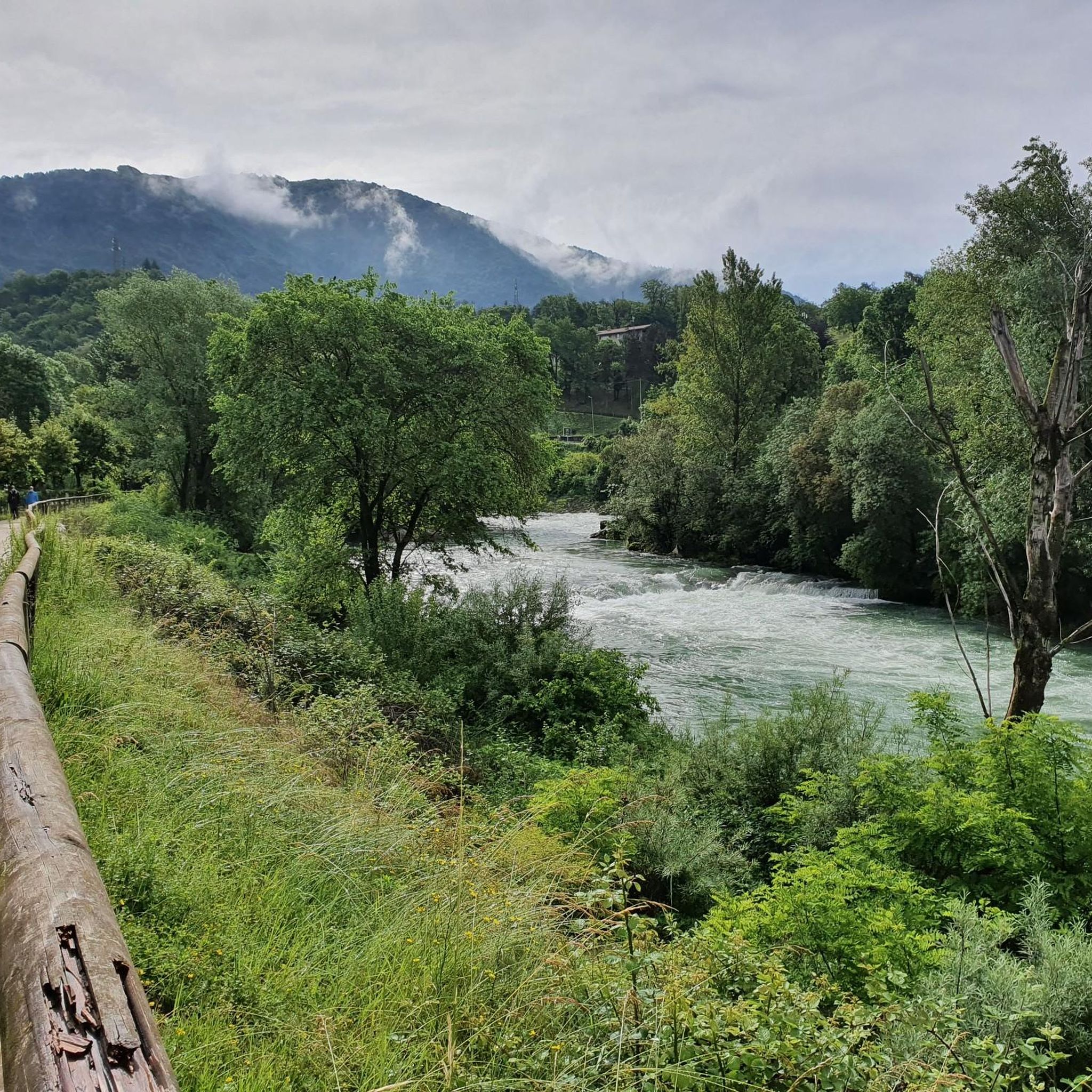
The terrain around Albino is highly diverse. You'll find paths along the Serio River, ancient mule tracks, trails through woodlands, and ascents to panoramic summits. The region offers a mix of natural beauty, historical sites, and varied landscapes, from gentle valley paths to demanding mountain trails.
Are there any easy hikes suitable for beginners or families in Albino?
Yes, Albino offers a good selection of easier trails. There are 16 easy routes available, perfect for beginners or families looking for a relaxed outdoor experience. These paths often feature less elevation gain and shorter distances, making them accessible for all ages.
Where can I find panoramic views on hikes around Albino?
Many trails in Albino lead to stunning panoramic viewpoints. Notable summits include Canto Alto Summit and Monte Misma Summit, both offering expansive views of the surrounding landscape and the Seriana Valley. The Monte Poieto Summit Trail via CAI 537 also provides breathtaking vistas from its refuge.
Are there any circular hiking routes in the Albino area?
Yes, there are several circular routes available. For example, the Monte Rena loop with Devil's Foot (via Route 520) is a challenging 12.7 km trail known for its unique geological features. Another option is the Altino Sanctuary Pilgrimage Loop from Vall'Alta, an 8.6 km route combining outdoor activity with spiritual exploration.
What historical or cultural attractions can I discover while hiking in Albino?
Albino's trails often weave through historical and cultural sites. The Ancient Albino Valley Trail (via Route 550), an 8 km mule track, features prehistoric caves, rock shrines, and Renaissance frescoes. Additionally, you might encounter various castles, such as Terzi Castle or Castello Camozzi Vertova, along your routes.
Are there any challenging hikes for experienced trekkers in Albino?
For experienced hikers, Albino offers 40 difficult routes. These often involve significant elevation gain and longer distances. The Monte Poieto Summit Trail via CAI 537 is a challenging 16.3 km mountain hike leading through ancient ruins and narrow rock passages to a summit refuge, requiring good fitness and sure-footedness.
What do other hikers enjoy most about hiking in Albino?
The hiking trails around Albino are highly rated by the komoot community, with an average score of 4.5 stars from over 400 reviews. Hikers frequently praise the diverse landscapes, the blend of natural beauty with historical elements, and the variety of routes suitable for different skill levels. The scenic views from the summits are also a common highlight.
Can I reach hiking trailheads in Albino using public transport?
Yes, Albino is well-connected by public transport. A tram line from Bergamo provides convenient access to the town, allowing hikers to reach various trailheads in the Seriana Valley and beyond without needing a car. This makes it easy to explore a wider range of routes.
Are there any long-distance hiking options near Albino?
While Albino itself offers many day hikes, the region is part of larger networks. The Alta Via delle Grazie, for instance, is a 271 km walk from Bergamo that touches many evocative places in the Seriana Valley, characterized by sanctuaries, churches, and rich natural scenery, offering a multi-day trekking experience.
Are there any trails that follow the Serio River?
Yes, the Serio River plays a significant role in the local landscape, offering pleasant paths. The Serio River Cycle Path, while primarily for cycling, also provides opportunities for walking alongside the river, passing through numerous villages and offering views of nature, art, and mountains.
Most popular routes around Albino
Most popular attractions around Albino

Get inspired with the komoot mobile app


Explore more
Browse the best Hikes in other regions.
