The best cycling routes around Oricola
4.4
(25)
895
riders
61
rides
Touring cycling around Oricola features routes that navigate a landscape characterized by rolling hills, river valleys, and mountain passes. The terrain often includes significant elevation changes, leading through rural villages and offering views of the surrounding countryside. This area provides a mix of moderate and challenging routes, suitable for cyclists seeking varied gradients and longer distances.
Best touring cycling routes around Oricola
- The most popular touring cycling route is Camporotondo Village – Piana del Pozzo loop from Pereto, a…
Last updated: July 5, 2026
5.0
(1)
49
riders
70.7km
04:38
1,010m
1,010m
Hard bike ride. Very good fitness required. Mostly paved surfaces. Suitable for all skill levels.
15
riders
38.9km
02:19
290m
290m
Moderate bike ride. Good fitness required. Mostly paved surfaces. Suitable for all skill levels.

Sign up for free
28
riders
35.7km
03:44
1,080m
1,080m
Hard bike ride. Very good fitness required. You may need to push your bike for some segments of this route.
8
riders
48.8km
04:08
1,230m
1,230m
Hard bike ride. Very good fitness required. You may need to push your bike for some segments of this route.
5.0
(1)
12
riders
46.9km
03:12
790m
790m
Hard bike ride. Very good fitness required. Mostly paved surfaces. Suitable for all skill levels.
Get access to more routes and recommendations from other explorers.
Sign up for free
Already have an account?
Our route recommendations are based on thousands of hikes, rides, and runs completed by other people on komoot.
Start today with a free account
Your next adventure awaits.
Login or Signup

Tips from the Community

Panoramic point at about 1750 meters above sea level, important crossroads for singletrack
0
0

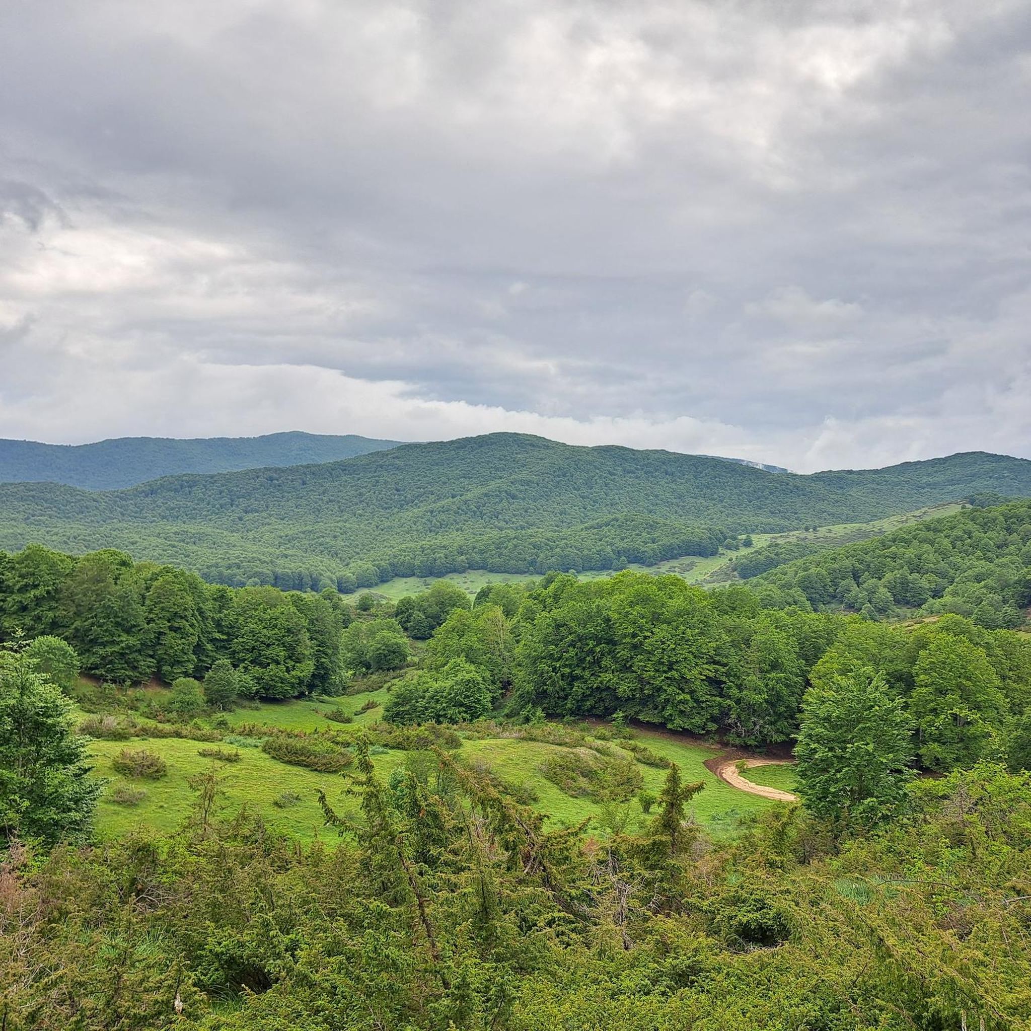
Starting from Campo dell'Osso, at an altitude of 1,750 meters, amid cool beech forests and silence broken only by the sound of tires on the ground. After a short initial stretch on a mixed trail, we immediately enter the heart of Cannavacciari, one of the most evocative trails in the Simbruini Mountains Natural Park. The trail winds steadily downhill, technical yet fluid, for 6.2 km, reaching Campo Secco at 1,340 meters. The elevation gain is significant—about 410 meters—but the varied terrain makes it fun and never boring. Fast sections alternate with tight curves, passages over roots, rocks, and some counter-slopes of up to 19%, reminding us that even on descents, you need to be strong. Every curve offers glimpses of the forest, shady sections, and the scent of pristine nature. The Cannavacciari trail has a touch of the ancient past: it's said to have been a link once used by charcoal burners and shepherds, and today it's beloved by mountain bike enthusiasts for its wild and authentic feel. The trail isn't always marked, so GPS is strongly recommended. Once you reach Campo Secco, an intense experience comes to an end, where every meter has been earned with technique and attention. A must for those who love natural, uncontrived enduro.
0
0
The Simbruini Mountains plateau is a crossroads for interesting and varied trails. Cycling on this plateau, you can take advantage of its connection to a wide variety of destinations, including Livata, Campaegli, Vedute, Cervara, and Fioio. The only drawback is the lack of fountains.
0
0

The statue is located in front of the house of the Sisters of Charity in Pozzaglia Sabina and represents Saint Agostina Pietrantoni (born Livia Pietrantoni), born in Pozzaglia Sabina in 1864. Saint Agostina was a nun of the Sisters of Charity of Saint Giovanna Antida Thouret and worked as a nurse at the Santo Spirito hospital in Rome, where she was killed in 1894 at just 30 years old while assisting the sick. She was proclaimed a saint by John Paul II in 1999 and is the patron saint of nurses in Italy. The statue is a bronze monument dedicated to her, placed in front of the house of the nuns in the center of the town, as a sign of devotion and memory of her work of charity and sacrifice. It is a spiritual point of reference for the community and for the pilgrims who visit Pozzaglia Sabina, and symbolizes the dedication, faith and service to the suffering that characterized the life of Saint Agostina.
0
0

Hello everyone, I can only tell you that it was a lucky excursion for a great running event on all the paths of Campo dell'Osso up to Monte Autoro, a beautiful trial marathon with many participants. Just the day, cool and sunny, perfect day
0
0

At the end of the dirt road that starts from Campo Minnio you arrive at the panoramic point Le Vedute with a view of Monte Tarino, Monte Viglio and the Santissima Trinità
0
0

Montorio in Valle is a hamlet of Pozzaglia Sabino, built in a dominant position over the Turano valley. Its parish church of S. Stefano Promartire, from the 14th century, has a beautiful travertine entrance portal with a lunette from the 15th century. It is located along the path of San Benedetto by bike.
4
0

Village in the circuit of "The most beautiful villages in Italy". The roads to go up are also very beautiful, both from Licenza and from Poggio Moiano
0
0
Frequently Asked Questions
What kind of terrain can I expect on touring cycling routes around Oricola?
The touring cycling routes in Oricola are characterized by rolling hills, river valleys, and mountain passes. You'll encounter significant elevation changes, leading through rural villages and offering scenic views of the surrounding countryside. The area provides a mix of moderate and challenging routes.
Are there any easy or beginner-friendly touring cycling routes in Oricola?
While Oricola's touring cycling routes are generally moderate to difficult, there are a few options that are less strenuous. For instance, the Castel di Tora Bridge – View of Castel di Tora loop from Carsoli is a moderate 33.8-mile (54.5 km) path featuring a bridge crossing and scenic views, making it a good choice for those seeking a less intense ride compared to the more challenging routes.
What are some of the longer touring cycling routes available?
For those looking for longer distances, the View of Castel di Tora – Roman Bridge over the Velino River loop from Carsoli is a challenging 70-mile (112.7 km) route that typically takes over 7 hours to complete. This route offers extensive exploration of the region's landscapes.
Are there any circular touring cycling routes in the Oricola area?
Yes, many of the touring cycling routes around Oricola are designed as loops, allowing you to start and finish in the same location. Examples include the Camporotondo Village – Piana del Pozzo loop from Pereto and the Colli di Monte Bove – Colle Civitella Pass loop from Oricola - Pereto, both offering comprehensive tours of their respective areas.
What kind of viewpoints or scenic spots can I find along the routes?
The routes often pass through areas with excellent viewpoints. For example, the Ascrea Viewpoint – Obito Gorge loop from Carsoli specifically highlights a viewpoint and a gorge. Additionally, many routes offer panoramic views of the surrounding hills and valleys as they traverse the varied terrain.
What are some interesting places to explore or landmarks near the touring cycling routes?
Beyond the cycling, you can explore several attractions. Notable natural features include the Lagustelli di Percile and the Rioscuro Stream Waterfalls. For historical interest, consider visiting the Massimo Castle of Arsoli or the Morella Ruins.
What is the best time of year for touring cycling in Oricola?
Given the region's hilly and mountainous terrain, spring and autumn generally offer the most pleasant conditions for touring cycling in Oricola. Temperatures are milder, and the natural scenery is vibrant. Summer can be warm, especially on exposed sections, while winter may bring colder temperatures and potential for snow at higher elevations.
How many touring cycling routes are available in Oricola?
There are over 50 touring cycling routes available around Oricola, offering a wide range of options for different skill levels and preferences. The majority of these routes are rated as difficult, with a smaller selection of moderate trails.
What do other touring cyclists say about the routes in Oricola?
The touring cycling routes in Oricola are highly regarded by the komoot community, with an average rating of 4.7 stars from over 20 reviews. Cyclists often praise the challenging ascents, the scenic river valleys, and the rewarding mountain passes that define the area's unique cycling experience.
Are there any cafes or places to stop for refreshments along the touring cycling routes?
While specific cafes are not listed for every route, the touring cycling paths often lead through or near rural villages. These villages, such as Percile or Cineto Romano, are good places to look for local eateries or shops where you can refuel and take a break during your ride.
What should I wear for touring cycling in Oricola?
Due to the significant elevation changes and varied terrain, it's advisable to wear layered cycling clothing that can be adjusted to changing temperatures. Consider moisture-wicking fabrics, a windproof jacket, and appropriate sun protection. Helmets are always recommended for safety.
Most popular attractions around Oricola

Get inspired with the komoot mobile app


Explore more
Browse the best Cycling routes in other regions.
