The best walks and hikes around Río Guadiana Menor - Tramo Inferíor
4.5
(17)
74
hikers
9
hikes
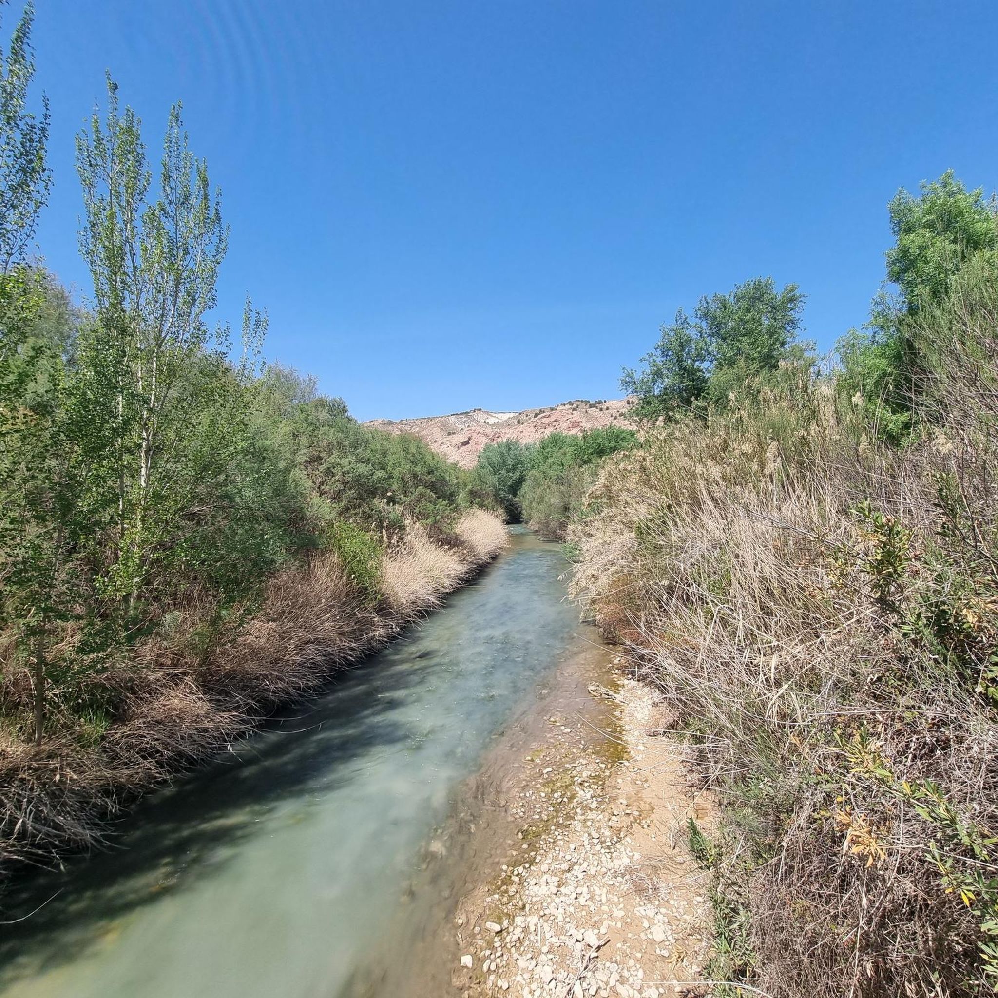
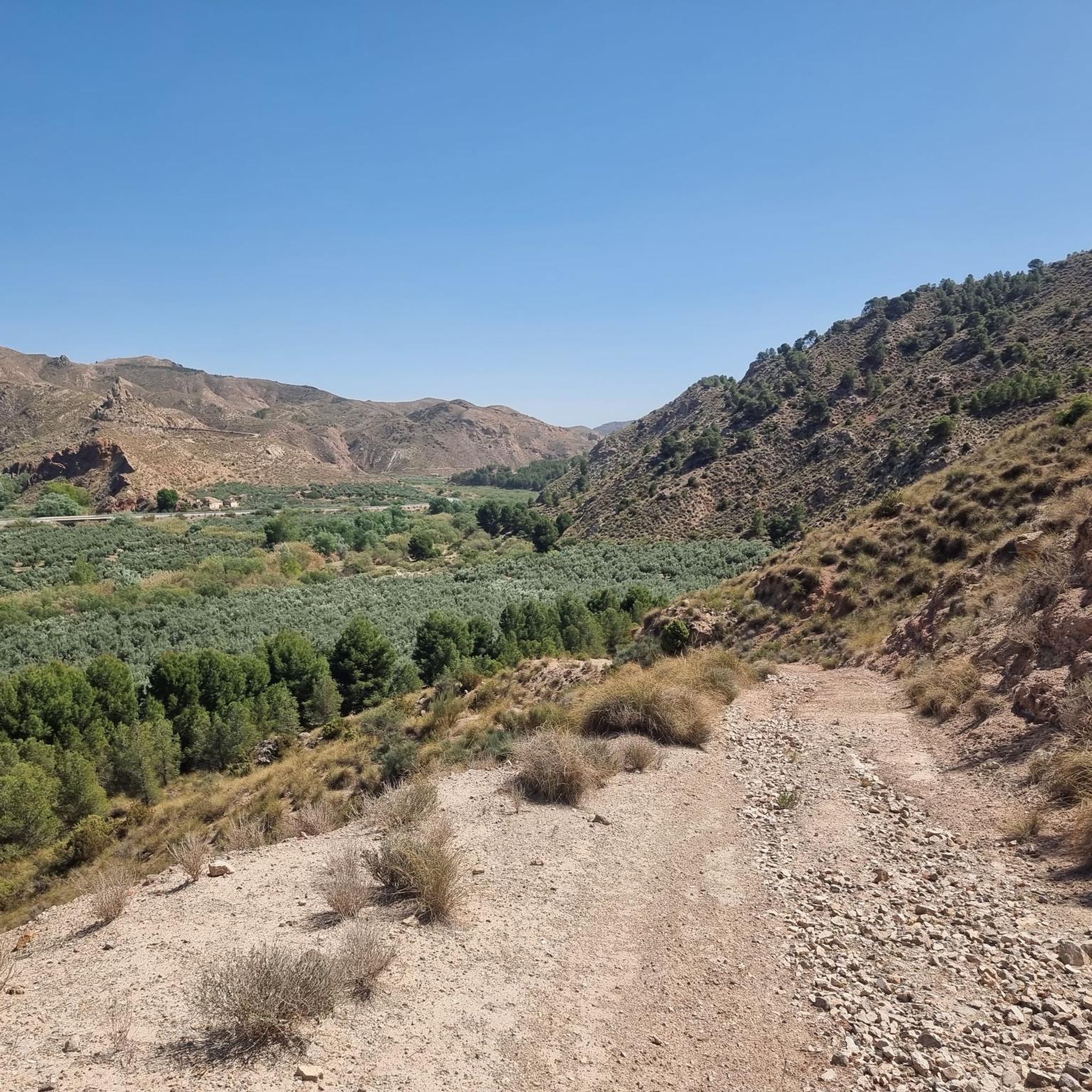
Hiking around Río Guadiana Menor - Tramo Inferíor offers diverse terrain characterized by distinctive badlands and deep ravines, sculpted from soft earth and vertical rock formations. The region features expansive fluvial terraces and steppe plateaus, contrasting with important riparian forests along the riverbanks. The prominent Negratín Reservoir forms an "interior sea" amidst this sub-desertic ecosystem, providing unique geological formations and varied landscapes for exploration.
Best hiking trails around Río Guadiana Menor - Tramo Inferíor
- The most popular hiking route is…
Last updated: July 4, 2026
4.3
(7)
21
hikers
Moderate hike. Good fitness required. Easily-accessible paths. Suitable for all skill levels.
5.0
(1)
2
hikers
11.7km
03:17
230m
230m
Moderate hike. Good fitness required. Easily-accessible paths. Suitable for all skill levels.

Sign up for free
4.7
(3)
17
hikers
3.78km
01:16
200m
200m
Easy hike. Great for any fitness level. Easily-accessible paths. Suitable for all skill levels.
4.0
(4)
20
hikers
3.13km
01:03
160m
160m
Easy hike. Great for any fitness level. Easily-accessible paths. Suitable for all skill levels.
3
hikers
4.02km
01:03
30m
20m
Easy hike. Great for any fitness level. Easily-accessible paths. Suitable for all skill levels.
4
hikers
12.8km
03:26
150m
150m
Moderate hike. Good fitness required. Easily-accessible paths. Suitable for all skill levels.
Get access to more routes and recommendations from other explorers.
Sign up for free
Already have an account?
Our route recommendations are based on thousands of hikes, rides, and runs completed by other people on komoot.
Start today with a free account
Your next adventure awaits.
Login or Signup
Tips from the Community

Nice hotel in Peal de Beccero. We stayed there on our long-distance hike from Tarifa to Switzerland and can highly recommend the hotel.
5
0
Beautiful hermitage, just above Peal de Beccerro
3
0

Cave that is located at the foot of Cerro de los Carboneras and to the south of the Sierra de Quesada we find this cave that gave rise to the Santuario de Tiscar to the north of the cave.
1
0

The Blue Pilon is between the villages of Don Pedro and Belerda. The waterfall is formed by the Tíscar river, which comes down from the incredible Cueva del Agua and creates this waterfall.
0
0

The Salto del Pilón Azul in the Tíscar river waterfall next to the Sierra de Cazorla Natural Park, is one of the most beautiful, hidden and unknown in the Province of Jaén. The waterfall is 10 meters high located inside a stone canyon that creates a beautiful pool. Easy access from the main road. Cool on a warm summer day.
1
0

Canyon with vertical walls with numerous waterfalls through which the Tíscar River flows with all the power and beauty of the water. It is prepared with walkways and wooden railings for safety and good care of the area.
3
0
Small foray into the sandstone desert located on the Atayuela hill.
0
0
Village and municipality of the province of Jaén, belonging to the county of Sierra de Cazorla. It borders the municipalities of Pozo Alcón, Huesa and Quesada and by its term the rivers Guadiana Menor, Ceal, Turrillas flow. Almost the entire municipality is part of the nature park of the Sierra de Cazorla, Segura and Las Villas.
0
0
Frequently Asked Questions
How many hiking trails are available in Río Guadiana Menor - Tramo Inferíor?
There are 9 hiking routes in the Río Guadiana Menor - Tramo Inferíor area. These include 6 easy trails and 3 moderate trails, offering options for various fitness levels.
What is the best time of year to go hiking in Río Guadiana Menor - Tramo Inferíor?
The region experiences a sub-desertic climate with scarce rainfall and extreme temperatures. For comfortable hiking, spring and autumn are generally the best times, offering milder temperatures. Summers can be very hot, and winters can be chilly, though often sunny.
Are there any family-friendly hiking routes in the area?
Yes, the Río Guadiana Menor - Tramo Inferíor offers several easy routes suitable for families. An example is the Pilón Azul Waterfall – Cueva del Agua loop from Río Tíscar, which is 3.8 km long and takes about 1 hour 16 minutes to complete, featuring notable water features.
Can I bring my dog on the hiking trails?
While specific regulations for dogs on trails can vary, many natural areas in Spain permit dogs on a leash. It's always advisable to check local signage or specific park rules for each trail. Given the sub-desertic environment, ensure your dog has plenty of water, especially during warmer months.
Are there circular hiking routes available?
Yes, there are several circular routes. A popular moderate option is the Cueva de la Virgen del Agua y el Pilón Azul - circular by the P. N. de las Sierras de Cazorla, Segura y las Villas, which is 8.3 km long. For an easier circular walk, consider the Hotel Al Ándalus loop from Peal de Becerro, a 4.0 km trail.
What kind of terrain and landscapes can I expect while hiking here?
The region is known for its dramatic and unique landscapes. You'll encounter impressive "badlands" and ravines with vertical rock formations, expansive fluvial terraces, and steppe plateaus. The riverbanks also feature important riparian forests, providing a green contrast to the more arid surroundings. The Negratín Reservoir is a prominent feature, creating an "interior sea" amidst the badlands.
Are there any notable natural landmarks or viewpoints along the trails?
The primary natural landmarks are the striking badlands formations and the vast Negratín Reservoir. Many trails offer panoramic views of these unique geological features and the contrasting riparian forests. The area's sub-desertic ecosystem itself is a point of interest, with specialized flora and diverse wildlife.
What is the difficulty level of the hikes in Río Guadiana Menor - Tramo Inferíor?
The trails in this region range from easy to moderate. There are 6 easy routes, perfect for a relaxed stroll or family outing, and 3 moderate routes for those seeking a bit more challenge. There are no difficult routes listed in this guide.
Is public transport available to access the hiking trails?
The region is characterized by the absence of major urban centers, and public transport options directly to trailheads may be limited. Access to the river and various starting points is primarily facilitated by the road network, such as the A-315. It is generally recommended to use a private vehicle for flexibility when exploring this area.
What do other hikers enjoy most about hiking in Río Guadiana Menor - Tramo Inferíor?
The area is highly rated by the komoot community, with an average score of 4.5 stars from over 10 reviews. Hikers often praise the unique and dramatic badlands landscapes, the tranquility of the riparian forests, and the diverse terrain that offers a rich and engaging outdoor experience.
Are there any trails that feature waterfalls?
Yes, some trails incorporate water features. For example, the Pilón Azul Waterfall – Cueva del Agua loop from Río Tíscar is an easy 3.8 km route that highlights a waterfall and a cave, offering a refreshing element to your hike.
Where can I find parking for the trailheads?
Given the rural nature of the Río Guadiana Menor - Tramo Inferíor, parking is typically available near the start of popular trailheads or in small villages adjacent to the routes. It's advisable to check specific route details on komoot for designated parking areas or suitable roadside spots.
What kind of wildlife might I encounter?
Despite its arid appearance, the region supports diverse wildlife, particularly along the riparian corridors. You might spot various bird species, including kingfishers and eagle owls, as well as otters and certain fish in the river. The unique sub-desertic ecosystem also hosts specialized flora.
Most popular routes around Río Guadiana Menor - Tramo Inferíor

Get inspired with the komoot mobile app


Explore more
Browse the best Hikes in other regions.
