The best walks and hikes around Lic-Rio Miera
4.4
(712)
5,338
hikers
38
hikes
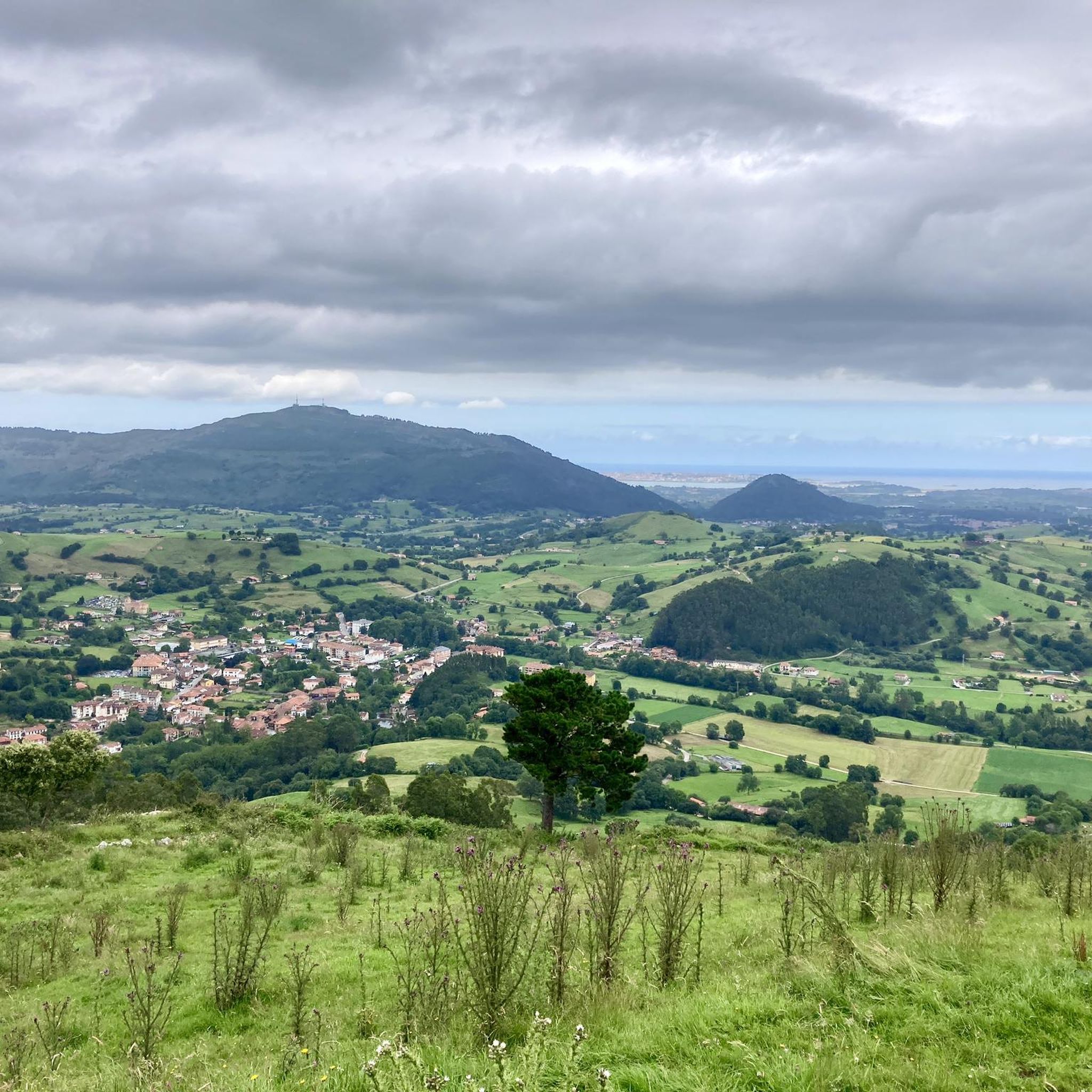
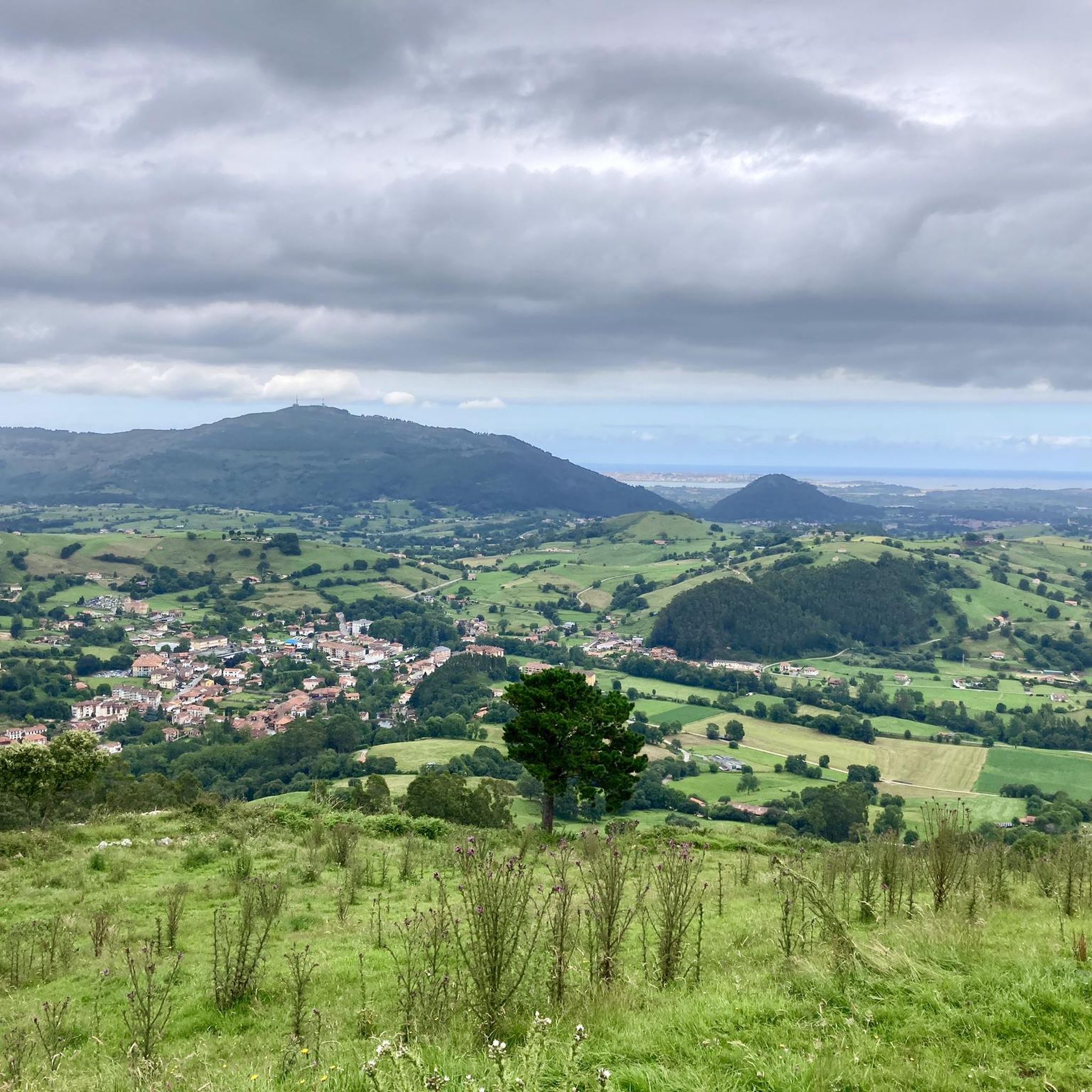
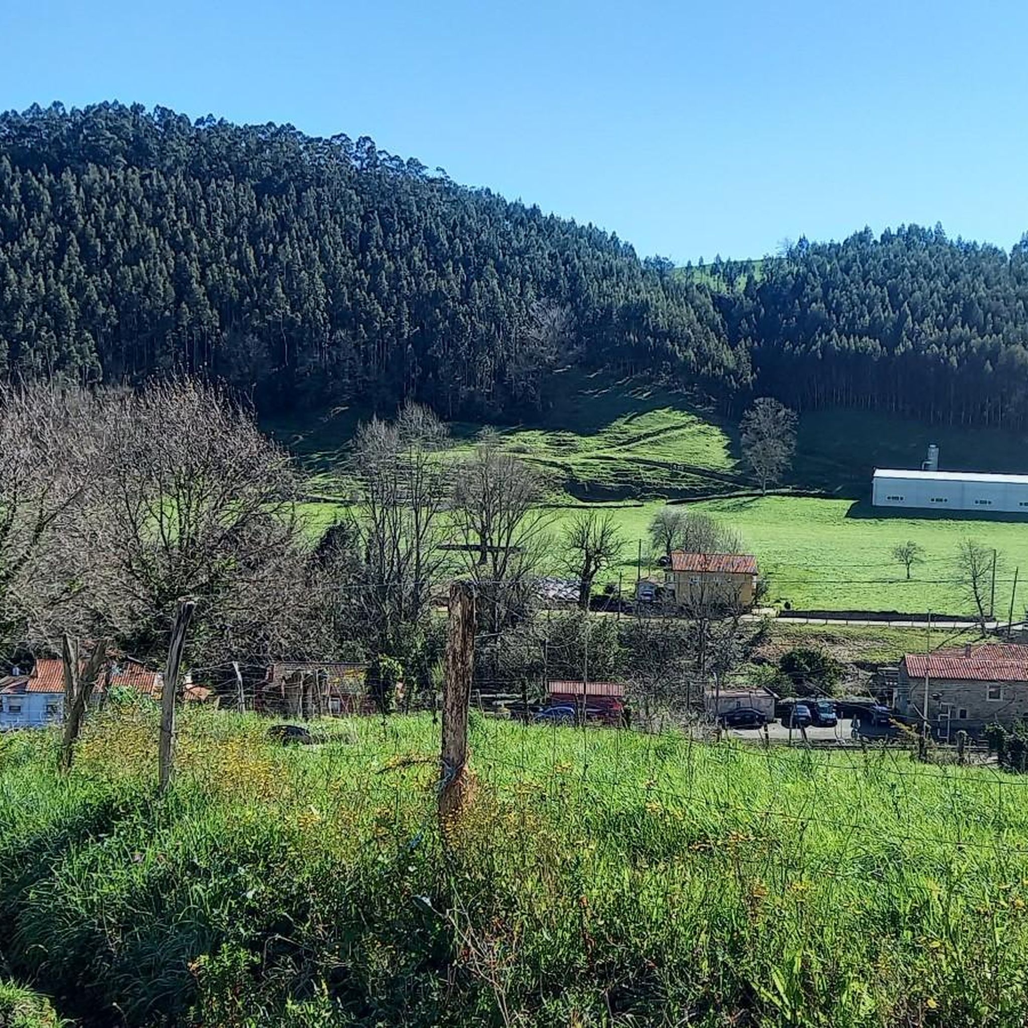
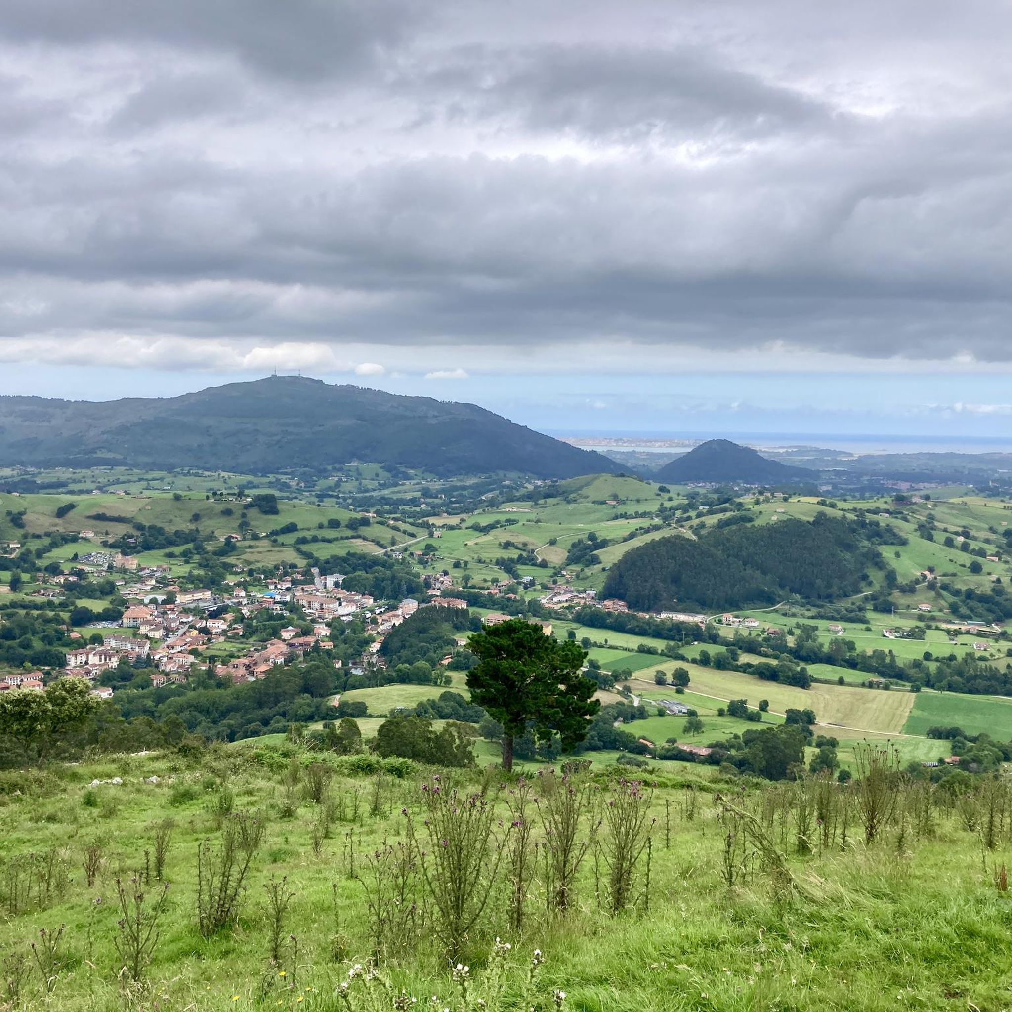
Hiking around Lic-Rio Miera offers diverse landscapes, from the Miera River's transition through gorges to extensive forested areas. The region features significant beech and holm oak forests, including the Haza Mina beech grove. Glacial morphology and intense karstification processes have shaped the upper valley, creating unique landforms like sinkholes and poljes. This varied terrain provides a range of hiking experiences.
Best hiking trails around Lic-Rio Miera
- The most popular hiking route is Pico Vizmaya Trail, an easy 3.4 miles…
Last updated: June 23, 2026
4.0
(4)
10
hikers
5.41km
01:40
190m
190m
Hike the easy 3.4-mile Pico Vizmaya Trail in Cantabria, Spain, gaining 627 feet for panoramic views of Santander Bay.
4.0
(2)
7
hikers
12.3km
04:59
990m
990m
This difficult 7.6-mile hike from La Pedrosa via the Calseca stream offers panoramic views from Pico Porracolina and 3254 feet of gain.

Sign up for free
2
hikers
19.6km
06:15
710m
710m
Hard hike. Very good fitness required. Sure-footedness, sturdy shoes and alpine experience required.
4.9
(10)
52
hikers
9.79km
03:12
420m
420m
Moderate hike. Good fitness required. Easily-accessible paths. Suitable for all skill levels.
4.0
(3)
39
hikers
15.3km
04:17
300m
300m
Moderate hike. Good fitness required. Easily-accessible paths. Suitable for all skill levels.
4.6
(5)
18
hikers
13.0km
03:57
460m
460m
Moderate hike. Good fitness required. Easily-accessible paths. Suitable for all skill levels.
4.5
(4)
19
hikers
8.30km
02:12
80m
80m
Moderate hike. Good fitness required. Easily-accessible paths. Suitable for all skill levels.
5.0
(2)
11
hikers
16.0km
06:02
1,060m
1,060m
Hard hike. Very good fitness required. Easily-accessible paths. Suitable for all skill levels.
1.0
(1)
5
hikers
13.4km
03:56
380m
380m
Moderate hike. Good fitness required. Easily-accessible paths. Suitable for all skill levels.
4.9
(35)
16
hikers
5.89km
01:32
30m
30m
Easy hike. Great for any fitness level. Easily-accessible paths. Suitable for all skill levels.
Get access to more routes and recommendations from other explorers.
Sign up for free
Already have an account?
Our route recommendations are based on thousands of hikes, rides, and runs completed by other people on komoot.
Start today with a free account
Your next adventure awaits.
Login or Signup

Tips from the Community


It is impressive to see it from the outside.
2
0

Very nice but very badly marked, hard to find without Komoot
1
0

La Cueva de la Colodra is a curious cavity with the typical shape of a movie cave that you can enter its "portico" perfectly standing up but after a few steps inside you discover that it continues through a much smaller and narrower cavity in which You have to crouch down and have more trouble if you want to explore, yes, a flashlight and some basic precautions are necessary here with some more equipment in case it is necessary. It is found going up a few steps from the path that goes up to Alto de Brenas and also to Alto de los Escajos, it is a comfortable path to follow so it does not cost much to deviate and visit this cave, and just a few meters away the birth also begins from the stream of the same name. Of course, if you look calmly from inside it seems that you have a wonderful window to paradise and you breathe authentic peace and tranquility, it is a great place.
0
0

Magnificent cave with beautiful views that is worth visiting. It is a few meters away from the path up to Brenas and passing through the Peñal de Brenas.
0
0
One of the most visited peaks in the Alto Asón area, from its 1414 masl it offers beautiful views of the entire Cantabrian interior in all directions.
4
0
Frequently Asked Questions
How many hiking trails are available in Lic-Rio Miera?
The Lic-Rio Miera region offers a wide variety of hiking experiences, with over 35 routes available. These range from easy walks to challenging mountain ascents, catering to different fitness levels.
What kind of landscapes can I expect to see while hiking in Lic-Rio Miera?
Hikers in Lic-Rio Miera will encounter diverse and dramatic natural landscapes. The Miera River transitions from steep mountain sections to broader valleys, featuring narrow gorges and rapids. You'll also find well-preserved alder and willow forests along riverbanks, significant beech and holm oak forests like Haza Mina, and unique glacial and karst formations such as sinkholes and limestone pavements.
Are there easy hiking options for beginners or casual walkers in Lic-Rio Miera?
Yes, Lic-Rio Miera has several easy trails suitable for beginners. For example, the Pico Vizmaya Trail is an easy 3.4-mile (5.4 km) route that takes about 1 hour 40 minutes to complete, offering accessible paths for a shorter excursion. There are 12 easy routes in total.
Are there challenging hikes for experienced trekkers in Lic-Rio Miera?
Absolutely. For experienced hikers seeking a challenge, Lic-Rio Miera offers difficult routes with significant elevation gain. The Pico Porracolina via Calseca Stream Trail is a difficult 7.6-mile (12.3 km) path leading through varied mountain terrain. Another demanding option is the Alto de los Escajos – circular via the ascent path to Brenas (PR-S 137), a 12.2-mile (19.6 km) trail through steep relief and forested sections.
Are there family-friendly hiking trails in Lic-Rio Miera?
While specific 'family-friendly' designations aren't always available, many of the easy and moderate trails in Lic-Rio Miera are suitable for families. Look for shorter routes with less elevation gain, such as the Pico Vizmaya Trail, which offers accessible paths. The diverse riverine environments and forests provide engaging scenery for all ages.
Can I bring my dog on the trails in Lic-Rio Miera?
Generally, dogs are welcome on many hiking trails in the Lic-Rio Miera region, especially in natural areas. However, it's always advisable to keep them on a leash, particularly in areas with livestock or protected wildlife. Be sure to check local regulations for specific trails or natural parks before you go.
Are there circular hiking routes in the Lic-Rio Miera region?
Yes, the region offers several circular routes, perfect for varied exploration without retracing your steps. An example is the La Garma Blanca – Hayedo de Zamina loop from San Roque de Riomiera, which takes you through beautiful forested areas. Another option is the View of Porracolina – Pico Porracolina loop from La Pedrosa for a more challenging circular trek.
What are some notable natural features or landmarks to look out for?
The Lic-Rio Miera region is rich in natural and historical points of interest. You can explore the unique karst landscapes with sinkholes and limestone pavements, or visit the extensive cave systems, such as the 'Alto del Tejuelo' system. Along the trails, you might encounter the Aguanaz River and Frenchman’s Cave or the Aguanaz River Dam. For historical interest, the Carlos III Gate and Casa de Miera-Rubalcaba are also nearby.
What is the best time of year to go hiking in Lic-Rio Miera?
The Lic-Rio Miera region offers hiking opportunities throughout much of the year. Spring and autumn generally provide the most pleasant conditions with mild temperatures and vibrant scenery, especially when the beech and holm oak forests change colors. Summer can be warm but is still suitable, particularly for higher-altitude trails. Winter hiking is possible but requires appropriate gear due to potentially challenging weather and soil conditions.
Is public transport available to reach hiking trailheads in Lic-Rio Miera?
Public transport options to specific trailheads within the rural Lic-Rio Miera valley can be limited. However, towns like Liérganes and San Roque de Riomiera, which serve as starting points for several routes, may have bus connections from larger urban centers. It's recommended to check local bus schedules in advance or consider driving to access a wider range of trailheads.
Where can I find parking for hiking trails in Lic-Rio Miera?
Many trailheads, especially those near villages like Liérganes, San Roque de Riomiera, or smaller hamlets, often have designated parking areas or roadside spots where hikers can leave their vehicles. As the area is popular for outdoor activities, parking facilities are generally available, though they might be limited during peak seasons or on popular routes. Always park responsibly and respect local signage.
What do other hikers enjoy the most about hiking in Lic-Rio Miera?
The hiking routes in Lic-Rio Miera are highly rated by the komoot community, with an average score of 4.4 stars from more than 300 reviews. Hikers often praise the diverse riverine environments, the extensive and well-preserved forested areas, and the dramatic karst landscapes that make each trail unique and visually stunning.
Most popular routes around Lic-Rio Miera
Most popular attractions around Lic-Rio Miera

Get inspired with the komoot mobile app


Explore more
Browse the best Hikes in other regions.
