The best hikes from bus stations around The Municipal District of Dundalk
4.5
(336)
2,511
hikers
29
hikes
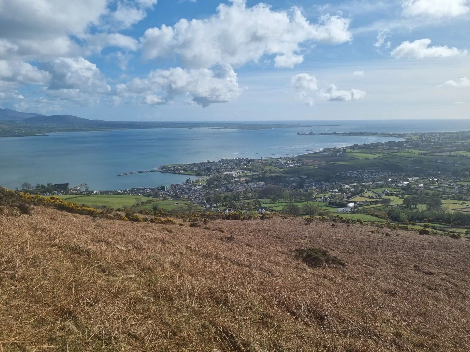
Bus station hiking trails around The Municipal District of Dundalk offer access to varied landscapes, from coastal paths along Carlingford Lough to the elevated terrain of the Cooley Mountains. The region is characterized by its blend of maritime scenery and rugged uplands, including Slieve Foye, the highest peak in County Louth. Hikers can explore dense woodlands, open mountain ridges, and scenic bays, providing diverse environments for outdoor activity. This area provides a range of bus accessible routes for different skill…
Last updated: July 16, 2026
4.8
(6)
33
hikers
15.4km
05:26
780m
780m
Hard hike. Very good fitness required. Mostly accessible paths. Sure-footedness required.
4.4
(9)
76
hikers
8.84km
03:01
450m
450m
Moderate hike. Good fitness required. Easily-accessible paths. Suitable for all skill levels.

Sign up for free
4.3
(12)
87
hikers
Moderate hike. Good fitness required. Easily-accessible paths. Suitable for all skill levels.
4.3
(3)
42
hikers
7.98km
02:51
490m
490m
Moderate hike. Good fitness required. Easily-accessible paths. Suitable for all skill levels.
4.7
(6)
34
hikers
5.39km
01:49
280m
280m
Easy hike. Great for any fitness level. Easily-accessible paths. Suitable for all skill levels.
Get access to more routes and recommendations from other explorers.
Sign up for free
Already have an account?
Our route recommendations are based on thousands of hikes, rides, and runs completed by other people on komoot.
Start today with a free account
Your next adventure awaits.
Login or Signup
Popular around The Municipal District of Dundalk

Other adventures around The Municipal District of Dundalk


Tips from the Community

In the middle of the forest, you suddenly find yourself standing in front of a bizarre stone creature - the "witch". She looks as if she has just risen from the mossy ground, with a mischievous smile and deep, expressive wrinkles on her face. This artfully designed stone is one of those unexpected encounters that transform the forest into a small adventure land. When you explore this magical place surrounded by old trees and whispering leaves, it almost seems as if the witch is greeting you with a wink. Here you can linger for a moment, enjoy the silence and let your imagination run wild - who knows what stories this forest still has to tell?
1
0
The hike to the Cloghmór Stone feels like a journey through time. Over 10,000 years ago, the ice brought this massive granite block from Scotland here, and now, weighing an estimated 50 tons, it towers majestically over the landscape. But it's not just the geology that's fascinating - according to legend, it was the giant Finn McCool who threw this enormous stone over Carlingford Lough. To be honest, the legend is a much more exciting explanation, isn't it? Once you've reached the top, you'll not only be greeted by the imposing boulder, but also by a fantastic view of Carlingford Lough and the surrounding hills. It's the perfect place to pause for a moment, take in the vastness and enjoy the peace that this place exudes.
0
0
The Viewpoint Trail takes you from Fiddlers Green through an enchanted landscape that takes you to the impressive Cloghmór Stone. The path is narrow and interspersed with moss-covered trees that create a mystical atmosphere, especially when the sun breaks through the dense branches. It is one of those trails that is best explored in dry conditions, as the ground can otherwise become quite slippery. Once at the top, you will be treated to stunning views over the water and the surrounding hills. The clear air and wide views invite you to pause for a moment and simply enjoy the moment. On the way back, you have the opportunity to wander through Fiddlers Green and soak up the peaceful atmosphere of this place. All along the path you will find rubbish bins to keep nature clean - a nice detail that shows respect for this place. When you look out over the valley, you will understand why this trail is a popular destination for hikers who want to leave the hustle and bustle behind and be inspired by nature.
0
0

Here it is worth climbing the mountain
0
2

Wikipedia (Slieve Foy (Irish: Sliabh Feá), 2023-12-02): https://en.m.wikipedia.org/wiki/Slieve_Foy Wikipedia (Lists of mountains in Ireland, 2023-12-02): https://en.m.wikipedia.org/wiki/Lists_of_mountains_in_Ireland MountainViews.ie (Slieve Foye, 2023-12-02): https://mountainviews.ie/summit/298/ TheIrishRoadtrip (“A Guide To The Slieve Foye Loop: Trail, Parking + Handy Info”, 2023-12-02): https://www.theirishroadtrip.com/slieve-foye-loop/
2
1
Wikipedia (Cooley Mountains, 2024-07-28): https://en.m.wikipedia.org/wiki/Cooley_Mountains "... Barnavave (350m). This latter name comes from Bearna Mhéabha (Maeve's Gap), and refers to the legendary Queen Medb (Maeve), whose army is said to have dug a pass through the mountain. ..."
1
0

A beautiful round stone, there is a legend about it but unfortunately we could not find out
0
0
A beautiful forest with good views of the sea
0
0
Frequently Asked Questions
How many bus station hiking trails are available in The Municipal District of Dundalk?
There are over 20 hiking routes in The Municipal District of Dundalk that are accessible from bus stations, offering a variety of experiences for different fitness levels.
Are there easy hiking routes accessible by bus for beginners?
Yes, The Municipal District of Dundalk offers several easy hiking routes accessible by bus, perfect for beginners or those seeking a relaxed stroll. For example, the Stone Bridge in Mourne AONB loop from Kilkeel Golf Club is an easy option. The region also features gentle coastal paths along Carlingford Lough and Dundalk Bay, and trails within Ravensdale Forest, which are generally suitable for all abilities.
What kind of views can I expect on bus-accessible hikes near Dundalk?
The region boasts diverse and stunning views. Hikes in the Cooley Mountains, such as the challenging Slieve Foye & Barnevave loop from Carlingford, offer panoramic vistas of the Irish Sea, Carlingford Lough, and even the distant Mourne Mountains. Coastal paths provide tranquil waterside scenery, while trails through Ravensdale Forest offer lush woodland views.
Are there any circular bus-accessible walks in the area?
Yes, many of the bus-accessible routes in The Municipal District of Dundalk are circular, allowing you to start and end your hike at the same point. The Slieve Foye & Barnevave loop from Carlingford is a notable circular route, and the Slieve Gullion Summit – Calliagh Beara Lough loop from Ring of Gullion AONB also provides a rewarding circular experience.
What are some interesting landmarks or attractions I can see along these bus-accessible trails?
Many trails offer access to fascinating landmarks. You can reach the Slieve Foye Summit for incredible views, explore the charming village of Carlingford, or discover historical sites like the Long Woman's Grave Memorial and the Druids' Circle in Ravensdale Forest. The Clermont Carn Summit is another accessible point of interest.
What do other hikers enjoy most about hiking in The Municipal District of Dundalk?
The area is highly rated by the komoot community, with an average score of 4.5 stars. Reviewers often praise the diverse landscapes, from rugged mountains to peaceful coastal paths, and the stunning panoramic views, particularly from peaks like Slieve Foye. The accessibility of trails from bus stations is also frequently highlighted as a major convenience.
Are there any moderate difficulty hikes accessible by bus?
Absolutely. The Municipal District of Dundalk offers 8 moderate difficulty hikes accessible by bus. An example is the View of Carlingford Lough – Slievemeen Summit loop from Rostrevor, which provides a good challenge with rewarding scenery. The Slieve Gullion Summit – Calliagh Beara Lough loop from Ring of Gullion AONB is another excellent moderate option.
What is the best time of year for hiking near Dundalk bus stations?
Spring and autumn generally offer the most pleasant hiking conditions with milder temperatures and beautiful scenery, from blooming wildflowers to vibrant autumn foliage. Summer is also popular, though trails can be busier. Winter hiking is possible, but requires appropriate gear for potentially wet and windy conditions, especially on exposed mountain trails.
Are there any bus-accessible trails that offer a pub or refreshment stop nearby?
Many trails in the region lead to or pass through charming villages like Carlingford, which is well-served by bus routes and offers a selection of pubs, cafes, and restaurants. The Slieve Foye & Barnevave loop from Carlingford, for instance, starts and ends in Carlingford, making it convenient for post-hike refreshments.
What should I wear for hiking near Dundalk, especially in winter?
For hiking in The Municipal District of Dundalk, especially during winter, it's crucial to dress in layers. Waterproof and windproof outer layers are essential, as is sturdy, waterproof hiking footwear. A hat, gloves, and warm socks are also highly recommended. Even in milder seasons, carrying rain gear is advisable due to Ireland's changeable weather.
Are there any bus-accessible trails that are considered 'hidden gems'?
While many trails are well-known, exploring sections of the longer Táin Way or lesser-known loops within Ravensdale Forest can offer a sense of discovery. The Cloughmore Stone loop from Rostrevor, while not strictly a 'hidden gem,' offers unique geological interest and stunning views without being as heavily trafficked as some other routes.
Most popular routes around The Municipal District of Dundalk
Most popular attractions around The Municipal District of Dundalk

Get inspired with the komoot mobile app


