The best hikes from bus stations around Donegal Municipal District
4.6
(605)
3,823
hikers
8
hikes
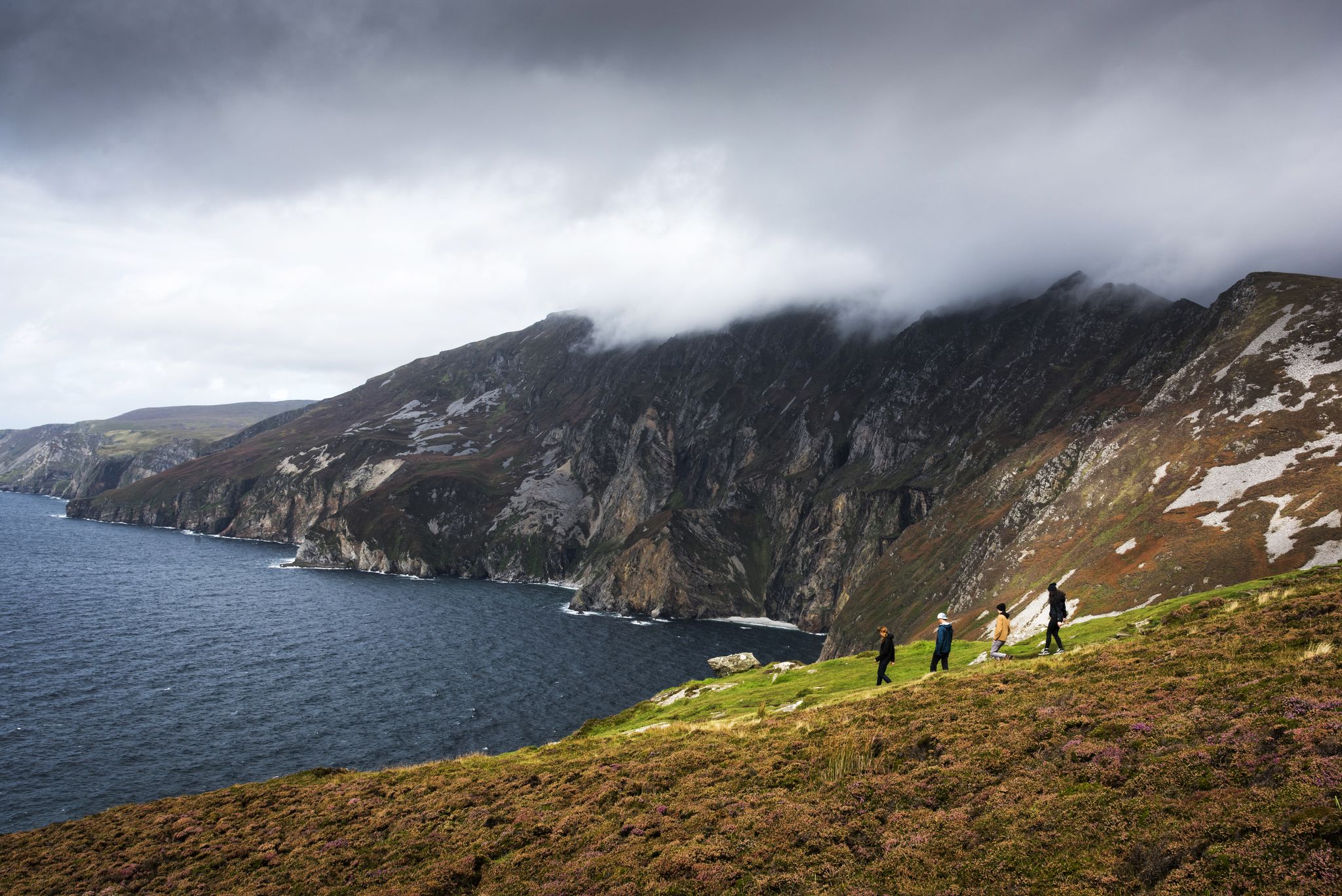
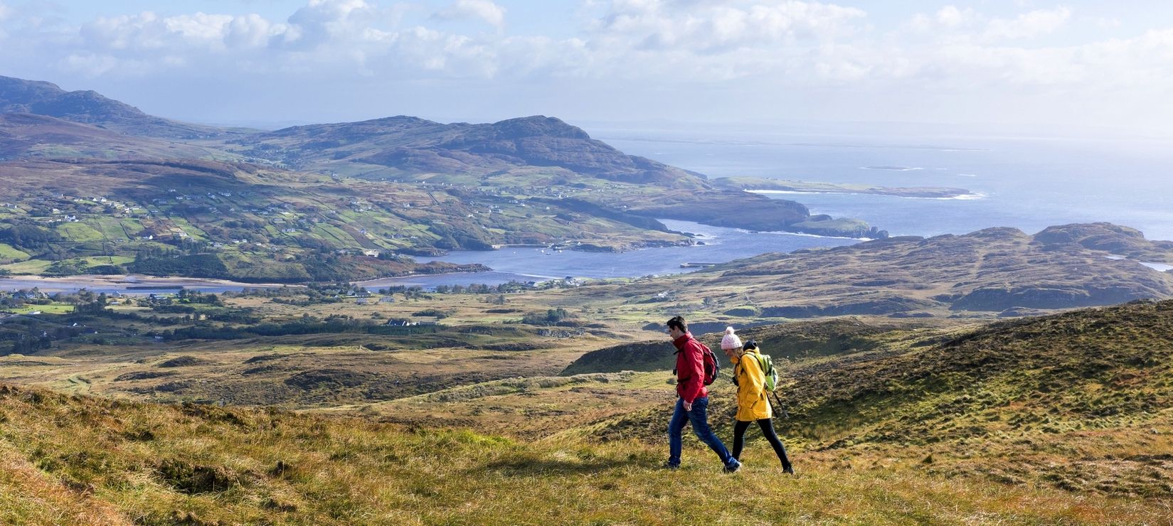
Hiking around Donegal Municipal District offers a diverse range of landscapes, from rugged coastlines and towering sea cliffs to majestic mountains and serene loughs. The region features prominent natural landmarks such as the high sea cliffs of Sliabh Liag and the distinctive Errigal Mountain. Trails traverse varied terrain, including moorlands, ancient woodlands, and coastal paths, providing a comprehensive outdoor experience.
Best bus station hiking trails around Donegal Municipal District
- The most popular bus station hiking route is Crockrawer/Cnoc Ramhar Summit, a 5.1 miles (8.2 km) trail that takes about 3 hours to complete. This moderate route ascends to a summit offering sweeping ocean views.
- Another top favourite among local hikers is Bundoran Beach – Donegal Bay loop from Tullaghan, a moderate 7.8 miles (12.6 km) path. This trail explores coastal scenery and the shores of Donegal Bay.
- Local hikers also love the Donegal Castle – Donegal Church loop from Donegal, a 2.4 miles (3.8 km) trail leading through the town center and along the river, often completed in about 1 hour.
- Hiking around Donegal Municipal District is defined by rugged coastlines, mountain ascents, and tranquil lough-side paths. The network offers options for various ability levels, from easy town loops to moderate mountain trails.
- The routes in Donegal Municipal District are highly rated by the komoot community with an average score of 4.6 stars from more than 500 reviews. More than 3,400 hikers have used komoot to explore Donegal Municipal District's varied terrain.
Last updated: July 2, 2026
4.9
(65)
418
hikers
8.16km
02:59
320m
320m
Moderate hike. Good fitness required. Mostly accessible paths. Sure-footedness required.
2
hikers
2.96km
00:45
10m
10m
Easy hike. Great for any fitness level. Easily-accessible paths. Suitable for all skill levels.

Sign up for free
5.0
(2)
27
hikers
3.85km
01:00
30m
30m
Easy hike. Great for any fitness level. Easily-accessible paths. Suitable for all skill levels.
4.3
(3)
13
hikers
12.6km
03:14
60m
60m
Moderate hike. Good fitness required. Easily-accessible paths. Suitable for all skill levels.
4
hikers
2.52km
00:40
20m
20m
Easy hike. Great for any fitness level. Easily-accessible paths. Suitable for all skill levels.
Get access to more routes and recommendations from other explorers.
Sign up for free
Already have an account?
Our route recommendations are based on thousands of hikes, rides, and runs completed by other people on komoot.
Start today with a free account
Your next adventure awaits.
Login or Signup
Popular around Donegal Municipal District
Other adventures around Donegal Municipal District


Tips from the Community

The West End Pool is a huge rock pool that has been dammed to become a tidal swimming pool. The high tide changes the water, and the low tide exposes the pool which then warms up (sometimes). It's a great place for a safer swim.
0
0
Known as the west end Cliff Walk this coastal trail follows the shoreline west of Bundoran. You can visit the tidal pool, make the walk into a longer loop by including the Rougey Walk or simply time it right and witness a perfect sunset.
0
0

Modern stone interpretation at the visitor centre, with illustrations depicting old customs and legends surrounding Sliabh Liag. Not a historical monument, but an artistic marker summarising the mountain's cultural significance.
5
0
On the banks of the River Eske stands Donegal Castle, the 15th-century stronghold of the mighty O’Donnell clan. The combination of the robust medieval tower and the later 17th-century manor house gives it a layered appearance: Gaelic-Irish at the base, with a subtle English finish on top. From the road and the bridge, you get a beautiful view of the massive walls and its position above the water, making the castle a natural landmark as you enter Donegal Town.
8
1
Beautiful sandy beach on Donegal Bay, overlooking Mullaghmore and the Donegal coastline. A lively, accessible beach along Bundoran's promenade.
2
0
Quiet, open part of Donegal Bay where the Breedoge River flows into the sea. Wide horizon, tidal flats and views of Bundoran make this a subtle but atmospheric landscape moment between Tullaghan and the Donegal coast.
3
0

Beautiful ancient customs made visible again in the reconstruction. It makes you curious about the history behind them.
1
0

[Google Translation may change URLs] Heritage Ireland (Donegal Castle, 2024-09-04): https://heritageireland.ie/places-to-visit/donegal-castle/ Wikipedia (Donegal Castle (Irish: Caisleán Dhún na nGall), 2024-09-04): https://en.m.wikipedia.org/wiki/Donegal_Castle https://de.m.wikipedia.org/wiki/Donegal_Castle Tripadvisor (Donegal Castle, 2024-09-04): https://www.tripadvisor.com/Attraction_Review-g186602-d318379-Reviews-Donegal_Castle-Donegal_Town_County_Donegal.html google (Street View, 2024-09-04): https://www.google.com/maps/@54.6549279,-8.1101163,3a,90y,272.84h,83.94t/data=!3m6!1e1!3m4!1sP-rzPJRTXEaVQuk0Z9UYgg!2e0!7i16384!8i8192
2
1
Frequently Asked Questions
How many bus station hiking trails are available in Donegal Municipal District?
There are currently 7 bus station hiking trails available in Donegal Municipal District, offering a variety of experiences from easy strolls to more challenging routes. These trails are designed to be easily accessible via public transport, making it convenient to explore the region's natural beauty.
What types of bus-accessible hikes can I find in Donegal Municipal District?
You'll find a good mix of trails. The majority, 5 out of 7, are easy hikes, perfect for a relaxed outing. There are also 2 moderate routes for those looking for a bit more challenge. These trails often feature coastal paths, town loops, and routes leading to scenic viewpoints.
Are there any easy, family-friendly walks accessible by bus in Donegal Municipal District?
Yes, several easy routes are suitable for families. For example, the Donegal Castle – Donegal Church loop from Donegal is an easy 3.8 km walk right from Donegal Town, perfect for a gentle stroll. Another great option is the Ballyshannon Town Center loop from Ballyshannon, which is just over 2 km and offers a pleasant exploration of the town.
What are some scenic viewpoints or natural features I can reach on a bus-accessible hike?
Many bus-accessible routes offer stunning views. The Crockrawer/Cnoc Ramhar Summit hike, for instance, leads to the Cnoc Ramhar (Crockrawer) Summit, providing sweeping ocean views. You can also experience the dramatic coastline with the Bundoran Beach – Donegal Bay loop from Tullaghan, which offers views of Donegal Bay.
Are there any circular routes available from bus stations?
Yes, all the bus station hiking trails listed are circular routes, meaning you'll end up back where you started. This makes planning your public transport journey much simpler. Examples include the Donegal Castle – Donegal Church loop from Donegal and the Donegal Bay – Bundoran Beach loop from Bundoran.
What kind of landmarks or attractions can I see on these bus-accessible trails?
You can explore historical and natural landmarks. The Donegal Castle – Donegal Church loop takes you past the historic Donegal Castle. For natural wonders, the region is known for its spectacular coastlines, including the famous Slieve League Cliffs and the unique Fairy Bridges and the Wishing Chair, though these might require a short additional journey from the bus station.
What is the best time of year to hike these bus-accessible trails in Donegal Municipal District?
The best time to hike in Donegal Municipal District is generally from late spring to early autumn (May to September). During these months, the weather is milder, with longer daylight hours and less rainfall, making for more enjoyable hiking conditions. However, the dramatic landscapes are beautiful year-round, and winter hikes can be very rewarding for experienced walkers prepared for colder, wetter conditions.
What do other hikers enjoy most about the bus-accessible trails in Donegal Municipal District?
The komoot community highly rates the trails in this area, with an average score of 4.6 out of 5 stars from over 550 ratings. Reviewers often praise the accessibility of these routes from bus stations, the stunning coastal views, and the opportunity to explore charming towns like Donegal and Ballyshannon on foot.
Are there any moderate difficulty bus-accessible hikes for more experienced walkers?
Yes, for those seeking a moderate challenge, the Crockrawer/Cnoc Ramhar Summit trail is an excellent choice. This 8.1 km route involves a significant elevation gain of over 300 meters, rewarding hikers with panoramic views from the summit. Another moderate option is the Bundoran Beach – Donegal Bay loop from Tullaghan, which is a longer coastal walk at 12.5 km.
Where can I find more information about public transport schedules to these trailheads?
For detailed information on bus routes and schedules to the various trailheads in Donegal Municipal District, it's best to consult local public transport providers. You can also find general information about exploring Donegal's natural beauty and activities on the official tourism website: govisitdonegal.com.
Most popular routes around Donegal Municipal District
Most popular attractions around Donegal Municipal District

Get inspired with the komoot mobile app


Explore more
Browse the best Hikes in other regions.
