The best hikes from bus stations around Muinebeag
4.6
(133)
900
hikers
13
hikes
Bus station hiking trails around Muinebeag offer access to a diverse landscape shaped by the River Barrow and the Blackstairs Mountains. The region features gentle riverside paths along the Barrow Way, as well as more challenging ascents into the hills and mountains. Hikers can explore woodlands, open fields, and varied terrain, with elevations ranging from river valleys to peaks like Mount Leinster.
Best bus station hiking trails around Muinebeag
- The most popular bus station hiking route is Brandon Hill Summit…
Last updated: July 2, 2026
5.0
(1)
10
hikers
11.2km
02:51
30m
30m
Moderate hike. Good fitness required. Easily-accessible paths. Suitable for all skill levels.
2
hikers
20.5km
06:57
710m
710m
Hard hike. Very good fitness required. Mostly accessible paths. Sure-footedness required.

Sign up for free
1
hikers
26.8km
08:39
860m
860m
Hard hike. Very good fitness required. Mostly accessible paths. Sure-footedness required.
10.5km
02:42
40m
90m
Moderate hike. Good fitness required. Easily-accessible paths. Suitable for all skill levels.
4.8
(5)
19
hikers
15.2km
04:47
500m
500m
Moderate hike. Good fitness required. Mostly accessible paths. Sure-footedness required.
Get access to more routes and recommendations from other explorers.
Sign up for free
Already have an account?
Our route recommendations are based on thousands of hikes, rides, and runs completed by other people on komoot.
Start today with a free account
Your next adventure awaits.
Login or Signup



Other adventures around Muinebeag


Tips from the Community

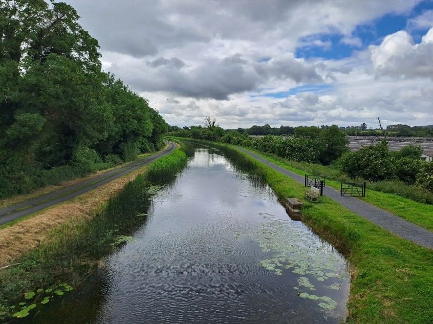
The Barrow Way is a 117 km (73 mile) long distance multi-user trail which follows the River Barrow from close to its source in the Slieve Bloom Mountains to the Celtic Sea at Waterford Harbour. This section of the trail (and river) follows a well-made and relatively flat trail between Goresbridge and Ballyteigelea.
0
0
White Mountain stands at 509 metres (1,670 ft), the highest point on the ridge running south from Blackstairs Mountain. The ridge makes a great walk or run and this southern side of the mountain tends to be much quieter than the popular northern side. Awesome views towards Mt Leinster.
0
0
Rathnure is a small village in rural Ireland at the eastern foot of the Blackstairs Mountain. On the R731 road it's accessible by bus which makes it a good start point for a mountain traverse. Monksgrange House is also in the village, a stately home built in 1769 which now houses an art gallery.
0
0

There are plenty of places to get refreshments: next to the old stone bridge, or in the nearby town itself. A perfect stop when walking the Barrow Way.
0
0

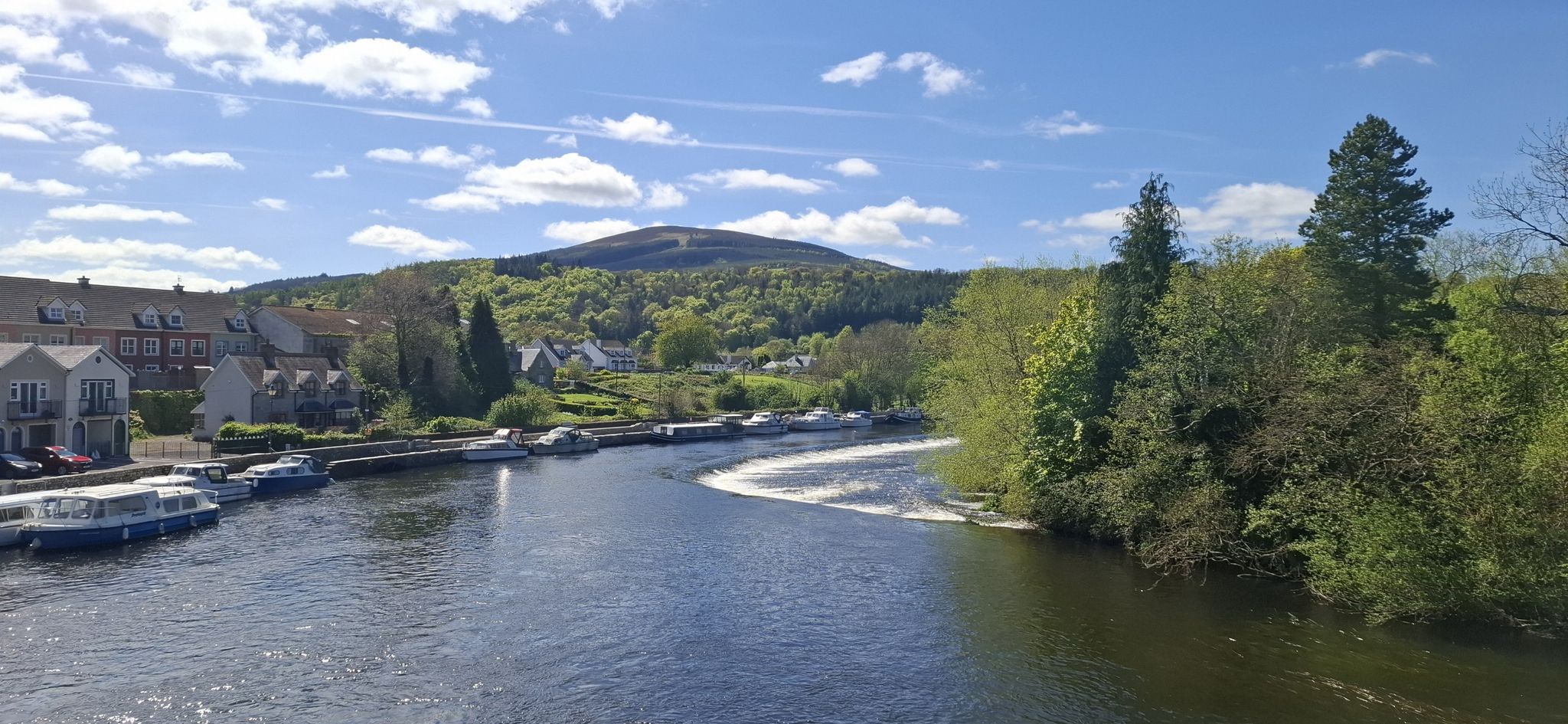
This is a scenic bridge across the beautiful River Barrow, a fine sight on both the Barrow Way and South Leinster Way long-distance trails. The river here marks the border between Counties Kilkenny and Carlow.
0
0

The Blackstairs Mountains (Irish: Na Staighrí Dubha) run roughly north/south along the border between County Carlow and County Wexford in Ireland. The highest peak is Mount Leinster with a total height of 2612 ft/ 796 metres. https://en.m.wikipedia.org/wiki/Blackstairs_Mountains
0
0
Car park with bench and information board. Starting point for the Brandon Hill Summit Walk.
1
0
Frequently Asked Questions
How many bus station hiking trails are available around Muinebeag?
There are 9 curated hiking routes accessible from bus stations around Muinebeag. These include a variety of options, from easy strolls to more moderate treks, allowing you to explore the diverse landscapes of County Carlow.
What is the overall rating for hiking in Muinebeag?
The komoot community highly rates the hiking experiences around Muinebeag, with an average score of 4.6 out of 5 stars from 120 ratings. Hikers often praise the scenic beauty of the River Barrow and the rewarding views from the Blackstairs Mountains.
Are there easy hiking trails accessible from bus stations in Muinebeag?
Yes, there are 7 easy routes available, perfect for a relaxed outing. Many of these follow the gentle towpaths of the River Barrow, offering serene lochs and charming bridges. A great example is the Ballykeenan Lock – Graiguenamanagh Bridge loop from Duiske Abbey, which is just over 5 km long.
Can I find circular hiking routes starting from bus stations in Muinebeag?
Absolutely. Many of the trails are designed as loops, bringing you back to your starting point. For instance, the Joyce's – Ballytiglea Bridge loop from Borris offers a pleasant 7.2 km circular walk, while the Saint Mullins – The Mullichain Café loop from Saint Mullins is another excellent option.
Are there family-friendly hiking routes near Muinebeag bus station?
Yes, the region offers several family-friendly options, particularly along the River Barrow. These routes are generally flat and well-maintained, suitable for various ages. The Ballykeenan Lock – Graiguenamanagh Bridge loop from Duiske Abbey is an easy, scenic choice that families can enjoy together.
What kind of landscapes can I expect on these bus station hikes?
You can expect a diverse range of landscapes. Many routes follow the tranquil River Barrow, offering views of its towpaths, locks, and rich biodiversity. Further afield, you'll find trails leading into the foothills of the Blackstairs Mountains, providing more challenging terrain and panoramic vistas. Areas like Kilbrannish Forest also offer beautiful woodland walks.
Are there any historical sites or landmarks to see on these trails?
Yes, the hiking routes often intertwine with historical elements. Along the Barrow Way, you'll encounter architectural interests like arched bridges and lock houses, as well as historical sites such as castles and abbeys. Notable landmarks in the wider area include Tinnahinch Castle and the charming settlement of Leighlinbridge.
Are there any routes that offer views of Mount Leinster?
Yes, several routes in the region provide stunning views of Mount Leinster, the highest peak in County Carlow. While some trails lead up the mountain itself, you can also find excellent viewpoints like Beautiful views of Mt Leinster that offer magnificent vistas across the surrounding counties.
Are there any challenging hikes from bus stations in Muinebeag?
For those seeking a more challenging experience, there are 2 moderate routes available. The Brandon Hill Summit – Beautiful views loop from Duiske Abbey is a good example, covering over 15 km with significant elevation gain, offering rewarding views from the summit.
Are the hiking trails around Muinebeag suitable for dogs?
Many of the outdoor areas and trails around Muinebeag, particularly the River Barrow towpaths and forest recreation areas like Kilbrannish Forest, are generally suitable for dogs. However, it's always recommended to keep dogs on a leash, especially in areas with livestock or wildlife, and to follow local signage regarding pet regulations.
Are there cafes or places to eat near the hiking trails?
Yes, you'll find charming villages and towns along many of the routes, such as Graiguenamanagh and Saint Mullins, which offer cafes and pubs. The Saint Mullins – The Mullichain Café loop from Saint Mullins specifically highlights a café along its route, providing a perfect stop for refreshments.
Where can I find more information about walking in County Carlow?
For additional details and resources on walking and hiking opportunities throughout County Carlow, you can consult the official Carlow Tourism walking guide. It provides comprehensive information on various trails and areas of interest: Walking in Carlow (PDF).
Most popular routes around Muinebeag
Most popular attractions around Muinebeag

Get inspired with the komoot mobile app


