The best traffic-free bike rides in Denali Wilderness
35
riders
5
rides
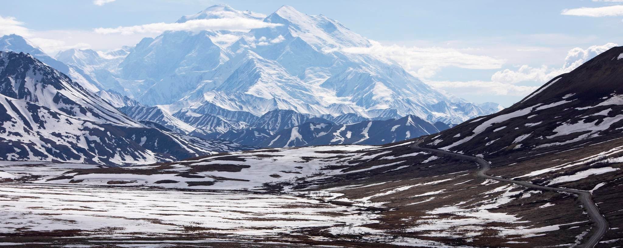
No traffic touring cycling routes in Denali Wilderness traverse a dramatic landscape, transitioning from boreal forest at lower elevations to vast tundra and glacial terrain at higher reaches. The region is dominated by the immense Alaska Range, featuring towering granite peaks and extensive glaciers, with Denali, North America's highest peak, as its centerpiece. The primary cycling artery, Denali Park Road, offers a 92-mile route through this wilderness, with private vehicle access restricted beyond mile 15, ensuring a serene experience for cyclists. This environment provides diverse cycling experiences, from sections of the challenging Denali Park Road to routes offering views of iconic features like Polychrome Pass.
Best no traffic touring cycling routes in Denali Wilderness
- The most popular no traffic touring cycling route is Mountain Vista Day Use Area to Polychrome Pass via Denali Park Road, a 66.6 miles (107.1 km) trail that takes 10 hours 31 minutes to complete. This difficult route traverses a significant portion of the Denali Park Road, offering expansive views across the tundra.
- Another top favourite among local touring cyclists is Teklanika View Point – View of the Teklanika River loop from Savage River Bus Stop, a difficult 31.6 miles (50.8 km) path. This loop provides scenic views of the Teklanika River and surrounding wilderness.
- Local touring cyclists also love the Visitor Center to Mountain Vista Day Use Area via Denali Park Road, a 24.5 miles (39.4 km) trail leading through the initial sections of Denali Park Road, often completed in about 2 hours 33 minutes.
- Touring cycling in Denali Wilderness is defined by vast tundra, the towering Alaska Range, and the unique access of the Denali Park Road. The network offers options for challenging multi-day adventures.
- The guide includes highly-rated routes that showcase the best of the region's landscape. More than 30 touring cyclists have used komoot to explore Denali Wilderness's varied terrain.
Last updated: July 9, 2026
5
riders
107km
10:31
1,590m
1,590m
Embark on a challenging touring bicycle journey from Mountain Vista Day Use Area towards Polychrome Pass, deep within Denali National Park. This difficult route spans 66.6 miles (107.1 km), guiding you through a dramatic landscape where taiga forest gives way to expansive tundra, offering sweeping views of the Alaska Range. You will conquer a significant 5226 feet (1593 metres) of elevation gain, with an estimated duration of 10 hours and 31 minutes to complete this immersive ride.
Before you set out, be aware that the Denali Park Road is currently closed to through traffic beyond Mile 43 due to the Pretty Rocks Landslide, meaning a direct cycling route to Polychrome Pass is not possible via the road itself. The park anticipates the road will reopen in 2027. To navigate this, you can utilize the park's transit buses, which are equipped with bike racks, allowing you to bypass closed sections or shorten your ride as needed.
This route offers a unique opportunity for wilderness immersion and exceptional wildlife viewing. As you cycle, keep an eye out for caribou, Dall sheep, and moose roaming the wide-open spaces. While the full road to Polychrome Pass is temporarily inaccessible, the journey to Mile 43 still provides spectacular scenery, showcasing the colorful mountains and vast Plains of Murie that define this iconic part of Denali National Park.
8
riders
Hard bike ride. Very good fitness required. Mostly paved surfaces. Suitable for all skill levels.

Sign up for free
6
riders
Hard bike ride. Very good fitness required. Mostly paved surfaces. Suitable for all skill levels.
11
riders
39.4km
02:33
540m
540m
Embark on a difficult touring cycling journey from the Visitor Center to Mountain Vista Day Use Area, covering 24.5 miles (39.4 km) with a substantial 1756 feet (535 metres) of elevation gain. This route offers a deep immersion into the Alaskan wilderness, promising panoramic views of the Savage River Valley and Mount Healy. You'll navigate a paved road, including the challenging "Government Hill" section, which contributes to the estimated 2 hours and 33 minutes duration. Keep an eye out for Mount McKinley, often visible from Mile 9 on clear days, as you pedal through Denali National Park's stunning scenery.
Before you set out, be aware that this touring cycling route shares the Denali Park Road with other vehicles, as there are no dedicated bike lanes. Denali's weather can shift quickly, so prepare for potential wind and colder temperatures, and remember that support services are limited along the way. It's wise to carry bear spray due to the possibility of encountering wildlife. Plan your start time to make the most of daylight and favorable conditions, ensuring you are well-equipped for this challenging ride.
This segment of Denali Park Road is renowned for its abundant wildlife viewing opportunities. As you cycle, you might spot moose, bears, Dall sheep, and caribou, making it a truly immersive experience in the park's ecosystem. The route provides a unique perspective on the vastness of Denali National Park and Preserve, connecting you directly with its natural wonders. It stands out as a challenging yet rewarding way to explore the Alaskan wilderness by bicycle.
Our route recommendations are based on thousands of hikes, rides, and runs completed by other people on komoot.
Start today with a free account
Your next adventure awaits.
Login or Signup
Popular around Denali Wilderness
Other adventures in Denali Wilderness


Tips from the Community

Built in 2005, the Denali Visitor Center and its surrounding campus are definitely worth a stop, either at the beginning or end of your trip. The center itself is the National Park Service's primary welcome and information center. Surrounding facilities include a restaurant, gift shop, bag check, bus stop, and train depot. The visitor center is open only during the summer and is located near the park entrance. During the summer, you can explore the exhibits, watch the park film, pay park admission, and speak with a ranger. During the fall, winter, and spring, the Murie Science and Learning Center (MSLC) serves as the park's winter visitor center. https://www.nps.gov/dena/planyourvisit/the-denali-visitor-center.htm
4
0

The Denali Visitor Center, located right at the entrance to Denali National Park, is the perfect starting point for your adventure in this rugged and fascinating landscape of Alaska. Here you will not only get useful information about the hiking trails and the wildlife, but you can also watch the park film Heartbeats of Denali, which will introduce you to the different facets of this breathtaking place. The exhibition in the center also gives you insights into the unique flora and fauna of the region. The area around the visitor center offers access to several popular hiking trails such as the Horseshoe Lake Trail and the Mt. Healy Overlook Trail. The Mt. Healy Overlook in particular rewards you after a steep climb with an impressive panoramic view of the park's vast landscape. There are also nearby trails for quieter hikes that lead through the dense forests and along the rivers and are ideal for relaxed exploration. A special highlight are the ranger-led tours and presentations that give you insights into the history of the park and its natural wonders. The Denali Visitor Center is not only an information point, but also a place that lets you immerse yourself in the unique atmosphere and the pristine nature of the wilderness - perfect for getting in the mood for the great Denali adventure.
2
0

This day use area doubles as the trailhead for the Savage River and Savage Alpine trails. It's most easily reached via the free Savage River Shuttle, a bus that does continuous loops from the park entrance to here and can also pick you up if you choose to hike one-way on the Savage Alpine Trail. If you have your own vehicle you can drive to this trailhead, but the limited parking fills up fast.
1
0

The Mountain Vista Day Use Area and Trailhead has a parking area, picnic tables, trail access to the Mountain Vista Loop and the Savage Alpine Trails, and is a stop on the free shuttle service from the park entrance. Many people who complete the Savage Alpine Trail will take the shuttle back to their cars at the other trailhead or the park entrance from here. On clear days you can get a fantastic views of Denali, the highest peak in North America, even though it is over 80 miles away. The Savage River Campground is also just down the road from the Mountain Vista Day Use Area.
0
0

The first few miles of Denali Park Road are paved and striped. The road has a few paved sections along the way, but the majority of the 92.5 mile route consists of dirt and gravel roads. It can be really dusty and muddy depending on the time of year (or even just the time of day), and trucks and buses use the roads during the dry months. Make sure you have a plan for staying visible and let vehicles pass safely.
0
0
There is a great view of the Teklanika River at this pull-off. This is also the location of the second-largest campground in the park. This spot has restrooms and potable water in the summer months.
0
0
At an elevation of 3,917 feet, Sable Pass is one of the several high points reaching nearly 4,000 feet along this section of Denali Park Road. This part of the road passes through an area of the park that is not as open to off-road exploring, so it is one of the best places to view wildlife. Likewise, this stretch of road is high enough that there are not many trees to block views, so you get great views of the surrounding mountains and landscape, too.
0
0
Polychrome Pass is a popular overlook and observation area along Denali Park Road. It's located at mile marker 45.8 and is the site of new bridge construction. Buses can only get here in the dry seasons, but you can attempt to run up here basically all year long.
0
0
Frequently Asked Questions
How many no-traffic touring cycling routes are available in Denali Wilderness?
There are several dedicated no-traffic touring cycling routes in Denali Wilderness, offering unique experiences. This guide features 4 routes, all rated as difficult, providing a challenging and rewarding adventure through the park's stunning landscapes.
What are the rules for cycling on the Denali Park Road to ensure a no-traffic experience?
The Denali Park Road is the primary cycling artery. Beyond mile 15, private vehicle access is restricted, making the majority of the road serene for cyclists. Traffic primarily consists of park buses and ranger vehicles. Cyclists can pedal the entire 92-mile length or use the park's bus system to cover sections. For detailed regulations and safety guidelines, it's advisable to check the official National Park Service website: nps.gov/dena/planyourvisit/cycling.htm.
Are there any family-friendly or beginner-level no-traffic cycling options in Denali Wilderness?
While the routes featured in this guide are rated as difficult, Denali National Park does offer frontcountry options for less strenuous rides. These include paved trails like the Roadside Bike Trail and flatter routes within campground loops near the park entrance. Bike rentals, including e-bikes, are available for shorter excursions, which can be suitable for families or beginners looking for a gentler experience.
What kind of wildlife can I expect to see on a no-traffic bike tour in Denali Wilderness?
Denali is teeming with wildlife, and cycling offers incredible viewing opportunities. You might encounter large mammals like grizzly bears, black bears, moose, caribou, Dall sheep, and wolves. Smaller creatures such as marmots, ptarmigans, and porcupines also inhabit the area. Always be aware of your surroundings and follow wildlife safety protocols.
What are some scenic viewpoints or natural monuments I can visit along the no-traffic routes?
Many routes offer breathtaking views. For instance, the route from Mountain Vista Day Use Area to Polychrome Pass takes you past the vibrant, multicolored hills of Polychrome Pass. Other notable natural features in the region include Sable Pass and The Triple Lakes, offering expansive vistas and stunning reflections.
Are there any loop routes for no-traffic touring cycling in Denali Wilderness?
Yes, there are loop options available. For example, the route Teklanika View Point – View of the Teklanika River loop from Savage River Bus Stop offers a substantial loop experience, allowing you to return to your starting point after exploring the scenic Teklanika River area.
What is the longest no-traffic touring cycling route featured in this guide?
The longest no-traffic touring cycling route in this guide is the journey from Mountain Vista Day Use Area to Polychrome Pass via Denali Park Road, covering approximately 107 kilometers (66 miles) with significant elevation gains.
What is the best time of year for no-traffic touring cycling in Denali Wilderness?
The best time for touring cycling in Denali Wilderness is typically during the summer months, from late May to early September, when the Denali Park Road is fully open and weather conditions are most favorable. This period offers the longest daylight hours and the highest chances of clear views of Denali and abundant wildlife sightings.
Are there facilities like campgrounds or places to resupply along the no-traffic cycling routes?
Yes, campgrounds along the Denali Park Road provide convenient spots for bike-packing. These are typically equipped with bear-resistant food storage facilities. It's essential to plan your resupply points carefully, as services can be limited within the park's interior. Always carry sufficient water and food for your planned route.
What do other touring cyclists enjoy most about the no-traffic routes in Denali Wilderness?
The komoot community highly values the immersive wilderness experience and the unparalleled natural beauty of Denali. Cyclists frequently praise the opportunity to witness diverse landscapes, from boreal forest to vast tundra, and the thrill of encountering abundant wildlife in their natural habitat, all while enjoying the serenity of restricted vehicle access on the Denali Park Road.
Are there any specific attractions or points of interest near the start of the routes?
Near the park entrance and the start of some routes, you can find points of interest like the Savage River Footbridge and the Savage River Day Use Area. These areas offer shorter trails and facilities before embarking on longer journeys into the park's interior.
Most popular attractions in Denali Wilderness

Get inspired with the komoot mobile app


Explore more
Browse the best Cycling routes in other regions.
