The best hikes from bus stations in Inyo National Forest
4.6
(241)
4,614
hikers
24
hikes
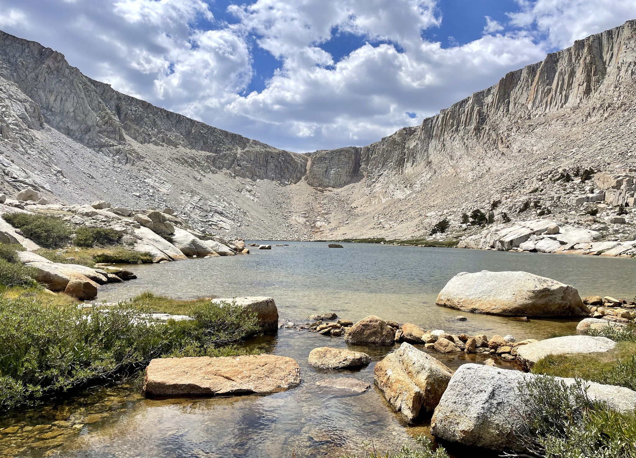
Bus station hiking trails in Inyo National Forest offer access to a vast landscape characterized by towering peaks, alpine lakes, and diverse ecosystems. The forest spans over two million acres, with elevations ranging from 3,900 to 14,495 feet, including Mount Whitney, the highest peak in the contiguous United States. This varied terrain supports everything from semi-arid deserts to high-alpine meadows, providing a wide array of hiking experiences. The region is defined by its granite peaks, pristine waterways, and unique geological formations.
Best bus station hiking trails in Inyo National Forest
- The most popular bus station hiking route is Shadow Creek, John Muir and Pacific Crest Trail Loop via Agnew Meadow, a 25.1 miles (40.5 km) trail that takes 12 hours 26 minutes to complete. This challenging loop offers extensive views and covers significant sections of two iconic long-distance trails.
- Another top favourite among local hikers is High Trail, a moderate 7.1 miles (11.5 km) path. This route features a steady ascent and panoramic vistas of the surrounding Sierra Nevada mountains.
- Local hikers also love the Chocolate Lakes loop, a 6.7 miles (10.7 km) trail leading through alpine scenery, often completed in about 3 hours 21 minutes.
- Hiking in Inyo National Forest is defined by towering mountains, pristine alpine lakes, and ancient forests. The network offers options for various ability levels, from easy walks to challenging multi-day treks.
- The routes in Inyo National Forest are highly rated by the komoot community with an average score of 4.7 stars from more than 250 reviews. More than 4800 hikers have used komoot to explore Inyo National Forest's varied terrain.
Last updated: July 8, 2026
2
hikers
40.5km
12:26
1,370m
1,070m
The Shadow Creek, John Muir and Pacific Crest Trail Loop via Agnew Meadow is a challenging yet incredibly rewarding journey through the High Sierra. You'll experience a dramatic shift from lush meadows and pine forests to rugged alpine landscapes, with highlights like the serene Shadow Lake offering clear views of the Minarets and Mount Ritter. The trail weaves past several glacier-fed lakes, including Olaine Lake and Ediza Lake, providing a constant panorama of natural beauty.
This difficult 25.1-mile (40.5 km) hike involves a substantial 4503 feet (1372 metres) of elevation gain, typically taking around 12 hours and 26 minutes to complete. During peak season, accessing the Agnew Meadows trailhead often requires a mandatory shuttle bus, and wilderness permits are essential for any overnight stays. The best window for this adventure is late summer, from August to October, to avoid snow and reduce mosquito activity.
What makes this loop truly special is its integration of sections from two of America's most famous long-distance routes: the Pacific Crest Trail and the John Muir Trail. This allows you to experience the grandeur of the Ansel Adams Wilderness and its iconic vistas, making it a memorable trek for advanced hikers seeking a deep dive into the High Sierra's natural splendor.
4
hikers
11.5km
03:29
560m
150m
The High Trail offers a quintessential high-country hiking experience, guiding you through the dramatic landscapes of the Ansel Adams Wilderness. This moderate 7.1-mile (11.5 km) hike, with its 1829 feet (557 metres) of elevation gain, promises a concentrated dose of adventure and unparalleled views, including a fantastic perspective of Shadow Creek falls from the Pacific Crest Trail. You'll traverse rugged terrain, often above the tree line, where the scenery shifts from exposed ridges to alpine meadows, all while gaining a sense of solitude away from more crowded paths.
Planning your visit means preparing for a true mountain environment. The High Trail Trailhead & stock area serves as your starting point, and while parking is generally available, it's wise to arrive early, especially on weekends. Given the high elevation, be ready for rapidly changing mountain weather, which can include cold temperatures and even snow, even during summer months. Always check conditions before you go and carry adequate layers and water for the 3 hours and 29 minutes estimated duration.
What makes the High Trail notable is its ability to deliver a challenging and rewarding wilderness experience in a relatively compact timeframe. It's an excellent route for ambitious backpackers looking to develop their alpine skills and enjoy the unique beauty of the Sierra Nevada. The trail provides a sense of exploration and immersion in nature that's hard to find on more accessible routes, making it a standout choice for those seeking genuine high-altitude adventure.

Sign up for free
26
hikers
10.7km
03:21
420m
420m
Hike the Chocolate Lakes loop in Inyo National Forest, a 6.7-mile moderate trail with 1387 feet of gain, featuring stunning alpine lakes and
3
hikers
12.9km
03:48
380m
380m
Hike the moderate 8.0-mile Red Cones Loop via John Muir Trail, gaining 1254 feet through volcanic terrain and old-growth forests.
1
hikers
3.93km
01:04
50m
60m
Hike the moderate 2.4-mile Lee Vining Creek Trail and town loop, offering riparian views, desert scrub, and vistas of Mono Lake.
Get access to more routes and recommendations from other explorers.
Sign up for free
Already have an account?
Our route recommendations are based on thousands of hikes, rides, and runs completed by other people on komoot.
Start today with a free account
Your next adventure awaits.
Login or Signup
Popular around Inyo National Forest



Other adventures in Inyo National Forest


Tips from the Community

Chocolate Lake is not made of chocolate but serves crystal clear water with sweet views of Cloudripper Mountain and Chocolate Peak. This is the first and smaller lake of the three Chocolate Lakes. Take your time here, but remember that there is much more to see.
1
0
This is the third and biggest of the Chocolate Lakes. Each one of the lakes has its beauty and a different perspective of the mountains. The lakes have this name because they sit in front of Chocolate Peak, which is formed by rocks of a soft brown color, looking like a chocolate mountain.
2
0

Olaine Lake is a beautiful alpine lake. It is surrounded by woods and mountains. The path from the nearest parking lot is not too challenging, so it is definitely worth the effort for the great scenery.
0
0
Long Lake is one of several lakes surrounding Chocolate Peak. From the trail, you are treated to wonderful views of Long Lake, Cloudripper, Chocolate Peak and Mount Goode.
0
0

Don’t spend too much time down here! Or else you might pass out from the breathtaking views!! Here, Mt Goode dominates the skyline to the west, and Picture Puzzle watches closely over the lake from the east!! OH OH OH- and can we talk about the fact that there is an ISLAND in this lake?! It’s a little baby island!!
1
0
I really enjoyed the views from this lake a chocoLOT 😆 Cloudripper really takes the (chocolate)cake as far as mountain vistas goes here! Oh you thought we were done with the chocolate puns? Haha, nope- I’ve still got a few Twix up my sleeve 😉
1
0
I know, I know… You walked all the way here for a lake made of chocolate, and all you got was this epic view onto Cloudripper. Everything is a trade off, I suppose 🤷♀️
0
0
Frequently Asked Questions
How many bus-accessible hiking trails are available in Inyo National Forest?
There are nearly 30 hiking routes in Inyo National Forest that are accessible from bus stations, offering a convenient way to explore the region's diverse landscapes without a car. These routes range from easy strolls to challenging multi-day treks.
Are there easy hiking options accessible by bus for beginners or families?
Yes, Inyo National Forest offers a good selection of easy hikes from bus stations, with 12 routes rated as easy. For a pleasant, shorter option, consider the Lee Vining Creek Trail and town loop, which provides gentle terrain and scenic views suitable for families.
What kind of landscapes can I expect to see on bus-accessible hikes in Inyo National Forest?
Hikes accessible by bus in Inyo National Forest traverse a wide array of stunning landscapes. You can expect to encounter towering Sierra Nevada peaks, pristine alpine lakes, diverse ecosystems ranging from semi-arid deserts to high-alpine meadows, and unique volcanic formations. Many trails offer breathtaking views of the Eastern Sierra.
Are there any circular routes I can do from a bus stop?
Yes, several circular routes are accessible from bus stops, allowing you to start and end your hike at the same point. A notable moderate option is the Chocolate Lakes loop, offering a rewarding experience with varied scenery. For a more challenging multi-day adventure, consider the Shadow Creek, John Muir and Pacific Crest Trail Loop via Agnew Meadow.
What are some notable natural attractions or landmarks I can see along these bus-accessible trails?
Many bus-accessible trails lead to or offer views of significant natural attractions. You might encounter stunning alpine lakes like Thousand Island Lake or Twin Lakes. The unique tufa towers of Mono Lake (South Tufa Area) are also accessible, offering a distinct geological experience. Some routes provide distant views of majestic peaks like Mount Whitney.
Is it possible to hike with dogs on trails accessible by bus in Inyo National Forest?
Many trails in Inyo National Forest are dog-friendly, though regulations can vary by specific area, especially within wilderness areas or near water sources. Always check local signage and regulations before heading out. Generally, dogs must be on a leash. Be mindful of wildlife and pack out all waste.
What is the best time of year to hike from bus stations in Inyo National Forest?
The best time to hike is typically from late spring through early fall (May to October). During these months, trails are generally free of snow, and the weather is more predictable. High-elevation trails may still have snow into early summer. Fall offers stunning foliage, especially in areas with aspen trees.
Are there any moderate difficulty hikes accessible by bus?
Yes, the majority of bus-accessible routes, 13 out of 27, are rated as moderate. These trails offer a good balance of challenge and reward. An example is the High Trail, which provides significant elevation gain and expansive views without being overly strenuous for experienced hikers.
What should I pack for a bus-accessible hike in Inyo National Forest?
Given the varied terrain and elevations, always pack layers of clothing, plenty of water, snacks, sun protection (hat, sunscreen), a map and compass or GPS device, and a first-aid kit. Even on day hikes, weather can change rapidly in the mountains, so be prepared for cooler temperatures or rain. For longer routes, consider a water filter.
What do other hikers enjoy most about hiking in Inyo National Forest?
The Inyo National Forest is highly rated by the komoot community, with an average score of 4.7 stars from over 250 ratings. Reviewers often praise the breathtaking alpine scenery, the solitude found on many trails, the crystal-clear lakes, and the diverse range of ecosystems that make each hike a unique experience.
Are there any long-distance or challenging hikes I can start from a bus station?
Yes, for experienced hikers seeking a challenge, there are 2 difficult routes accessible by bus. The Shadow Creek, John Muir and Pacific Crest Trail Loop via Agnew Meadow is a prime example, offering a multi-day backpacking experience through some of the most iconic wilderness areas, including sections of the famous John Muir Trail and Pacific Crest Trail.
Can I find amenities like visitor centers or cafes near bus-accessible trailheads?
While direct amenities at every bus stop trailhead are not guaranteed, major hubs like Mammoth Lakes or areas near Mono Lake often have visitor centers and cafes. For example, the Schulman Grove Visitor Center in the Ancient Bristlecone Pine Forest or the Mono Basin Scenic Area Visitor Center can be starting points for hikes and offer facilities. It's always best to check specific bus routes and their proximity to services.
Most popular routes in Inyo National Forest
Most popular attractions in Inyo National Forest

Get inspired with the komoot mobile app


