The best traffic-free bike rides in St. Charles County
4.6
(84)
1,908
riders
36
rides
No traffic road cycling routes in St. Charles County, Missouri, are primarily characterized by the extensive network of greenways and the Katy Trail State Park, which follows the Missouri River. The terrain is largely flat, built on former railroad corridors, offering accessible paths through diverse landscapes. The region features river views, woodlands, and open green spaces, providing a varied backdrop for cycling.
Best no traffic road cycling routes in St. Charles County
- The most popular no traffic road cycling route…
Last updated: October 10, 2026
5.0
(1)
81
riders
39.9km
02:44
50m
40m
If you're looking for a wonderfully flat and scenic road cycling experience, the Katy Trail: St. Charles to Machens is a fantastic option. This route follows the Missouri River, treating…
24
riders
49.9km
02:47
240m
240m
The Katy Trail and Weldon Spring Loop offers a dynamic road cycling experience, blending the famously flat, crushed limestone surface of the Katy Trail with the more rugged, hilly terrain…

12
riders
52.9km
03:07
80m
80m
The Katy Trail and Earth City Levee Loop offers a unique blend of surfaces and scenery for cyclists near St. Louis. You'll ride along the historic Katy Trail's crushed limestone,…
4.5
(4)
121
riders
Moderate road ride. Great for any fitness level. Some segments of this route may be unpaved and difficult to ride.
32
riders
Moderate road ride. Good fitness required. Mostly well-paved surfaces and easy to ride.
Get access to more routes and recommendations from other explorers.
Already have an account?
Our route recommendations are based on thousands of hikes, rides, and runs completed by other people on komoot.
Start today with a free account
Your next adventure awaits.




Tips from the Community

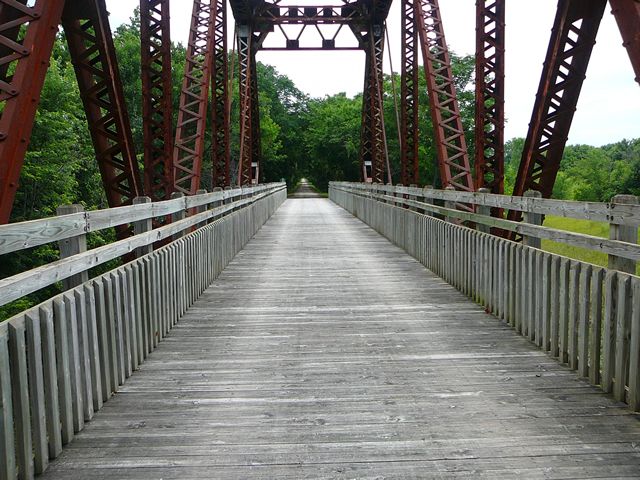
take the time to stop and enjoy the view while crossing the bridge
1
0

Fantastic bike path over the Daniel Boone Bridge. Great views of the Missouri.
1
0
Lovely ride through the valley
0
0
Country club atmosphere, but the well-maintained roads make for a great ride
0
0
Frequently Asked Questions
How many traffic-free road cycling routes are available in St. Charles County?
St. Charles County offers a wide selection of traffic-free road cycling routes, with over 35 options available. These routes cater to various skill levels, from easy to moderate, ensuring there's something for every cyclist looking for a car-free experience.
What kind of bike is best suited for the traffic-free routes in St. Charles County?
While many routes are paved, the iconic Katy Trail, which forms a significant part of the traffic-free network, is a crushed limestone path. For optimal comfort and stability on the Katy Trail, especially after rain, tires 38mm-45mm wide are recommended. However, road bikes with tires 25mm or wider can generally manage the well-packed surface.
Where can I find parking for these traffic-free cycling routes?
Many trailheads for the traffic-free routes, especially along the Katy Trail and various greenways, offer dedicated parking. For instance, the St. Charles trailhead for the Katy Trail is a popular starting point with parking. Parks like Klondike Park and Frontier Park also provide convenient access and parking for cyclists.
Are there family-friendly traffic-free cycling routes in St. Charles County?
Yes, St. Charles County is excellent for family-friendly cycling. Many sections of the Katy Trail are largely flat and scenic, making them ideal for all ages. Additionally, paved greenways like the Boschert Greenway offer gentle, car-free paths perfect for families. Look for routes marked as 'easy' for the most suitable options.
Can I find circular, traffic-free road cycling routes?
Yes, there are several excellent circular routes that combine traffic-free sections. For example, the Katy Trail and Weldon Spring Loop offers a moderate 49.9 km ride, while the Katy Trail and Earth City Levee Loop provides a 52.9 km option, both incorporating car-free paths.
What natural features or attractions can I see along these routes?
Many traffic-free routes offer stunning views of the Missouri River, especially along the Katy Trail. You can also explore diverse natural habitats including savannas, wetlands, and woodlands. Notable highlights include the Missouri River Overlook and the unique landscape of Klondike Park, known for its white silica sand and river vistas.
Are there historical sites accessible from the traffic-free routes?
Absolutely. The region is rich in history. Historic St. Charles, located at the eastern end of the Katy Trail, was the starting point for the Lewis and Clark expedition. You can also find the Historic Daniel Boone Home near Defiance, offering a glimpse into early 19th-century life, often accessible via nearby trail networks.
When is the best time of year to enjoy traffic-free road cycling in St. Charles County?
Spring and fall are generally the best times for cycling in St. Charles County. The weather is mild, and the natural scenery is particularly beautiful, with blooming wildflowers in spring and vibrant fall foliage. Cycling during these seasons also helps avoid the peak heat of summer.
Are there any less crowded traffic-free routes or sections?
While the Katy Trail is popular, its extensive length means you can often find quieter sections, especially further away from major trailheads like St. Charles. Exploring some of the smaller greenways or park trails during off-peak hours (weekdays, early mornings) can also provide a more serene experience.
Are there places to stop for food or refreshments along the routes?
Yes, especially along the Katy Trail, you'll find charming towns with cafes and restaurants. Historic St. Charles offers numerous dining options right at the trailhead. Local shops like Bike Stop Cafe also provide rentals, gear, and repair services, often conveniently located near the trails.
What do other road cyclists enjoy the most about traffic-free cycling in St. Charles County?
The komoot community highly rates the cycling experience in St. Charles County, with an average score of 4.48 stars. Reviewers often praise the extensive network of car-free paths, the scenic Missouri River views, and the opportunity to explore historic towns and diverse natural landscapes without vehicle traffic.
Are there any easy, beginner-friendly traffic-free routes?
Yes, many of the traffic-free routes are suitable for beginners. The Katy Trail offers long, flat sections perfect for those new to cycling or looking for a relaxed ride. For example, the Chesterfield Settlers Cemetery – Le Cave Memorial Trailhead loop is an easy 41.3 km route with minimal elevation gain, ideal for beginners.
Most popular routes in St. Charles County
Most popular attractions in St. Charles County

Get inspired with the komoot mobile app


Didn’t find what you were looking for?
Check out more Road cycling routes throughout St. Charles County below and find the perfect route in your destination.
Explore more
Browse the best Road cycling routes in other regions.
