The best traffic-free bike rides around Roannes-Saint-Mary
4.5
(157)
5,375
riders
44
rides
No Traffic road bike trails around Roannes-Saint-Mary are characterized by diverse and challenging terrain within the Cantal department of the Auvergne-Rhône-Alpes region. The area is part of the Parc Régional des Volcans d'Auvergne, featuring ancient volcanic landscapes, numerous valleys, and high-altitude plateaus. Road cycling routes here involve repeated ascents and descents on quiet roads, offering varied topography suitable for different skill levels.
Best no traffic road cycling routes around Roannes-Saint-Mary
- The most popular no traffic road cycling route is Aurillac…
Last updated: July 6, 2026
3.0
(1)
103
riders
40.5km
02:08
760m
760m
Moderate road ride. Good fitness required. Mostly well-paved surfaces and easy to ride.
4.4
(8)
43
riders
64.2km
03:34
1,240m
1,240m
Hard road ride. Very good fitness required. Mostly well-paved surfaces and easy to ride.

Sign up for free
16
riders
44.2km
02:16
560m
560m
Moderate road ride. Good fitness required. Mostly well-paved surfaces and easy to ride.
4.0
(1)
16
riders
54.9km
02:56
970m
970m
Hard road ride. Very good fitness required. Mostly well-paved surfaces and easy to ride.
5.0
(7)
11
riders
68.6km
03:23
1,000m
1,000m
Hard road ride. Very good fitness required. Mostly well-paved surfaces and easy to ride.
Get access to more routes and recommendations from other explorers.
Sign up for free
Already have an account?
Our route recommendations are based on thousands of hikes, rides, and runs completed by other people on komoot.
Start today with a free account
Your next adventure awaits.
Login or Signup
Popular around Roannes-Saint-Mary

Tips from the Community

Located in the heart of the Jordanne valley, Lac des Graves displays an exceptional and preserved setting. It's an ideal place for a walk or nap by the water!
0
0

I recommend the visit of the castle of Anjony overlooking the valley from its 40m high, with its 3 levels of rooms with rich furniture and its round tower!
0
0

A truffade a sweet/salty pancake
0
0

Located in the Jordanne valley, the Château de Fabrègues dates back to the 10th century, even though it was rebuilt in the 19th century. Its classic French style is remarkable and, although unfortunately it cannot be visited, it is worth taking a short detour to admire its facade.
0
0
The Château Saint-Étienne dominates the town of Aurillac from its hill. The tower dates from Carolingian times. Few elements of the medieval castle remain, due to a fire in the early 19th century. Rebuilt at the end of the century, it now houses the Volcanoes Museum, a must visit if you are in the region! The castle's English gardens are perfect for a stroll.
0
0

Quiet road on the ridges between Aurillac and Saint-Cirgues de Jordanne, with magnificent views.
1
0

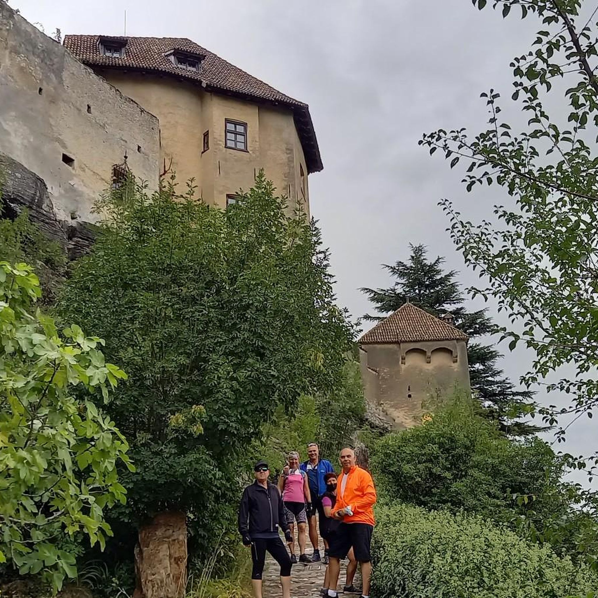
very beautiful village with its castle. Ranked among the most beautiful villages in France
0
0
Frequently Asked Questions
How many no-traffic road cycling routes are available around Roannes-Saint-Mary?
There are over 40 dedicated no-traffic road cycling routes around Roannes-Saint-Mary listed in this guide. These routes offer a variety of distances and elevations, allowing you to explore the stunning volcanic landscapes of the Cantal department without the distraction of heavy vehicle traffic.
What makes the road cycling routes around Roannes-Saint-Mary particularly traffic-free?
The region benefits from an extensive local road network, often described as a 'labyrinth' of quiet country lanes. Many routes utilize these less-trafficked roads, and specific sections of routes like the V74 (La Grande Traversée du Volcan à Vélo) are designed to minimize encounters with cars, offering a serene cycling experience through the Parc naturel régional des Volcans d'Auvergne.
Are there any easy or beginner-friendly no-traffic road cycling routes?
Yes, while the Cantal is known for its challenging terrain, there is at least one easy route available. For example, the Col de la Croix de Cheules – Route des Crêtes loop from Aurillac is a moderate option that offers a good balance of challenge and accessibility, covering 35.8 km with 571 meters of elevation gain.
What is the best time of year to enjoy no-traffic road cycling in Roannes-Saint-Mary?
The best time to cycle in the Cantal region is generally from late spring to early autumn (May to October). During these months, the weather is typically more favorable, and the high-altitude passes are clear of snow. The landscapes, from verdant hills to vast pasturelands, are particularly beautiful, offering comfortable conditions for exploring the quiet roads.
What kind of landscapes can I expect on these traffic-free routes?
You'll experience diverse and stunning volcanic landscapes. The routes often traverse the Parc Régional des Volcans d'Auvergne, offering panoramic views of the Monts du Cantal, rolling hills, and poetic country lanes. Expect repeated ascents and descents, with breathtaking vistas from many passes and plateaus, giving the impression of cycling through ever-changing scenery.
Are there any notable points of interest or attractions along the no-traffic cycling routes?
Yes, the region is rich in natural beauty and cultural sites. You might pass through charming villages like Marcolès or enjoy views of the Cantal mountains from sites like La Capelotte. The V74 route itself, which links the Lot and Allier valleys, offers numerous scenic points. The area is also close to Aurillac, a larger town with its own attractions.
Where can I find parking for these traffic-free cycling routes?
Many routes, especially those starting or passing through towns like Aurillac, will have designated parking areas. For routes like the V74, it's advisable to check local information for specific parking facilities at trailheads or nearby villages. Aurillac, being a larger hub, offers various parking options suitable for accessing routes in the vicinity of Roannes-Saint-Mary.
Can I find cafes or restaurants along the no-traffic road cycling routes?
While many routes utilize quiet country roads, you will often find opportunities for refreshments in the villages and towns they pass through or near. Larger towns like Aurillac offer a full range of amenities. For specific routes, it's a good idea to check the route details for points of interest like Le Manoir de Marcolès, which might include cafes or restaurants.
What is the difficulty level of the no-traffic road cycling routes in this area?
The routes around Roannes-Saint-Mary offer a range of difficulties. While there is one easy route, the majority are classified as moderate (23 routes) or difficult (17 routes). This reflects the region's hilly topography with significant ascents and descents, making it ideal for cyclists seeking a rewarding challenge. An example of a difficult route is the Col de la Croix de Cheules – Col de Légal loop from Aurillac, which covers 89.4 km with over 1600 meters of climbing.
Are there any circular no-traffic road cycling routes available?
Yes, many of the routes are designed as loops, allowing you to start and finish at the same point. For instance, the Aurillac – Col de la Croix de Cheules loop from Aurillac is a difficult circular route covering nearly 64 km. This design is convenient for exploring the region without needing to arrange return transport.
What do other cyclists say about road cycling in Roannes-Saint-Mary?
The area is highly rated by the komoot community, with an average score of 4.6 stars from over 145 reviews. Cyclists often praise the stunning volcanic landscapes, the challenging yet rewarding climbs, and the quiet, picturesque roads that offer a true sense of escape and immersion in nature.
Is public transport available to reach the starting points of these routes, especially with a bike?
Aurillac serves as a key transport hub in the region. While specific information on bike transport on local public transport (buses, regional trains) needs to be verified with local operators, it's often possible to reach Aurillac by train, which may accommodate bikes. From Aurillac, you can then access many of the routes listed in this guide, such as the Aurillac – View of Oyez Castle loop from Aurillac.
Most popular routes around Roannes-Saint-Mary
Most popular attractions around Roannes-Saint-Mary

Get inspired with the komoot mobile app


Explore more
Browse the best Road cycling routes in other regions.
