The best traffic-free bike rides around Thézac
4.0
(3)
31
riders
4
rides
Gravel biking around Thézac offers diverse terrain across the Lot-et-Garonne department. The region is characterized by rolling hills, extensive vineyards, and wooded areas, providing varied surfaces for cycling. Routes often feature a mix of unpaved segments and quiet roads, suitable for no traffic gravel bike trails. The landscape includes the scenic Lot River valley and the undulating Quercy hills, offering both ascents and descents.
Best no traffic gravel bike trails in Thézac
- The most popular no traffic gravel bike trail…
Last updated: October 20, 2026
4.0
(1)
7
riders
74.6km
04:28
390m
390m
Moderate gravel ride. Good fitness required. Mostly paved surfaces. Suitable for all skill levels.
6
riders
48.2km
02:53
320m
320m
Moderate gravel ride. Good fitness required. Mostly paved surfaces. Suitable for all skill levels.

3.0
(1)
8
riders
46.9km
02:53
170m
170m
Moderate gravel ride. Good fitness required. Mostly paved surfaces. Suitable for all skill levels.
3
riders
29.1km
01:47
180m
180m
Moderate gravel ride. Good fitness required. Mostly paved surfaces. Suitable for all skill levels.
5.0
(1)
2
riders
Moderate gravel ride. Good fitness required. Mostly paved surfaces. Suitable for all skill levels.
Our route recommendations are based on thousands of hikes, rides, and runs completed by other people on komoot.
Start today with a free account
Your next adventure awaits.
Popular around Thézac

Tips from the Community

🏛️ Construction: 18-19 AD The arch was built around 18-19 AD, during the reign of Emperor Tiberius. It stood at the entrance to the Roman bridge crossing the Charente, at the outlet of the Via Agrippa, which connected Lyon to Saintes. It is therefore not truly a "triumphal arch": it was both a road monument and a monumental gate marking the entrance to Mediolanum Santonum, the capital of Roman Aquitaine. 👤 Who had it built? The arch was financed by Caius Julius Rufus, a Romanized notable from Saintonge. He dedicated it to Tiberius as well as his nephew Germanicus. The inscriptions engraved on the entablature still allow us today to know the figures to whom it was dedicated. The name "Arch of Germanicus" therefore comes from this dedication, and not from the fact that Germanicus personally had the arch built or crossed it. 🏗️ A rather exceptional monument The arch has two bays, likely allowing for the differentiation of traffic flows. It measures approximately 15 m high by 16 m wide. Its Corinthian and composite capitals bear witness to particularly meticulous Roman architecture. It constituted a true demonstration of the power and Romanization of Saintes. ⚠️ The moment the arch almost disappeared This is probably the most interesting episode in its history. For centuries, the arch was always located at the level of the Roman bridge and then the medieval bridge, on the right bank of the Charente. In the 19th century, the old bridge had become dilapidated. When it was decided to demolish it, around 1843, the arch was also threatened with destruction. It was then that Prosper Mérimée, Inspector General of Historical Monuments, intervened. He advocated for its preservation and arranged for its dismantling, relocation, and reassembly on the new bank. Another figure is also associated with this preservation: Victor Hugo, who stayed in Saintes in September 1843 and intervened in favor of the monument's conservation with Mérimée. 📍 Why is the arch no longer exactly in its ancient location? The arch we see today, on Place Bassompierre, is therefore no longer in its original location. It was moved a few dozen meters during the transformation of the quays and the disappearance of the old bridge. It was dismantled stone by stone and then reassembled in order to preserve it. It is now located in the immediate vicinity of the ancient Roman bridge crossing. 🏛️ Protection The Arch of Germanicus was finally classified as a historical monument in July 1905. An interesting detail The Crazannes quarries, located near Saintes, supplied a limestone widely used in the region's ancient constructions. Crazannes stone was notably used for monuments such as the Arch of Germanicus. In summary: 18-19 → construction of the arch at the entrance to the Roman bridge ↓ Antiquity → Middle Ages → the arch remains associated with the crossing of the Charente ↓ 1843 → demolition of the old bridge and threat to the arch ↓ 1843-1844 → Mérimée's intervention and relocation of the arch ↓ 1905 → classified as a Historical Monument
0
0
The port of Ribérou is a major heritage site in Saujon, bearing witness to a prosperous maritime past linked to the salt and wine trade. Transformed in the 19th century by ambitious works, it has now been reinvented as a place for living, relaxation, and preserving local history. 🛶 Origins and the Middle Ages The port of Ribérou takes its name from the Latin word ripa ("riverbank") or the Occitan word ribèira ("river"). It is located at the head of the Seudre estuary. It existed as early as the 11th century and became an important river and sea port thanks to its strategic position at the head of the estuary, used particularly for the salt trade—then called "white gold"—a highly sought-after product for preserving food. 🚢 Medieval Period and International Trade With the opening of British markets during the reigns of Eleanor of Aquitaine and Henry II Plantagenet, ships laden with wool, salt, wine, and other goods flocked to Ribérou. In the 16th century, the port exported local wines (such as cognac and pineau) throughout Europe. In 1577, during the Wars of Religion, the port was a strategic site: troops were stationed there, and battles took place. 🏗️ Decline, Reconstruction, and the 19th Century The estuary gradually silted up, making navigation difficult. By 1691, only smaller vessels could dock there. During the French Revolution, the sale of the tidal mill, which helped remove sediment, worsened the silting, leading to the port's decline. A modernization project began in 1822, but it wasn't until 1839 that an ambitious program was launched under the impetus of Jules Dufaure—a native of Saujon and Minister of Public Works—with the construction of sturdy quays, slipways, a lock bridge (marking the boundary between fresh and salt water), and reception facilities. In 1842, the work was completed, and the main quay was named Quai Dufaure in honor of this political support. 📉 Gradual Decline and Modernization The arrival of the railway in 1876 and the persistent problems of silting led to a decline in the port's traditional commercial activity, already facing competition from other transport networks. In the 20th century, the port gradually lost its economic importance but remained active for traditional fishing and became a place for pleasure boating, leisure, and local culture. Urban and tourism development projects (particularly in 2011–2012) modernized the port while preserving its historical charm. 🌊 Today The port of Ribérou is now a small fishing and pleasure port, much appreciated for its walks along the Seudre River, water sports (canoeing, kayaking, paddleboarding, etc.), and seasonal events.
0
0


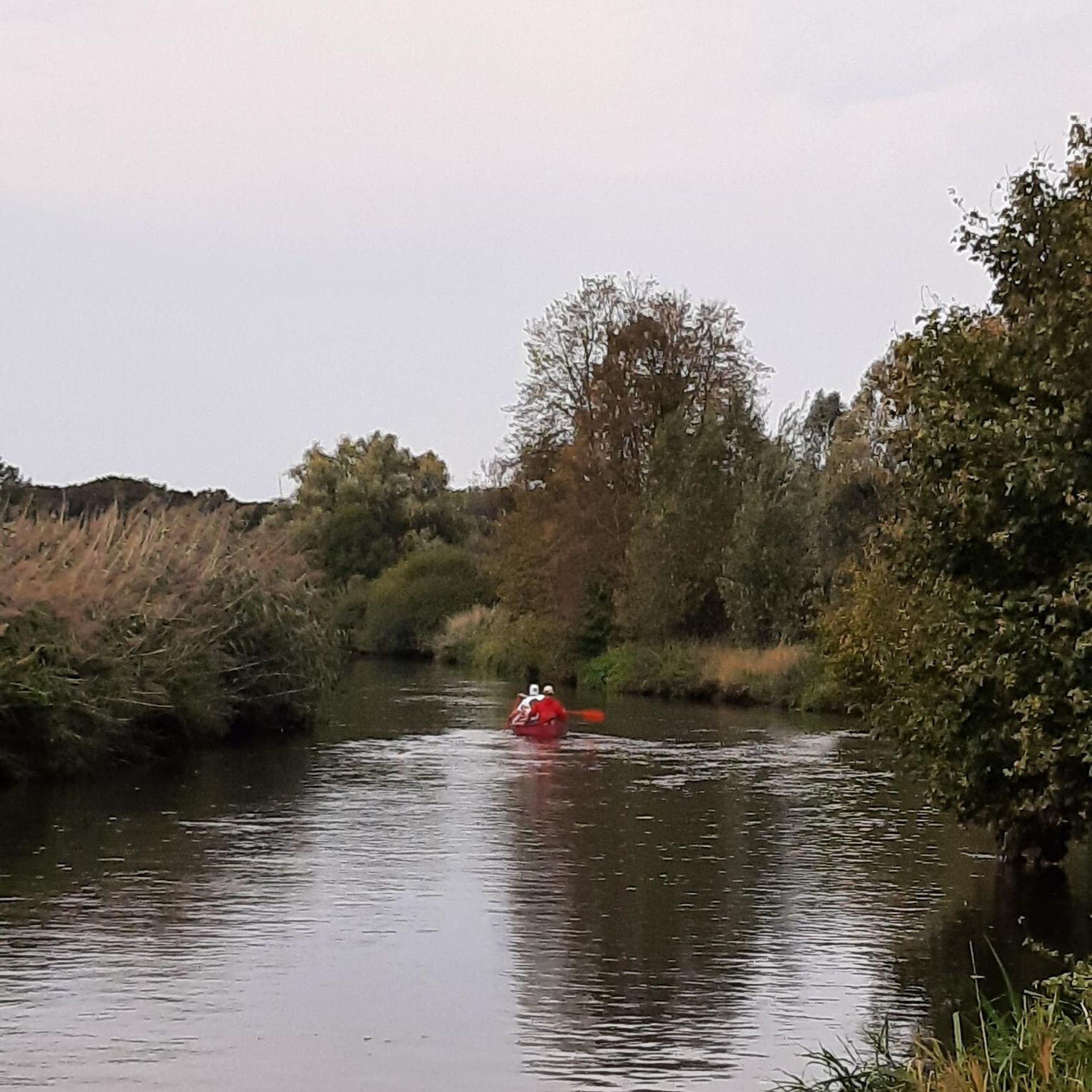
beautiful passages along the Charente with pretty monuments and small waterfront cafés in Port d’Envaux and Saintes.
0
0

The Gallo-Roman amphitheater of Sainte, also called the Arena of Saintes, is an elliptical monument built between 40 and 50 AD, probably during the reigns of Tiberius and Claudius. It measures approximately 126 meters by 102 meters and could accommodate between 12,000 and 15,000 spectators, making it one of the largest and oldest amphitheaters in Gaul. Located in a natural valley called the "Arènes valley," it takes advantage of the topography to limit construction work, with stands backing onto the hill. The site has two monumental gates, the "Gate of the Living" to the east and the "Gate of the Dead" to the west, and has been the subject of a major restoration project since 2021 to preserve this exceptional heritage. Accessible on foot from the city center, it offers an immersion in Roman history with an educational trail and activities for families
1
0
Notre Dame de Nazareth Middle School is a private Catholic school under a state partnership agreement...and on a human scale, with 142 students and seven classes (two sixth-form, two fifth-form, one fourth-form, and two ninth-form), whose main focuses are student support and monitoring, valuing all achievements, and welcoming all. Depending on the families' schedules and needs, two statuses exist at Notre Dame de Nazareth Middle School: - Status 1: Children enter and exit NDN according to the school's hours: 8:55 a.m. - 5:10 p.m. They cannot enter later or leave earlier. - Status 2: Children can enter and leave the school at the first and last class times on their schedule. They have the option of entering later and leaving earlier than the school's hours, particularly in the event of a teacher's absence during the first and/or last class times of the day. 1865 The school was founded by three nuns from the Congregation of the Holy Family of Bordeaux at the "Château" in Sorlut. 1873 The sisters purchased land on the Route de Talmont in the hope of constructing a building there. 1875 The Château de Sorlut was put up for sale, and the school was relocated near the church on Rue Traversière. 1878 The building on the Route de Talmont was constructed, and the school was relocated there. 1902-1905 Despite the new secularization laws, the sisters continued their mission. 1914 The Red Cross flag flew over the school. 1923 The house was put up for sale by the estates. With some friends of the school, Father du Boulet placed a bid of 100 francs; no one else came forward, and the school was saved! 1940 The Red Cross flag flies over the house again, and the sisters carry out charitable works there. 1958 The school welcomes 70 children. 1959 The school is named "Our Lady of Nazareth." 1960 First expansion, installation of prefabricated classrooms, and opening of a complementary course. The school has 120 students. 1965 With 180 students, the school expands its enrollment to the surrounding towns: Cravans, Tesson, Montpellier, Corme Ecluse, Saint André de Lidon, etc. The classrooms and dormitories are modernized, and a refectory and a covered playground are built. 1983 The nuns hand over management to lay people while retaining supervision. 1987 A new building replacing the prefabricated buildings was constructed for the middle school students, with classrooms, a science laboratory, a technology room, and a computer room. The old building was completely renovated: the administrative area and a primary classroom were housed on the ground floor; the primary classrooms were housed on the first floor; and the library and chapel were located on the second floor. The entire school building, including the classrooms, courtyards, and grounds, underwent a complete renovation. 1989 Construction and development of the dining area: kitchen and refectories. 2008 Expansion of the middle school: new restrooms, 3 classrooms, and 1 study room. 2010 Creation of a nap and motor skills room for kindergarten students. 2012 Expansion of the refectory and construction of 3 additional classrooms at the middle school. 2015-2016 Nazareth celebrates its 150th anniversary! 2020 Opening of the flexible timetable (CHA) football classes, in partnership with the Cozes club. 2021 Interior renovation of the administrative building 2022 Opening of the CHA dance and table tennis classes Summer 2023 Renovation of the chapel and meeting room. Attic insulation. March 2025 Restoration underway
0
0
This vast building was originally owned by the Augustinian Abbey of Saint-Étienne de Mortagne (now defunct). Built beginning in the 13th century, the current church was supplemented with a flat chevet pierced by a triplet in the following century. The bell tower, set on a powerful square stump, extends into an octagonal floor, built in the 15th century. At that time, it housed seven bells. As in many parishes in the region, the bells of Cozes were taken down and taken to Royan Castle in 1548 as punishment for ringing the alarm bells of revolt during the Pitauds Jacquerie. The nave vaults collapsed in 1756 and were economically rebuilt in the 19th century. The five bays of the nave are covered with a very simple basket-handle ceiling, while the side chapels, on either side of the choir, are covered with groin vaults. The church has retained its 13th-century capitals with plant or historiated motifs, and part of its exterior ornamentation (cords, frieze, small columns, and an allusion to Aesop's fable, The Fox and the Stork). The façade contrasts sharply with the rest of the building. Neoclassical in inspiration, with its triangular pediment, it was redone in the 19th century. The furnishings include elements from all periods. The church nevertheless retains an 18th-century pulpit. Assembled by a cabinetmaker from Burie, it was intended for the Sainte-Colombe church in Saintes. It was later sold to the parish priest of Cozes. In 2000, the stained-glass windows were restored. An access ramp was installed for the disabled. Until the winter of 1862-1863, the church was surrounded by a cemetery. It was moved to La Grande Herbaude, and the square surrounding the church was then The area was leveled and planted with trees. In 1877, five bells were reinstalled. The bell tower houses a peal of five swinging bells, cast in 1877 by the Guillaume d'Angers foundry: Claire-Louise: F3 - approximately 950 kilos, Marie-Thérèse: A3 - approximately 450 kilos, Marie-Louise: C4 - approximately 250 kilos, Louise-Georgette: F4 - approximately 100 kilos, Marie-Madelaine: A4 - approximately 50 kilos. This peal is exceptional for several reasons. Peals composed of five bells are very rare in the Charente-Maritime department: there are fewer than five. It is rare for four or more bells to be cast simultaneously. Often, over time, one bell is recast, another is added, and often the different bells do not come from the same foundry. In Cozes, the five bells were cast together by a single founder. This is the only case in Charente-Maritime. Since these bells were cast at the same time, this guarantees the same homogeneity of the metal and therefore a much better sound when the five bells chime together. They form the perfect chord of F major.
0
0
Frequently Asked Questions
What kind of terrain can I expect on no-traffic gravel bike trails around Thézac?
The region around Thézac is characterized by its rolling hills, extensive vineyards, and charming wooded areas, typical of the Quercy region. You'll find a mix of unpaved segments perfect for gravel bikes, offering both challenging ascents and rewarding descents. Expect to cycle through agricultural landscapes with fruit orchards and enjoy scenic vistas of the rural French countryside.
Are there any easy, traffic-free gravel bike routes suitable for beginners or families near Thézac?
While the guide focuses on routes that are generally moderate to difficult, the region does offer varied terrain. For a relatively easier option, consider the L'Éguille-sur-Seudre – Riberou Port loop from Saujon, which is rated easy and covers about 21 km. This route offers a gentler introduction to gravel biking in the area.
What historical sites or landmarks can I see along the gravel bike trails around Thézac?
The region is rich in history. While exploring, you might encounter charming small villages and Romanesque churches. A notable highlight is the formidable Château de Bonaguil, a 13th-century castle, which can be reached via marked paths. You can also find highlights like the Riberou Port, or various religious buildings such as the Saint-Romain Church of Saint-Romain-de-Benet and the Notre-Dame Church of Corme-Écluse.
What do other gravel bikers enjoy most about the no-traffic trails in Thézac?
The komoot community rates the trails around Thézac with an average score of 3.5 stars. Riders often praise the quiet, car-free nature of the routes, allowing for an immersive experience through vineyards and wooded areas. The blend of natural beauty and cultural stops, like passing through charming villages, is frequently highlighted as a key enjoyment.
Are there any circular no-traffic gravel bike routes available?
Yes, many of the routes in the area are designed as loops, allowing you to start and finish at the same point. For example, the Cathedral of Saintes – Basilica of Saint-Eutrope loop from Thénac offers a moderate, circular ride of approximately 48 km.
What is the best season to gravel bike around Thézac to avoid traffic and enjoy the scenery?
Spring and autumn are generally ideal for gravel biking in Thézac. During these seasons, the weather is milder, and the natural scenery, with blooming vineyards or vibrant autumn colors, is particularly beautiful. There's also less tourist traffic compared to the peak summer months, enhancing the 'no traffic' experience on the trails.
Can I find routes that pass through vineyards or offer opportunities for local produce tasting?
Absolutely. The region is known for its vineyards, especially those producing 'vins du Tsar.' Many gravel routes weave through these vineyards and fruit orchards, offering picturesque scenery. Some local wineries, like La Cave du Vin du Tsar, offer free tastings and visits, providing a perfect opportunity to experience local viticulture during your ride.
Are there any longer, more challenging no-traffic gravel bike routes for experienced riders?
For experienced riders seeking a challenge, the Crazannes Castle – Saint Saturnin of Séchaud loop from Puineuf is a difficult route spanning over 56 km. This trail offers significant elevation changes and a longer duration, perfect for those looking to push their limits on unpaved surfaces.
What are the typical elevation gains on gravel bike trails near Thézac?
The rolling hills of the Quercy region mean that elevation gains are a common feature. For instance, a moderate route like the Pirelonge Tower – Riberou Port loop from Corme-Royal involves around 165 meters of ascent, while more difficult trails can feature over 300 meters of climbing, such as the Cathedral of Saintes – Basilica of Saint-Eutrope loop from Thénac with approximately 318 meters of elevation gain.
Where can I find more information about the region's cycling routes and attractions?
For additional insights into the broader Lot-et-Garonne department and its cycling opportunities, you can visit the official tourism website: tourisme-lotetgaronne.com. This can provide context on the regional landscape and cultural offerings that complement your gravel biking adventures.
Are there any routes that offer views of the Lot River Valley?
Thézac is within reach of the Lot River Valley, and while specific routes in this guide might not directly follow the river, the region's topography allows for routes with scenic views of the river and its banks. The Fumel-Monsempron-Libos Greenway, part of the Véloroute de la Vallée du Lot V86, is a dedicated path in the wider area that connects to marked paths leading towards historical sites and offers river views.
Most popular attractions around Thézac

Get inspired with the komoot mobile app


Explore more
Browse the best Gravel rides in other regions.
