The best traffic-free bike rides around Champcella
4.5
(229)
4,558
riders
46
rides
No traffic touring cycling routes around Champcella are situated in the Hautes-Alpes department of France, nestled between cliffs and forests. The region is characterized by its tiered landscape, extending from the Durance river up to mountain pastures, and connects the Durance Valley with the Freissinières Valley. This area offers a diverse range of landscapes, transitioning from high mountains to orchards of peaches, apricots, apples, and pears. The Durance Valley itself features small back roads and cycle lanes, providing varied terrain for touring cyclists.
Best no traffic touring cycling routes around Champcella
- The most popular no traffic touring cycling route is Small lake – Jardin des Simples loop from La Roche-de-Rame, a 16.8 miles (27.0 km) trail that takes 3 hours 1 minute to complete. This route features significant elevation gain through varied terrain.
- Another top favourite among local touring cyclists is Séa nipples loop from Champcella, a difficult 13.9 miles (22.4 km) path. This route offers challenging climbs and panoramic views of the surrounding valleys.
- Local touring cyclists also love the Banks of the Durance – Eygliers Lake loop from Champcella, a 18.7 miles (30.1 km) trail leading through the Durance Valley and past Eygliers Lake, often completed in about 2 hours 47 minutes.
- Touring cycling around Champcella is defined by the Durance Valley, surrounding mountains, and agricultural lands. The network offers options for different ability levels, including easy, moderate, and difficult routes.
- The routes in Champcella are highly rated by the komoot community with an average score of 4.4 stars from more than 200 reviews. More than 5000 touring cyclists have used komoot to explore Champcella's varied terrain.
Last updated: July 3, 2026
4.6
(13)
37
riders
17.6km
01:28
80m
80m
Easy bike ride. Great for any fitness level. Mostly paved surfaces. Suitable for all skill levels.
3.0
(1)
19
riders
27.0km
03:01
930m
930m
Hard bike ride. Very good fitness required. Mostly paved surfaces. Suitable for all skill levels.

Sign up for free
5.0
(1)
12
riders
21.9km
02:09
730m
730m
Hard bike ride. Very good fitness required. Mostly paved surfaces. Suitable for all skill levels.
4.0
(1)
21
riders
30.1km
02:48
580m
580m
Hard bike ride. Very good fitness required. Mostly paved surfaces. Suitable for all skill levels.
5.0
(1)
11
riders
Moderate bike ride. Good fitness required. Mostly paved surfaces. Suitable for all skill levels.
Get access to more routes and recommendations from other explorers.
Sign up for free
Already have an account?
Our route recommendations are based on thousands of hikes, rides, and runs completed by other people on komoot.
Start today with a free account
Your next adventure awaits.
Login or Signup
Popular around Champcella
Tips from the Community

In addition to picnic tables and a green area, there is water, power outlets and a roof
1
0
In addition to picnic tables and a green area, there is water, power outlets and a roof
0
0

This is the Chapelle Saint-Roch, a place rich in history and reverence in the Pays des Écrins. Saint Roch himself is believed to have visited this chapel during his pilgrimage, finding solace and strength within its walls.
0
0

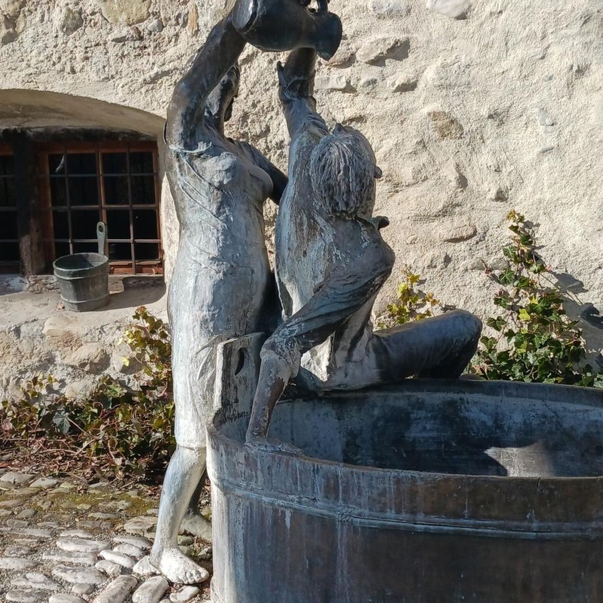
Roadside fountain, with a bench. Ideal for taking a cool break on the climb!
0
0

Just splendid place, impressive in size. It's time to enjoy a bar or a sandwich.
1
0

Leisure center accessible free of charge and where it is possible to swim. Two restaurants on the banks and numerous shaded picnic spots.
1
0

323 km long, the Durance is the most important river in Provence. From here there are beautiful views of the river and the mountains.
0
0

A nice and flat place to take a break. Either by going around the body of water or on the asphalt road. All at 900m altitude.
0
0
Frequently Asked Questions
How many no-traffic touring cycling routes are available around Champcella?
There are over 45 dedicated no-traffic touring cycling routes around Champcella. These routes offer a fantastic way to explore the Durance Valley and its surroundings, providing a blend of authentic village charm and secondary roads perfect for a different pace of exploration.
What is the best time of year to go touring cycling in Champcella?
Champcella benefits from generous sunshine and a southern climatic influence, making spring and autumn ideal for touring cycling. The weather is generally pleasant, allowing you to enjoy the transition from high mountains to orchards and, further south, even lavender fields. Summer can be warm, but the Durance Valley often offers refreshing breezes.
Are there any easy no-traffic touring cycling routes suitable for beginners or families?
Yes, Champcella offers several easier routes. While many routes are rated moderate or difficult, there are 4 routes specifically categorized as easy. These routes often utilize small back roads and cycle lanes, making them suitable for those looking for a more relaxed ride. For example, the area around Rama Lake is known for easy nature breaks.
What kind of terrain and elevation can I expect on these no-traffic routes?
The terrain around Champcella is diverse, ranging from the valley bottom along the Durance river to routes that ascend into the surrounding mountains. You can expect a mix of flat sections along the river and more challenging climbs, especially on routes leading to 'balconies of the Durance' which offer panoramic views. Routes can have significant elevation gains, with some difficult tours featuring over 900 meters of ascent.
What natural features and landmarks can I see along the no-traffic touring cycling routes?
The routes offer stunning natural beauty. You'll encounter the dramatic gorges of the Durance river, picturesque landscapes nestled between cliffs and forests, and views of the Massif des Écrins. Notable natural highlights include Eygliers Lake and the impressive Gorges du Guil. You might also pass by traditional ovens, fountains, and stone houses in local villages.
Are there any circular no-traffic touring cycling routes around Champcella?
Yes, many of the no-traffic touring cycling routes around Champcella are circular, allowing you to start and end your journey in the same location. An example is the challenging Small lake – Jardin des Simples loop from La Roche-de-Rame, which covers over 27 km with significant elevation. Another option is the Banks of the Durance – Eygliers Lake loop from Champcella, offering a 30 km ride.
What are some of the more challenging no-traffic touring cycling routes in the area?
For experienced touring cyclists seeking a challenge, Champcella offers 28 difficult routes. These routes often involve substantial elevation gains and longer distances. For instance, the Séa nipples loop from Champcella is a difficult 22 km route with over 700 meters of ascent, providing a demanding yet rewarding experience.
What do other cyclists enjoy most about touring cycling in Champcella?
The area is highly rated by the komoot community, with an average score of 4.4 stars. Reviewers often praise the stunning Alpine scenery, the diversity of routes, and the opportunity to explore the region on quiet, traffic-free roads. The blend of natural beauty and historical sites like the nearby Vauban fortifications also adds to the appeal.
Are there any historical sites or cultural attractions accessible from these routes?
Absolutely. Champcella itself maintains its architectural heritage with traditional ovens and the Saint-Laurent-de-Rame chapel. The ancient site of Rama, a stop on the Roman road Via Cottia per Alpem, features Gallo-Roman remains. Within a short distance, you can also visit the UNESCO World Heritage Vauban fortifications of Mont-Dauphin (7km away) and Briançon (21km away), or the historic silver mines of L'Argentière-la-Bessée (8km away).
Where can I find parking or public transport options for accessing these routes?
While specific parking details for each trailhead vary, Champcella and nearby villages like La Roche-de-Rame often provide public parking areas suitable for accessing cycling routes. For public transport, regional bus services connect some of the larger towns in the Durance Valley, which could serve as starting points for your tours. It's advisable to check local transport schedules for the most up-to-date information.
Can I find places to eat or stay near the no-traffic touring cycling routes?
Yes, Champcella and the surrounding villages in the Durance Valley offer various amenities for cyclists. You'll find local cafes, restaurants, and accommodation options ranging from guesthouses to small hotels. These establishments are often cyclist-friendly, providing a convenient base for your multi-day touring adventures or a welcome break during your ride.
Most popular routes around Champcella
Most popular attractions around Champcella

Get inspired with the komoot mobile app


Explore more
Browse the best Cycling routes in other regions.
