The best traffic-free bike rides around Treschenu-Creyers
4.6
(415)
9,541
riders
7
rides
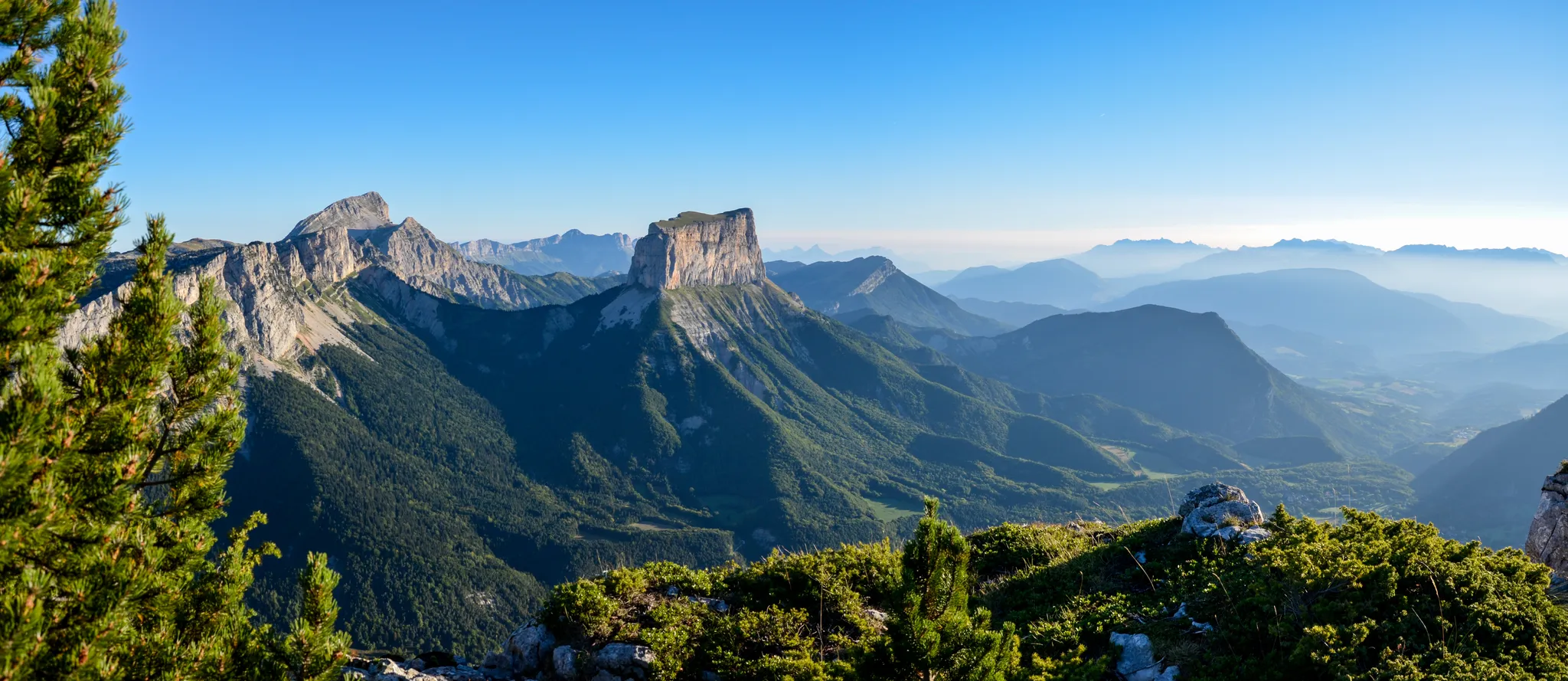
No traffic road cycling routes around Treschenu-Creyers traverse a landscape characterized by deep gorges, towering limestone cliffs, and expansive high plateaus within the Vercors Regional Natural Park. The region features challenging mountain passes and picturesque valleys, offering varied terrain for road cyclists. Roads are generally well-maintained, providing an immersive cycling experience with minimal vehicle traffic.
Best no traffic road cycling routes around Treschenu-Creyers
- The most popular no traffic road cycling route is Downhill from Col de de Pennes – Col…
Last updated: July 16, 2026
4.8
(8)
163
riders
57.0km
03:23
1,460m
1,460m
Hard road ride. Very good fitness required. Mostly well-paved surfaces and easy to ride.
4.7
(3)
93
riders
82.2km
04:33
1,780m
1,780m
Hard road ride. Very good fitness required. Mostly well-paved surfaces and easy to ride.

Sign up for free
4.9
(7)
75
riders
37.5km
01:58
700m
710m
Moderate road ride. Good fitness required. Mostly well-paved surfaces and easy to ride.
4.8
(5)
37
riders
26.6km
01:24
440m
440m
Moderate road ride. Good fitness required. Mostly well-paved surfaces and easy to ride.
13
riders
42.2km
02:13
750m
750m
Moderate road ride. Good fitness required. Mostly well-paved surfaces and easy to ride.
Get access to more routes and recommendations from other explorers.
Sign up for free
Already have an account?
Our route recommendations are based on thousands of hikes, rides, and runs completed by other people on komoot.
Start today with a free account
Your next adventure awaits.
Login or Signup

Other adventures around Treschenu-Creyers


Tips from the Community

The Col de Pennes (1,038 m) is a pass in the Diois massif, in the Drôme, which connects the Drôme valley with the Roanne valley. It is a little-known climb but highly appreciated by cyclists for the tranquility of the road, the good asphalt and the splendid panoramas.
4
0
Asphalt in perfect condition.
2
0
Very beautiful rock formation.
3
0
If you mean the Municipality of Mens, it is the village of Mens, located in the Isère region, within the historic Trièves area, at the foot of the Mont Aiguille massif.
6
0

Here is the route for the ascent of the Col de Menée starting from Menée
1
0

plan on 3 or 4€ for the fridge, the oasis is very cold, thank you!!!!
0
0
For a short Sunday outing, a quiet, clean road for a family bike ride
0
0
Frequently Asked Questions
How many no-traffic road cycling routes are available around Treschenu-Creyers?
There are several dedicated no-traffic road cycling routes around Treschenu-Creyers, offering a range of distances and difficulties. This guide features 4 routes, from easy riverside rides to challenging mountain passes, all designed for a peaceful cycling experience.
What kind of terrain can I expect on these no-traffic road cycling routes?
The terrain varies significantly, reflecting the diverse landscapes of the Vercors Regional Natural Park and the Drôme region. You'll find routes with challenging ascents to iconic cols like the Col de Grimone and Col de Menée, as well as more gentle rides through picturesque valleys. Expect well-maintained roads, often with stunning views of limestone cliffs, high plateaus, and charming forests.
Are there any easy, no-traffic road cycling routes suitable for beginners or families?
Yes, for those seeking a gentler ride, the Along the Drôme River – Die loop from Solaure en Diois offers an easy, no-traffic option. This route covers about 15 kilometers with minimal elevation gain, perfect for a relaxed outing along the scenic Drôme River.
What are some of the most scenic viewpoints or natural features along these routes?
Many routes offer breathtaking views. For instance, the Vercors high plateaus provide magnificent 360-degree panoramas, including peaks like Grand Veymont. You might also encounter the majestic Cirque d'Archiane, known for its imposing limestone cliffs and griffon vultures. The Archiane Cirque loop from Ville Basse is a great way to experience this natural wonder.
When is the best time of year to enjoy no-traffic road cycling in Treschenu-Creyers?
The best time for road cycling in Treschenu-Creyers is typically from late spring to early autumn (May to October). During May and June, the Vallon de Combau is particularly vibrant with rich flora and opportunities to spot marmots. Summer offers warm, sunny conditions, while early autumn brings pleasant temperatures and beautiful foliage. Always check local weather forecasts before heading out, especially for higher passes.
Are there any challenging no-traffic road cycling routes for experienced riders?
Absolutely. Experienced cyclists will find demanding routes with significant elevation gains. The Downhill from Col de de Pennes – Col de Pennes loop from Saint-Roman, for example, is a difficult route covering nearly 57.5 kilometers with over 1400 meters of climbing. Another challenging option is the Col de la Croix – Col de la Croix (746 m) loop from Die, which features similar elevation and distance.
What do other cyclists say about road cycling in Treschenu-Creyers?
The komoot community highly rates the road cycling experience around Treschenu-Creyers, with an average score of 4.56 out of 5 stars from 385 ratings. Cyclists often praise the stunning natural beauty, the challenging yet rewarding climbs, and the generally low traffic on many of the roads, making for an immersive and peaceful ride.
Are there any circular no-traffic road cycling routes available?
Yes, many of the routes in this guide are circular, allowing you to start and end at the same point. For example, the Die – Col de Marignac loop from Die is a moderate circular route, perfect for exploring the area without needing to retrace your steps. The Archiane Cirque loop from Ville Basse is another excellent circular option.
Can I find places to eat or stay near the no-traffic road cycling routes?
Treschenu-Creyers and nearby towns in the Drôme region offer various amenities for cyclists. You'll find cafes, restaurants, and accommodation options ranging from guesthouses to hotels. It's advisable to check in advance, especially during peak season, to ensure availability and opening hours.
Are there any gorges or canyons I can see while cycling?
Yes, the region is known for its dramatic gorges. The Gorges des Gâts is a notable natural monument that you might encounter or pass near on some routes. The Meyrosse Gorge Crossing also offers impressive views of these geological formations.
What are the typical distances and durations for these no-traffic road cycling routes?
The routes vary significantly in length and duration. You can find shorter rides like the Along the Drôme River – Die loop from Solaure en Diois, which is about 15 kilometers and takes less than an hour. Longer, more challenging routes, such as the Col de la Croix – Col de la Croix (746 m) loop from Die, can extend to nearly 69 kilometers and take over 3.5 hours to complete, depending on your pace and stops.
Most popular routes around Treschenu-Creyers
Most popular attractions around Treschenu-Creyers

Get inspired with the komoot mobile app


Explore more
Browse the best Road cycling routes in other regions.
