The best traffic-free bike rides around Riemst
4.6
(189)
2,273
riders
93
rides
Gravel biking around Riemst offers a landscape characterized by rolling hills, distinctive marl formations, and open vistas. The region features picturesque plateaus like Caestert, alongside fertile fields and gentle ascents. Riders can explore routes alongside the Albert Canal and through the Jeker Valley, encountering varied terrain suitable for gravel cycling. This blend of geological features and waterways provides a diverse setting for no traffic gravel bike trails.
Best no traffic gravel bike trails around Riemst
- The most popular no traffic…
Last updated: July 14, 2026
5
riders
90.8km
06:42
360m
360m
Explore historic buildings and stunning vistas around Hasselt on this difficult 56.4-mile gravel biking route through Limburg.
4.4
(8)
71
riders
48.4km
03:13
370m
370m
Moderate gravel ride. Good fitness required. Mostly paved surfaces. Suitable for all skill levels.

Sign up for free
5.0
(3)
139
riders
84.8km
05:48
950m
950m
Hard gravel ride. Very good fitness required. You may need to push your bike for some segments of this route.
5.0
(1)
61
riders
Hard gravel ride. Very good fitness required. You may need to push your bike for some segments of this route.
5.0
(3)
21
riders
76.6km
05:19
920m
920m
Hard gravel ride. Very good fitness required. You may need to push your bike for some segments of this route.
Get access to more routes and recommendations from other explorers.
Sign up for free
Already have an account?
Our route recommendations are based on thousands of hikes, rides, and runs completed by other people on komoot.
Start today with a free account
Your next adventure awaits.
Login or Signup


Tips from the Community

At the Van Tienhovenmolen, everything revolves around traditional milling. This authentic windmill is still used to process various types of grain into high-quality flour. Our products are available not only at the mill but also for delivery to local shops and businesses in the surrounding area. Due to work on the mill, the shop and webshop will be closed from July 19 to August 13, 2026.
7
0


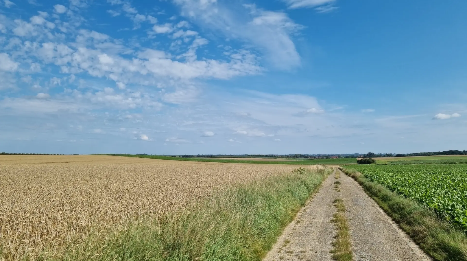
Cycling across the heath takes you right through the Hoge Kempen National Park. In this park, vast pine forests alternate with endless heathlands. Thanks to the new connection between cycle nodes 550 and 551, nature is presented to you on a platter. You cycle across the Mechelse Heide, with 700 hectares, one of the largest heathland areas in Flanders. The highlight of this route is undoubtedly the almost 300-meter-long wooden bridge, a recognizable element in the landscape. From the bridge, you have a panoramic view of the natural surroundings.
0
0

On the border of the poor Kempen and fertile Haspengouw lies the Munsterbos. Northeast of the village center of Munsterbilzen, 450 hectares of forests, ponds, marshes, and grasslands stretch out. Here and there, even a patch of purple heather peeks through. The area is so special due to its location on the transition from the sandy Kempen Plateau to the Haspengouw clay region.
4
0
This section, together with the water lock and the outer bailey, belongs to the oldest parts: in the Apostles' House, remains of the late Gothic ordinance from the second half of the 16th century from the building campaign of Land Commander Wijnandt van Brijel have been preserved. The complex is located at the highest point of the domain, on the eastern side of the commandery. Seven avenues converge at the gate, symbolizing the Seven Sorrows and Joys of Mary. To the right of the gatehouse was the now disappeared Apostles' House; it was an L-shaped building of two storeys, with a chapel on the ground floor, and twelve rooms for needy men, hence the name Apostles' House; late Gothic core from the second half of the 16th century, enlarged and adapted in 1716-1726, under Commander Damian Hugo von Schönborn, as indicated by a facade stone. After World War II, the Apostles' House slowly deteriorated but has since been restored.
2
0
The Katteberg is said to owe its name to a quarry in the nearby Leten called 'In de Kat'. This nature reserve on the Demer is very varied with its fish ponds, species-rich meadows, rough areas, an orchard and a slope forest. The walking path that leads via the Leterweg to Alden Biesen follows the route of a vanished tram line. This was built in 1908-1910 to connect the industrial area of Liège with the Limburg coal mines. The tram line had to bridge a height of 25 meters here and crossed the Demer via a double arched bridge in masonry. The tram tracks were removed in 1952. The pond behind the tram bridge was created by the extraction of clay for the Belisia tile factory in the Zeepstraat.
5
0

Beautiful view of the caves.
0
0

The Katteberg follows the route of an old tramway. A climb not to be underestimated awaits you here. Historical context: This semi-hardened gravel path follows the route of the former tram line that connected the coal mines of Genk with the industrial area of Liège. The construction of the tram line began in 1908. To overcome the difference in altitude between the station and the hamlet of Leten, an earthen embankment was built over a distance of 700 meters, cutting straight through the Katteberg. A double arch bridge in masonry was built over the Demer river. The steam tram was put into operation in 1910 and caused a huge increase in passenger traffic in the region. The tram was definitively taken out of service in August 1948. The tram tracks were removed in 1952. Now, this is a route where recreational users, hikers, and cyclists can cross paths. Each at their own pace, enjoying together.
7
0
Frequently Asked Questions
How many no-traffic gravel bike trails are available in Riemst?
Riemst offers a wide selection of traffic-free gravel bike trails, with over 85 routes available. These range in difficulty from easy to difficult, ensuring there's something for every gravel biker.
What kind of terrain can I expect on Riemst's no-traffic gravel trails?
Riemst's gravel trails feature a diverse landscape, from rolling hills and open farmland to unique marl formations and riverine scenery along the Albert Canal and Maas river. You'll encounter a mix of quiet country roads, gravel paths, and even some sections that incorporate mountain bike trails for added challenge. The region's 'southern feel' with vast vistas provides a distinct riding experience.
Are there any challenging climbs on the no-traffic gravel routes in Riemst?
Yes, Riemst is known for several 'kuitenbijters' (calf-biters) or steep climbs. For example, the Bemelerberg Climb – Oosterberg Climb loop from Eijsden includes the notable Bemelerberg, which offers a challenging ascent and an alpine feel. The Slingerberg also provides phenomenal views after a good climb.
What natural features or landmarks can I see along the gravel trails?
You can explore a variety of natural and historical sights. The region is famous for its marl landscape, including impressive marl walls along the Albert Canal and numerous marl caves. You might pass by the Bemelerberg Climb, the Lanaye Lock, or even the Fort Sint Pieter. The Caestert Plateau is a beautiful nature reserve, and the ENCI Quarry Viewpoint offers expansive vistas.
Are there family-friendly no-traffic gravel routes in Riemst?
While many routes offer quiet sections, some of the longer and more challenging routes might be less suitable for younger families due to significant elevation changes. For easier, more leisurely rides, look for routes with lower elevation gain and shorter distances. The region's extensive cycling junction network makes it easy to plan custom, shorter loops on quiet paths.
Can I bring my dog on the gravel bike trails in Riemst?
Many outdoor areas in Riemst are dog-friendly, especially on public paths and trails, provided dogs are kept on a leash. However, specific rules can vary in nature reserves or private land. It's always best to check local signage or the specific route details on komoot for any restrictions before heading out with your furry friend.
Where can I find parking for gravel biking in Riemst?
Riemst is well-integrated into the cycling network, and many villages and starting points for routes offer public parking. For example, routes starting from Eijsden or Eben-Emael, such as the Karreweg Gravel Path loop, typically have parking facilities nearby. Look for designated parking areas in towns like Kanne or near popular attractions.
Is it possible to reach the gravel trails in Riemst by public transport?
Yes, Riemst is accessible by public transport, though connections might require some planning. Buses connect Riemst to larger cities like Tongeren or Maastricht, from where you can start your ride. The region's cycling junction network makes it easy to navigate once you arrive. For detailed public transport information, you might consult local transport websites.
What is the best time of year to go gravel biking in Riemst?
The spring and autumn months generally offer the most pleasant conditions for gravel biking in Riemst, with mild temperatures and beautiful scenery. Spring brings blooming landscapes, while autumn showcases vibrant foliage. Summer can also be enjoyable, but be prepared for warmer weather. Winter rides are possible, but some paths might be muddy or require more robust gear.
Are there any long-distance no-traffic gravel routes available?
Yes, Riemst and its surroundings offer several longer gravel routes. For instance, the Hasselt Grand Loop: De Wijers and Hoge Kempen is a challenging 90 km route, and the Alden Biesen Gatehouse – Cycling through the Mechelse Heide loop extends over 114 km, providing extensive traffic-free gravel experiences.
Where can I find refreshments or places to stop along the gravel trails?
Riemst's charming villages, like Kanne, offer cafes and a lively atmosphere perfect for a break. You can also find stops at unique locations such as the Wijnkasteel Genoels-Elderen, Belgium's oldest and largest wine estate, which offers wine tastings. Many routes pass through or near these spots, allowing for convenient refreshment stops.
What do other gravel bikers enjoy most about the trails in Riemst?
The gravel trails in Riemst are highly rated by the komoot community, with an average score of 4.5 stars. Reviewers often praise the quiet, traffic-free nature of the routes, the diverse and scenic landscapes, and the unique geological features like the marl walls. The feeling of stepping into a different world with open vistas is frequently highlighted.
Most popular attractions around Riemst

Get inspired with the komoot mobile app


Explore more
Browse the best Gravel rides in other regions.
