The best traffic-free bike rides around Berzo Inferiore
4.3
(13)
290
riders
15
rides
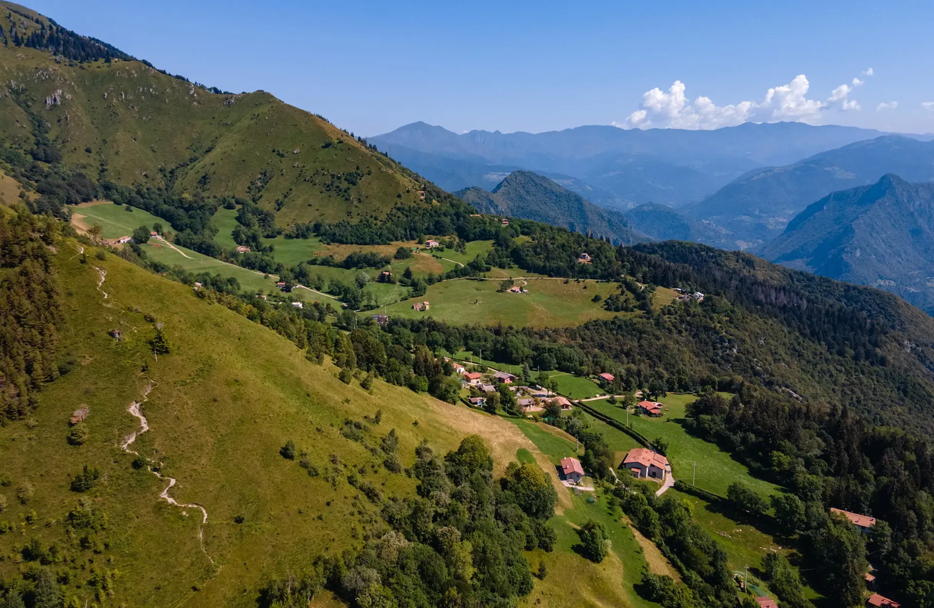
No traffic gravel bike trails around Berzo Inferiore are set within the mountainous Val Camonica region, offering diverse landscapes for cycling. The area features significant peaks like Monte Muffetto, serene alpine lakes such as Lova Lake and Lake Moro, and lush valleys like Val Grigna. Gravel bikers can navigate varied ascents and descents through dense forests and along historic pathways, including the cycle-pedestrian Montecchio Roman Bridge. This terrain provides a mix of challenging mountain routes and more accessible valley paths.
…Last updated: July 13, 2026
10
riders
71.0km
06:41
2,650m
2,650m
Hard gravel ride. Very good fitness required. Mostly paved surfaces. Suitable for all skill levels.
5.0
(1)
20
riders
38.7km
02:53
700m
700m
Hard gravel ride. Very good fitness required. Mostly paved surfaces. Suitable for all skill levels.

Sign up for free
12
riders
43.7km
03:50
1,380m
1,380m
Hard gravel ride. Very good fitness required. Mostly paved surfaces. Suitable for all skill levels.
3.8
(4)
15
riders
Moderate gravel ride. Good fitness required. Mostly paved surfaces. Suitable for all skill levels.
11
riders
67.5km
05:00
1,770m
1,770m
Hard gravel ride. Very good fitness required. Mostly paved surfaces. Suitable for all skill levels.
Get access to more routes and recommendations from other explorers.
Sign up for free
Already have an account?
Our route recommendations are based on thousands of hikes, rides, and runs completed by other people on komoot.
Start today with a free account
Your next adventure awaits.
Login or Signup


Other adventures around Berzo Inferiore

Tips from the Community

By train to Edolo and then by bike up to Ponte di legno. The next day, departure in four stages to Mantua. Beautiful cycle path. Recommended
0
0

🏔️ Monte Altissimo — Identity and location Monte Altissimo is the highest peak of the short mountain range that separates Bassa Val Camonica and Valle di Scalve. It is known for two very different slopes: North slope (Borno): gentle, wooded, with ski slopes and mountain huts. South slope (Erbanno–Gorzone): steep, rocky, with significant elevation changes. This dual nature is also confirmed by the hiking itineraries documented online . 🚶♂️ The main documented itineraries Online sources show several routes, including: 1) From Croce di Salven – Path 6 (classic loop) Passes through Pozze di Val Sorda, Rifugio Lorenzini, Malga Guccione. A very popular loop itinerary, with a gentle and scenic ascent. Data confirmed by hikr.org (loop with ascent from Croce di Salven) . 2) From Borno – Via Mine e Segable A longer and scenic itinerary, with passages over woods, mountain huts, and ridges. Documented in detail on Wikiloc, with a complete description of path 112 → 151 → 155 . 3) From Erbanno – Path 155 Steep and challenging ascent, with sections on rocky outcrops. Direct connection to the final ridge of the Altissimo. 🏞️ Environment and notable points Sources confirm the places you have already visited: Pozze di Val Sorda: damp and bright clearings. Rifugio Colonnello Ferruccio Lorenzini: in the Pratolungo basin, at 1478 m. Malga Guccione: a passing point before the final ascent. Borno ski slopes: often used for descent on winter loops.
0
0
The Malga di Val Sorda is not a "classic" alpine pasture hut with grazing activities, but a hiking landmark located in the large meadow of Val Sorda, along the paths that lead from Croce di Salven towards Pratolungo, Malga Guccione, and finally Monte Altissimo. Online information describes it as part of the valley's pasture and pool system, crossed by CAI trails 186 and 187. 📍 Location The hut is located in the central pasture of Val Sorda, reached after about 1h10 of walking from Croce di Salven along trail 186. It is a junction point between: trail 186 (towards Pratolungo and Altissimo) trail 187 (steeper, climbs towards the Val Sorda refuge/structure)
0
0

Nice, historic, relaxing...a beautiful ride along the Oglio cycle path.
0
0
The Campelli Pass is an Alpine pass at approximately 1,892 meters above sea level that connects the Scalve Valley (province of Bergamo) with the Camonica Valley (province of Brescia). It is a popular hiking destination for its scenic beauty and the variety of available itineraries. 🏔️ Main Features Location: Between Schilpario (BG) and Cerveno (BS) Elevation: approximately 1,892 m View: Spectacular view of Cimon della Bagozza and the Piccole Dolomiti Scalvine Access: From Schilpario – Fondi: winter route for snowshoeing or ski mountaineering From Schilpario – Baracca Rossa: shorter and more scenic summer route From Ono San Pietro (BS): longer and more challenging route 🚶♂️ Recommended Activities Summer Hiking: Well-marked trails, also suitable for families Winter Snowshoeing: Safe and picturesque itineraries in the snow Mountain Biking: Technical and scenic routes, with stops at the Campione Refuge and Campelli Lake 📍 Nearby Points of Interest Campione Refuge: Not far from the pass, offers refreshments and overnight accommodations Campelli Lake Campelli: a small Alpine lake, ideal for a break Madonnina dei Campelli: a panoramic and spiritual point along the route
0
0

Stone bridge with nice views around. The river was brown due to heavy rain some hours earlier.
1
0

To reach Montecchio di Darfo, starting from Boario, you cross the so-called "Roman bridge." It is a scenic 24-meter, single-span bridge, built from blocks of granite and Simona stone in 1686, over the remains of an older bridge that connected the medieval castle on Monticolo to the opposite bank of the river. It has been recognized as a national monument.
0
0

A very pleasant climb from Val di Scalve to Borno. Beautiful and not particularly challenging. 😊
2
0
Frequently Asked Questions
How many traffic-free gravel bike trails are available around Berzo Inferiore?
There are over 10 dedicated traffic-free gravel bike trails around Berzo Inferiore, offering a variety of distances and difficulties. These routes are carefully selected to provide a serene cycling experience away from vehicle traffic.
What kind of terrain can I expect on the gravel bike trails near Berzo Inferiore?
The terrain around Berzo Inferiore is predominantly mountainous, nestled within the Val Camonica. You can expect varied ascents and descents through lush valleys like Val Grigna and dense forests. Some routes, such as the challenging Croce di Salven Pass – Campelli Pass loop from Ceto - Cerveno, feature significant elevation gains, while others like the By bike along the Oglio – Cividate-Breno Cycle Tunnel loop from Breno offer more moderate profiles along river paths.
Are there any circular gravel bike routes in the area?
Yes, many of the gravel bike trails around Berzo Inferiore are designed as loops, allowing you to start and end in the same location. Examples include the scenic Monti di Cerveno – Prato Torio loop from Borno and the Prato Torio – View of Losine loop from Niardo ‐ Losine, which offer diverse landscapes and viewpoints.
What are some interesting landmarks or natural attractions I can see along these routes?
The region is rich in natural beauty and historical sites. You can cycle past serene alpine lakes like Lova Lake and Lake Moro. The historic Montecchio Roman Bridge, now exclusively cycle-pedestrian friendly, is another notable point of interest. For those seeking mountain vistas, routes might lead you towards areas with views of significant peaks like Monte Muffetto or the Passo Crocedomini.
What is the best season for gravel biking in Berzo Inferiore?
Spring and autumn generally offer the most pleasant conditions for gravel biking in Berzo Inferiore, with mild temperatures and vibrant scenery. Summer can also be excellent, especially at higher elevations, though some lower valley routes might be warmer. Winter can be challenging due to snow and ice, particularly on higher mountain passes, but some lower-altitude trails may still be accessible.
Are there any family-friendly or beginner-friendly traffic-free gravel trails?
While many routes in the mountainous Val Camonica region can be challenging, there are options suitable for those seeking a more relaxed ride. The By bike along the Oglio – Cividate-Breno Cycle Tunnel loop from Breno, for instance, features a moderate difficulty grade and follows the Oglio river, making it a good choice for families or beginners looking for a traffic-free experience.
Where can I find parking for these gravel trails?
Parking is generally available in the towns and villages that serve as starting points for these trails, such as Berzo Inferiore, Breno, Borno, Ceto, and Cividate Camuno. Specific parking information is often detailed on individual route pages on komoot, helping you plan your starting point efficiently.
Can I bring my dog on these gravel bike trails?
Many natural trails in the Val Camonica region are dog-friendly, provided your dog is well-behaved and kept on a leash, especially in areas with wildlife or livestock. Always check local regulations and be mindful of other trail users. Ensure you carry enough water for both yourself and your pet, as water sources may be limited on some routes.
What do other gravel bikers enjoy most about the trails in Berzo Inferiore?
The komoot community highly rates the gravel biking experience around Berzo Inferiore, with an average score of 4.6 stars. Reviewers often praise the stunning natural landscapes, the tranquility of the traffic-free routes, and the diverse challenges offered by the mountainous terrain. The opportunity to discover hidden gems and historical sites away from busy roads is also frequently highlighted.
Are there places to eat or stay near the gravel bike routes?
Yes, the towns and villages in Val Camonica, including Berzo Inferiore, Breno, and Borno, offer various amenities. You'll find local restaurants, cafes, and pubs where you can refuel after your ride. There are also bike-friendly accommodations available, ranging from hotels to guesthouses, which cater to cyclists and provide facilities like secure bike storage.
Are there any specific bike parks or dedicated cycling infrastructure in the area?
Beyond the natural gravel trails, the region is committed to cycling. The Montecchio Roman Bridge is a notable piece of cycle-pedestrian infrastructure. While this guide focuses on gravel, you can also find information on dedicated bike parks around Berzo Inferiore, which might offer different types of cycling experiences.
Most popular routes around Berzo Inferiore
Most popular attractions around Berzo Inferiore

Get inspired with the komoot mobile app


Explore more
Browse the best Gravel rides in other regions.
