The best traffic-free bike rides around Valgoglio
4.1
(81)
3,344
riders
5
rides
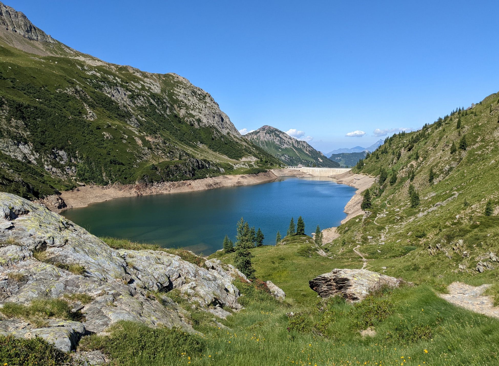
No traffic road cycling routes around Valgoglio are situated in the upper Valle Seriana, characterized by dramatic mountain landscapes and significant elevation changes. The region features pristine natural scenery, including alpine lakes, streams, and dense forests, providing varied terrain for road cyclists. Roads often wind through valleys and ascend towards mountain passes, offering both challenging climbs and scenic descents. This area is part of the Parco delle Orobie Bergamasche, known for its high biodiversity and rugged topography.
Best no traffic road cycling routes around Valgoglio
- The most popular no traffic road cycling route is Climb to Spiazzi di Gromo – Spiazzi di Gromo loop from Valcanale, a 22.8 miles (36.7 km) trail that takes 2 hours 27 minutes to complete. This difficult route features substantial elevation gain through mountainous terrain.
- Another top favourite among local road cyclists is Piazza dell'Orologio, Clusone loop from Clusone, an easy 9.7 miles (15.6 km) path. This shorter route explores the area around Clusone with minimal elevation changes.
- Local road cyclists also love the Spiazzi Fountain – Gromo Historic Village loop from Gromo, a 17.8 miles (28.7 km) trail leading through scenic villages and offering panoramic views, often completed in about 1 hour 56 minutes.
- Road cycling around Valgoglio is defined by challenging mountain passes, serene alpine lakes, and the biodiverse Val Sanguigno. The network offers options for easy, moderate, and difficult routes, catering to various ability levels.
- The routes in Valgoglio are highly rated by the komoot community with an average score of 4.3 stars from more than 60 reviews. More than 3,500 road cyclists have used komoot to explore Valgoglio's varied terrain.
Last updated: October 16, 2026
30
riders
36.7km
02:26
1,180m
1,180m
Hard road ride. Very good fitness required. Mostly well-paved surfaces and easy to ride.
27
riders
28.5km
01:55
900m
900m
Moderate road ride. Good fitness required. Mostly well-paved surfaces and easy to ride.

12
riders
24.5km
01:15
380m
380m
Moderate road ride. Good fitness required. Mostly well-paved surfaces and easy to ride.
12
riders
17.8km
01:08
520m
520m
Moderate road ride. Good fitness required. Mostly well-paved surfaces and easy to ride.
8
riders
21.5km
01:22
580m
580m
Moderate road ride. Good fitness required. Mostly well-paved surfaces and easy to ride.
Our route recommendations are based on thousands of hikes, rides, and runs completed by other people on komoot.
Start today with a free account
Your next adventure awaits.





Tips from the Community

is cleaned and dredged from time to time, rowing activity
0
0

Gromo, which is part of the circuit of “The most beautiful villages in Italy” and has obtained the “Orange Flag” from the Touring Club Italiano, rises on a rocky promontory, surrounded by meadows and fir forests. The town, famous in antiquity for its iron and silver mines and for its white weapon factories, maintains the compact medieval fabric in the upper part of the inhabited area.
0
0
Gromo, which is part of the circuit of “The most beautiful villages in Italy” and has obtained the “Orange Flag” from the Touring Club Italiano, rises on a rocky promontory, surrounded by meadows and fir forests. The town, famous in antiquity for its iron and silver mines and for its white weapon factories, maintains the compact medieval fabric in the upper part of the inhabited area.
0
0
Perfectly working. It was 5:30 PM daylight saving time.
0
0
Palazzo Bonetti is located along the road connecting the lower part of the village to Piazza Dante. It is one of the first stately homes that welcomes those entering the historic center on foot from the main car park.
0
0

There is a small fountain 50m away. Very quiet place except for the noise of some cars (but it is really worth it)
1
0
Clusone historic center clock tower
1
0
Frequently Asked Questions
How many no traffic road cycling routes are available around Valgoglio?
There are 8 dedicated no traffic road cycling routes around Valgoglio, catering to various skill levels. You'll find 1 easy route, 5 moderate routes, and 2 difficult routes to explore.
What is the general difficulty level of no traffic road cycling routes in Valgoglio?
The routes around Valgoglio offer a good mix of challenges. While there is 1 easy route, the majority (5 out of 8) are rated as moderate, and 2 are considered difficult, featuring significant elevation gains. This makes the area suitable for cyclists looking for both scenic rides and physical challenges.
What kind of natural features can I expect to see on these routes?
Valgoglio's no traffic road cycling routes are set amidst dramatic alpine scenery. You'll encounter stunning natural features such as the pristine waters of the Goglio and Sanguigno streams, with their clear green and blue pools and captivating waterfalls. The region is also known for its high-altitude lakes, including Lago Nero, Lago di Aviasco, Lago Campelli Alta, Lago Cernello, and Lago Sucotto, offering breathtaking alpine vistas.
Are there any challenging climbs or mountain passes on the no traffic road cycling routes?
Yes, the mountainous topography of Valgoglio means many routes feature challenging climbs and descents, with some reaching elevations over 2,000 meters. While specific road cycling passes aren't explicitly named in the routes, the area is rich with mountain passes like Branchino Pass and Zambla Pass, which offer significant elevation changes and panoramic views.
What do other cyclists say about road cycling in Valgoglio?
The komoot community highly rates the road cycling experience in Valgoglio, with an average score of 4.25 out of 5 stars from 67 ratings. Cyclists often praise the region's dramatic alpine scenery, the challenging yet rewarding climbs, and the opportunity to explore pristine natural environments away from traffic.
Are there any circular no traffic road cycling routes available?
Yes, several routes are designed as loops, allowing you to start and end in the same location. For example, consider the challenging Climb to Spiazzi di Gromo – Spiazzi di Gromo loop from Valcanale or the moderate Valcanale Lake – Valcanale Lake loop from Villa d'Ogna.
What is the best season for no traffic road cycling in Valgoglio?
The best season for road cycling in Valgoglio is typically from late spring through early autumn (May to October). During these months, the weather is generally favorable, and the mountain roads are clear of snow, offering ideal conditions to enjoy the scenic landscapes and challenging terrain.
Are there any historical or cultural landmarks along the no traffic road cycling routes?
While the focus is on natural beauty, you might encounter charming villages like Valgoglio itself, with its hamlets of Novazza and Colarete, offering a glimpse into local culture. Additionally, the region features historical points of interest such as the Manina Chapel near some of the mountain passes.
What is the longest no traffic road cycling route in the area?
The longest no traffic road cycling route listed is the challenging Climb to Spiazzi di Gromo – Spiazzi di Gromo loop from Valcanale, which covers a distance of approximately 36.7 kilometers with over 1,100 meters of elevation gain.
Are there any easy no traffic road cycling routes suitable for beginners or a more relaxed ride?
Yes, there is one easy no traffic road cycling route available: the Piazza dell'Orologio, Clusone loop from Clusone. This route is approximately 15.5 kilometers long with minimal elevation gain, making it perfect for a relaxed ride or for those new to road cycling in the region.
Can I find places to rest or eat along the no traffic road cycling routes?
While specific cafes or pubs are not detailed for each route, the region's mountain huts, known as rifugi, serve as excellent rest stops. Places like Rifugio Gianpace offer hospitality, local cuisine, and stunning panoramic views, making them ideal destinations or mid-ride breaks.
What is the shortest no traffic road cycling route available?
The shortest no traffic road cycling route is the Piazza dell'Orologio, Clusone loop from Clusone, which is an easy 15.5-kilometer loop, ideal for a quick spin or a leisurely ride.
Most popular routes around Valgoglio
Most popular attractions around Valgoglio

Get inspired with the komoot mobile app


Explore more
Browse the best Road cycling routes in other regions.
