The best hikes from bus stations in Garajonay
4.5
(27523)
98,694
hikers
26
hikes
Bus station hiking trails in Garajonay National Park traverse a landscape dominated by ancient laurisilva forests, deep ravines, and unique volcanic rock formations. The park's terrain features a humid, subtropical rainforest ecosystem, often shrouded in mist, creating a distinct atmosphere. Prominent geological features include the towering "Los Roques" and the significant "La Fortaleza," remnants of solidified magma exposed by erosion. The highest point, Alto de Garajonay at 1,487 meters, offers panoramic views across the island.
Best bus station hiking trails…
Last updated: June 29, 2026
4.6
(507)
1,599
hikers
4.24km
01:12
90m
90m
Easy hike. Great for any fitness level. Easily-accessible paths. Suitable for all skill levels.
4.5
(441)
1,433
hikers
4.58km
01:20
120m
120m
Easy hike. Great for any fitness level. Easily-accessible paths. Suitable for all skill levels.

Sign up for free
4.7
(326)
1,135
hikers
5.33km
01:49
180m
180m
Moderate hike. Great for any fitness level. Mostly accessible paths. Sure-footedness required.
4.7
(158)
551
hikers
Moderate hike. Good fitness required. Mostly accessible paths. Sure-footedness required.
4.8
(362)
1,202
hikers
Moderate hike. Good fitness required. Mostly accessible paths. Sure-footedness required.
Get access to more routes and recommendations from other explorers.
Sign up for free
Already have an account?
Our route recommendations are based on thousands of hikes, rides, and runs completed by other people on komoot.
Start today with a free account
Your next adventure awaits.
Login or Signup



Tips from the Community

La Fortaleza is a large volcanic formation located in the west-central part of La Gomera, near Chipude. It is an ancient volcanic plug that resisted erosion for millions of years, becoming isolated and elevated above the surrounding ravines. At an altitude of approximately 1,243 meters, it was a sacred place for the ancient gomeros and today it is one of the island's most emblematic landscapes, with spectacular views towards the mountains, ravines, and the Atlantic.
1
0
El Roque de Agando is probably the most iconic and photographed rock formation on La Gomera. It is a huge volcanic plug formed by very resistant rock that was exposed after millions of years of erosion. While the rest of the volcanic terrain gradually disappeared, this gigantic needle remained standing, dominating the entire landscape in the center of the island. It rises to an altitude of about 1,250 meters and is part of a group of volcanic rocks visible from much of Garajonay. Its vertical and isolated silhouette, especially when it appears shrouded in mist or illuminated by the setting sun, gives it an almost unreal appearance. The road that passes by the rock is considered one of the most spectacular on La Gomera and is a classic spot to stop and contemplate the landscape. For the ancient inhabitants of Gomera, it also held symbolic and territorial importance, and even today it remains one of the island's great natural emblems. The contrast between the dark rock, the green ravines, and the low clouds creates one of the most recognizable images of the Canary Islands.
1
0

The forest is wonderfully cool.
0
0
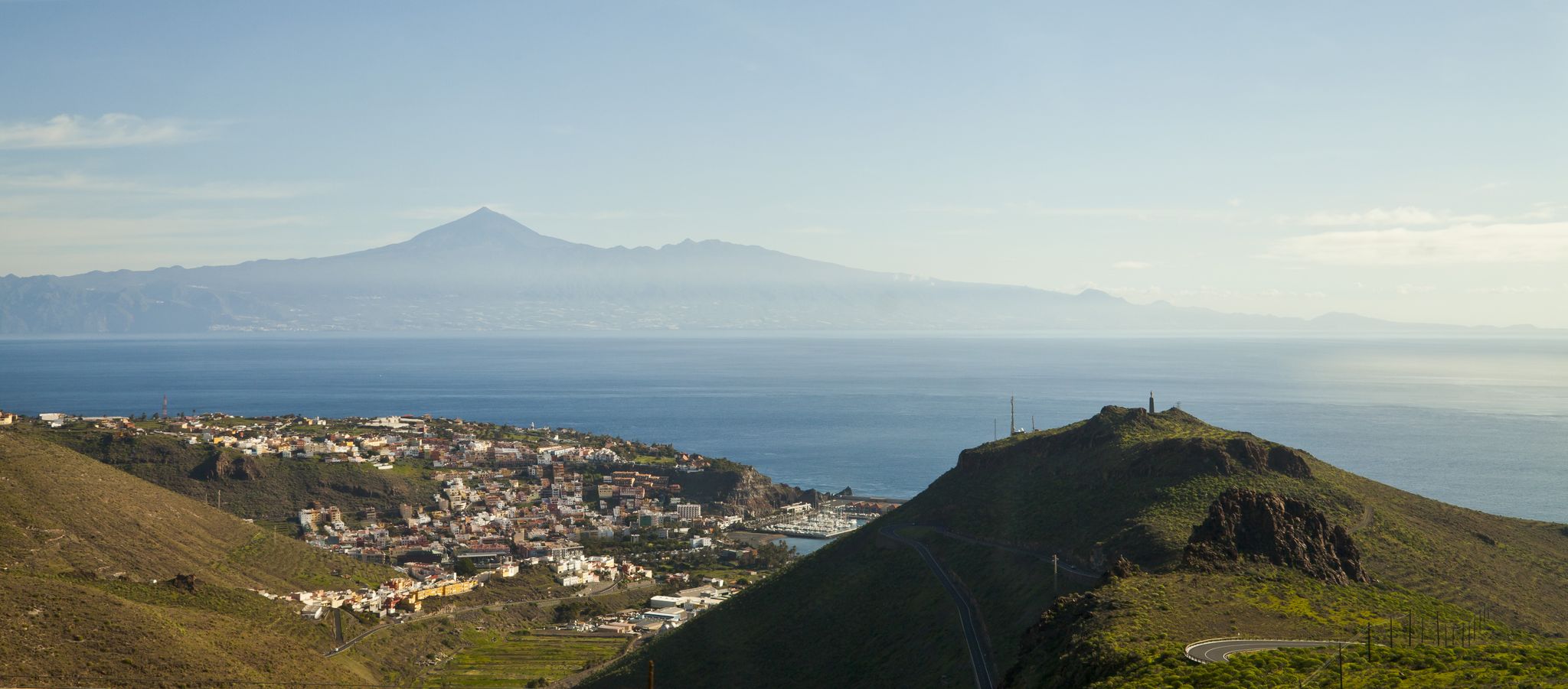
An imposing, flat-topped volcanic formation that rises above the green valleys of La Gomera. From here, you can enjoy panoramic views of Garajonay National Park and the island's rugged landscape. The summit, easily accessible for hikers, was a sacred place for the ancient Gomeros, who used it for ceremonies and rituals. Some say that on very clear days, you can even see Mount Teide silhouetted on the horizon.
2
0

Table Mountain: We hiked with a guide, which I would recommend to anyone new to the hike. Good hiking gear and hiking poles are a plus. The trails are often uneven. Once you reach Table Mountain, you can still climb it, which requires a lot of caution. At the end of the hike, we stopped at a restaurant, which I highly recommend.
0
0
A beautiful hike with a great group. Some of the trails are challenging. The restaurant at the end of the tour is highly recommended. Good hiking gear is recommended.
2
0
This hike is definitely worth doing. It's beautiful there, and the trails are good.
2
1
Frequently Asked Questions
How many hiking trails are accessible from bus stations in Garajonay National Park?
There are over 35 hiking trails in Garajonay National Park that are easily accessible from various bus stations, offering a range of difficulties from easy strolls to more challenging treks. This makes it convenient to explore the park's unique landscapes using public transport.
Are there easy, family-friendly hikes accessible by bus in Garajonay?
Yes, Garajonay National Park offers several easy, family-friendly routes accessible by bus. An excellent option is the Las Creces Trail (Route 5), which is about 4.2 km long and takes you through the enchanting laurisilva forest. Another great choice is Route 17: Pajarito - Alto de Garajonay Loop, an easy 4.5 km path that includes views from the island's highest point.
What kind of natural landscapes can I expect to see on these bus-accessible trails?
The trails accessible from bus stations in Garajonay National Park primarily lead through the ancient laurisilva forest, a UNESCO World Heritage site. You'll experience a unique, misty, subtropical rainforest ecosystem characterized by mosses, lichens, and ferns. Many routes also offer stunning views of volcanic rock formations like Los Roques and La Fortaleza, as well as panoramic vistas from higher elevations such as Alto de Garajonay.
Are there any circular hiking routes starting from bus stops?
Yes, many of the bus-accessible trails in Garajonay are circular, allowing you to start and end your hike at the same bus stop. For example, the View of El Teide – Laurel Forest loop from Alto de Garajonay is a moderate 12.4 km circular route that offers diverse scenery and can be accessed via public transport.
What is the best time of year to hike in Garajonay National Park from bus stations?
Garajonay National Park can be hiked year-round due to La Gomera's mild climate. However, the misty conditions that characterize the laurisilva forest are more prevalent during the cooler months, creating a truly magical atmosphere. Summers are generally drier and warmer. Always check the local weather forecast before heading out, as conditions can change quickly, especially at higher altitudes.
Are there any challenging routes accessible by bus for experienced hikers?
For experienced hikers seeking a challenge, the park offers more demanding routes accessible by bus. The Enchanted cloud forest – Los Barranquillos Viewpoint loop from Las Creces is a difficult 12.4 km trail that provides a strenuous workout while immersing you in the dense, ancient forest and offering rewarding viewpoints.
What should I pack for a bus station hike in Garajonay?
Given the often misty and humid conditions of the laurisilva forest, it's advisable to pack layers, including a waterproof or water-resistant jacket, even on sunny days. Sturdy hiking shoes are essential, as trails can be damp and uneven. Bring plenty of water, snacks, and a map or GPS device. Sun protection is also recommended for sections of the trail that are exposed.
Can I find viewpoints along the bus-accessible trails?
Absolutely. Garajonay National Park is dotted with numerous viewpoints (miradores) that offer breathtaking vistas. Many bus-accessible trails lead to or pass by these points, providing panoramic views of the park's unique topography, volcanic formations, and on clear days, even neighboring islands like Tenerife. Alto de Garajonay itself, accessible via several routes, offers expansive views.
What do other hikers enjoy most about these trails?
The komoot community highly rates the hiking experience in Garajonay National Park, with an average score of 4.5 stars from over 24,500 ratings. Reviewers frequently praise the unique, ancient laurisilva forest, describing it as 'magical' and 'otherworldly.' The well-maintained trails, the sense of tranquility, and the stunning panoramic views from various miradores are also consistently highlighted as favorite aspects.
Are there any specific attractions or landmarks to look out for along the bus-accessible routes?
While hiking from bus stations, you'll encounter several notable features. Keep an eye out for the impressive volcanic rock formations known as "Los Roques," such as Roque de Agando. "La Fortaleza" is another significant rock formation with historical importance. The trails also lead through the serene El Cedro forest, known for its ancient beauty and the small Lourdes Hermitage. The highest point, Alto de Garajonay, is also a key landmark offering incredible views.
Are there any moderate difficulty trails accessible by bus?
Yes, there are many moderate trails accessible by bus. A great example is the View of La Fortaleza (1243 m) – View of Fortaleza loop from Alto de Garajonay, which is an 11.2 km route offering a balanced challenge with rewarding views of the iconic La Fortaleza rock formation and the surrounding laurel forest.

Get inspired with the komoot mobile app


Explore more
Browse the best Hikes in other regions.
