The best hikes from bus stations around Foresta della Valle Benedetta
4.3
(1295)
6,429
hikers
24
hikes
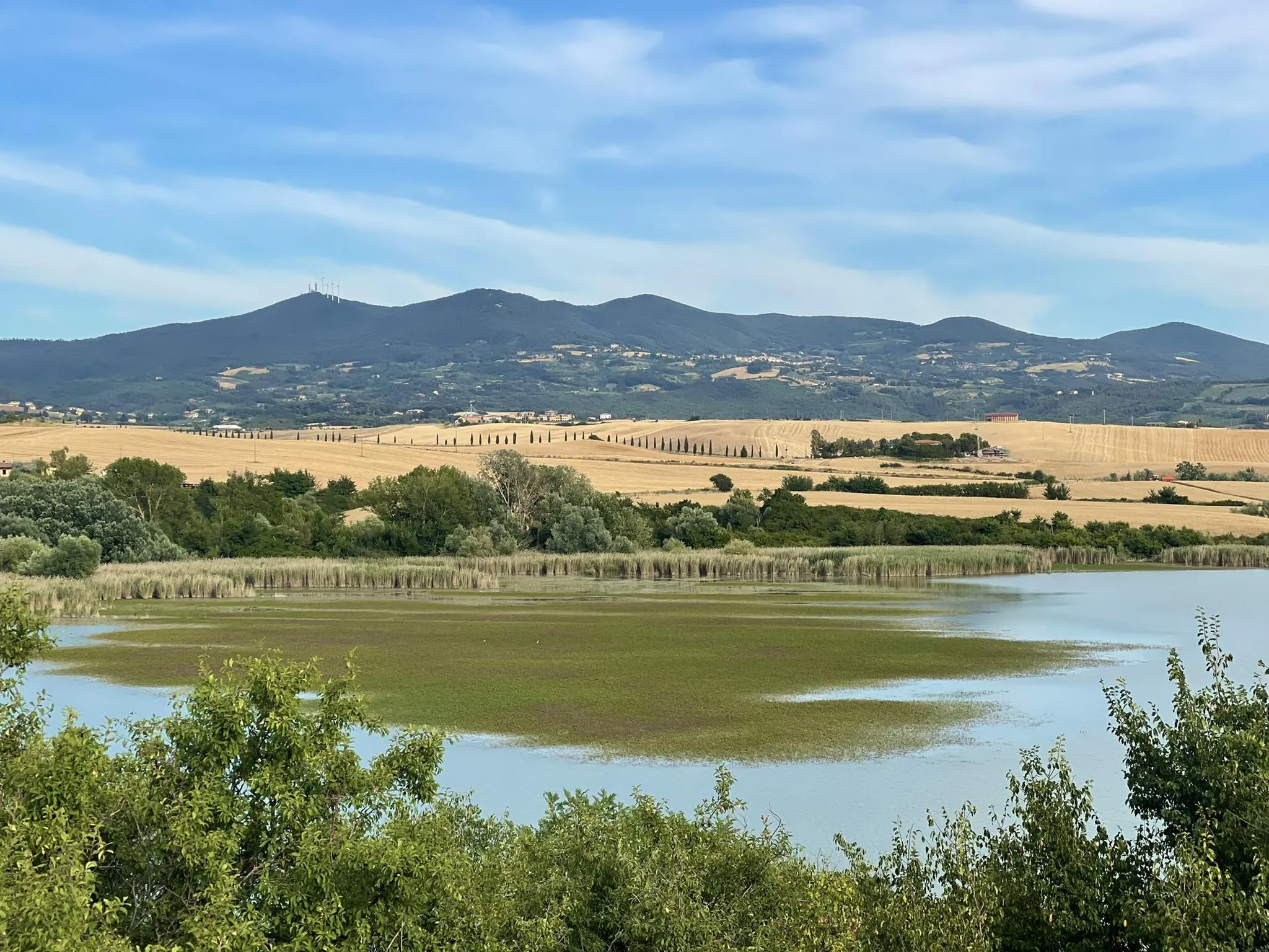
Bus station hiking trails around Foresta della Valle Benedetta traverse a protected natural area within the Livorno hills, characterized by maritime pine and Mediterranean maquis. The region features diverse landscapes, including the valley of the Ugione stream, and offers elevation changes with routes around Cima Monte Pelato. Some trails provide coastal views towards areas like the Calafuria Canyon, blending natural beauty with historical sites such as the Eremo della Sambuca.
Best bus station hiking trails around Foresta della Valle Benedetta
…Last updated: July 7, 2026
4.1
(22)
49
hikers
9.80km
03:01
320m
320m
Moderate hike. Good fitness required. Mostly accessible paths. Sure-footedness required.
5.0
(6)
23
hikers
15.6km
04:38
420m
420m
Moderate hike. Good fitness required. Mostly accessible paths. Sure-footedness required.

Sign up for free
5.0
(2)
12
hikers
17.3km
05:13
530m
530m
Hard hike. Very good fitness required. Mostly accessible paths. Sure-footedness required.
4.6
(5)
22
hikers
10.2km
03:04
320m
320m
Moderate hike. Good fitness required. Mostly accessible paths. Sure-footedness required.
5.0
(3)
7
hikers
5.68km
01:39
160m
160m
Easy hike. Great for any fitness level. Easily-accessible paths. Suitable for all skill levels.
Get access to more routes and recommendations from other explorers.
Sign up for free
Already have an account?
Our route recommendations are based on thousands of hikes, rides, and runs completed by other people on komoot.
Start today with a free account
Your next adventure awaits.
Login or Signup
Popular around Foresta della Valle Benedetta
Other adventures around Foresta della Valle Benedetta

Tips from the Community

Please take into account that it is very technical and some roads are closed.
0
0

An 18th-century masterpiece just waiting for you Also known as the Poccianti Aqueduct or the Colognole Aqueduct, this ambitious project, begun in 1793, was conceived by order of Grand Duke Ferdinand III in response to the growing water needs of an expanding Livorno. Thanks to its port, in fact, the city was experiencing a significant population increase. However, it was Leopold II who brought it to completion, inaugurating the work only in 1852. The project of the aqueduct, which supplied water to the city of Livorno from 1816 to 1912 and still serves the neighboring towns, was conceived by the skilled Florentine architect Giuseppe Salvetti, the first to trace the path through the hills of Colognole, where various springs gush generously. Due to his premature death, the work was assigned to the architect Calocchieri and completed by Pasquale Poccianti. The latter in particular left an indelible mark on the structure, creating the three imposing cisterns visible in Livorno: the Cisternone, the Cisternino di Città and the Cisternino di Pian di Rota.
0
0


Poggio Lecceta, 457 meters above sea level, is the highest peak of the Livorno Hills and is divided between the municipalities of Livorno and Collesalvetti. The summit is occupied by a radar station, whose radome can be seen from a great distance. On the slopes of the hill is the Livorno hamlet of Valle Benedetta (364 m), known for being the site of numerous excursions by the C.A.I. of Livorno. Among the numerous streams that have their sources in Poggio Lecceta are the Rio Maggiore and the Torrente Ugione, which are among the longest that descend from the Livorno Hills. (from Wikipedia) Access to the Radar area is via a short, but very steep climb along Via del Radar; However, since it is a military structure that has the purpose of providing meteorological information, as well as ensuring air traffic control and surveillance of maritime navigation, access to the structure is prohibited to unauthorized persons.
3
0
Eremo della Sambuca (Valle Benedetta - Livorno) The hermitage is located south of the Valle Benedetta in the forest of the Livorno Mountains. Already known in the 13th century as an Augustinian hermitage, one of the many that flourished throughout the Christian West to welcome those who wanted to retreat in prayer far from the noise of the world, in 1390 it took the name of Eremo di Santa Maria in Parrana Among others, the Gesuati penitential friars settled there. The Gesuati (not to be confused with the Jesuits) were born as an association of lay penitents founded in the 14th century by St. Giovanni de' Colombini from Siena. They preached peace, poverty and their main function, in addition to prayer, was to assist the sick, the poor and the needy. They spread throughout Italy and, in particular in Tuscany, founded many convents. The Augustinian hermitage was expanded and strengthened by them with other interventions in the vicinity (cultivations, a water mill, "icehouses"). Precisely because of the holy life that these monks led and because of its position sunken into the valley of the Ugione stream, the hermitage took the name of Santa Buca, or Sambuca. Over time, the Gesuati also took over the administration of the Sanctuary of Montenero. After the Gesuati order was suppressed in 1668 by Pope Clement IX (and their assets confiscated to support the war against the Turks), the complex passed to a series of private owners and followed a long period of decline. The structure consisting of a small church (with a single nave, divided into three bays with a circular apse, cross vaults and remains of frescoes, including an Annunciation), cells, guesthouse, refectory, kitchen, granary, cellar, is in poor condition. Since 1950 the structure has been a state-owned building of the Municipality of Collesalvetti. In 1912 it was declared a national monument and a few years ago it was entrusted to the Parish of Giovanni Gualberto in Valle Benedetta.
2
0

Villa Cristina is a scout house. In the summer of 2023 I was also lucky enough to go camping with the Salesians
1
0
Nice dirt road at times with large stones but nothing complicated, all pedalable.
1
0
Ancient Hermitage, whose oldest nucleus dates back to 1100 (small church of Santa Maria di Parrana, with a few cells, Augustinian Fathers of S. Jacopo in Acquaviva), located in the valley of the Ugione torrent, in the Provincial Natural Park of the Livornesi Mountains and in the complex regional agricultural-forestry Livornesi Hills (Valle Benedetta Forest). From 1390 the hermitage took the name of Santa Maria della Sambuca and the penitential Gesuati friars settled there (until 1668, the year of dissolution of the order), with consequent expansion of the structure (church, cells, guesthouse, refectory, kitchen, barn, cellar). A state property since 1950, the Hermitage has been partly renovated with CIPE funds, but is in a state of abandonment and the other two wings (including the beautiful cloister) require urgent conservative restoration. Of great interest for the circuit of existing routes that touch other cultural emergencies such as the remains of mills on the Ugione stream (late 1600s - early 1700s), the ice houses (late 1700s) and other historical-cultural testimonies, as well as naturalistic and geological emergencies.
2
0
Frequently Asked Questions
How many bus station hiking trails are available in Foresta della Valle Benedetta?
There are over 20 hiking routes in Foresta della Valle Benedetta that are easily accessible from bus stations. These trails offer a range of difficulties, from easy strolls to more challenging treks, ensuring options for various fitness levels.
Are there easy hiking options accessible from bus stops in Foresta della Valle Benedetta?
Yes, Foresta della Valle Benedetta offers several easy hiking options that start conveniently from bus stops. These trails are generally well-maintained and suitable for a relaxed outing. There are 6 easy routes available, perfect for a gentle introduction to the area's natural beauty.
What kind of landscapes and views can I expect on these bus-accessible trails?
The bus-accessible trails in Foresta della Valle Benedetta traverse diverse landscapes, from dense maritime pine forests and Mediterranean maquis to open areas offering panoramic views. You can expect to see fascinating coastal vistas, especially towards the Calafuria Canyon, and enjoy the natural beauty of the Livorno hills. Some routes also provide rewarding views from higher elevations like those around Cima Monte Pelato.
Are there any historical sites or landmarks I can visit on hikes from bus stations?
Absolutely. Many bus-accessible hikes lead to or pass by significant historical sites. A prominent example is the ancient Eremo della Sambuca, a hermitage with parts dating back to 1100, nestled in the Ugione stream valley. You might also encounter historical watchtowers along coastal routes or the impressive Colognole Aqueduct.
Can I find circular hiking routes starting from bus stops in the area?
Yes, many of the trails accessible from bus stations in Foresta della Valle Benedetta are circular, allowing you to return to your starting point without retracing your steps. For instance, the Ruins of Poggio ai Tre Molini loop from Colognole offers a moderate circular hike, or the Eremo della Sambuca loop from Limoncino provides another excellent option.
Are the bus station hiking trails in Foresta della Valle Benedetta suitable for families?
Foresta della Valle Benedetta offers trails suitable for families, especially the easier and moderate routes. The diverse scenery and historical points of interest like the Eremo della Sambuca can make for an engaging day out for all ages. Always check the route's distance and elevation gain to ensure it matches your family's capabilities.
Are dogs allowed on the hiking trails accessible by bus?
Generally, dogs are welcome on trails in Foresta della Valle Benedetta, but it's always advisable to keep them on a leash, especially in protected areas or near wildlife. Please ensure you clean up after your pet to maintain the natural environment for everyone.
What is the best time of year to hike from bus stations in Foresta della Valle Benedetta?
The spring and autumn months are ideal for hiking in Foresta della Valle Benedetta, offering pleasant temperatures and vibrant natural colors. Summer can be warm, so early morning or late afternoon hikes are recommended. Winter hiking is also possible, though some paths might be muddy after rain, and coastal winds can be brisk.
Are there any challenging hikes accessible by bus for experienced hikers?
For experienced hikers seeking a challenge, Foresta della Valle Benedetta offers several difficult routes accessible by bus. These trails often feature significant elevation changes and require good fitness and sure-footedness. An example is the Eremo della Sambuca – Villa Cristina loop from Colognole, which covers over 17 km with substantial ascents.
What do other hikers say about the bus-accessible trails in Foresta della Valle Benedetta?
The bus-accessible trails in Foresta della Valle Benedetta are highly rated by the komoot community, with an average score of 4.4 out of 5 stars from over 1200 ratings. Reviewers often praise the region's diverse landscapes, the historical charm of sites like the Eremo della Sambuca, and the rewarding coastal views.
Where can I find refreshments or places to eat near the bus-accessible trails?
While the trails themselves are within a natural forest area, you can find cafes and restaurants in the nearby villages and towns that serve as bus stops, such as Colognole or Limoncino. It's a good idea to check opening times in advance, especially if you plan to rely on them for post-hike refreshments.
Most popular routes around Foresta della Valle Benedetta
Most popular attractions around Foresta della Valle Benedetta

Get inspired with the komoot mobile app


Explore more
Browse the best Hikes in other regions.
