The best family-friendly hikes and walks around Stausee Obermaubach
4.6
(30643)
106,409
hikers
54
hikes
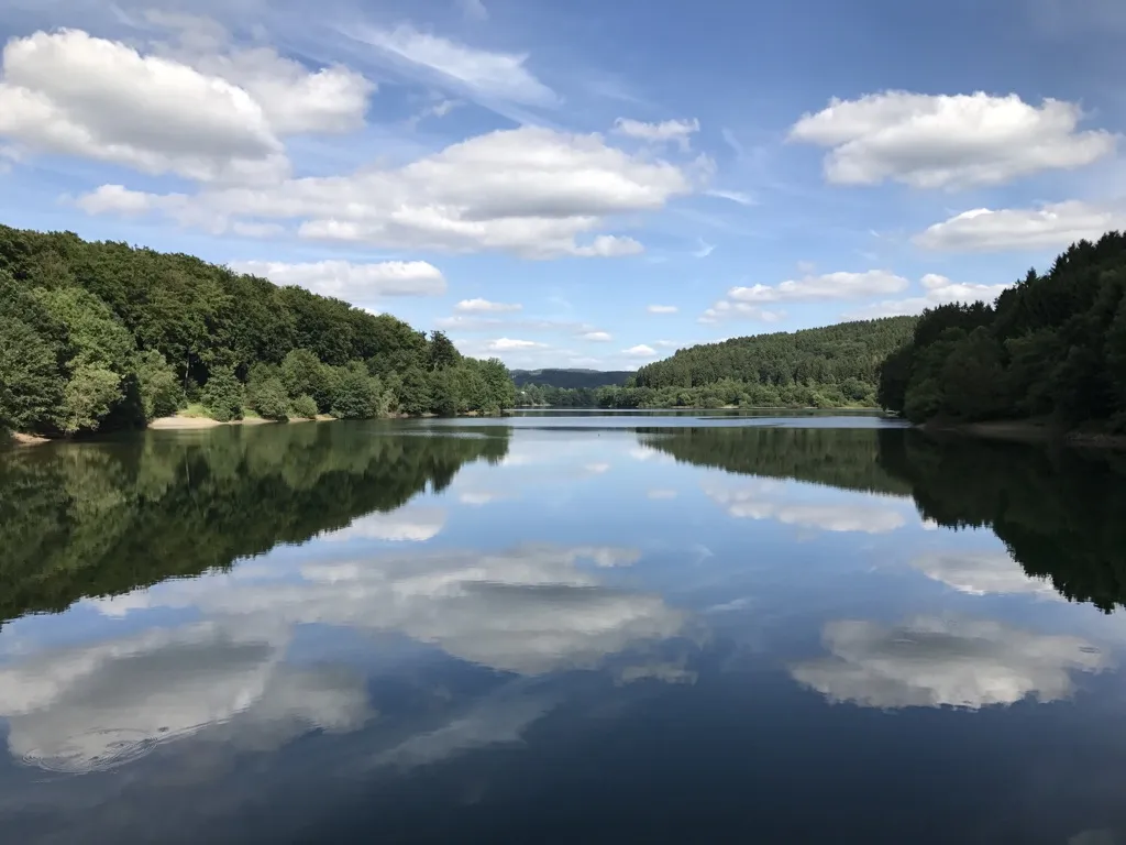
Family friendly hiking trails around Stausee Obermaubach are set within the Rureifel region of North Rhine-Westphalia, Germany. The area is characterized by the Stausee Obermaubach reservoir, which is approximately 3 km long, and surrounded by rolling hills and dense forests. Hikers can explore the Rur Valley, known for its red sandstone rock formations, some reaching up to 90 meters deep. The landscape offers diverse terrain, from accessible paths along the reservoir banks to trails with moderate elevation changes through forested areas.
Best family friendly hiking trails around Stausee Obermaubach
- The most popular family friendly hiking route is Obermaubach Fish Pass – Circular Bench by the Lake loop from Obermaubach, a 4.1 miles (6.6 km) trail that takes 1 hour 53 minutes to complete. This easy route guides hikers along the reservoir banks and past the fish ladder.
- Another top favourite among local hikers is Obermaubach Reservoir – Hindenburg Gate loop from Obermaubach, a moderate 8.2 miles (13.2 km) path. This trail offers varied scenery, including views of the reservoir and surrounding forests.
- Local hikers also love the Kickley Rock Formation – Obermaubach Dam loop from Obermaubach, a 6.8 miles (11.0 km) trail leading through the Rur Valley and past red sandstone formations, often completed in about 3 hours 8 minutes.
- Hiking around Stausee Obermaubach is defined by the scenic reservoir, dense forests, and unique red sandstone rock formations. The network offers options for various ability levels, including many easy family hikes around Stausee Obermaubach with kids.
- The routes in Stausee Obermaubach are highly rated by the komoot community with an average score of 4.7 stars from more than 1,900 reviews. More than 7,400 hikers have used komoot to explore Stausee Obermaubach's varied terrain.
Last updated: July 13, 2026
4.8
(229)
693
hikers
6.67km
01:53
150m
150m
Easy hike. Great for any fitness level. Easily-accessible paths. Suitable for all skill levels.
4.8
(269)
934
hikers
13.2km
03:51
360m
360m
Moderate hike. Good fitness required. Mostly accessible paths. Sure-footedness required.

Sign up for free
4.7
(65)
265
hikers
11.0km
03:09
260m
260m
Moderate hike. Good fitness required. Mostly accessible paths. Sure-footedness required.
4.8
(940)
3,083
hikers
16.2km
04:39
350m
350m
Moderate hike. Good fitness required. Mostly accessible paths. Sure-footedness required.
4.9
(58)
235
hikers
8.30km
02:13
90m
90m
Moderate hike. Good fitness required. Easily-accessible paths. Suitable for all skill levels.
Get access to more routes and recommendations from other explorers.
Sign up for free
Already have an account?
Our route recommendations are based on thousands of hikes, rides, and runs completed by other people on komoot.
Start today with a free account
Your next adventure awaits.
Login or Signup
Popular around Stausee Obermaubach
Other adventures around Stausee Obermaubach

Tips from the Community


A very communicative bank.
1
1

Along the banks of the Eifel reservoirs, such as the Obermaubach Reservoir and the Rursee, you'll frequently find rest stops and picnic areas, but a special feature is the round bench by the water. These benches are often positioned so that you can look all around and enjoy a panoramic view of the lake and the surrounding valleys. Unlike conventional, straight benches, these round seats invite conviviality, as several people can sit comfortably and simultaneously enjoy the view in every direction. A round bench by a reservoir not only serves as a resting place for hikers, cyclists, or fishermen but also forms a natural vantage point. At the Obermaubach Reservoir, for example, such benches are strategically placed along hiking trails and viewpoints overlooking the water and the wooded slopes. From such a spot, you can watch the gently lapping water of the reservoir, observe the surrounding forests and hills, and even recognize the outline of the village of Obermaubach or the dam itself in the distance. These benches are also designed to promote peace and contemplation. The round shape allows you to turn your face towards the sun or the water without having to leave the bench. Moreover, they are often made of sustainable wood or combined with concrete, making them weatherproof and able to withstand years of use, even in the damp environment of a reservoir. For hikers or cyclists following the Rurtalradweg or the trails around the reservoir, the round bench offers an ideal spot to rest, take photos, or simply enjoy the surroundings. The view over the water, the surrounding forests, and the changing light in the morning or evening make this simple arrangement a small but memorable part of the natural experience.
1
0
The Rursee viewpoint is one of the most beautiful panoramic views in the Eifel region (North Rhine-Westphalia, Germany). It's a vast reservoir (Rursee or Rurlake) surrounded by forests, slopes, and hiking trails. It's not only a focal point of the Eifel National Park but also offers spectacular views of the water and the surrounding valleys from several locations. The Rursee is a large reservoir of approximately 780 hectares, created by the dam at Schwammenauel on the Rur River. The lake is part of a chain of reservoirs in the Eifel region used for water regulation, energy generation, recreation, and nature experiences. Around the lake, you'll find cycling routes, hiking trails, and viewpoints, offering ever-changing perspectives of the water and the surrounding landscape. 🏞️ Famous viewpoints on Lake Rur 1. Eifel View "Hirschley" (Heimbach) From this elevated spot, approximately 512m above sea level, you have a spectacular panorama of Lake Rur and the steep slopes of its northern shore. The viewpoint is located in the Wilder Kermeter area of the Eifel National Park and is accessible via hiking trails from a parking lot on the Kermeter. 2. Eifel View Kierberg (Simmerath-Woffelsbach) At an altitude of approximately 455m, the viewpoint at Kierberg offers a wide view over Lake Rur, with views towards the Eifel National Park. This viewpoint is located along a country road (L128) between Steckenborn and Woffelsbach and is an excellent place for a short stop during a tour or hike. 3. Eifel View Beautiful View (Nideggen/Simmerath-Einruhr) This viewpoint on the Simonsley slope (approximately 415m) offers a panoramic view of Lake Rursee, clearly showing the wooded core of the Eifel National Park. It is a classic spot for many hikers who walk around the lake, especially beautiful at sunset or in autumn. 4. Eifel View Youth Hostels (Simmerath-Rurberg) Near the youth hostel in Rurberg, there is a viewing point at an altitude of approximately 470m. From here, you can see the lake and the forests of the Eifel National Park in the distance, with panoramic panels for orientation. 5. Eifel-Blick Wolfshügel (Simmerath-Einruhr) This viewpoint above Einruhr overlooks the village of Obersee and the Rur River valleys beyond. It is situated on a small plateau (approximately 360m above sea level) and can be reached via a short, slightly steep hike from the Rur Bridge in Einruhr. Several hiking trails around Lake Rur are specially designed to offer the most beautiful views of the lake. The Rurseeblick route, for example, is a circular walk of approximately 6.5km with several photogenic viewpoints and panoramic stops along the way, ideal for an afternoon stroll with water views. The longer Eifeler Steilküste route also takes you along cliffs and elevated paths with beautiful views of the dam and the lake. Along the way, you'll see not only the water but also the deeply incised valleys and wooded landscape of the Eifel. 🌄 Tips for the best view • Morning and evening light often create the most beautiful interplay of colors across the lake. • Walk along the shores or on the slopes surrounding the lake to gain ever-changing perspectives on the water and vegetation. • In autumn and spring, the views are often clearer because the air is cleaner and the forests have a rich contrast in color.
0
0

Coming from Obermaubach, after crossing the new arched bridge over the Rur River, one has a view of the Eugenienstein and the Rur towards Nideggen. The Eugenienstein rises to a height of 334 meters above sea level. The rock formation is composed of red sandstone.
0
0

beautiful surroundings and wonderful hiking trails
1
0

These will accompany you on many hiking trails around Nideggen. Worth seeing
0
0

The interesting formations formed by the red sandstone cliffs here are not man-made. Nature was the architect, piling up rocks here over the course of Earth's history and partially smoothing them down again through erosion—a perpetual process.
4
0
Frequently Asked Questions
How many family-friendly hiking trails are available around Stausee Obermaubach?
There are over 50 family-friendly hiking trails around Stausee Obermaubach, ranging from easy strolls to more moderate adventures. This guide focuses on routes specifically chosen for their suitability for families, ensuring a great outdoor experience for all ages.
What kind of terrain can we expect on family hikes in the Stausee Obermaubach area?
The terrain around Stausee Obermaubach is generally characterized by rolling hills and lush forests. You'll find well-maintained paths along the reservoir, as well as trails that ascend gently through woodlands. Some routes, like those offering views of the red sandstone formations, might have slightly more varied elevation, but are still manageable for active families.
Are there any circular routes suitable for families?
Yes, many of the family-friendly trails around Stausee Obermaubach are circular, offering convenient starting and ending points. A popular option is the Obermaubach Fish Pass – Circular Bench by the Lake loop from Obermaubach, which is an easy 6.6 km route. Another great choice is the Mausauel Rur Bridge – Obermaubach Reservoir loop from Obermaubach, a moderate 8.4 km trail.
What interesting landmarks or natural features can we see along the trails?
The Stausee Obermaubach area is rich in natural beauty and unique features. You can explore the impressive Obermaubach Reservoir itself, or visit the fascinating Obermaubach Fish Pass, which even has a glass viewing window to observe fish migration. Keep an eye out for the striking red sandstone rock formations in the Rurtal, and enjoy panoramic views from various viewpoints like the Eifel-Blick forest chapel or the Engelsblick platform.
Is Stausee Obermaubach suitable for hiking with a stroller or young children?
Many paths directly along the reservoir are suitable for strollers, offering flat and accessible surfaces. For younger children, there are numerous easy trails, such as the Obermaubach Fish Pass – Circular Bench by the Lake loop. Additionally, the area features a forest and nature play area (Waldspielplatz Obermaubach) with an educational nature trail, perfect for engaging little ones.
Are dogs allowed on the family-friendly hiking trails?
Yes, the Stausee Obermaubach region is generally dog-friendly. Most trails welcome dogs, but it's always recommended to keep them on a leash, especially in nature reserve areas and near wildlife. Please ensure you clean up after your pet to help keep the trails enjoyable for everyone.
What is the best time of year to visit Stausee Obermaubach for family hiking?
The Stausee Obermaubach area is beautiful year-round. Spring offers vibrant greenery and blooming flora, while autumn provides stunning fall colors in the dense forests. Summer is ideal for combining hiking with other recreational activities on the lake. Even in winter, the serene, snow-dusted landscapes can be magical, though some paths might be slippery. For comfortable hiking, spring through autumn are generally preferred.
Where can we park when visiting Stausee Obermaubach for a hike?
Stausee Obermaubach is well-equipped with ample free parking options, making it convenient for visitors arriving by car. You'll find designated parking areas close to popular trailheads and the reservoir itself.
Can we reach the hiking trails by public transport?
Yes, Stausee Obermaubach is easily accessible by public transport. The Rurtalbahn train stops directly at Obermaubach, providing a convenient and eco-friendly way to reach the starting points of many trails around the reservoir.
What do other hikers enjoy most about the family-friendly trails here?
The area is highly rated by the komoot community, with an average score of 4.7 stars. Reviewers often praise the picturesque landscapes, the well-maintained and varied trails suitable for all ages, and the unique attractions like the fish pass. Many highlight the tranquil escape offered by the lush forests and stunning views of the reservoir.
Are there any cafes or facilities near the family hiking routes?
Yes, you'll find various facilities around Stausee Obermaubach. There are cafes and restaurants in the village of Obermaubach where you can refuel after your hike. The area also offers recreational facilities and the aforementioned forest and nature play area, ensuring a comfortable and enjoyable visit for families.
Are there any longer, more challenging family routes for older children?
For families with older children looking for a bit more challenge, there are moderate routes that offer longer distances and more elevation. The Obermaubach Reservoir – Hindenburg Gate loop from Obermaubach is a moderate 13.1 km trail, while the Kickley Rock Formation – Obermaubach Dam loop from Obermaubach covers 10.9 km with rewarding views.
Most popular routes around Stausee Obermaubach
Most popular attractions around Stausee Obermaubach

Get inspired with the komoot mobile app


Explore more
Browse the best Hikes in other regions.
