The best traffic-free bike rides around Weinfelder Maar
4.4
(3087)
14,966
riders
275
rides
No traffic touring cycling routes around Weinfelder Maar traverse a unique volcanic landscape characterized by deep crater lakes, known as maars, and surrounding wooded slopes. The region features former railway lines converted into cycle paths, offering gentle gradients and asphalt surfaces. These routes often pass through tunnels and over viaducts, connecting the volcanic Eifel to river valleys and sparse forests. The terrain includes both flat sections and moderate inclines, providing varied cycling experiences.
Best no traffic touring cycling routes around…
Last updated: July 13, 2026
4.5
(4)
12
riders
46.5km
03:39
740m
740m
Hard bike ride. Very good fitness required. Mostly paved surfaces. Suitable for all skill levels.
4.6
(217)
888
riders
Moderate bike ride. Good fitness required. Mostly paved surfaces. Suitable for all skill levels.

Sign up for free
4.7
(40)
195
riders
Easy bike ride. Great for any fitness level. Mostly paved surfaces. Suitable for all skill levels.
5.0
(7)
28
riders
Hard bike ride. Very good fitness required. Mostly paved surfaces. Suitable for all skill levels.
4.5
(4)
12
riders
Hard bike ride. Very good fitness required. Mostly paved surfaces. Suitable for all skill levels.
Get access to more routes and recommendations from other explorers.
Sign up for free
Already have an account?
Our route recommendations are based on thousands of hikes, rides, and runs completed by other people on komoot.
Start today with a free account
Your next adventure awaits.
Login or Signup
Popular around Weinfelder Maar
Tips from the Community

Discovering the historical is always a highlight
0
0

A truly amazing experience for young and old. Turn on the lights – even though the tunnel is lit. And in hot weather, it's like riding through a "refrigerator."
0
0

Motorhome port at the holiday village Pulvermaar
0
0

Unfortunately, it is not possible to cycle directly around the maar.
0
0

"Old Station" Schalkenmehren Passenger service between Daun and Wittlich was discontinued on November 1, 1981. Schalkenmehren. Approaching the Old Station in Schalkenmehren on the former railway line, today's Maare-Mosel cycle path, and seeing the station building, it's hard to believe that it was opened as a fourth-class railway station exactly 100 years ago. But how did it all begin 100 years ago? Surveying for the Daun-Wittlich railway line began as early as 1897. General preparatory work for the single-track line began in 1907. But it would take some time before the Daun-Schalkenmehren-Gillenfeld section opened on December 1, 1909, with the line running over the 28-meter-high Daun viaduct and through the 560-meter-long Schalkenmehren railway tunnel, "Großes Schlitzohr" (Great Sly Fox). The extension from Gillenfeld to Manderscheid to Pantenburg was completed on May 1, 1910, and the extension from Manderscheid-Pantenburg to Wittlich, signifying the completion of the entire line, was completed on July 1, 1910. The completion of the Daun-Wittlich railway line brought rapid development to the village of Schalkenmehren. In the first year of the line's existence (1910), 18,968 tickets were sold in Schalkenmehren, followed by 25,057 in 1913, 27,969 in 1919, and even 30,279 in 1922. In addition, Schalkenmehren station was designed for general cargo traffic and the receipt and dispatch of wagonloads. Text / Source: www.volksfreund.de/ https://www.volksfreund.de/region/vulkaneifel/ein-schmuckstueck-fuer-nostalgiker_aid-5712448
13
0
Old Railway Tunnel "Großes Schlitzohr" near Daun At the end of the first decade of the 20th century, the railway tunnel was driven 560 meters through the mountain. 80 years later, it was converted into a cycle path. The tunnel contains several niches with rounded arches, through which the water seeping in above is drained. The sound of this water has been a part of this place for almost 100 years. Text / Source: Institut Denkunternehmung, Hörscheider Straße 20, 54552 Darscheid https://denkunternehmung.de/alter-eisenbahntunnel-grosses-schlitzohr-bei-daun
16
0
The Daun Maars - 10,000-Year-Old Volcanic Lakes The Daun Maars were formed around 10,000 years ago from volcanic steam explosions. Hot lava rises from the Earth's interior and meets water, which suddenly evaporates. This blasts away entire mountain peaks. What remains is a deep crater that fills with water over the years and a wall of boulders surrounding the lake. The Daun Maars include the Gemünden Maar, the Weinfelder Maar, and the Schalkenmehrener Doppelmaar. One crater of the Schalkenmehren Maar has silted up over the millennia. The area is a nature reserve and a refuge for waterfowl and rare dragonfly species. Text / Source: deutschland-outdoor.der https://deutschland-outdoor.de/eifel/dauner-maare
13
0
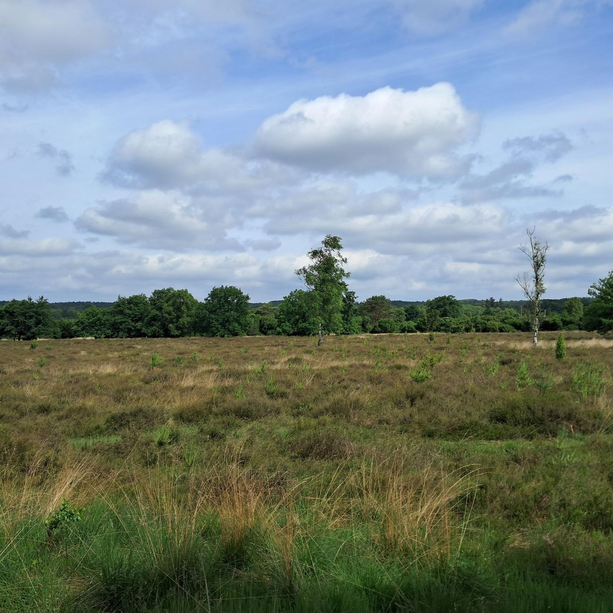
Weinfelder Maar The Weinfelder Maar, formed by volcanic activity around 20,000 to 30,000 years ago, is the highest of the three Daun Maars at 487 meters above sea level. The lake is 51 meters deep and has a diameter of 396 to 429 meters. An almost melancholic atmosphere surrounds the maar. Many legends surround the tranquil Eifel eye. A castle is said to have once stood on the site of the crater, where a count lived with his wife and only child. After returning home from a hunt, the castle had sunk as punishment for the woman's nastiness, and he found only a lake where a cradle miraculously floated his child safely to the shore. If you look at the dark surface of the water long enough, it is said that you can make out the outline of the castle. The German landscape painter Fritz von Wille was so fascinated by the Weinfelder Maar that he repeatedly immortalized it in his paintings. Among his favorite motifs was the small chapel on the north bank, dedicated to Saint Martin. It was once the parish church of the village of Weinfeld, which was ravaged by the plague in the 16th century. Anyone who rings the bells inside by pulling the ropes can make a wish. To this day, the associated cemetery is maintained and used by the local community of Schalkenmehren. This is also where its second name, Totenmaar, comes from. Donkeys and goats have been introduced to the Weinfelder Maar to regulate vegetation. The maar's unique flora and fauna are protected. Swimming and other water sports are prohibited in the Weinfelder Maar, but a nearly two-kilometer-long path makes it a wonderful place to explore on foot. Parking: Guests can park along the L64 either in the parking lot at the Weinfelder Maar or on the Maarsattel between the Weinfelder Maar and the Schalkenmehrener Maar. Text / Source: GesundLand Vulkaneifel GmbH, Leopoldstr. 9 A, 54550 Daun https://www.eifel.info/a-weinfelder-maar
13
0
Frequently Asked Questions
How many traffic-free touring cycling routes are available around Weinfelder Maar?
The komoot community has curated over 260 traffic-free touring cycling routes around Weinfelder Maar. These routes cater to various skill levels, ensuring there's a suitable option for everyone looking to explore the volcanic Eifel region by bike.
Are there easy or family-friendly traffic-free cycling routes near Weinfelder Maar?
Yes, the region offers many easy and family-friendly options. The View of Daun from Daun Viaduct – Großes Schlitzohr Tunnel loop from Schalkenmehren is a moderate route that's relatively short and features tunnels, which are often a hit with children. The Maare-Mosel Cycle Path, which passes by Weinfelder Maar, is particularly well-suited for families due to its predominantly downhill gradient and asphalt surface, built on a former railway line.
What kind of terrain and elevation can I expect on these routes?
The terrain around Weinfelder Maar is characterized by its volcanic origins, featuring circular crater lakes (maars) and lush, wooded slopes. Many routes, especially those utilizing former railway lines like the Maare-Mosel Cycle Path, offer gentle inclines (maximum 3%) and asphalt surfaces. However, some routes, such as the Holzmaar – Cycle path on a railroad line loop from Daun, can involve more significant elevation changes, with over 700 meters of ascent and descent, making them more challenging.
What natural features and landmarks can I see along the traffic-free cycling routes?
You'll encounter stunning volcanic landscapes, including the deep-blue Weinfelder Maar itself, often called Totenmaar. The region is dotted with other maars like Gemündener Maar and Schalkenmehrener Maar. Cyclists can also pass through impressive illuminated tunnels and over viaducts, remnants of the old railway lines. Historic sites like the Weinfelder Chapel (Totenmaar Chapel) on the northern bank of the maar and the Dronke Tower, offering panoramic views, are also notable landmarks.
Are there circular traffic-free touring bike routes available?
Yes, many routes are designed as loops, allowing you to start and end at the same point. For example, the Cycle path on a railroad line – View of the Pulvermaar loop from Daun offers a moderate circular experience, taking you past scenic viewpoints and maars. The Pulvermaar – Cycle path on a railroad line loop from Schalkenmehren is another excellent circular option.
What is the best time of year to go touring cycling around Weinfelder Maar?
The spring and autumn months are generally ideal for touring cycling around Weinfelder Maar. Spring brings blooming nature and mild temperatures, while autumn offers spectacular fall foliage. Summer can also be pleasant, but routes might be busier. Winter cycling is possible, but you should be prepared for colder temperatures and potentially icy conditions, especially on shaded paths.
Can I bring my dog on these traffic-free cycling routes?
While specific regulations can vary by route or nature reserve, many paths in the Vulkaneifel region are dog-friendly, provided your dog is kept on a leash. It's always advisable to check local signage or specific route details on komoot for any restrictions, especially within designated nature reserves like the immediate surroundings of Weinfelder Maar.
Where can I park my car to access these routes?
Parking is generally available in the towns and villages surrounding Weinfelder Maar, such as Daun and Schalkenmehren. These locations often serve as excellent starting points for many of the region's cycling routes, including those that connect to the Maare-Mosel Cycle Path. Look for designated parking areas near trailheads or town centers.
Is public transport available to reach the starting points of these routes?
Yes, public transport options exist to access the Vulkaneifel region. The Maare-Mosel Cycle Path, for instance, is well-integrated with public transport, allowing cyclists to use buses or trains to reach towns like Daun, which is a common starting point. Some regional buses are equipped to carry bicycles, making it convenient to plan one-way trips or reach specific trailheads.
What do other touring cyclists enjoy most about cycling in Weinfelder Maar?
The area is highly rated by the komoot community, with an average score of 4.5 stars. Reviewers often praise the serene, traffic-free nature of the routes, the stunning volcanic scenery, and the unique experience of cycling through illuminated tunnels and over impressive viaducts. The well-maintained paths and the variety of routes catering to different fitness levels are also frequently highlighted.
Are there cafes or places to eat along the traffic-free routes?
Yes, many of the routes pass through or near charming villages and towns in the Vulkaneifel region. You'll find opportunities to stop at local cafes, restaurants, and traditional German Gasthäuser, especially in places like Daun, Schalkenmehren, and along the Maare-Mosel Cycle Path, where you can refuel and enjoy regional specialties.
Most popular routes around Weinfelder Maar

Get inspired with the komoot mobile app


Explore more
Browse the best Cycling routes in other regions.
