The best hikes from bus stations around L'Eau d'Heure
4.4
(2435)
13,805
hikers
212
hikes
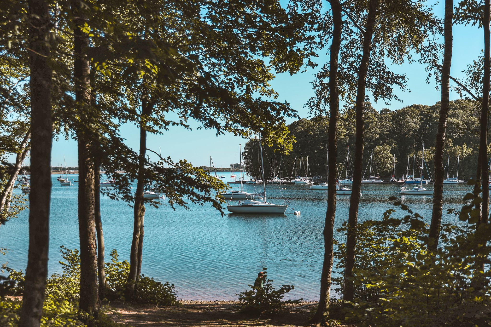
Bus station hiking trails around L'Eau d'Heure navigate a landscape defined by Belgium's largest artificial lake complex, encompassing five interconnected lakes. The region features a diverse terrain of tranquil woods, open grasslands, and freshwater ecosystems along the Eau d'Heure river. This area covers 1,800 hectares, with significant portions dedicated to forests, grasslands, and water bodies, providing varied environments for exploration. The elevation gain on routes is generally moderate, with no significant peaks.
Best bus station hiking trails around L'Eau d'Heure
- The most popular bus station hiking route is View of Lac de l'Eau d'Heure – Eau d'Heure Lake loop from L'Eau d'Heure, a 10.9 miles (17.6 km) moderate trail that takes 4 hours 41 minutes to complete. This route offers continuous views of Lac de l'Eau d'Heure.
- Another top favourite among local hikers is Eau d'Heure Lake – Lake Viewpoint loop from Soumoy, a moderate 7.2 miles (11.6 km) path. This trail includes viewpoints overlooking the lake and features varied terrain.
- Local hikers also love the Plate-Taille Dam – View of Lac de la Plate Taille loop from L'Eau d'Heure, a 6.3 miles (10.1 km) trail leading through areas around Lac de la Plate Taille, often completed in about 2 hours 41 minutes.
- Hiking around L'Eau d'Heure is defined by extensive lake shorelines, tranquil woods, and open grasslands. The network offers options for different ability levels, from easy walks to more challenging routes.
- The routes in L'Eau d'Heure are highly rated by the komoot community with an average score of 4.4 stars from more than 2,000 reviews. More than 12,000 hikers have used komoot to explore L'Eau d'Heure's varied terrain.
Last updated: June 29, 2026
4.1
(16)
167
hikers
17.6km
04:41
190m
190m
Moderate hike. Good fitness required. Easily-accessible paths. Suitable for all skill levels.
4.3
(111)
600
hikers
8.07km
02:05
50m
50m
Moderate hike. Good fitness required. Easily-accessible paths. Suitable for all skill levels.

Sign up for free
4.6
(8)
25
hikers
10.1km
02:42
110m
110m
Moderate hike. Good fitness required. Easily-accessible paths. Suitable for all skill levels.
4.7
(7)
41
hikers
12.4km
03:15
110m
110m
Moderate hike. Good fitness required. Easily-accessible paths. Suitable for all skill levels.
5.0
(5)
72
hikers
9.18km
02:21
40m
40m
Moderate hike. Good fitness required. Easily-accessible paths. Suitable for all skill levels.
Get access to more routes and recommendations from other explorers.
Sign up for free
Already have an account?
Our route recommendations are based on thousands of hikes, rides, and runs completed by other people on komoot.
Start today with a free account
Your next adventure awaits.
Login or Signup
Popular around L'Eau d'Heure
Other adventures around L'Eau d'Heure

Tips from the Community

The development of the dams and associated lakes began in the second half of the 20th century with the aim of providing a structural solution to several problems in the region. On the one hand, it involved regulating water flows and limiting flood risks in downstream areas. On the other hand, the project was set up to create a strategic water supply for industrial and domestic use and to generate energy through hydropower plants. The dam itself is part of a network of several dams that together delineate several artificial lakes. This infrastructure is technically designed to store water and release it in a controlled manner depending on rainfall, demand, and ecological requirements. The constructions consist of massive concrete works with adjustable outlets and safety mechanisms to accurately manage the water level. Hydrologically, the system has a major impact on regional water management. The lakes act as a buffer that absorbs peak flows during heavy rainfall, thereby reducing the risk of flooding in downstream rivers such as the Sambre and Meuse. In addition, controlled water management ensures a more stable water supply during dry periods. Ecologically, the construction of the dams has led to the creation of new ecosystems around the artificial lakes. The bodies of water attract various bird species and support diverse flora and fauna. At the same time, management requires attention to the balance between recreational use, water quality, and natural habitats. Today, the area around the L’Eau d’Heure dam has grown into an important recreational center. The lakes are used for water sports, tourism, and relaxation, giving the area an economic function in addition to its original water management task. This makes it a multifunctional landscape where engineering, nature, and recreation come together.
0
0
The Plate-Taille Dam is located in southern Belgium in Wallonia, on the border of the provinces of Namur and Hainaut. The dam is situated near the villages of Froidchapelle and Cerfontaine and forms the central element of the Lacs de l’Eau d’Heure lake district, the largest artificial lake complex in the country. This area covers approximately 1800 hectares and consists of several interconnected lakes that together form a unique landscape of open water, wooded hills, and extensive recreational zones. Due to its location between the Ardennes and the Fagne, the area has a varied and gently rolling terrain. The origin of the dam dates back to the 1970s when Belgium faced water management problems. The Sambre River, an important waterway for industry and shipping, experienced highly fluctuating water levels. During dry periods, the water level dropped too low, which had economic consequences. To solve this problem, an ambitious project was launched, including the construction of a series of dams on the Eau d’Heure River and its tributaries. The construction of the Plate-Taille dam began around 1974 and was completed in 1981. As a result of its construction, five lakes were created: * Plate Taille (the largest and deepest) * Eau d’Heure * Falemprise * Ry Jaune * Féronval The construction brought about a major change for the region. Certain areas were submerged, and residents had to relocate. At the same time, this project laid the foundation for a new economic model based on tourism and recreation. The Plate-Taille dam is the largest dam in Belgium and an impressive example of modern hydraulic engineering. The Plate Taille lake itself has a surface area of approximately 350 hectares and is the largest and deepest lake in Belgium. The dam holds back an enormous mass of water and literally forms the heart of the entire lake district. One of the dam's main functions is energy generation through a pumped-storage power plant. * Capacity: ± 140 megawatts * Number of turbines: 4 (reversible) * Type: pumped-storage power plant System Operation The system operates on a clever principle: * During low energy demand, water is pumped to a higher reservoir. * During high energy demand, the water flows back down through turbines, generating electricity. This makes the plant particularly valuable for stabilizing the electricity grid, especially in combination with renewable energy sources such as wind and solar power. Around the dam lies a surprisingly rich nature reserve. The combination of water, forests, and open plains ensures great biodiversity. The landscape is characterized by: * Dense deciduous and coniferous forests * Open grasslands * Reed beds along the banks * Quiet bays and small islands Animals found here include: * Roe deer * Foxes * Waterfowl such as grebes and cormorants * Birds of prey The creation of the lakes has led to new ecosystems where flora and fauna have adapted to the water-rich environment. For someone who enjoys long and challenging hikes, like myself, this area is ideal, and you can easily create routes of several hours here without much crowds. 🚴♂️ Cycling and Recreation Besides hiking, the area is also popular with: * Road cyclists (hilly terrain) * Mountain bikers * Families (flat cycling paths around the lakes) There are well-maintained cycling routes that connect the entire lake district. 🚤 Water Sports and Activities The Lacs de l’Eau d’Heure are the center for water sports in Belgium. Possibilities: * Sailing * Kayaking * Windsurfing * Diving (in certain zones) * Swimming Motorized water sports are permitted to a limited extent, which contributes to a relatively calm and natural atmosphere. 🧭 Tourist Facilities The area is highly developed for visitors without losing its natural charm. Key attractions: * Skywalk Plate-Taille – a panoramic tower with views over the entire area * Natura Parc L’Eau d’Heure – adventure park with climbing routes and zipline * Marinas and beach areas * Holiday parks and campsites This makes the area suitable for both day trips and longer stays.
0
0

From the cycle path there are always beautiful views of the lakes
1
0

beautiful walk to do with the family
1
0

Swimming area where a few brave souls took to the water for the New Year
1
0

Beautiful lake, a trip is worth it.
1
0
Frequently Asked Questions
How many bus-accessible hiking trails are there around L'Eau d'Heure?
The L'Eau d'Heure region offers a wide selection of hiking trails accessible by bus, with over 190 routes available. These range from easy strolls to more challenging treks, ensuring options for all fitness levels.
Are there easy hiking trails accessible by bus for beginners or families?
Yes, L'Eau d'Heure has numerous easy trails perfect for beginners or families. For example, the Eau d'Heure Dam – View of Lac de l'Eau d'Heure loop from L'Eau d'Heure is an easy 5.8 km route that offers beautiful lake views without significant elevation gain. Many of these shorter, gentler paths are designed to be easily reached via public transport.
What kind of terrain can I expect on bus-accessible hikes in L'Eau d'Heure?
The bus-accessible hikes in L'Eau d'Heure offer incredibly varied terrain. You'll find tranquil woods, open grasslands, and extensive shorelines around the five interconnected lakes. The region is known for its picturesque views and a mix of natural and man-made attractions, including the impressive Barrage de la Plate Taille.
Are there any circular hiking routes starting from bus stations?
Absolutely. Many of the trails accessible by bus are circular, allowing you to return to your starting point without needing additional transport. A great example is the Lake Plate Taille – Eau d'Heure Lakes loop from L'Eau d'Heure, an 8.1 km moderate route that brings you back to where you began.
Can I bring my dog on the bus-accessible trails around L'Eau d'Heure?
Most trails in the L'Eau d'Heure region are dog-friendly, making it a great destination for hiking with your canine companion. However, always keep dogs on a leash, especially in nature reserves or areas with livestock, and be mindful of local regulations. Check specific route details on komoot for any restrictions.
What natural features or landmarks can I see on bus-accessible hikes?
Hiking from bus stations in L'Eau d'Heure allows you to discover a wealth of natural features and landmarks. You can explore the shores of the five interconnected lakes, including Lac du Ry-Jaune, and enjoy panoramic views from various Lake Viewpoints. The region also features the impressive Barrage de la Plate Taille, Belgium's largest dam, which offers breathtaking vistas.
What is the best time of year to hike from bus stations in L'Eau d'Heure?
L'Eau d'Heure is beautiful year-round, but spring and autumn offer particularly pleasant hiking conditions with mild temperatures and vibrant scenery. Summer is also popular, especially for combining hikes with water activities on the lakes. Even in winter, the trails can be enjoyed, though some paths might be muddy or icy, so appropriate gear is essential.
Are there any facilities like cafes or pubs near the bus-accessible trailheads?
Yes, the L'Eau d'Heure region is well-equipped with amenities. You'll find several cafes and restaurants, such as L'Heure Bleue, located near popular trailheads and attractions, perfect for a refreshment before or after your hike. The Water sports center area also offers facilities.
What do other hikers say about the bus-accessible trails in L'Eau d'Heure?
The komoot community highly rates the trails in L'Eau d'Heure, with an average score of 4.4 out of 5 stars. Hikers often praise the diverse landscapes, the well-maintained paths, and the stunning lake views. Many appreciate the accessibility of these routes via public transport, making it easy to explore the region's natural beauty.
Are there longer, more challenging bus-accessible hikes available?
For those seeking a greater challenge, L'Eau d'Heure also offers longer, moderate to difficult routes accessible by bus. The View of Lac de l'Eau d'Heure – Eau d'Heure Lake loop from L'Eau d'Heure, for instance, is a moderate 17.6 km trail with over 180 meters of elevation gain, providing a more extensive exploration of the lake complex.
Can I find trails that offer views of the Barrage de la Plate Taille?
Many trails in the region provide excellent views of the Barrage de la Plate Taille, Belgium's largest dam. The Plate-Taille Dam – View of Lac de la Plate Taille loop from L'Eau d'Heure is a moderate 10.1 km route that specifically highlights this impressive structure and the surrounding lake.
Are there any trails that pass through forests or wooded areas?
Yes, the L'Eau d'Heure region boasts extensive forests, covering 600 hectares of its landscape. Many bus-accessible trails weave through these tranquil woods, offering shaded paths and opportunities to observe local wildlife. You'll find a pleasant mix of forest and open areas on most routes.
Most popular routes around L'Eau d'Heure
Most popular attractions around L'Eau d'Heure

Get inspired with the komoot mobile app


Explore more
Browse the best Hikes in other regions.
