Easy hikes and walks around L'Eau d'Heure
4.4
(2460)
13,459
hikers
23
hikes
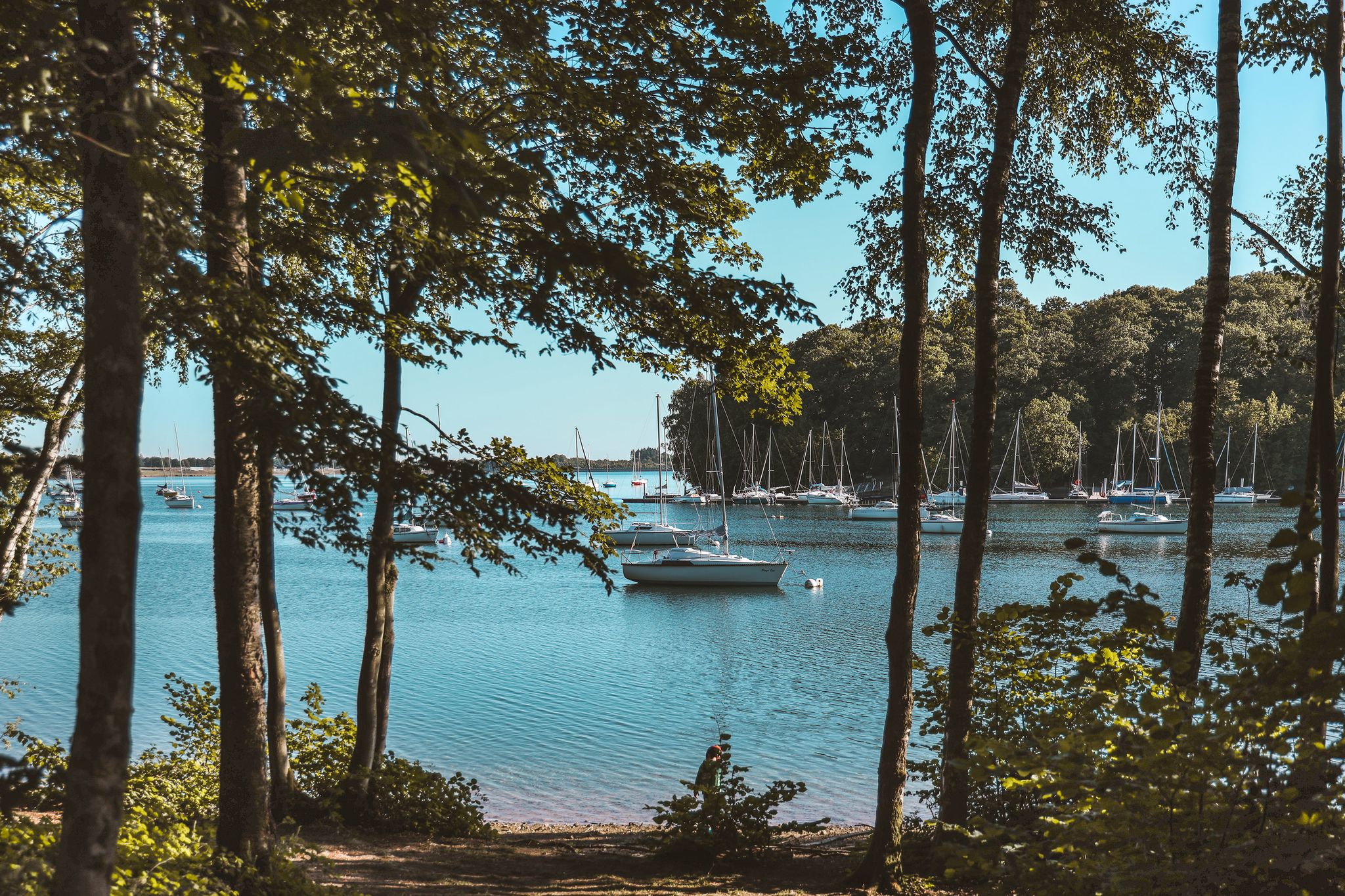
Easy hiking trails around L'Eau d'Heure navigate a landscape characterized by five artificial lakes, dense forests, and expansive meadows in Wallonia, Belgium. This region, the largest lake area in Belgium, combines man-made water bodies with the natural features of the Ardennes. Hikers can expect serene lakeside paths, bucolic trails through wooded areas, and views of the surrounding countryside. The terrain generally features gentle elevation changes, making it suitable for easy walks.
Best easy hiking trails around L'Eau d'Heure
- The most popular easy hiking route is Wooden Shelter and Picnic Area – Lake Eau d'Heure loop from Eau d'heure, a 4.5 miles (7.2 km) trail that takes 1 hour 55 minutes to complete. This route offers views of the lake and passes by a designated picnic area.
- Another top favourite among local hikers is View of the Dam – Eau d'Heure Lake loop from Cerfontaine, an easy 2.6 miles (4.3 km) path. This trail provides perspectives of the dam and the lake's expanse.
- Local hikers also love the Eau d'Heure Lake – View of the Dam loop from Cerfontaine, a 3.0 miles (4.8 km) trail leading through lakeside scenery, often completed in about 1 hour 17 minutes.
- Hiking around L'Eau d'Heure is defined by its extensive lake system, dense woodlands, and open meadows. The network offers options for different ability levels, with many easy hiking trails available.
- The routes in L'Eau d'Heure are highly rated by the komoot community with an average score of 4.3 stars from over 700 reviews. More than 5,000 hikers have used komoot to explore L'Eau d'Heure's varied terrain.
Last updated: August 24, 2026
3.6
(5)
59
hikers
Easy hike. Great for any fitness level. Easily-accessible paths. Suitable for all skill levels.
4.0
(3)
34
hikers
6.81km
01:48
60m
60m
Easy hike. Great for any fitness level. Easily-accessible paths. Suitable for all skill levels.

Sign up for free
4.6
(7)
30
hikers
6.95km
01:51
80m
80m
Easy hike. Great for any fitness level. Easily-accessible paths. Suitable for all skill levels.
12
hikers
3.58km
00:56
20m
20m
Easy hike. Great for any fitness level. Easily-accessible paths. Suitable for all skill levels.
4.0
(2)
9
hikers
5.66km
01:31
70m
70m
Easy hike. Great for any fitness level. Easily-accessible paths. Suitable for all skill levels.
Get access to more routes and recommendations from other explorers.
Sign up for free
Already have an account?
Our route recommendations are based on thousands of hikes, rides, and runs completed by other people on komoot.
Start today with a free account
Your next adventure awaits.
Login or Signup
Popular around L'Eau d'Heure
Other adventures around L'Eau d'Heure

Tips from the Community

The lock, designated as the Sluis van La Plate Taille, was built as part of a large-scale water project developed in the second half of the 20th century. This project aimed to buffer water, prevent floods, create drinking water reserves, and provide a stable basis for energy production through hydropower. The lock allows water to be moved in a controlled manner between different levels and compartments of the lake system. Technically, the lock functions on the principle of water level regulation between two basins with different levels. Using sluice gates and lock doors, water can be slowly let in or drained, allowing ships (where applicable) or water masses to be moved safely without sudden pressure differences. In this specific case, the emphasis is less on shipping and more on hydrological control within the reservoir complex. Its location at La Plate Taille is hydrologically strategic. This lake serves as a central reservoir within the Lacs de l’Eau d’Heure and directly influences the water balance of the surrounding region. The lock helps regulate water levels, especially during heavy rainfall or dry periods, thus supporting the broader water management system. Ecologically, the lock indirectly contributes to the management of the ecosystem in and around the lakes. Controlled water movement affects the quality and distribution of water, which in turn impacts fish populations, aquatic plants, and bank vegetation. Managing the water level is therefore not only a technical but also an ecological responsibility.
0
0
The origin of water ski clubs in Belgium lies in the growth of recreational water sports in the second half of the 20th century. The construction of larger bodies of water and reservoirs, such as the Lacs de l’Eau d’Heure, created suitable locations for activities like water skiing, wakeboarding, and other towed water sports. This made it possible to establish organized clubs that offered training, competition, and recreation. Water ski clubs typically function as sports associations where members can practice under the guidance of experienced instructors. Activities include basic skills such as balance, starting technique, and safety on the water, as well as advanced techniques for speed and jumps. Safety rules play a central role, as water skiing is a sport that combines high speeds and direct interaction with water surfaces. The infrastructure of a water ski club usually consists of a demarcated water area, a starting dock, and boat facilities or cable systems that pull the athletes. In some modern facilities, cable parks are used instead of boats, making the sport more accessible and environmentally friendly. Additionally, there are often changing rooms and meeting places for members and visitors. Ecologically, water ski clubs depend on good water quality and a stable water level. Therefore, they are often located in artificial lakes or controlled water zones, such as those at Lacs de l’Eau d’Heure. This ensures a balance between recreational use and nature management, where rules are applied to limit disturbance to fauna and flora. Socially, water ski clubs play an important role in the community. They bring people together around sport, encourage youth activities, and contribute to tourism in the region. In areas like Viroinval, they can also have an economic impact by attracting visitors and supporting local hospitality and services.
0
0
The origin of the dam lies in the need to regulate water flows in the region. In a landscape characterized by calcareous soils, hilly relief, and fast-reacting watercourses, floods and seasonal water fluctuations were a recurring phenomenon. The construction of weirs and small dams like the one at Féronval therefore served to stabilize water levels, distribute water, and in some cases also support energy or irrigation.
0
0

The murder of the guard Augustin Rouard in Cerfontaine In the 19th century, Cerfontaine was shaken by a particularly violent event: the murder of the 30-year-old garde-champêtre Augustin Rouard. He was a municipal field guard, responsible for overseeing forests, fields, and properties — a role that was often dangerous at the time due to conflicts with poachers and wood thieves. According to the historical reconstruction in Soirmag, Rouard was “lâchement assassiné”, a phrasing typical of the newspapers of the time that emphasized the seriousness of the act. He was attacked and killed while carrying out his duties, presumably by individuals he caught engaging in illegal activities. The murder deeply affected the local community, which relied heavily on law enforcement during a period when rural crime was a real problem. In memory of Rouard, a kruis d’occis was erected — a traditional Walloon memorial cross placed at the site where someone had met a violent end. Such crosses are often simple but carry great symbolic value: they not only mark the place of the tragedy but also remind us of the vulnerability of daily life in earlier times. The cross of Augustin Rouard belongs to the series of small, often forgotten monuments scattered throughout the villages and forests of Wallonia. They form a silent testimony to local history, tragedies, and popular devotion. Thanks to the article, his name is brought to light again, and the story of this young guard is preserved.
0
0
The Féronval dam is part of the impressive Les Lacs de l’Eau d’Heure lake complex, the largest artificial lake area in Belgium. These dams and reservoirs were built in the 1970s to improve water quality in the region, support the flow of the Sambre and Meuse rivers, and make the Charleroi–Brussels Canal suitable for larger inland vessels. The Lac de Féronval, formed by the dam, is one of the smaller but important links within this hydrological system. The dam is located near the N907, where various hiking and cycling routes pass. The surroundings are quiet, green, and very popular with recreational users. Anglers like to come here because fishing from a boat on Lac de Féronval is permitted, which is not possible on all lakes in the area. Several beautiful walks start around the dam. A popular route is the Balade du Grand Cerf, an accessible tour of about eight kilometers that starts at the Féronval pre-dam. The walk leads through forests and open fields and regularly offers beautiful views of the Lac de l’Eau d’Heure. There are picnic spots and ample parking along the way, making it an ideal outing for families or leisurely walkers. Also
2
0

Nice place for barbecue, not very respected unfortunately.
0
0
Very nice place to have a barbecue. Not very respected unfortunately.
0
0
Frequently Asked Questions
How many easy hiking trails are available in L'Eau d'Heure?
L'Eau d'Heure offers a wide selection of easy hiking trails. There are over 150 easy routes available, making it a great destination for relaxed walks amidst diverse landscapes.
What kind of terrain can I expect on easy hikes around L'Eau d'Heure?
The easy trails in L'Eau d'Heure navigate a varied landscape featuring serene lakeside paths, dense forests, and expansive meadows. You can expect generally gentle elevation changes, making the routes suitable for a comfortable walking experience.
Are there any easy circular routes around L'Eau d'Heure?
Yes, many easy trails in L'Eau d'Heure are circular, allowing you to start and end at the same point. For example, the Wooden Shelter and Picnic Area – Lake Eau d'Heure loop from Eau d'heure is a popular 7.2 km circular route, and the Eau d'Heure Lake – View of the Dam loop from Cerfontaine offers a 4.8 km loop with lakeside scenery.
Are the easy hiking trails in L'Eau d'Heure suitable for families?
Absolutely. The easy hiking trails in L'Eau d'Heure are well-suited for families, offering manageable distances and gentle terrain. Many paths wind through forests and along the lakeshores, providing a pleasant and safe environment for all ages to explore.
Can I bring my dog on the easy trails?
Yes, dogs are welcome on the hiking trails in L'Eau d'Heure. To ensure a pleasant experience for everyone and to protect the local wildlife, please keep your dog on a leash.
Are there any viewpoints or scenic spots on the easy trails?
Many easy trails offer beautiful views of the lakes and surrounding nature. You can find scenic spots like the Lake Viewpoint or the Beautiful viewpoint over the water. The Barrage de la Plate Taille also offers panoramic views from its viewing tower, which can be accessed near some trails.
What attractions can I find near the easy hiking trails?
Beyond the trails, L'Eau d'Heure offers several attractions. You can visit the Barrage de la Plate Taille, Belgium's largest dam, or explore the Lac du Ry-Jaune. For dining, L'Heure Bleue is a nearby restaurant. The region also features Natura Parc for adventure activities and the Aquascope de Virelles for nature discovery.
What is the typical distance and duration for easy hikes here?
Easy hikes in L'Eau d'Heure typically range from 4 to 7 kilometers (2.5 to 4.5 miles) and can be completed in about 1 to 2 hours. For instance, the View of the Dam – Eau d'Heure Lake loop from Cerfontaine is 4.3 km and takes around 1 hour 10 minutes.
What do other hikers say about the easy trails in L'Eau d'Heure?
The easy trails in L'Eau d'Heure are highly regarded by the komoot community, with an average rating of 4.3 stars from over 700 reviews. Hikers often praise the well-maintained paths, the serene lakeside environments, and the beautiful views of the surrounding nature.
Are there options for parking near the easy hiking trails?
Yes, parking is generally available at various access points around the lakes and trailheads. Many starting points for popular routes offer designated parking areas, making it convenient to begin your hike.
How can I reach the easy hiking trails using public transport?
While L'Eau d'Heure is primarily accessed by car, some public transport options might connect to nearby towns. However, direct public transport links to specific trailheads within the complex are limited. It's advisable to check local bus schedules for connections to the main lake areas.
Are there any easy winter hikes available in L'Eau d'Heure?
L'Eau d'Heure's trails can be enjoyed year-round. In winter, the landscape takes on a different charm, though conditions may vary. Always check local weather forecasts and trail conditions before heading out, and wear appropriate footwear for potentially icy or muddy paths.
Most popular routes around L'Eau d'Heure
Most popular attractions around L'Eau d'Heure

Get inspired with the komoot mobile app


Explore more
Browse the best Hikes in other regions.
