The best traffic-free bike rides around Bisingen
4.6
(368)
1,807
riders
30
rides
No traffic touring cycling routes around Bisingen are situated at the foot of the Swabian Alb, characterized by an idyllic hilly landscape with rolling hills, green meadows, and dense forests. The region features the impressive Albtrauf, offering panoramic views, and includes notable viewpoints like Zeller Horn. This diverse terrain provides a scenic backdrop for cycling, with routes often incorporating views of Hohenzollern Castle.
Best no traffic touring cycling routes around Bisingen
- The most popular no traffic touring cycling route is…
Last updated: July 11, 2026
4.7
(52)
224
riders
49.0km
03:07
400m
400m
Moderate bike ride. Good fitness required. Mostly paved surfaces. Suitable for all skill levels.
4.6
(56)
217
riders
44.6km
02:47
370m
370m
Moderate bike ride. Good fitness required. Mostly paved surfaces. Suitable for all skill levels.

Sign up for free
4.4
(25)
104
riders
28.7km
01:55
350m
350m
Moderate bike ride. Good fitness required. Mostly paved surfaces. Suitable for all skill levels.
4.7
(11)
40
riders
15.8km
01:01
170m
160m
Moderate bike ride. Good fitness required. Mostly paved surfaces. Suitable for all skill levels.
5.0
(3)
38
riders
12.5km
00:52
130m
130m
Easy bike ride. Great for any fitness level. Mostly paved surfaces. Suitable for all skill levels.
Get access to more routes and recommendations from other explorers.
Sign up for free
Already have an account?
Our route recommendations are based on thousands of hikes, rides, and runs completed by other people on komoot.
Start today with a free account
Your next adventure awaits.
Login or Signup


Tips from the Community

Definitely look for the QR code, the first one is at the railway underpass in Engstlatt. This opens up interesting audio contributions about life in the Wüste company.
0
0

Waldschenke - Good refreshment stop at the reservoir 🌊 - Schömberg - Zollernalbkreis
1
0
The Schlichemtalsperre (also known as Schömberger Stausee, mostly just called Stausee locally) east of Schömberg in Baden-Württemberg dams the Schlichem, a tributary of the Neckar coming from the Swabian Jura. The 90.6 ha Schömberger Stausee mit Palmbühl nature reserve surrounds the Schlichemtalsperre. The approximately 1.35 km long and initially narrow reservoir, which widens to about 175 m towards the end and has an area of 10.4 ha at 643.8 m above sea level (NHN), begins at the hamlet of Untere Säge and extends to the old town center of Schömberg. It has a catchment area of about 33.5 km², to which the Schlichem, already over 11 km long at its mouth, contributes almost 90%. The watercourses Hölzlegraben from the forest to the right of the lake and Scheubühlgraben and Räßentälebach from the left, which are up to 1.2 km long, flow into it from the sides. From the Vorsee forebay near the Untere Säge, a fish ladder leads to the reservoir. There is also the only bridge over the lake that can be walked and driven on. The Schlichem Viaduct can only be used by the railway. The Schlichemtalsperre was built between 1940 and 1944. The Portlandzementwerk Rudolf Rohrbach KG (today Holcim (Süddeutschland) GmbH) in neighboring Dotternhausen, which was the builder of the dam, initially used it for cooling water and electricity generation. An outdoor swimming pool built in 1935 was flooded. After the Second World War, the facility was taken over by the state of Württemberg-Hohenzollern in 1948. The reservoir was renovated from 1975 to 1983. The dam structure is an earth dam, and the hydropower plant within it has a capacity of 60 kW. There is a forebay called Vorsee, which was built from 1975 to 1977. Source: https://de.wikipedia.org/wiki/Schlichemtalsperre
1
0
The Schlichemtalsperre (also Schömberger Stausee, usually just called Stausee locally) east of Schömberg in Baden-Württemberg dams the Schlichem, a tributary of the Neckar coming from the Swabian Jura. The 90.6-hectare Schömberger Stausee mit Palmbühl landscape protection area surrounds the Schlichemtalsperre. The approximately 1.35 km long and initially narrow reservoir, which widens to about 175 m towards the end, with an area of 10.4 hectares at 643.8 m above sea level, begins at the hamlet of Untere Säge and extends to the old town center of Schömberg. It has a catchment area of approximately 33.5 km², to which the Schlichem, which is already over 11 km long at the inflow, contributes almost 90%. The Hölzlegraben from the forest to the right of the lake and the Scheubühlgraben and Räßentälebach from the left flow into it. From the Vorsee forebay near the Untere Säge, a fish ladder leads to the reservoir. There is also the only bridge over the lake that can be walked and driven on. The Schlichem Viaduct can only be used by the railway. The Schlichemtalsperre was built between 1940 and 1944. The Portlandzementwerk Rudolf Rohrbach KG (today Holcim (Süddeutschland) GmbH) based in neighboring Dotternhausen, which was the client for the dam, initially used it for cooling water and electricity generation. An outdoor swimming pool built in 1935 was flooded. After the Second World War, the facility was taken over by the state of Württemberg-Hohenzollern in 1948. The reservoir was renovated from 1975 to 1983. The dam is an earth dam, and the hydropower plant within it has a capacity of 60 kW. There is a forebay, the Vorsee, which was built from 1975 to 1977. Source: https://de.wikipedia.org/wiki/Schlichemtalsperre
3
0

A pair of storks has been nesting on the tower of the Weilheim church for years.
1
0

Schömberger Reservoir
1
0

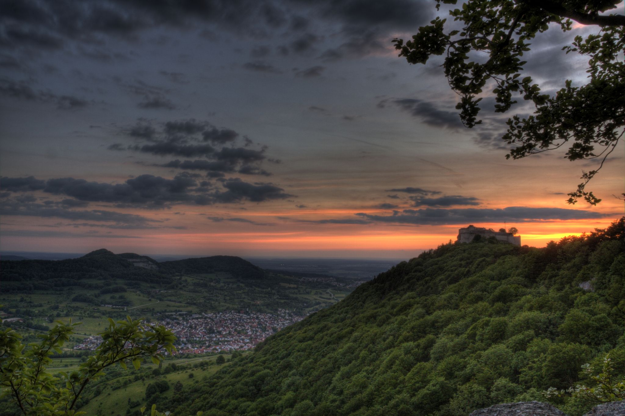
A bench right next to the bike path offers a beautiful view of the Alb. Hohenzollern Castle can be seen in the distance.
1
0

Great view of Hohenzollern Castle
0
0
Frequently Asked Questions
How many traffic-free touring cycling routes are available around Bisingen?
There are over 25 dedicated traffic-free touring cycling routes around Bisingen. These routes cater to various skill levels, with 9 easy, 13 moderate, and 5 difficult options, ensuring a suitable ride for everyone.
Are there easy, traffic-free touring routes suitable for beginners or families?
Yes, Bisingen offers 9 easy, traffic-free touring routes perfect for beginners or families. These routes typically feature gentler gradients and well-maintained paths, allowing for a relaxed and enjoyable experience through the scenic landscapes of the Swabian Alb foreland.
What natural features can I expect to see on these no-traffic cycling routes?
The routes around Bisingen showcase the diverse natural beauty of the Swabian Alb. You'll cycle through idyllic hilly landscapes, green meadows, dense forests, and distinctive juniper heaths. Many routes offer stunning views of the 'Albtrauf,' the steep northwestern edge of the Swabian Alb, and panoramic vistas from viewpoints like the Zeller Horn or Hangender Stein.
Can I see Hohenzollern Castle from any of the traffic-free touring routes?
Absolutely! Many routes are specifically designed to offer spectacular views of the majestic Hohenzollern Castle. For instance, the View of Hohenzollern Castle loop from Bisingen and the View of Hohenzollern Castle – Domäne Estate loop from Bisingen provide excellent opportunities to admire this iconic landmark from various perspectives.
Are there any circular no-traffic touring routes available in Bisingen?
Yes, many of the traffic-free touring routes around Bisingen are circular, allowing you to start and end your ride in the same location. Examples include the moderate Schömberg Reservoir loop from Bisingen, which takes you past the reservoir, or the View of the Swabian Jura loop from Bisingen, offering expansive vistas.
What is the best time of year to go touring cycling in Bisingen?
The best time for touring cycling in Bisingen is generally from spring to autumn (April to October). During these months, the weather is typically mild, and the landscapes are vibrant. Summer offers longer daylight hours, while spring and autumn provide pleasant temperatures and beautiful foliage, making for very scenic rides.
Are there any waterfalls or caves I can visit near the cycling routes?
Yes, the region around Bisingen features several natural attractions. You can find beautiful waterfalls such as the Starzel Waterfall or the Zillhausen Waterfall. For those interested in geology, there are also caves like the Heidenstein Cave or the Hexenküche Cave, which can be explored as part of a longer day out.
What do other touring cyclists enjoy most about the traffic-free routes in Bisingen?
The touring cycling routes in Bisingen are highly rated by the komoot community, with an average score of 4.6 stars. Reviewers often praise the peaceful, traffic-free nature of the paths, the stunning panoramic views of Hohenzollern Castle and the Swabian Alb, and the well-maintained surfaces that make for a smooth ride. The variety of landscapes, from forests to open meadows, is also frequently highlighted.
Are there any other notable attractions or points of interest along these routes?
Beyond Hohenzollern Castle, you can explore other points of interest. The Zollern Castle Balingen loop from Hohenzollern Castle takes you towards the historic Zollern Castle in Balingen. The Schömberg Reservoir is another popular destination, offering a tranquil setting for a break. The region also has historical sites like the 'Tiefenhöhle' Mine for those interested in local history.
Where can I find parking or public transport options to access these routes?
Bisingen offers various parking options, especially near the town center or at designated trailheads, which provide convenient access to the cycling network. For public transport, Bisingen has a train station, making it accessible by regional trains. You can often find routes that start or end near the station, allowing for easy arrival and departure without a car. Always check local public transport schedules for bike carriage policies.
Most popular routes around Bisingen
Most popular attractions around Bisingen

Get inspired with the komoot mobile app


Explore more
Browse the best Cycling routes in other regions.
