The best city hikes and walks around Otterndorf
4.5
(496)
3,148
hikers
6
hikes
Urban hiking trails around Otterndorf offer a blend of coastal, riverine, and town environments. Situated at the confluence of the River Elbe and the North Sea, the area features coastal paths, green beaches, and the winding River Medem. The landscape is characterized by its proximity to the Wadden Sea and the Elbe Estuary, providing flat terrain suitable for urban exploration. These routes primarily traverse the town and its immediate surroundings, offering accessible paths.
Best urban hiking trails around Otterndorf
- The…
Last updated: July 11, 2026
4.0
(5)
16
hikers
Easy hike. Great for any fitness level. Easily-accessible paths. Suitable for all skill levels.
3.9
(7)
9
hikers
Easy hike. Great for any fitness level. Easily-accessible paths. Suitable for all skill levels.

Sign up for free
2
hikers
Easy hike. Great for any fitness level. Easily-accessible paths. Suitable for all skill levels.
2
hikers
3.12km
00:47
0m
0m
Easy hike. Great for any fitness level. Easily-accessible paths. Suitable for all skill levels.
2
hikers
2.35km
00:35
0m
0m
Easy hike. Great for any fitness level. Easily-accessible paths. Suitable for all skill levels.
Our route recommendations are based on thousands of hikes, rides, and runs completed by other people on komoot.
Start today with a free account
Your next adventure awaits.
Login or Signup


Tips from the Community

So the Medem Bridge was built. People also called it Katten-Stigg at that time. The language is called Plattdeutsch. More than a hundred years ago Johann Meyer lived in Ihlienworth. Johann Meyer was a merchant, he had a shop in Otterndorf. The shop was on one side of the river. People from the other side of the river could not shop with him. Johann Meyer wanted to change that, so they could also shop with him. Without having to take a boat. Johann Meyer then built a bridge, the bridge had to be high enough so that ships could sail under the bridge. He then built stairs around it on each corner. The bridge was then called Medem Stieg.
1
0
Beautiful fountain to see at the Sparkasse in Otterndorf, Cuxhavener Straße 18, at the Weser Elbe Sparkasse. Opening hours are (Service & Advice), Monday: 09:00 – 12:00 and 14:00 – 16:00. Tuesday to Thursday: 09:00 – 12:00 Friday: 09:00 – 12:00. ATM & Self-service area: Accessible daily from 05:00 to 23:00 (including coin deposit and deposit/withdrawal function). Telephone customer service: Monday to Friday from 08:00 to 20:00 at 0471 4800-0. Emergency hotline: For card blocking outside of opening hours, 116 116 is available around the clock.
1
0

A very beautiful fountain. Fittingly for the village name Otterndorf, the fountain is decorated with otters.
0
0

Heraldic animals immortalized as fountains - the cute little rascals
1
0
The canal is part of Otterndorf's late medieval town fortifications, which consist of the northern and southern ramparts. Originally, the ramparts and the moat in front of them (the present-day canal) served to protect the town, which received its town charter in 1400. The fortifications almost completely encircle the historic town center. The moat canal forms the water-side barrier of the defensive line.
1
0
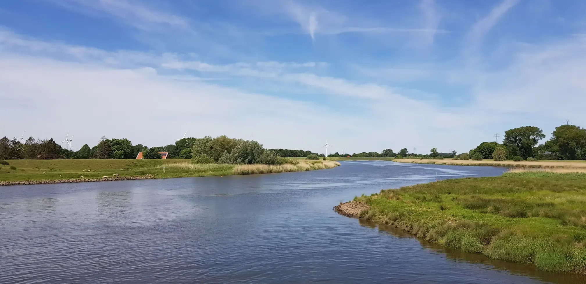
The bridge offers a fantastic view of the Medem river. The entire village of Otterndorf is worth a visit.
1
0
Otterndorf's town center is very beautiful. A visit is highly recommended 👍🏻.
1
0
Frequently Asked Questions
How many urban hiking trails are available in Otterndorf?
Otterndorf offers a selection of 7 urban hiking trails, ranging from easy strolls through the town to slightly longer routes exploring its immediate surroundings. Most of these are easy, making them accessible for various fitness levels.
What kind of landscapes can I expect on urban hikes in Otterndorf?
Urban hikes in Otterndorf offer a unique blend of coastal, riverine, and town environments. You can expect to see the historic old town, paths along the River Medem, and routes that bring you close to the Elbe Estuary and the Wadden Sea UNESCO World Heritage Site, even within the urban context. The area is known as the 'Green City by the Sea' for a reason!
Are there easy or short urban hiking options in Otterndorf?
Yes, Otterndorf has several easy and short urban hiking options perfect for a relaxed stroll. For example, the Hiking loop from Otterndorf is just over 2 km, and the Otterndorf Town Hall Square – Wolfgang Larisch Bridge loop is around 3.4 km, both offering pleasant, easy walks.
Can I find circular urban hiking routes in Otterndorf?
Absolutely! All the urban hiking trails listed in this guide are circular routes, meaning you'll end up right back where you started. This makes planning your walk convenient and hassle-free. For instance, try the Wolfgang Larisch Bridge – Otterndorf Town Center loop for a pleasant circular experience.
What are some interesting sights or landmarks I can see on urban hikes in Otterndorf?
Otterndorf's urban hikes often lead you past fascinating sights. You can explore the Historic Town Center of Otterndorf with its well-preserved architecture. Some routes might offer glimpses of the Dicke Berta Lighthouse in the distance or provide views along the Elbe Dike Cycling Route. The Wadden Sea National Park is also nearby, offering unique natural beauty.
Are the urban hiking trails in Otterndorf suitable for families with children?
Yes, many of Otterndorf's urban trails are very suitable for families. The predominantly easy difficulty and shorter distances make them ideal for children. The varied scenery, from historic townscapes to river views, keeps things interesting for younger explorers. Consider the Otterndorf Train Station loop for a family-friendly outing.
Can I bring my dog on urban hikes in Otterndorf?
Generally, dogs are welcome on urban hiking trails in Otterndorf. However, it's always recommended to keep your dog on a leash, especially in populated areas, near wildlife, or on dikes. Be mindful of local regulations and ensure you clean up after your pet to keep the trails enjoyable for everyone.
What is the best time of year for urban hiking in Otterndorf?
The best time for urban hiking in Otterndorf is typically from late spring to early autumn (May to September). During these months, the weather is generally mild and pleasant, making it ideal for exploring the town and its natural surroundings. The coastal breeze can be refreshing on warmer days.
How can I reach the urban hiking trails in Otterndorf using public transport?
Otterndorf has a train station, making it accessible by public transport. Many urban hiking trails, such as the Otterndorf Train Station loop, start directly from or near the station, allowing for convenient access without a car. Check local train schedules for the best connections.
Is parking available near the urban hiking trailheads in Otterndorf?
Yes, parking is generally available in and around Otterndorf's town center, which serves as a common starting point for many urban hikes. Look for designated parking areas within the town to easily access trails like the Otterndorf Town Hall Square – Teekontor Otterndorf loop.
What do other hikers say about the urban trails in Otterndorf?
The urban trails in Otterndorf are highly rated by the komoot community, with an average score of 4.5 out of 5 stars. Reviewers often praise the easy accessibility, the charming blend of historic town and natural landscapes, and the well-maintained paths that make for a pleasant walking experience.
Are there any urban trails that offer opportunities for a coffee break or refreshments?
Yes, given their urban nature, many trails in Otterndorf pass through or near the town center, where you'll find various cafes and restaurants. The Otterndorf Town Hall Square – Teekontor Otterndorf loop, for example, starts and ends near establishments perfect for a coffee break or a meal.
Are there any specific urban trails that offer unique views of the Elbe or Wadden Sea?
While most urban trails focus on the town itself, some routes extend towards the coast, offering glimpses of the Elbe Estuary and the Wadden Sea. The region's proximity to these natural features means you're never far from coastal views. Look for paths that venture towards the dikes for the best perspectives.
Most popular routes around Otterndorf
Most popular attractions around Otterndorf

Get inspired with the komoot mobile app


Explore more
Browse the best Hikes in other regions.
