The best traffic-free bike rides around Meißenheim
4.5
(344)
1,630
riders
15
rides
No traffic touring cycling routes around Meißenheim traverse the flat "Ried" landscapes and the extensive riparian and floodplain forests along the Rhine River. The region is characterized by minimal elevation changes, making it suitable for relaxed cycling. Key features include the Old Rhine Arm and the tree-lined paths along the Canal du Rhône au Rhin, offering varied surfaces from smooth asphalt to fine gravel. These routes provide tranquil scenery and opportunities to experience nature away from traffic.
Best no traffic…
Last updated: October 14, 2026
4.7
(24)
132
riders
Easy bike ride. Great for any fitness level. Mostly paved surfaces. Suitable for all skill levels.
4.6
(29)
101
riders
Easy bike ride. Great for any fitness level. Mostly paved surfaces. Suitable for all skill levels.

4.5
(11)
66
riders
49.4km
03:15
80m
80m
Moderate bike ride. Good fitness required. Mostly paved surfaces. Suitable for all skill levels.
4.7
(65)
339
riders
Moderate bike ride. Good fitness required. Mostly paved surfaces. Suitable for all skill levels.
4.6
(16)
76
riders
31.3km
02:02
60m
60m
Moderate bike ride. Good fitness required. Mostly paved surfaces. Suitable for all skill levels.
Get access to more routes and recommendations from other explorers.
Already have an account?
Our route recommendations are based on thousands of hikes, rides, and runs completed by other people on komoot.
Start today with a free account
Your next adventure awaits.


Other adventures around Meißenheim

Tips from the Community

The Rhine, with a total length of around 1,233 kilometers, is one of the most important, busiest, and historically significant rivers in Europe. It connects the Alps with the North Sea and flows through six countries.
0
0
The Rhine, with a total length of around 1,233 kilometers, is one of the most important, busiest, and historic rivers in Europe. It connects the Alps with the North Sea and flows through six countries.
0
0
The Rhine, with a total length of around 1,233 kilometers, is one of Europe's most important, busiest, and historically significant rivers. It connects the Alps with the North Sea and flows through six countries.
0
0


The name of the church is given incorrectly! In the Evangelical church there is no veneration of saints and thus the above designation is reserved for Catholic churches. It is simply: the evangelical church Meißenheim - dedicated to the Trinity (which is not a biblical concept): DEO TRIUNI 1766 You can read it here: https://www.ekimeissenheim.de/?page_id=3 By the way, the grave is that of Friederike Brion. The information board is located to the right of the church entrance. Know-it-all greetings from Mißne.
1
0

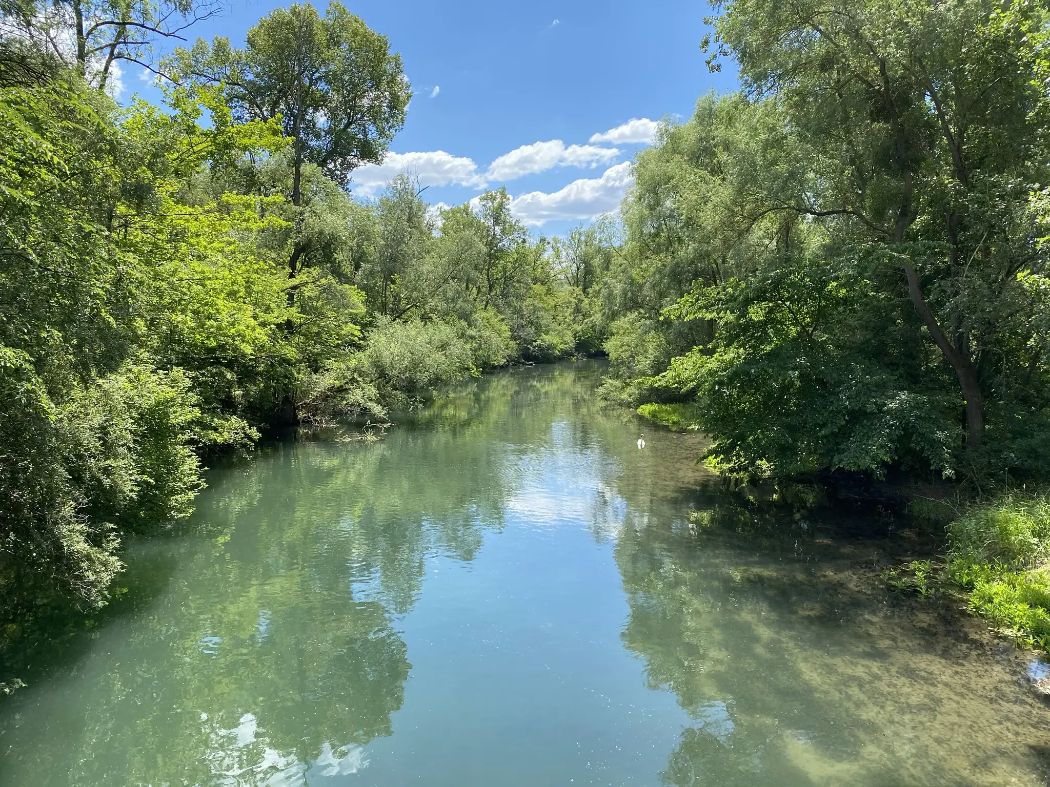
The Steinspore-Brugg is a small pedestrian and cycle bridge in Neuried-Altenheim, in the middle of the Rhine floodplains. It is located directly on the Auen-Wildnispfad near a small weir. At the bridge, there is a popular resting place with a table and bench, offering a beautiful view of the water.
1
0

simply a strong design. I think it's great.
3
0
Frequently Asked Questions
What kind of terrain can I expect on the no-traffic touring cycling routes around Meißenheim?
The Meißenheim region is characterized by its flat "Ried" landscapes and proximity to the Rhine River. This means most no-traffic touring routes offer minimal elevation changes, making them ideal for relaxed cycling. You'll find well-maintained paths, often consisting of good tarmac or fine gravel, particularly along the Canal du Rhône au Rhin and the Rhine riverbanks. Some routes might include unpaved segments, especially within natural areas like the Taubergießen Nature Reserve.
Are there many easy, traffic-free cycling routes suitable for beginners or families in Meißenheim?
Yes, Meißenheim is excellent for easy, traffic-free cycling. Out of the 14 routes featured in this guide, 13 are rated as easy, making them perfect for beginners, families, or anyone looking for a relaxed ride. These routes typically follow flat terrain through scenic natural areas, ensuring a pleasant experience away from vehicle traffic. A great example is the Vältinsschollensee Beach – View of the Rhine Split loop from Meißenheim, which is 18.3 km long and rated easy.
What natural attractions or landmarks can I see along the no-traffic cycling routes?
Many routes pass through or near significant natural features. You can explore the extensive riparian and floodplain forests along the Rhine River, particularly within the Taubergießen Nature Reserve, one of Baden-Württemberg's largest protected areas. Other highlights include the Old Rhine Arm and the tree-lined path along the Canal du Rhône au Rhin. You might also encounter man-made structures like the Gerstheim Rhine Weir or the Elzwehr near Wittenweier.
Are there any circular no-traffic cycling routes available?
Yes, many of the no-traffic touring cycling routes around Meißenheim are designed as loops, offering convenient circular journeys. For instance, the Rhine at Ichenheim – Kehl Marina on the Rhine loop from Meißenheim is a 29 km circular route, and the Salmengrund Rhine Riverbank – Kehl Marina on the Rhine loop from Meißenheim covers 27.8 km, both providing scenic rides along the river without retracing your steps.
What is the best time of year to go touring cycling in Meißenheim?
The region is particularly popular for cycling in June and July due to favorable weather conditions. However, the flat landscapes and well-maintained paths make it enjoyable throughout the spring, summer, and early autumn. The extensive riparian forests offer pleasant shade during warmer months, and the changing foliage in autumn provides beautiful scenery. Winter cycling is possible, but some paths might be less maintained or subject to weather conditions.
Can I find places to eat or stay along the no-traffic cycling routes?
While the routes themselves focus on natural, traffic-free paths, Meißenheim and the surrounding charming villages offer various options for refreshments and accommodation. You'll find local eateries and cafes in the towns, and many routes pass close enough to allow for a short detour to a village center. It's advisable to check specific route maps for proximity to amenities or plan your stops in advance.
What do other touring cyclists enjoy most about cycling in Meißenheim?
The area is highly rated by the komoot community, with an average score of 4.39 stars from over 249 ratings. Reviewers often praise the tranquil atmosphere of the Rhine floodplains, the well-maintained and flat paths, and the opportunity to experience nature away from traffic. The scenic views of the Rhine and the peaceful rides through the "Ried" landscapes are frequently highlighted as favorite aspects.
Are the no-traffic routes suitable for wildlife spotting?
Absolutely. The extensive riparian forests, particularly within the Taubergießen Nature Reserve, are rich in diverse flora and fauna. Cycling through these areas offers excellent opportunities for wildlife spotting, including various bird species and other local wildlife. The quiet nature of these traffic-free routes enhances the chances of observing animals in their natural habitat.
How long do the no-traffic touring cycling routes typically take to complete?
The duration varies depending on the route length and your cycling pace. The routes in this guide range from approximately 18 km to 48 km. For example, the Vältinsschollensee Beach – View of the Rhine Split loop is about 18.3 km and takes around 1 hour 15 minutes, while the longer Rheinauen Wilderness Trail – Rheinpromenade Ortenaukreis loop, at nearly 48 km, can take over 2 hours 45 minutes. These durations are estimates and can be adjusted based on stops and personal speed.
Is parking available near the starting points of these traffic-free routes?
Yes, Meißenheim and the surrounding villages typically offer parking facilities that can serve as convenient starting points for your cycling tours. While specific parking details for each route may vary, you can generally find public parking areas within the towns or near popular access points to the cycling network. It's always a good idea to check local signage for any parking restrictions or fees.
Can I access these routes using public transport?
Meißenheim is connected by public transport, which can provide access to the region. Depending on your starting point, you might be able to reach the vicinity of the routes by bus or train, often with options to bring your bicycle. For detailed information on public transport schedules and bike carriage policies, it's best to consult local transport providers or the regional tourism website for Baden-Württemberg.
Most popular attractions around Meißenheim

Get inspired with the komoot mobile app


Explore more
Browse the best Cycling routes in other regions.
