The best hikes from bus stations around Betzdorf
4.5
(342)
1,452
hikers
39
hikes
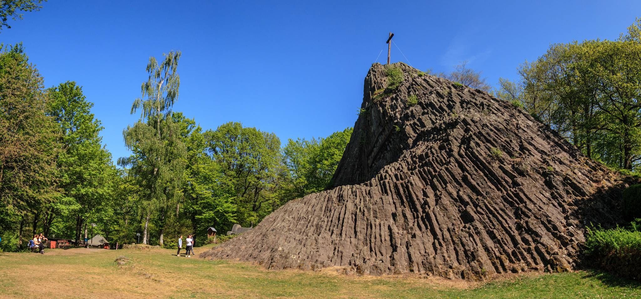
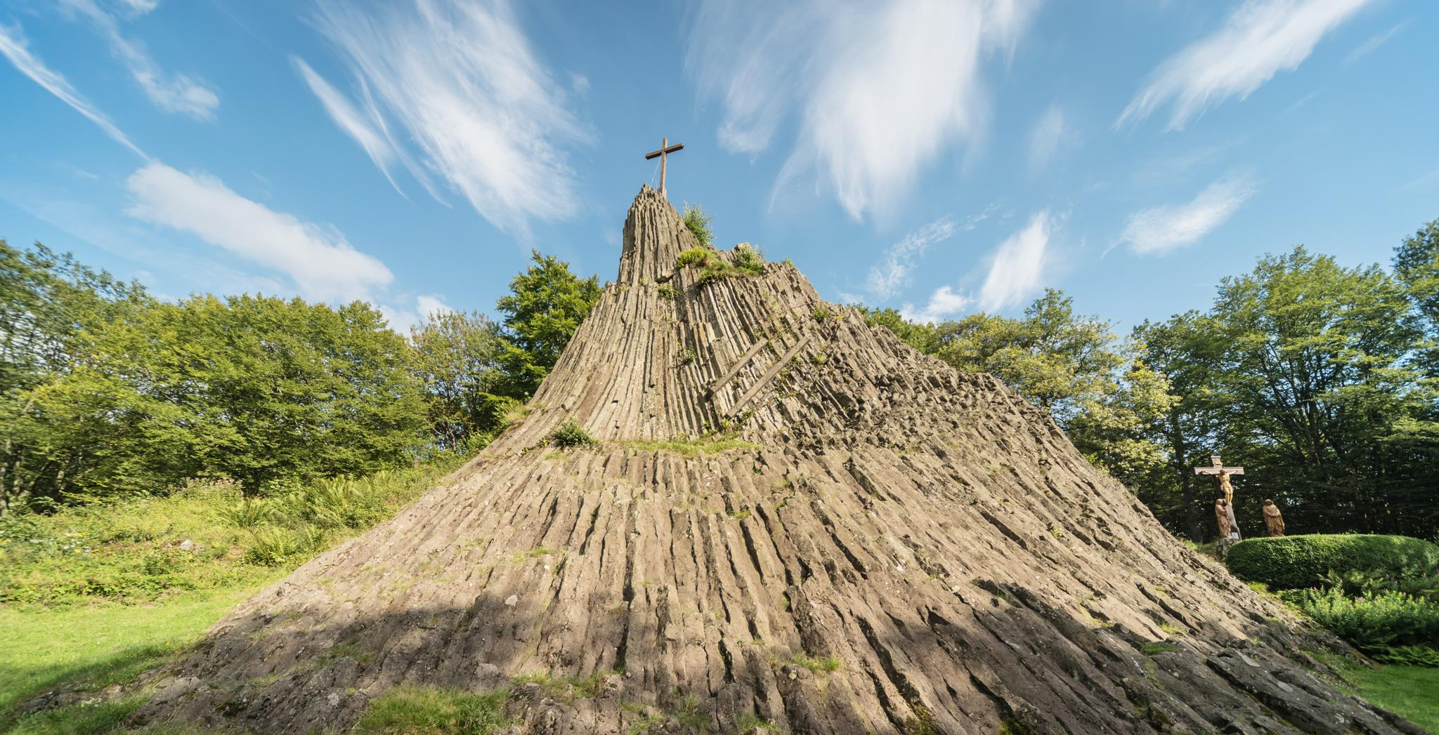
Bus station hiking trails around Betzdorf offer access to the diverse landscapes of the Westerwald-Sieg region, characterized by picturesque forests, rolling hills, and scenic valleys carved by the Sieg and Elbbach rivers. The area features a varied topography, including natural highlights like the Steinerother Kopf and geological formations such as the Druidenstein. Hikers can traverse lush forests, open meadows, and tranquil riversides, with routes often providing expansive views over the Elbbach valley.
Best bus station hiking trails around Betzdorf
- The…
Last updated: July 11, 2026
4.8
(68)
257
hikers
15.3km
04:32
440m
440m
Moderate hike. Good fitness required. Mostly accessible paths. Sure-footedness required.
4.3
(12)
51
hikers
Moderate hike. Good fitness required. Easily-accessible paths. Suitable for all skill levels.

Sign up for free
4.3
(21)
64
hikers
9.75km
02:42
160m
160m
Moderate hike. Good fitness required. Easily-accessible paths. Suitable for all skill levels.
4.8
(8)
39
hikers
5.06km
01:25
100m
100m
Easy hike. Great for any fitness level. Easily-accessible paths. Suitable for all skill levels.
4.6
(14)
58
hikers
6.72km
01:53
140m
140m
Easy hike. Great for any fitness level. Easily-accessible paths. Suitable for all skill levels.
Get access to more routes and recommendations from other explorers.
Sign up for free
Already have an account?
Our route recommendations are based on thousands of hikes, rides, and runs completed by other people on komoot.
Start today with a free account
Your next adventure awaits.
Login or Signup


Tips from the Community

Very well-maintained and also a very nice resting place. 😉
0
0

A truly impressive and stately specimen, it even has its own bus stop :-)
0
0

A lovely place to linger for a while and enjoy the peaceful atmosphere by the stream.
0
0

Nice rest area in the countryside.
1
0

Beautiful view with a great place to rest!
0
0

beautiful views
0
0
Coming from the north, it is easy to drive up to the bridge, but from the bridge onwards it becomes tricky.
2
0

Frequently Asked Questions
How many bus station hiking trails are available around Betzdorf?
There are over 30 hiking routes around Betzdorf that are easily accessible from bus stations. These trails offer a variety of experiences, from easy strolls to more challenging hikes, ensuring there's something for every skill level.
What kind of landscapes can I expect on bus-accessible hikes near Betzdorf?
Hikes accessible from Betzdorf's bus stations traverse the diverse landscapes of the Westerwald-Sieg region. You'll encounter picturesque forests, rolling hills, and scenic valleys carved by rivers like the Sieg and Elbbach. Expect lush woodlands, open meadows, and tranquil riverside paths, with notable features such as the Steinerother Kopf offering expansive views.
Are there any easy or family-friendly bus station hikes in Betzdorf?
Yes, Betzdorf offers several easy and family-friendly options accessible by bus. For example, the Forest Path in Westerwald – Nizzaweg Forest Trail loop is an easy route perfect for a relaxed outing. The region also features dedicated 'Kinderweg' (Children's Path) and 'Abenteuerpfad' (Adventure Path) trails, designed with engaging activities for families.
Can I find circular hiking routes starting from Betzdorf bus stations?
Absolutely. Many of the bus-accessible trails around Betzdorf are circular, allowing you to start and end your hike at the same point, often conveniently near a bus stop. Examples include the View from the Steinerother Kopf – Path to Dauersberger Mühle loop and the Forest Path in Westerwald – View from Molzbergspitze loop.
What are the best seasons for hiking around Betzdorf using public transport?
The best times for hiking in Betzdorf are spring and autumn. In spring, the natural surroundings are vibrant with blooming flowers, while autumn brings golden foliage. Temperatures are pleasantly mild during these seasons, enhancing the overall outdoor experience. However, some trails are also suitable for winter hikes, offering a different kind of serene beauty.
Are there any interesting historical or natural landmarks to see on these bus-accessible trails?
Yes, the region around Betzdorf is rich in both natural and historical landmarks. You might encounter impressive geological formations like the Druidenstein, or historical sites such as the Assberg slate mine and the Wilhelmslust Slate Mine. The historic Dickendorfer Mill in the Elbbachtal is also accessible via specific trails, offering a peaceful spot.
What do other hikers enjoy most about the bus station trails in Betzdorf?
The bus station trails around Betzdorf are highly rated by the komoot community, with an average score of 4.5 stars from over 240 reviews. Hikers often praise the region's diverse and well-maintained paths, the stunning views from points like the Steinerother Kopf, and the convenience of accessing these natural escapes directly from public transport.
Are there any trails that offer scenic viewpoints accessible by bus?
Many trails around Betzdorf provide excellent scenic viewpoints. The View of the Westerwald – Katzwinkel Airfield loop offers expansive vistas. The Steinerother Kopf provides panoramic views over the Elbbach valley and towards the Siebengebirge. The Ottoturm, accessible via stages of the Natursteig Sieg, also offers great views of the surrounding landscape.
Can I find trails that lead to places to eat or rest stops?
Yes, some hiking routes around Betzdorf incorporate opportunities for refreshments. The historic Dickendorfer Mill, located deep in the Elbbachtal, is a unique and peaceful site accessible via specific trails, offering a spot for a break. Many routes also pass through or near villages where you can find local eateries.
Are there any moderate difficulty hikes accessible from Betzdorf bus stations?
Certainly. The majority of bus-accessible hikes around Betzdorf are of moderate difficulty, offering a good balance of challenge and enjoyment. Routes like the Kreuzland Chapel Betzdorf – Hüttenschulzehaus loop are excellent examples, featuring varied terrain and elevation changes suitable for hikers looking for a bit more exertion.
Most popular routes around Betzdorf
Most popular attractions around Betzdorf

Get inspired with the komoot mobile app


Explore more
Browse the best Hikes in other regions.
